
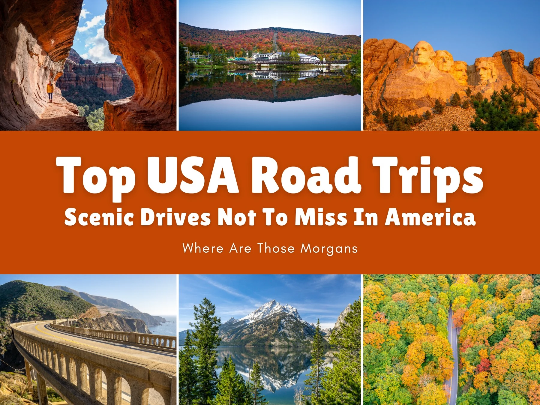
Is there a better place in the world than the USA to tick off a bucket list loaded with ultra scenic road trips? We don’t think so. We’ve been traveling the world since 2018, and for us, nowhere else has America’s diversity of landscapes – mountains, deserts, beaches, prairie, caves, forests, volcanoes, lakes, gorges, canyons, waterfalls, mega-cities, small towns, rolling countryside, and iconic landmarks – combined with such easy accessibility, safety, amenities, and consistency from coast to coast.
Over the years we’ve road tripped thousands of miles across more than 30 US states in our trusty Ford Escape nicknamed “big blue”, from New England to Washington, California to North Carolina, and a whole lot of places in-between. As far as we’re concerned, the best way to really see America is by hitting the road with an uplifting playlist, cameras and hiking gear packed, and a monumental sightseeing itinerary planned. No passport or visa required, all this is in one country.
Hi, we’re Mark and Kristen Morgan. We left our scientific careers in 2018 to become travel writers and photographers, and since then our expert guides have helped millions of travel planners take better trips. Read more about us.
Why trust us with your US road trip bucket list? We’ve spent years driving around America, and we’ve got a collection of inspirational road trip routes to share with you. As always, every photo in this guide is ours.
If pushed, we’d say our absolute favorite three USA road trip routes are Mt Rushmore to Yellowstone, the American Southwest Grand Circle, and New England in the fall. But we also loved the other super scenic drives in our guide too, so you’re in the right place for inspiration and vacation ideas. The goal here is to walk you through our real experiences to help you decide which road trip to take next. Our honest accounts might also make you think twice about a certain route you’ve always wanted to try.
This is our version of the top 10 scenic drives in the USA, listed in completely random order – it’s way too hard to rank them 1-10! Some are well-known road trips (don’t worry, you won’t find Route 66 in this guide) and others are custom routes of our own that ended up being so awesome we had no choice but to include them. Let’s dive in.
Note: Our content is reader supported and contains affiliate links. If you make a purchase through one of these links, we may earn a small commission at no extra cost to you and it helps us keep this site running.
Need a hand planning your road trip? Mark and Kristen help independent travelers plan better, stress-free trips. Schedule a video call and we’ll build a road trip itinerary that fits your style, budget and priorities. See our travel planning help.
Mount Rushmore To Yellowstone
Highlights: Mt. Rushmore, Badlands, Custer State Park, Wind Cave, Deadwood, Devils Tower, Yellowstone, Grand Teton.
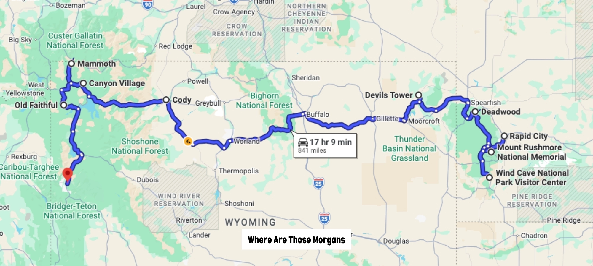
- Start: Rapid City, SD
- End: Jackson, WY
- Distance: 900+ miles
- Days: 10
- Seasons: April to October
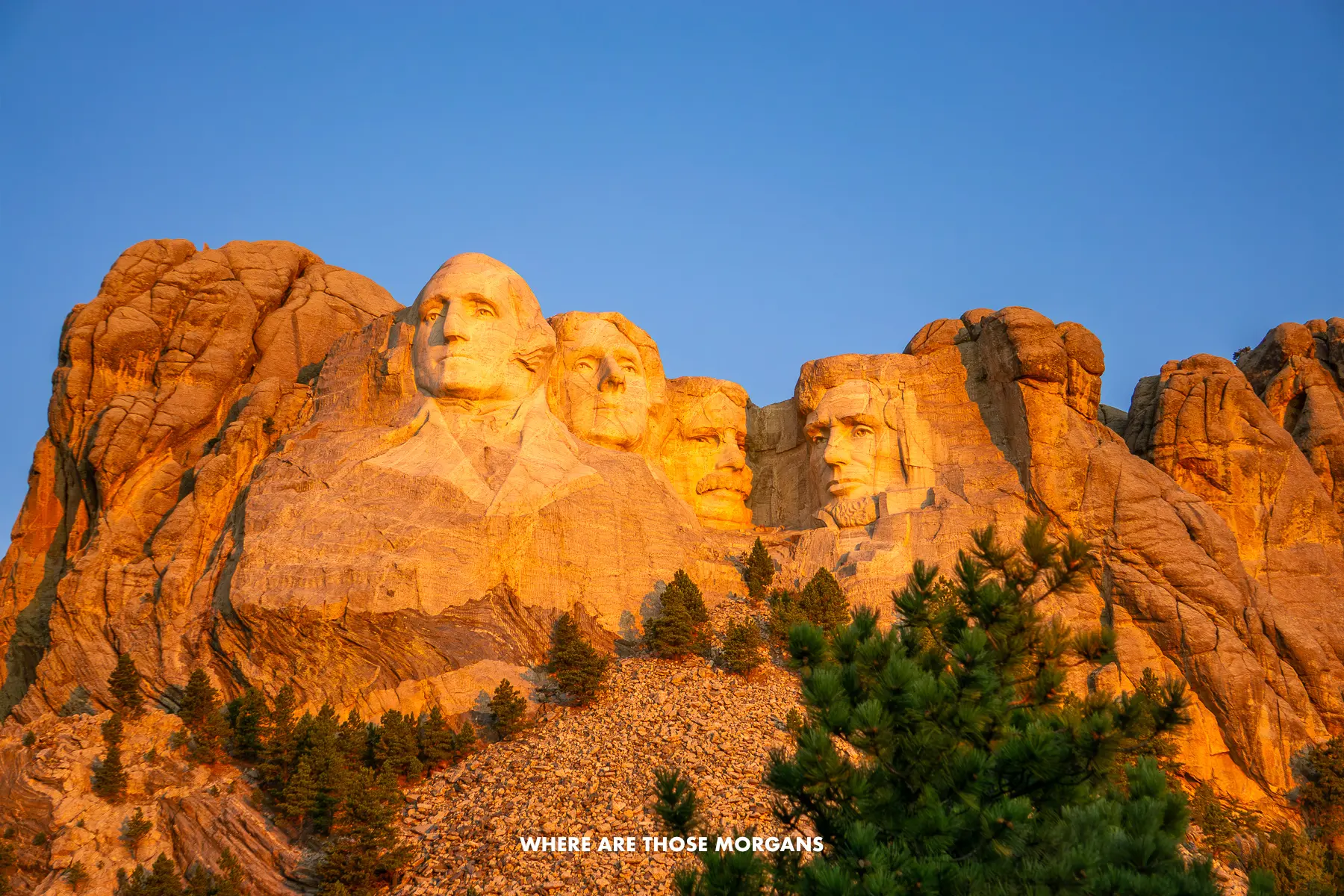
Back in 2019 during our first 3-month western US road trip, we had South Dakota’s Black Hills and Wyoming’s Yellowstone and Grand Teton regions firmly near the top of our own bucket list. It was early October, golden aspens were lighting up the granite Black Hills landscape, the weather was perfect, and the four days we spent exploring the Black Hills turned out to be among our favorites from the whole trip. We honestly had no idea there were so many awesome things to do near Mt Rushmore.
Then we climbed to over 10,000 ft as we crossed the Bighorn Mountains on Cloud Peak Skyway scenic byway, arrived into Cody, and woke up to a monster snow dump that delayed our entry into Yellowstone by a day. Eventually, we made it into the park via northeast entrance and spent the next five days ticking off the best of both Yellowstone and Grand Teton for a total of 10 days (excluding the day we lost). Both parks more than lived up to the hype.
Fast forward to April 2021, we moved from NYC to Seattle and knew we couldn’t miss the Black Hills or Yellowstone on our long cross-country drive. This time it was too early in the season, with snow on the ground in the Black Hills and only half of Yellowstone open. But we still drove the same way across Wyoming, barely passing any other cars in 7 hours, and it only reaffirmed how genuinely amazing this secluded part of the country was.
The diversity of landscape on this route was astounding. Badlands, underground caves, granite hills, prairie, snow-capped mountains, volcanic geysers, and vibrantly colored hot springs. There were a few awesome hikes along the way, but we don’t think this is a road trip for hikers, it’s a road trip for everyone. We’d happily do it with our parents, kids or any friends. And we’d say mid to late September is the ideal time to drive it.
We actually didn’t realize the two regions were that close, or the drive between them was that scenic. So we thought, why not combine them into one genuinely incredible road trip route for others to enjoy? That’s when we wrote our Mt Rushmore to Yellowstone road trip itinerary, and it’s helped thousands of travelers follow our exact route ever since. They’re both great areas to visit individually, but combined, they make for a truly fantastic road trip adventure.
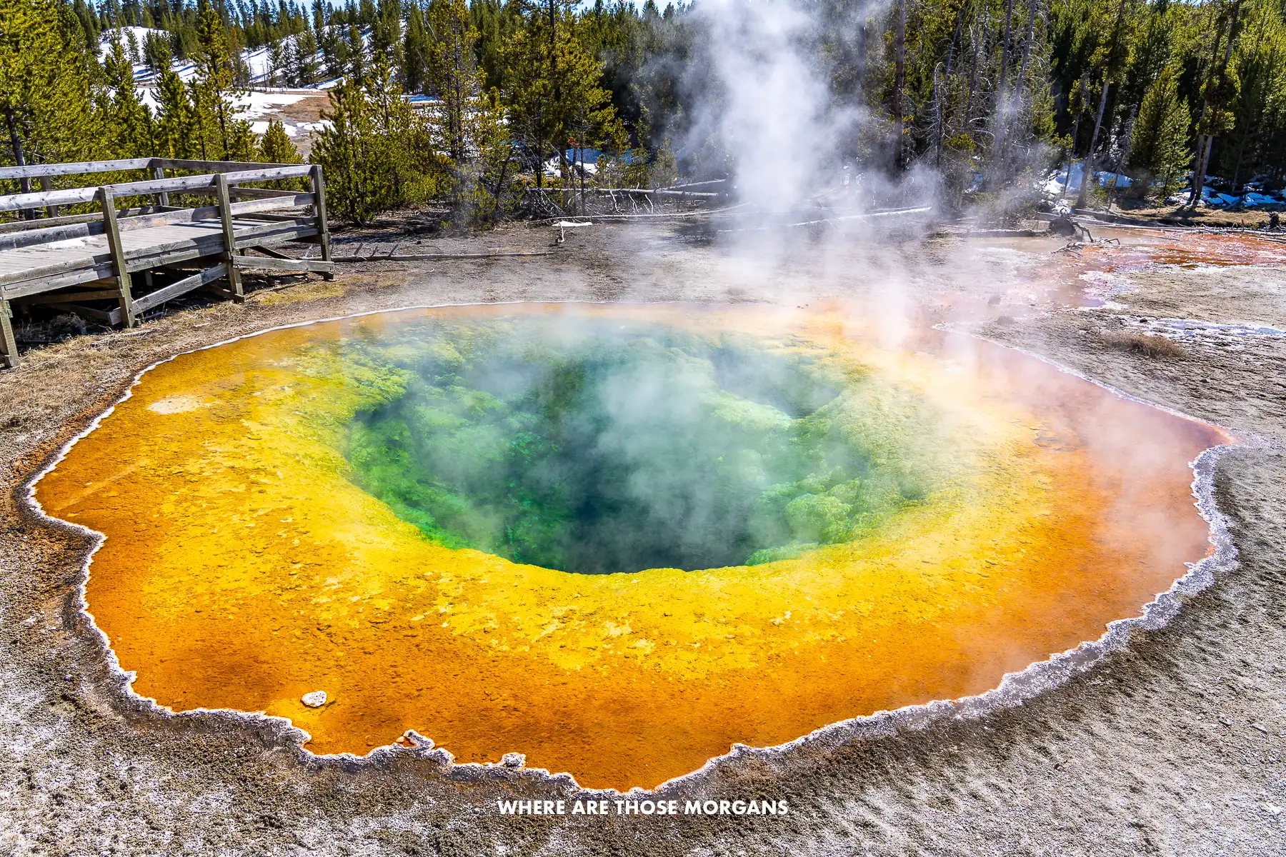
Our standout experiences from this route:
- Hiking Black Elk Peak
- Driving Needles Highway
- Visiting Badlands National Park
- Driving Iron Mountain Road
- Taking a guided tour in Wind Cave
- Visiting Mt Rushmore for 3 hours
- Diving the Custer Wildlife Loop
- Seeing Devils Tower National Monument
- Driving Spearfish Canyon
- Exploring the best of Yellowstone
- Spending 2 days in Grand Teton
If we weren’t driving our own vehicle, we’d rent a car from Rapid City airport and set the drop off location as either Jackson Hole airport or Salt Lake City airport. Logistically, it’s not the easiest road trip to organize because Rapid City and Jackson Hole only fly to a few places, so a transfer is likely on both ends for most people. But trust us, it’s worth the extra effort.
e-Book: Our popular Mt Rushmore to Yellowstone guidebook goes one step further with daily route maps, direct links to all attractions, reservations, hotels and restaurants, plus so much more.
New England In Fall
Highlights: Stowe, Woodstock, Franconia Notch, Mt. Washington, Kancamagus Highway
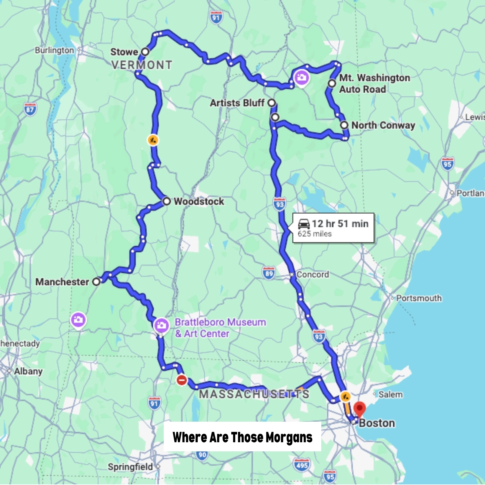
- Start: Boston, MA
- End: Boston, MA
- Distance: 625 miles
- Days: 7+
- Season: Late September to mid October
Our first New England fall foliage experience was a 2-week road trip we took in October 2021. Things were a bit eerie and weird back then because it was just after covid lockdowns, but we were still able to book lodging and eat in restaurants without any issues. We started from Kristen’s parents place in the Finger Lakes, so it was an easy drive to Lake Placid, and from there we chased the peak colors by hitting the popular spots in Vermont and New Hampshire from north to south, along with taking a long detour to Acadia half way through. It was immense.
We fell in love with New England’s quaint small towns, easy-going country roads, stunning photo ops, and awesome hiking trails with spectacular colors all around us. So we did it again in 2023, this time going for 3 weeks at the end of September and beginning of October. The colors were less vibrant (it was just one of those years), but we planned a far more efficient itinerary and spent longer in each place, which made it feel less hectic. We also introduced a few extra stops just to see if they were worth including in our New England fall foliage road trip guide, but they weren’t.
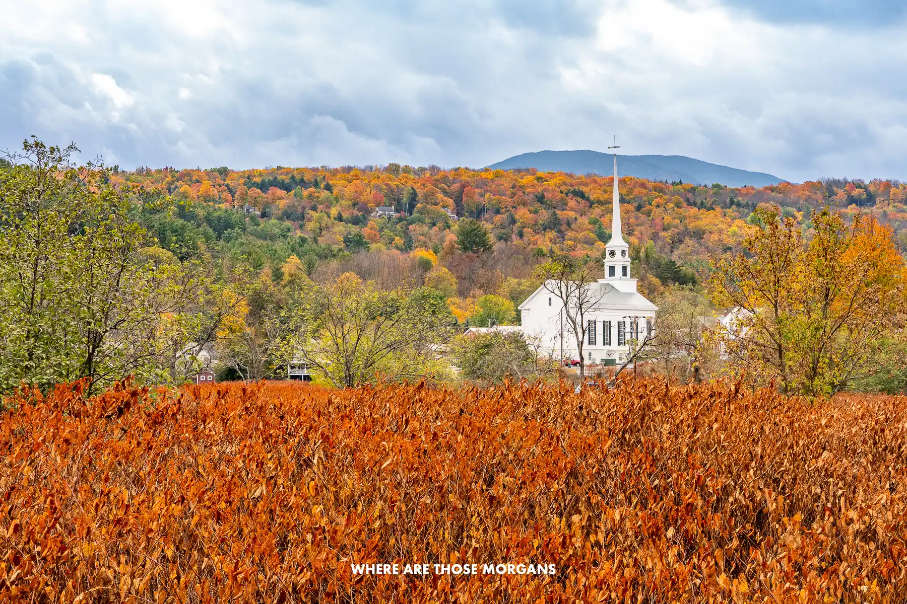
Our guide used to be a 14-day itinerary starting in Lake Placid NY and ending in Manchester VT. But most people fly into and out from Boston, and don’t have 2 weeks free. So we rewrote the guide to be a more realistic and inclusive one-week route starting and ending in Boston. After two long trips to the region, we can confidently say Vermont and New Hampshire are the best areas to focus on for fall foliage. But we also loved the Adirondack Mountains on the New York and Vermont border both times too.
This is a road trip for anyone who loves nature. The colors were spectacular, the hiking was achievable and scenic, the driving was so easy, and the photos we’ve got on our walls from those trips are among our favorites. We also just loved the vibe. Everyone was there for the same thing: Fall foliage colors, beer and cider in Stowe (our favorite spot), hiking great trails, taking home amazing photos.
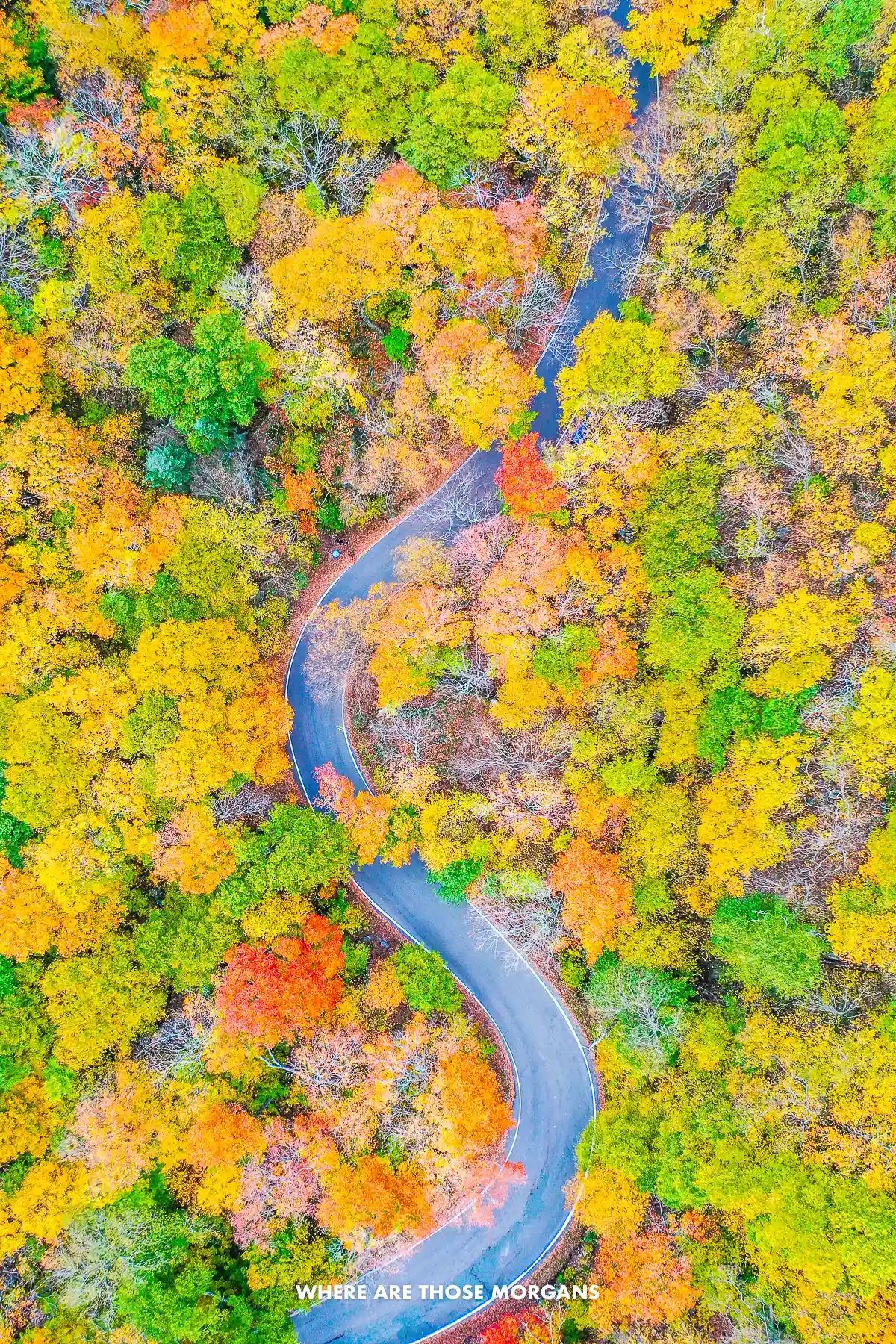
Our standout experiences from this route:
- Exploring the best of Lake Placid
- Hiking Artists Bluff Trail
- Soaking up the best of Stowe VT
- Driving the Mt Washington auto road
- Seeing the best of Woodstock VT
- Driving the Kancamagus Highway
- Discovering the best of Burlington VT
- Walking through the Flume Gorge
- Enjoying the best of Manchester VT
If we weren’t driving our own vehicle, we’d rent a car at Boston airport and use the same drop off location. There are other airport options like NYC, Montreal, or even Burlington VT but Boston is easiest and most commonly used.
e-Book: We also have a great New England fall road trip guidebook that includes itinerary variations, what to do in each stop, places to eat and stay, and an exclusive map to use throughout the road trip.
Utah Mighty 5 National Parks
Highlights: Zion, Bryce Canyon, Capitol Reef, Arches, Canyonlands
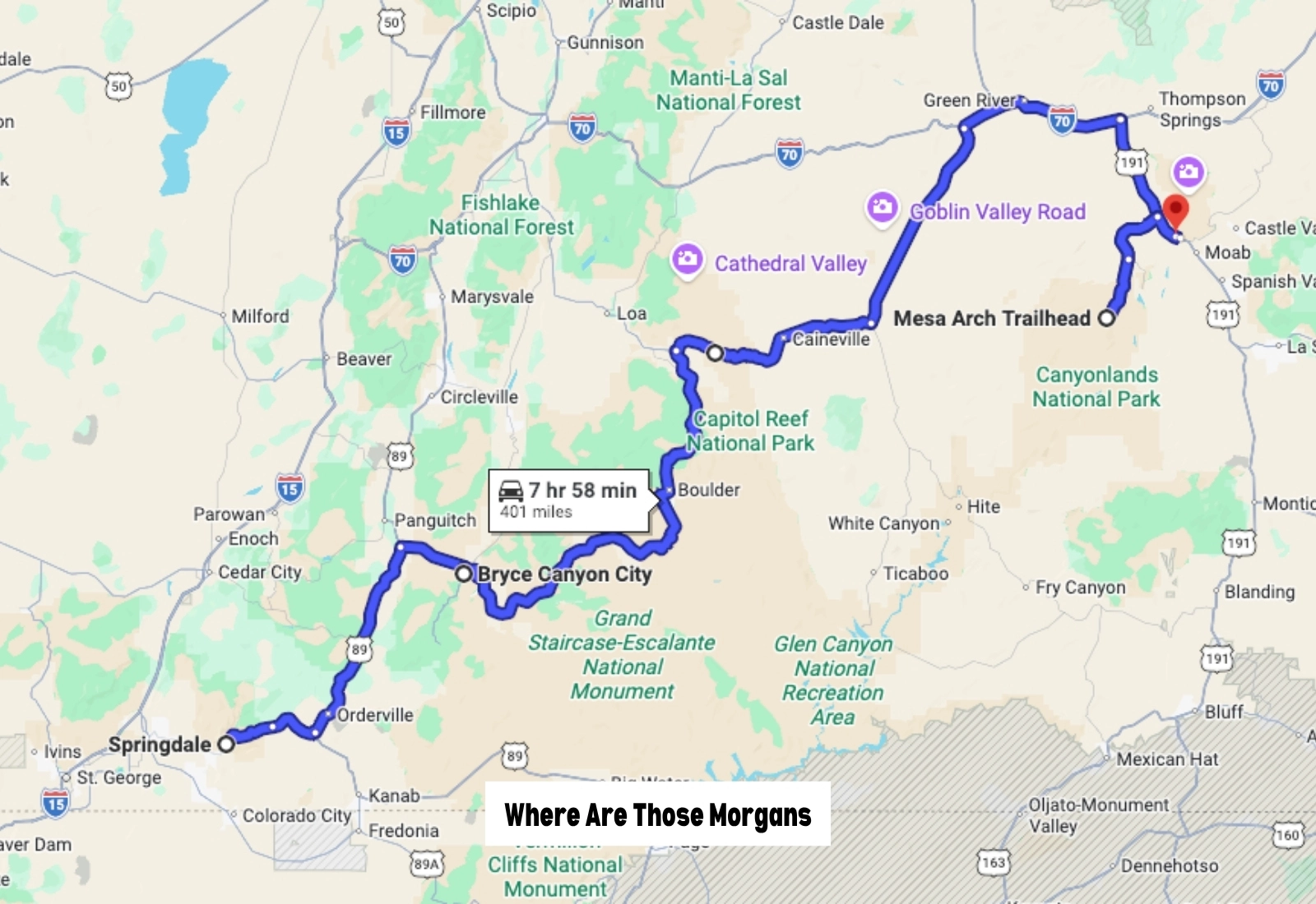
- Start: Springdale, UT
- End: Moab, UT
- Distance: 401 miles
- Days: 6+
- Season: Year round
Ask anyone to name a great American road trip, and they’re almost certainly going to say Route 66. It’s the default answer, right? But Route 66 peaked in the 1940’s and 1950’s. Today, we think Utah’s Mighty 5 National Parks route is probably the most well-known and heavily used road trip in the USA. We drove it back in 2019, visiting all five national parks along the way, and we immediately understood why it’s become so popular.
We love hiking and photography, they’re two of our favorite things in life. And the Mighty 5 road trip is like an adventure playground for hikers and photographers, so naturally, we were in our element. Zion’s hikes blew us away, Bryce Canyon’s striking amphitheater was totally unique, and we thought Capitol Reef was underrated. The hikes in Arches were so much fun, and we really liked the small section of Canyonlands we visited called Islands in the Sky.
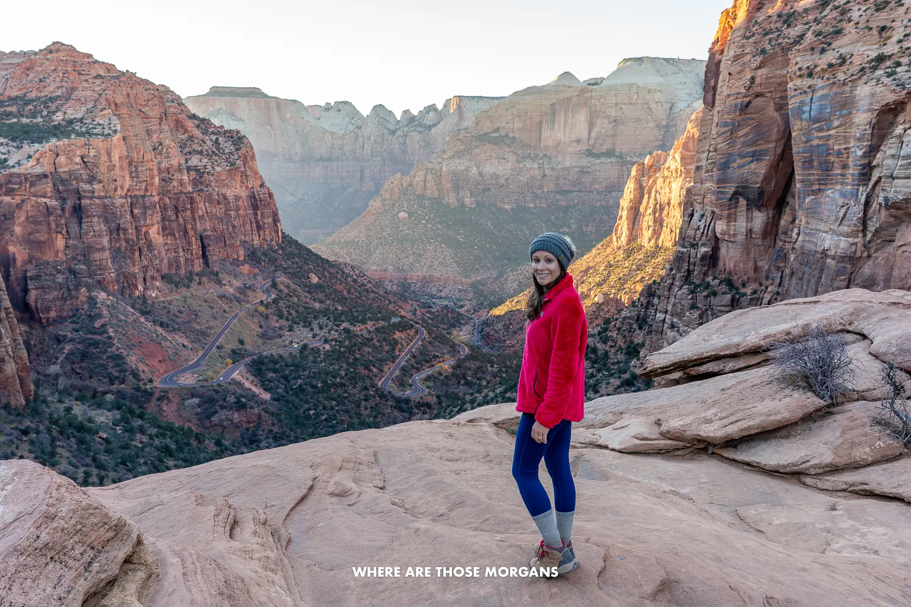
The only park we’ve revisited since is Zion, but we plan to visit them all again one day, and next time we’ll drive it in June or September when the temperatures are a bit warmer. We’d say 6 days is the minimum time frame to plan for the Mighty 5 – that would be two days for Zion, and for one for each of the other four parks. But 9-11 days would be much better.
This is a road trip for outdoorsy couples and families with kids who love to hike. To be honest, if we weren’t hikers, we’re not sure we’d bother driving the Mighty 5. Most of our major highlights from each park were hikes, and even the iconic photo spots required a hike to reach them. We don’t want to make it sound exclusionary, but it’s not a road trip we’d want to take older or less able family members. Instead, we’d look into other Utah road trip routes to see if they were a better fit.
Our standout experiences from this route:
- Day hiking The Narrows
- Hiking Angels Landing
- Day hiking The Subway
- Watching sunrise at Mesa Arch
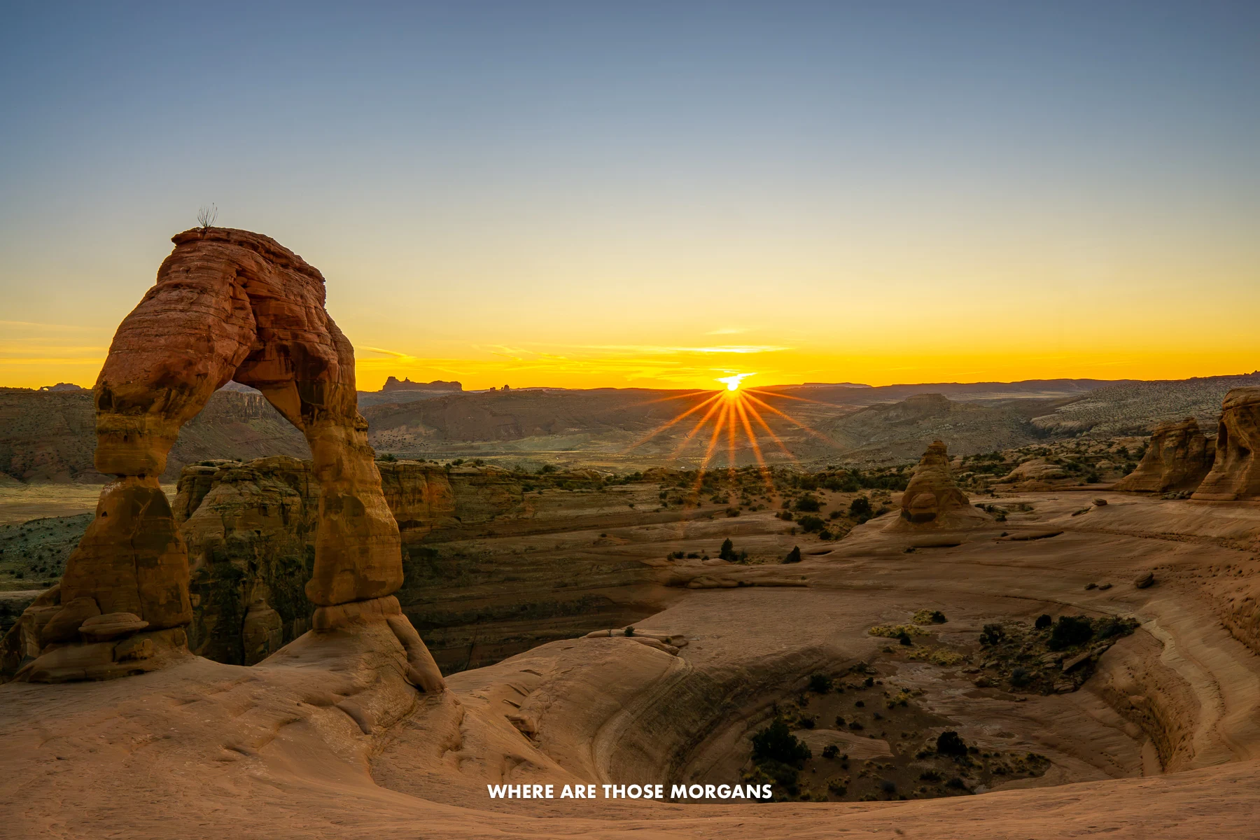
- Hiking Delicate Arch at sunset
- Watching sunrise over Bryce amphitheater
If we weren’t driving our own vehicle, we’d rent a car at Las Vegas airport. It would probably make more sense to drop it back off in Vegas, but we’d consider a Salt Lake City airport drop-off just for a change of scenery, although two one-way flights would almost certainly cost more than round trip flights through Vegas.
American Southwest (Grand Circle)
Highlights: Mighty 5, Grand Canyon, Kanab, Page, Monument Valley, Valley of Fire, Hoover Dam
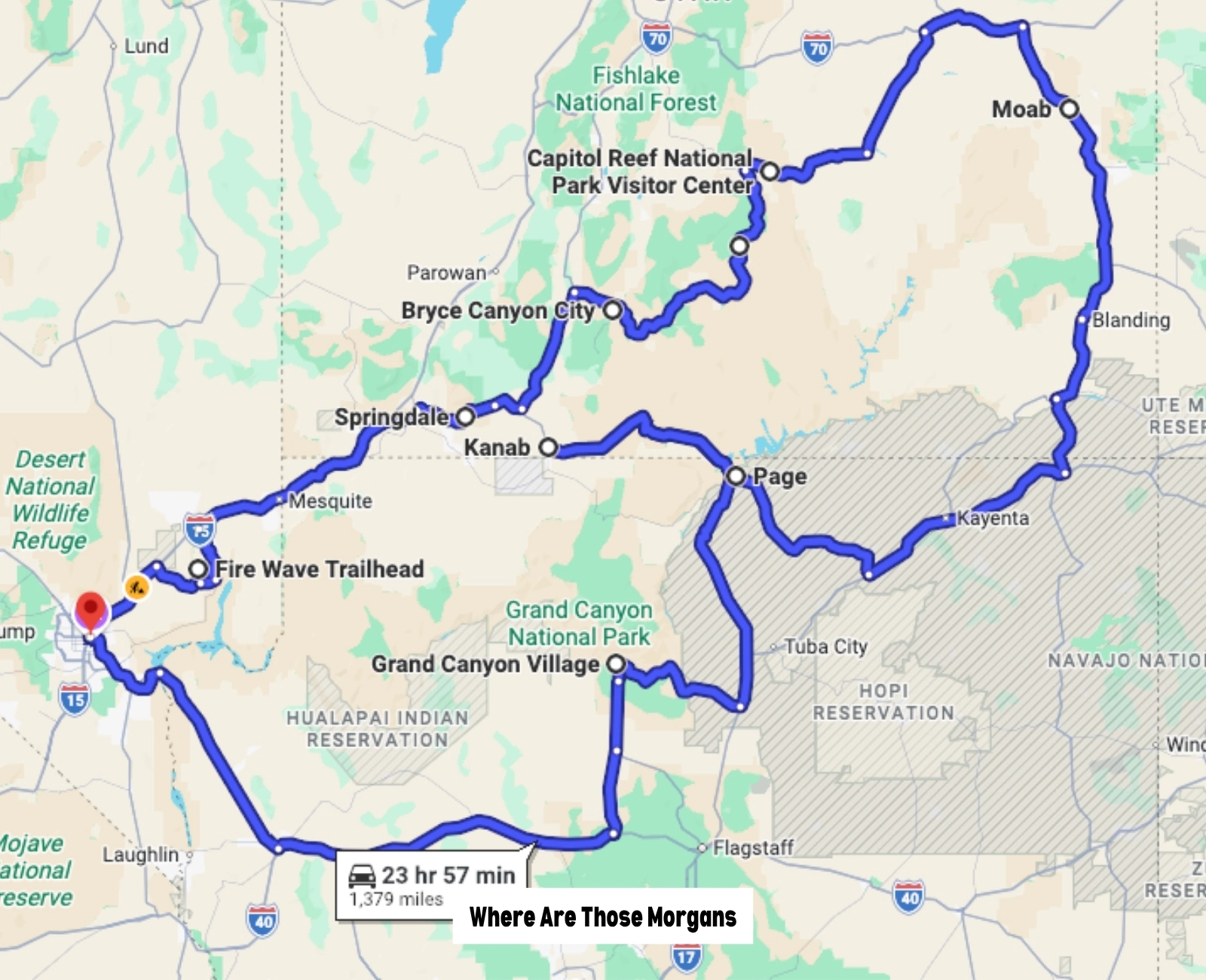
- Start: Las Vegas, NV
- End: Las Vegas, NV
- Distance: 1,300+ miles
- Days: 10+
- Season: Year round
The Grand Circle is the ultimate American Southwest road trip, and it’s not a one-size-fits-all route. For us, the core is basically the Mighty 5 plus Page (for Horseshoe Bend and Antelope Canyon), Kanab, and Grand Canyon South Rim. But the beauty of this region is that there’s so much more to see and do nearby. Many people add on parts of Colorado, New Mexico, Arizona, or Nevada depending on personal preferences. Personally, our very first addition to the classic route would be Sedona, one of our favorite places to hike in the US.
We wanted to include the Grand Circle separately to the Mighty 5 because they are completely different road trips. The Mighty 5 is about visiting Utah’s five national parks as quickly as possible, whereas the Grand Circle is better suited to longer trips and people who are interested in more than just hiking. Over the years, we’ve spent a lot of time around southern Utah and northern Arizona, and that’s where we’d focus most of our energy if we were planning this road trip right now.
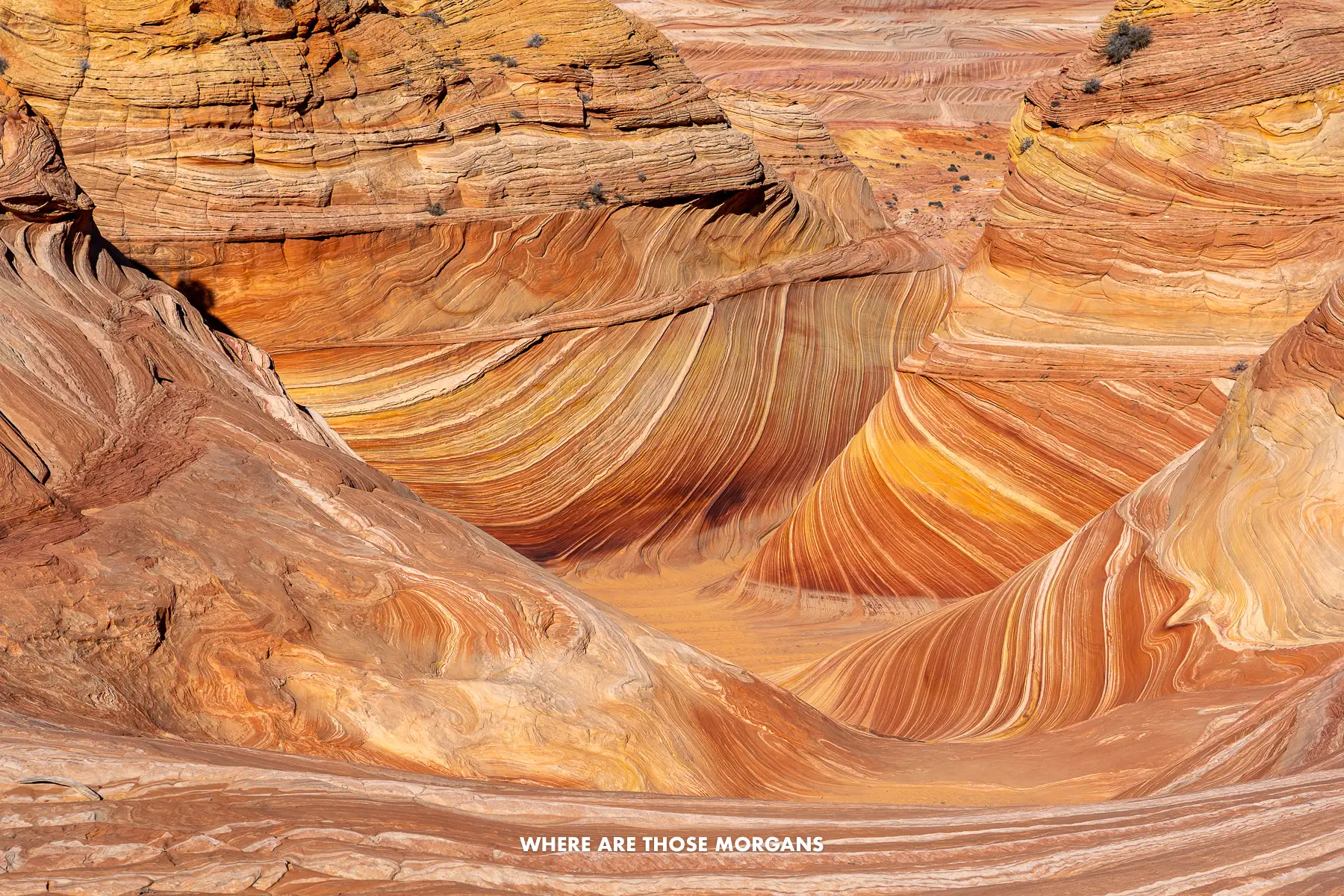
In its most basic form, we’d allow 10 days minimum for the Utah parks, Grand Canyon, Page and Kanab. And that’s not even factoring in time for Valley of Fire at the beginning which we think is an unmissable hidden gem, or a few days in Las Vegas at the end. So really, we’d be looking at closer to 20 days to slow down, enjoy it, and have wiggle room for things like bad weather or applying for a few next day permits to hike The Wave.
Las Vegas works really well as the start and end point for this amazing loop through the most dramatic red rock scenery in the southwest, not just for domestic travelers, but also for international long-haul visitors who want a taste of road tripping in America. And we’d say the Grand Circle has more of a true bucket list feel than just the Mighty 5, so it’s up there with the best options if you’re looking for a bit of inspiration.
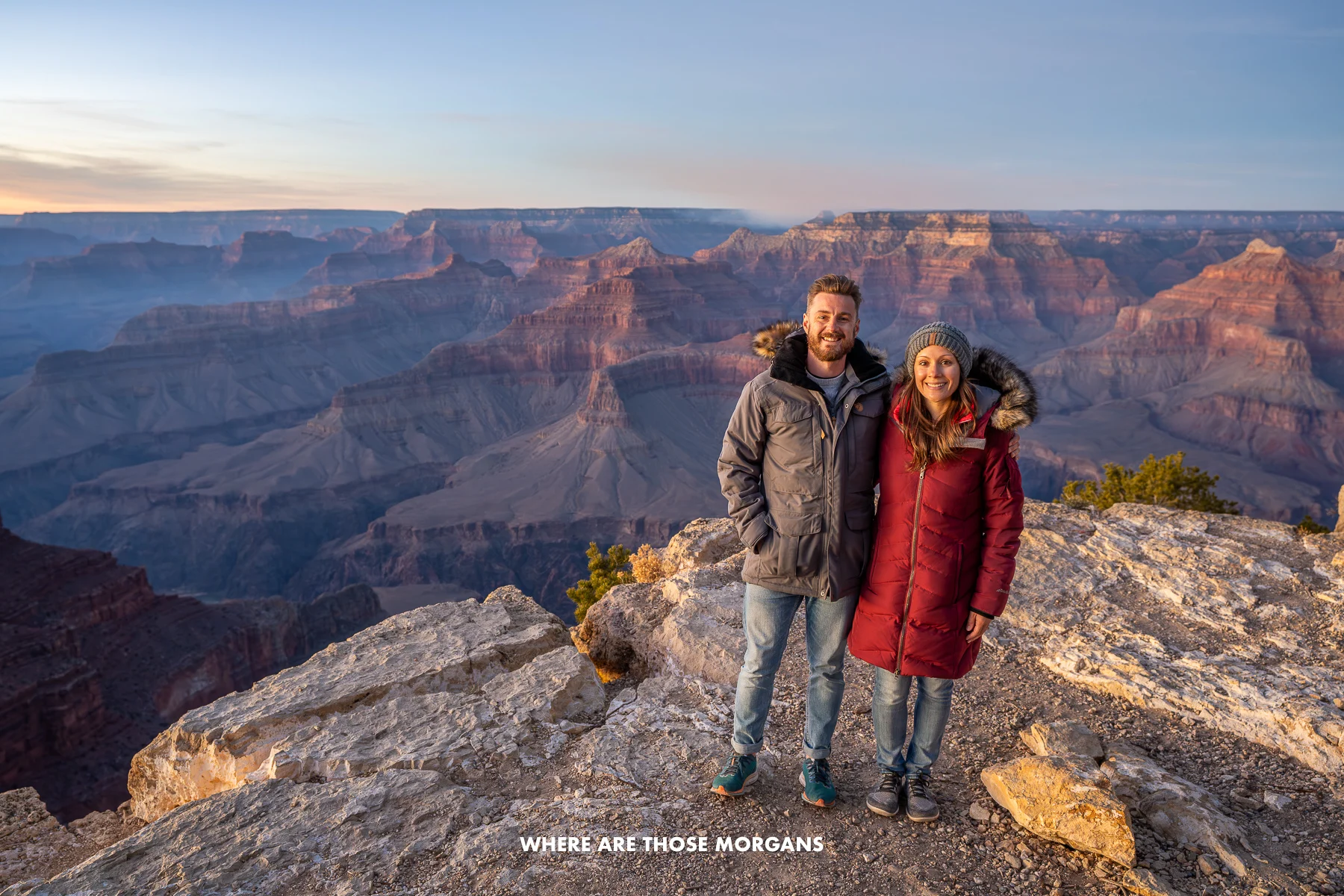
Our standout experiences from this route:
- Hiking to the Fire Wave in Valley of Fire
- Visiting the Mighty 5
- Hiking The Wave in Arizona
- Walking through Buckskin Gulch
- Seeing Monument Valley
- Photographing Horseshoe Bend
- Exploring the best of Kanab UT
- Visiting Grand Canyon South Rim
- Hiking in Sedona
- Visiting the Hoover Dam
- Seeing the best of Las Vegas
If we weren’t driving our own vehicle, we’d rent a car at Las Vegas airport and set the same drop-off. That said, the big alternative we’d consider here is adding in Sedona after Grand Canyon, which would make Phoenix airport the better drop-off option.
Our missing attraction: The only major thing we haven’t yet done on the Grand Circle is Antelope Canyon. We know how popular it is, and it does look cool – but for us it feels a bit overpriced so we’re reluctant to do it. Next time we probably will just to say we’ve done it, and we’ll book a tour like this Lower Canyon tour or this Upper Canyon tour.
Shenandoah & Blue Ridge Parkway
Highlights: Skyline Drive, Old Rag, Roanoke, Grandfather Mountain, Mt. Mitchell, Asheville, Great Smoky Mountains
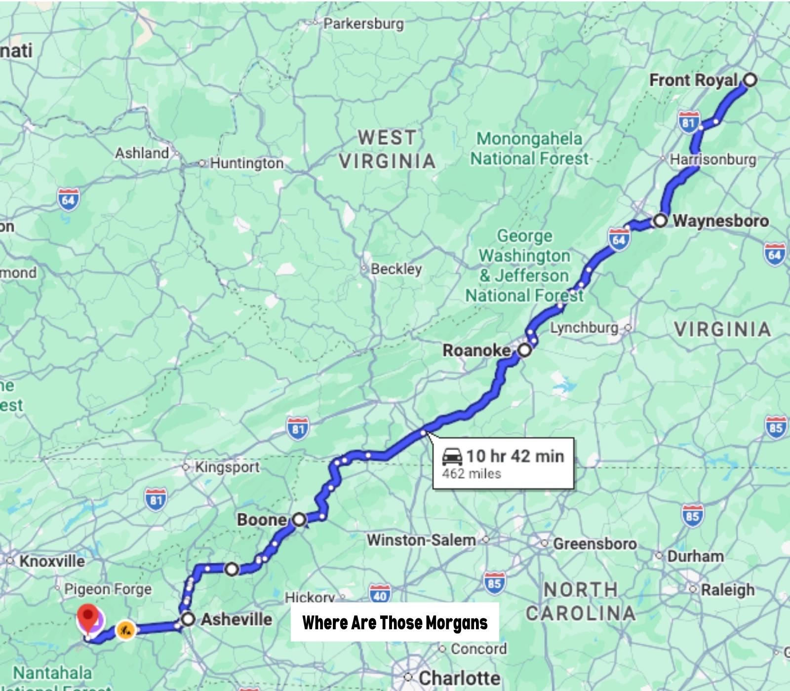
- Start: Front Royal, VA
- End: Cherokee, NC
- Distance: 500+ miles
- Days: 5+
- Season: May to October
Every year, the NPS releases visitor number statistics for the most visited national park service sites, and the Blue Ridge Parkway always occupies the number one spot (15.7 million in 2022 and 16.5 million in 2025). Because it’s on the heavily populated East Coast, and runs 469 miles point to point, there’s a lot of places for locals to quickly just hop on for a quick drive. But in our opinion, driving the whole thing from top to bottom should be on every US road trip bucket list.
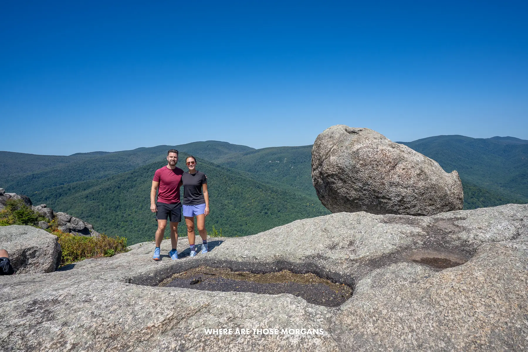
We’ve done the full Skyline Drive in Shenandoah and thought it was fantastic. We took 3 days to go slow, hike every trail (Old Rag was immense), and have a bit of time to enjoy in small towns along the way. Frustratingly, we’ve actually lived in the Raleigh / Durham area since 2024, and we still haven’t made it over to drive the Blue Ridge Parkway proper yet because we started a family and used up all our travel time visiting grandparents in the US and UK. So this one is at the very top of our wishlist.
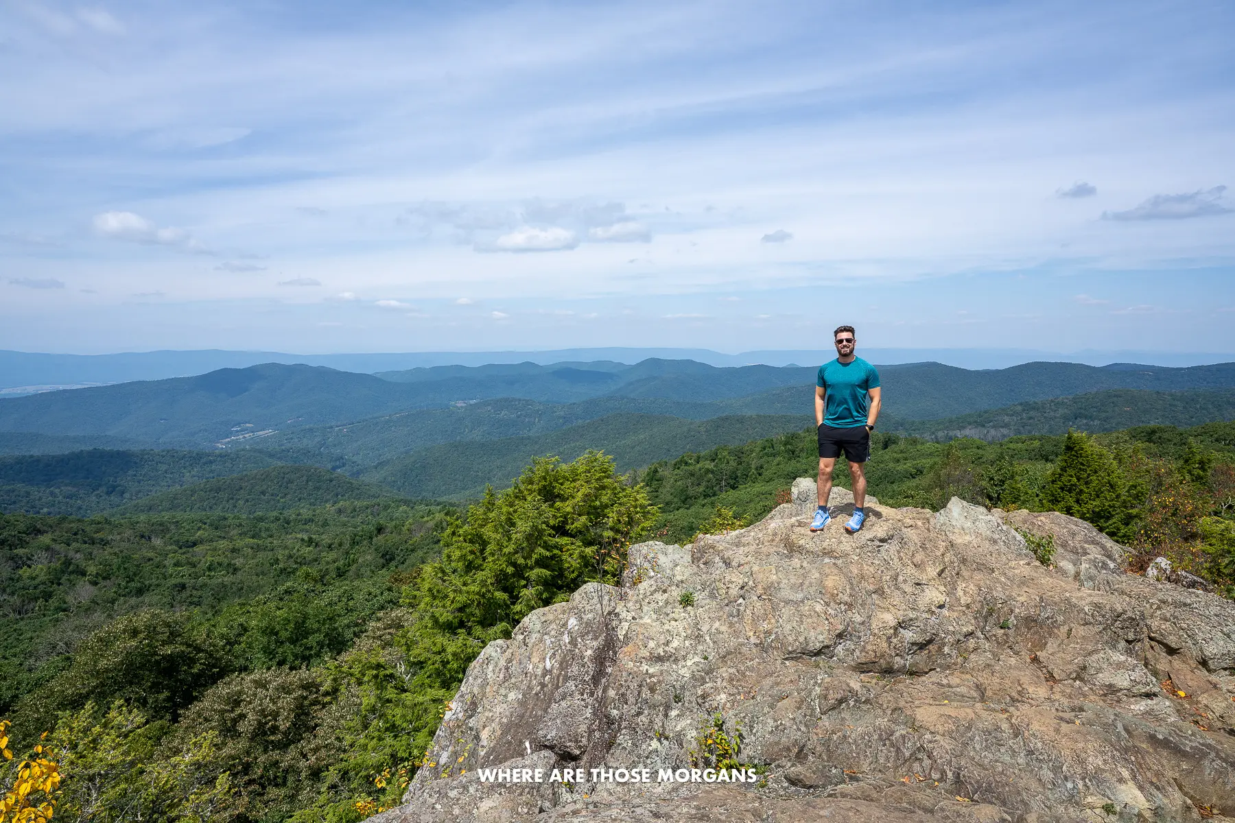
We’d love to drive the Blue Ridge Parkway when it really bursts into life in October as those fall foliage colors work down from New England and light up Virginia and North Carolina. But we know that’s when it also gets out of control busy, so maybe June or September might be better months to do it. We’d probably allow for at least a week, which would give us plenty of time to hike Mt. Mitchell and Grandfather Mountain, but also spend time wandering around towns like Roanoke, Boone, and Cherokee.
This is a road trip for pure scenery. It’s one of those snail-slow, constantly curving roads with tons of roadside pullover stops to soak in far reaching views. We’d definitely include a few hikes, but at the same time we don’t think hiking is an essential part of driving the Blue Ridge Parkway, which makes it feel more inclusive for anyone.
Our standout experiences from this route:
- Cruising Skyline Drive
- Hiking Old Rag
- Seeing Luray Caverns
- Drinking beers in Asheville’s breweries
And here’s what we’ll prioritize when we drive the whole thing:
- Natural Bridge
- Mabry Mill
- Roanoke
- Grandfather Mountain State Park
- Boone
- Mount Mitchell State Park
- Asheville
- Biltmore Estate
- Great Smoky Mountains National Park
If we weren’t driving our own vehicle, we’d rent a car from Washington Dulles airport and set the drop-off location as either Charlotte ariport or Atlanta airport. They’re around the same distance from Cherokee at the southern end of the Blue Ridge Parkway.
Outer Banks
Highlights: Corolla, Duck, Kitty Hawk, Hatteras Island, Ocracoke Island
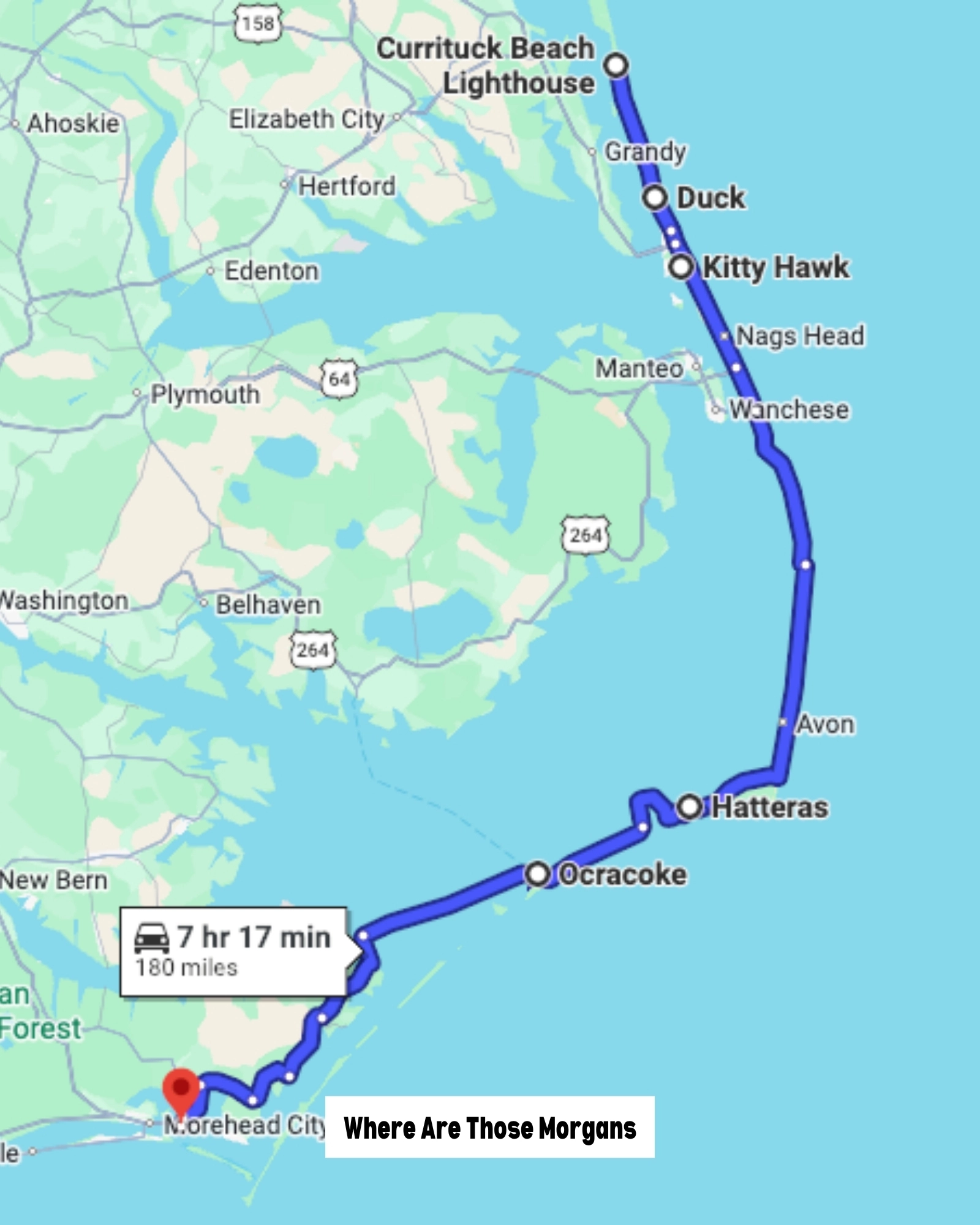
- Start: Corolla, NC
- End: Beaufort, NC
- Distance: 148 miles (+25 miles by ferry)
- Days: 2+
- Season: Year round
Looking for something a bit slower, easier, and more relaxing? Well, let’s shift focus from North Carolina’s mountains to its coastline, and specifically the Outer Banks scenic byway. The NC coast is loaded with beach vacation spots for different vibes, but the OBX is unique because it stretches more than 150 miles north to south – and it’s ready-made for a long weekend road trip.
We’d already done Wilmington and Topsail, and ever since watching the TV show Outer Banks, we’d been excited to see the OBX. We booked a 4-night midweek stay in Kitty Hawk, and we spent our days exploring Duck, Kill Devil Hills, Nags Head and Roanoke Island. It was a brilliant trip, but we didn’t expect it to be so commercialized, and it felt nothing at all like the TV show (yes, we know it was filmed near Charleston, SC).
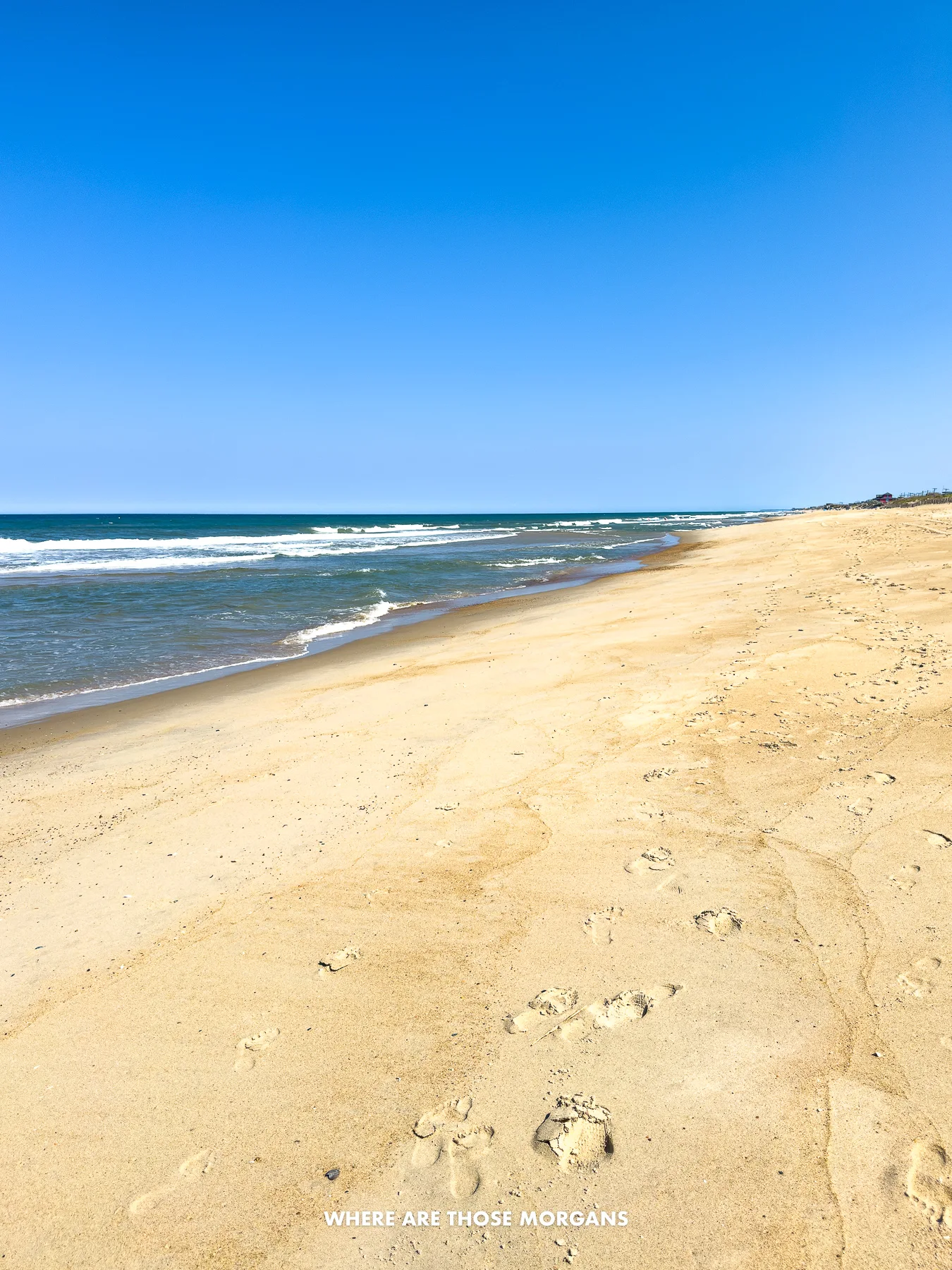
We chose to stay around Kitty Hawk because we wanted to visit the Wright Brothers National Memorial, Jockey’s Ridge State Park, and Nags Head Woods Preserve. But after doing a bit more research while lounging on the sand, we realized that the southern portion of the OBX from Bodie Island down through Cape Hatteras and Ocracoke Island was more like what we’d expected.
So next time, we’d skip the commercialized center of the OBX and instead spend two or three days very slowly driving down the quieter, more scenic portion of the scenic byway with two ferry crossings. We’d also give ourselves extra time to see wild horses running on the beach north of Corolla. This would be a road trip for escapism, beach access, photography, and ultimate relaxation.
Our standout experiences from this route:
- Tasting donuts at the original Duck Donuts
- Visiting Wright Brothers National Memorial
- Climbing the dunes at Jockey’s Ridge State Park
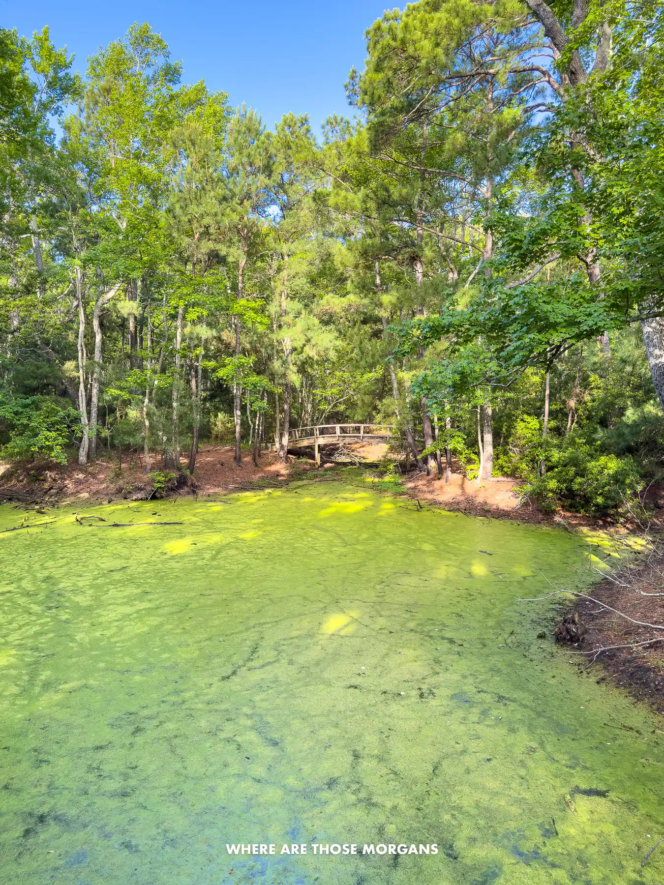
- Exploring Nags Head Woods Preserve
- Chilling on the beach
- Taking our daughter to North Carolina Aquarium
And here’s what we’ll prioritize when we drive the whole thing:
- Seeing wild horses in Corolla
- Seeing Currituck Beach Lighthouse
- Photographing Bodie Island Light Station
- Relaxing around Cape Hatteras National Seashore
- Seeing Cape Hatteras Light Station
- Visiting Graveyard of the Atlantic Museum
This road trip works better for East Coasters driving from home rather than flying in because airport logistics aren’t great. Raleigh / Durham (our home airport) is the closest major airport to the OBX, but it’s a 4-hour drive to the north side and 3 hours back from the south side of the Outer Banks. Here’s RDU airport car rental. The closer option would be Norfolk VA round trip with this car rental, but there would be a long drive back up from the south end of the OBX, and fewer airports will have direct connections to Norfolk vs Raleigh / Durham.
Seattle To Sedona
Highlights: Olympic, Oregon Coastline, Crater Lake, Lake Tahoe, Yosemite, Death Valley, Las Vegas, Grand Canyon, Sedona
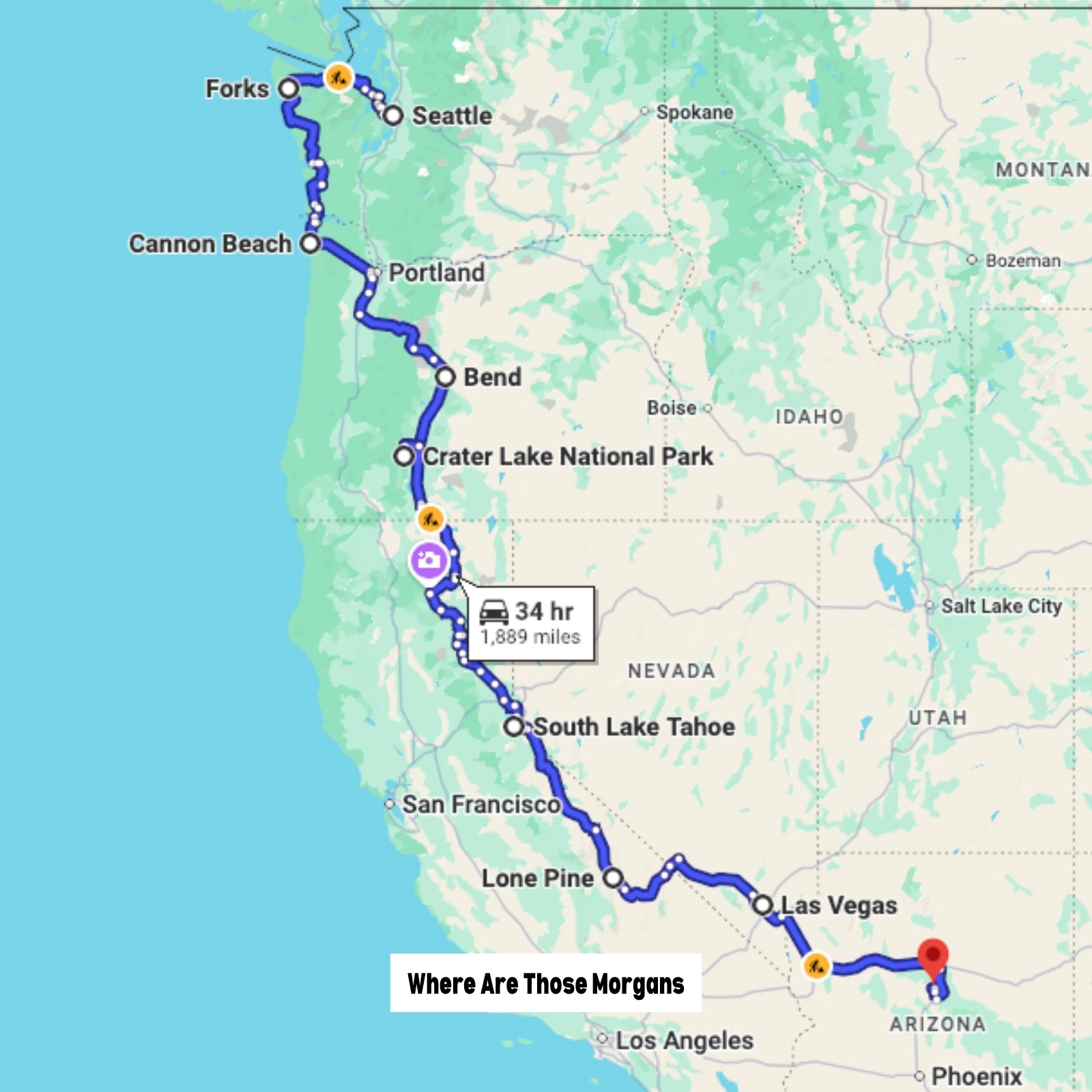
- Start: Seattle, WA
- End: Sedona, AZ
- Distance: 2,000+ miles
- Days: 30+
- Season: Year round
We know this looks like we’ve just chosen two totally random US cities and called it a road trip. But there was a plan here. After living in Seattle for 6 months in 2021, we had to drive back to Upstate NY, but we’d already driven across the northern US twice and we had no idea when we’d be back out west again, so we spent a few days mapping out an action-packed West Coast road trip.
We’d already done California’s PCH, and we wanted to see the Orgeon coastline, Lake Tahoe, and the Alabama Hills on the east side of the Sierra Nevada mountains. Plus, Sedona had been on our bucket list for years, so we planned a long stay at the end of our road trip. In the end we spent a little over 2 months driving this route and it was honestly an incredible experience that we’ll always remember.
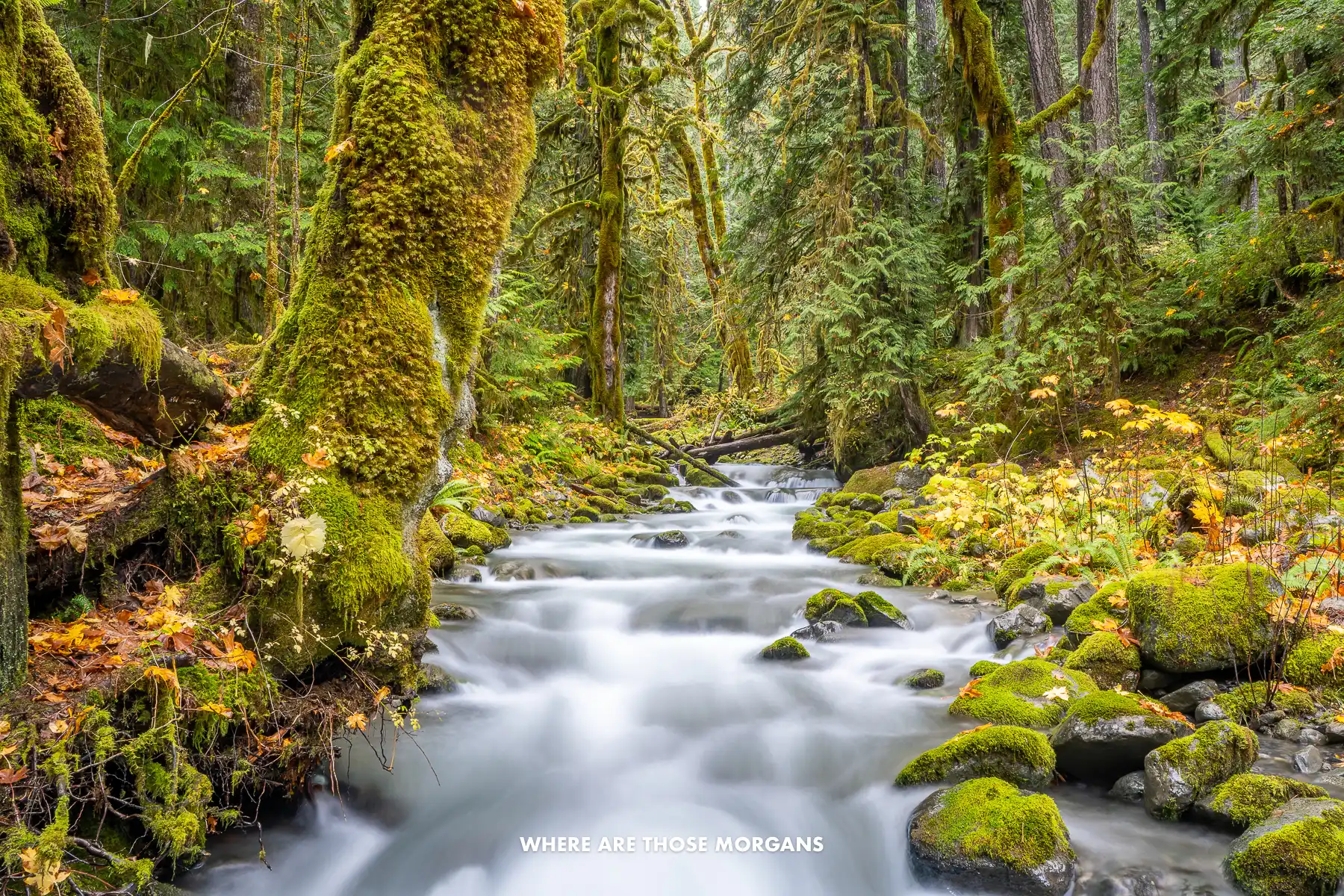
We left Seattle in October, spent a week town hopping on the Oregon coast, drove inland to Bend and Crater Lake, visited Lava Beds National Monument, stopped in Lake Tahoe for five days, bathed in secluded hot springs near Mammoth Lakes, took amazing photos of the Alabama Hills near Lone Pine, spent a few days in Death Valley, hung out in Vegas, revisited the Grand Canyon, and finished with one week in Sedona.
The beauty of this road trip was how many amazing options we had. This part of the US is overflowing with awesome outdoorsy adventure spots, so we had very few days of “just driving”. We know most people can’t just take a month or two off for a road trip, but if you do have the opportunity to do something like this, we can’t recommend our route highly enough. We’d say it’s a better West Coast road trip than driving the full PCH because our route was so much more varied and it avoided big cities like San Francisco and Los Angeles.
Our standout experiences from this route:
- Hiking in Olympic
- Photographing Haystack Rock in Cannon Beach
- Visiting Tillamook Creamery
- Hiking Silver Falls State Park
- Exploring Lava Beds underground tunnels
- Photographing Lake Tahoe
- Relaxing in Mammoth Lakes hot springs
- Photographing Mobius Arch in Alabama Hills
- Exploring Death Valley
- Soaking up Las Vegas
- Hiking Rim to River in Grand Canyon
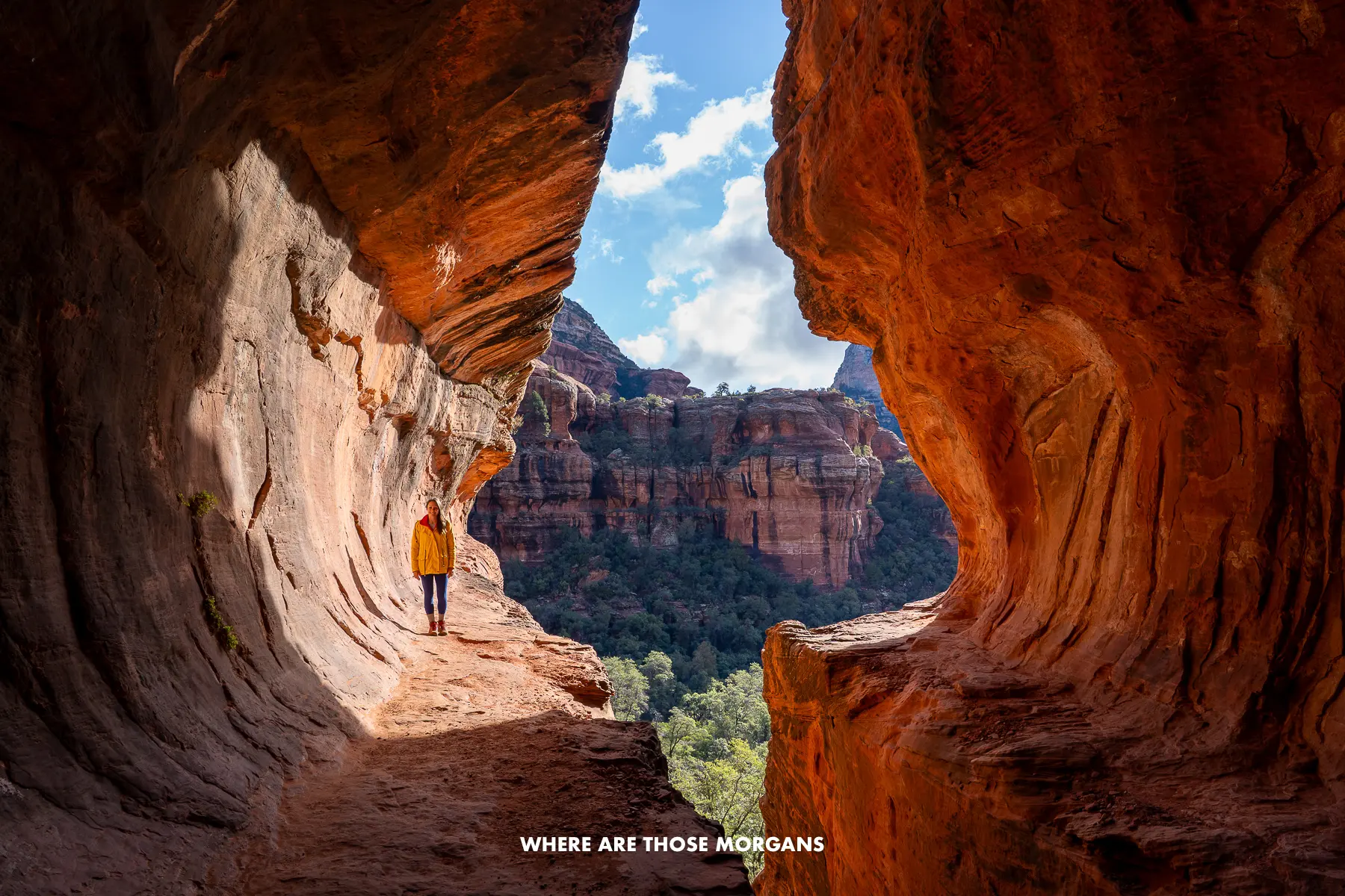
- Hiking in Sedona
East Coasters who wanted to follow this route would need to weigh up driving across country versus paying for flights and a long car rental. If we lived within 12-16 hours drive of Seattle, we’d drive our own car. Otherwise we’d fly and rent a car at Seattle airport with Phoenix as our drop-off location.
San Francisco To San Diego
Highlights: SF, Carmel, Big Sur, Solvang, Santa Barbara, LA, San Diego
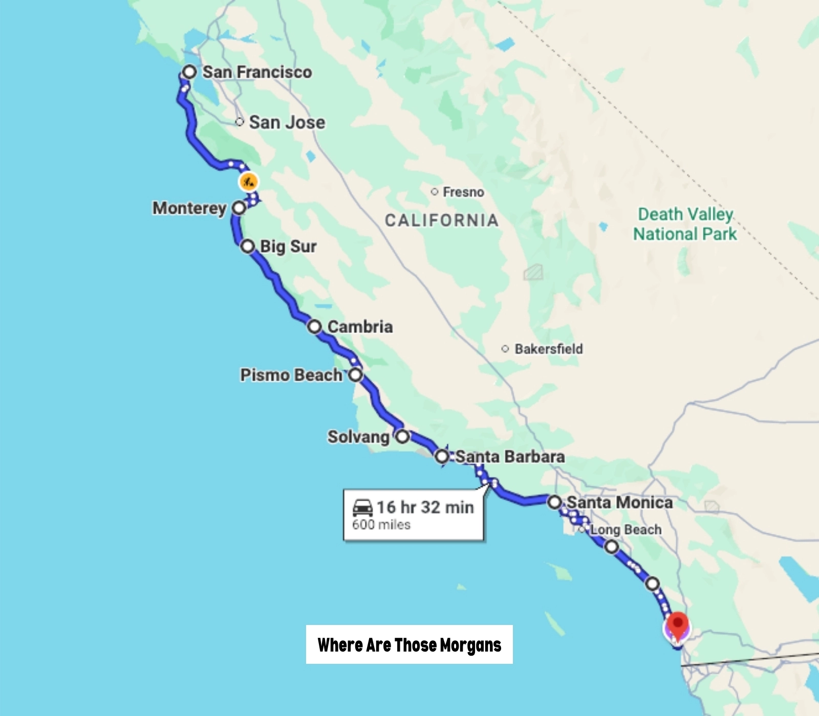
- Start: San Francisco, CA
- End: San Diego, CA
- Distance: 600 miles
- Days: 5+
- Season: Year round
The full Pacific Coast Highway from Olympic, WA to San Diego, CA would be an incredible road trip experience, but it’s also a mammoth undertaking that requires a lot of time, so most people stick to the California portion of Highway 1. We drove from San Francisco to San Diego in November 2019, and we absolutely loved it.
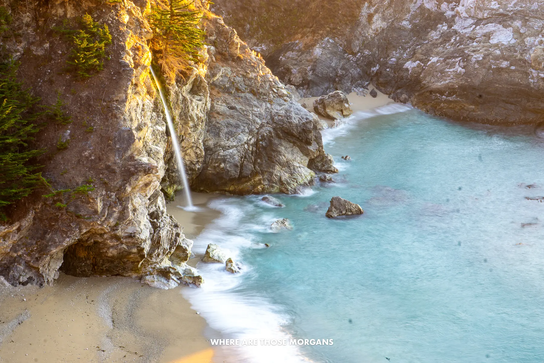
The weather was beautiful, the road was surprisingly quiet, and we stopped more than 20 times at golden sandy beaches, striking waterfalls, curving bridges, photogenic lighthouses, spectacular coastal viewpoints, unique small towns, and major cities. We did 3 days in each of San Francisco, Los Angeles and San Diego, and spent another 3 days driving along the PCH between SF and LA for a total of 12 days.
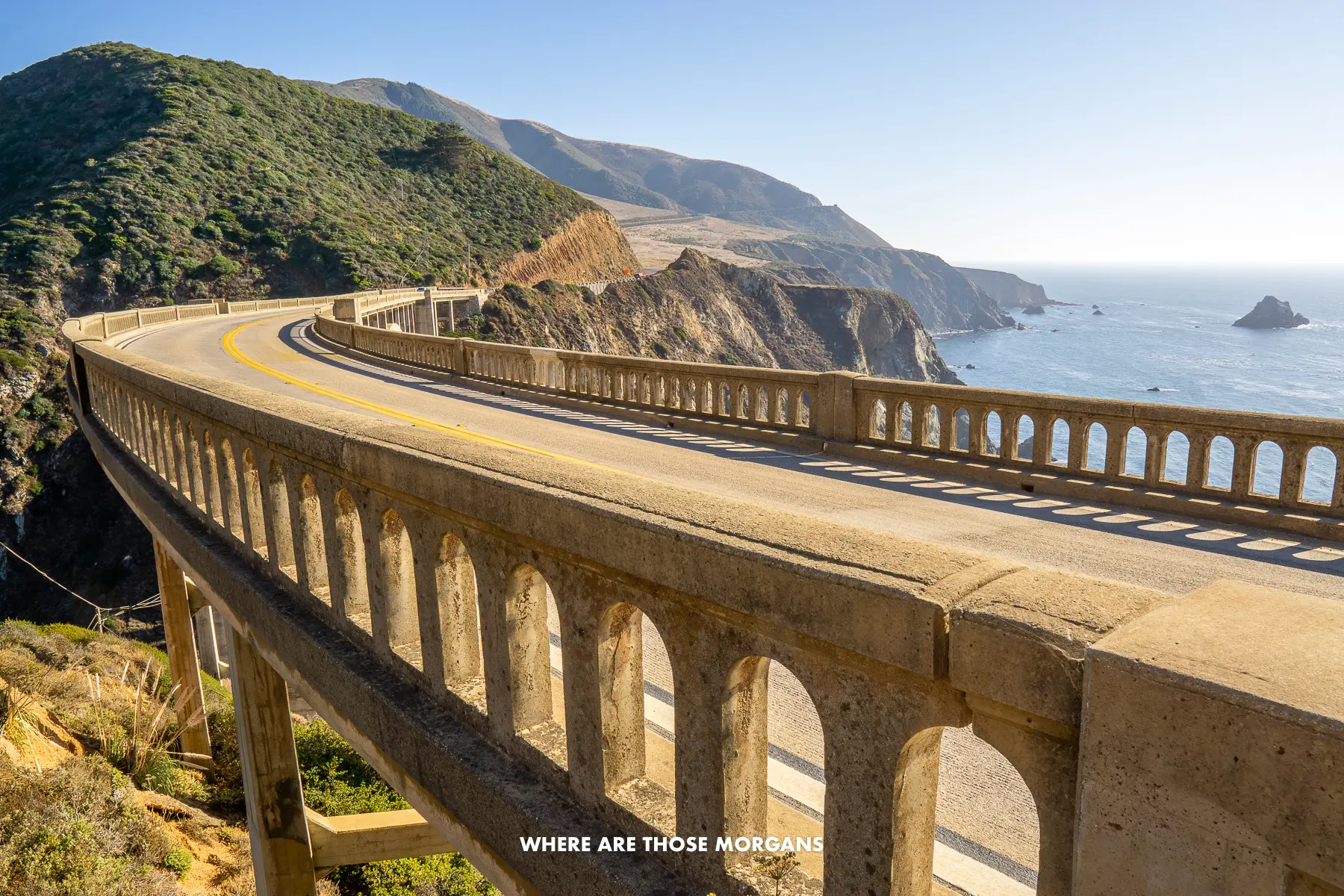
The famous cities were awesome to see for the first time, but our big regret was only having three days for the driving part between SF and LA. We wished we had longer to stop more times, not feel like we were against the clock, and drive fewer miles each day. We’d say our favorite stops along the road trip (other than the cities) were Carmel-by-the-Sea for elegance, Big Sur for big views, Solvang for beers, and Santa Barbara for style.
It wasn’t all good though. Some of the places we stopped were a bit more rough around the edges than other road trips we’ve taken, and US travel is never cheap but this road trip cost us small fortune. Not just hotels and food, but also every single state park had its own $10 entry fee which quickly added up. At the time, we said three of these small beach state parks don’t make a Yellowstone or Zion in terms of pricing.
This is a road trip for movie-style bucket list adventure. We’d guess this is the US route most long-haul international visitors drive. It’s hard to argue with a stunning coastline road connecting three major US city destinations!
Our standout experiences from this route:
- Seeing the best of San Francisco
- Touring Alcatraz
- Visiting Monterrey Aquarium
- Cruising the 17-Mile Drive
- Eating ice cream in Carmel-by-the-Sea
- Soaking up views along Big Sur
- Going Danish in Solvang
- Exploring the ritzy Santa Barbara
- Visiting the best of Los Angeles
- Touring Warner Bros Studio
- Watching the seals in La Jolla
- Seeing the best of San Diego
We had our own car when we drove down the California PCH, but if we didn’t, we would have spent our 3 days in SF, picked up a rental car in downtown SF (not the airport), driven the PCH including spending a few days in Los Angeles (taking the hit on paying for hotel parking), then continued driving down to San Diego. Or if we planned to spend 3+ days in LA, we would split into two different rentals, one from SF to LA, and one from LA to San Diego. We’d use Beverly Hills, West Hollywood or Santa Monica in LA, definitely not Downtown.
Coastal New England
Highlights: Boston, Salem, Portsmouth, southern Maine, Portland, Bar Harbor, Acadia
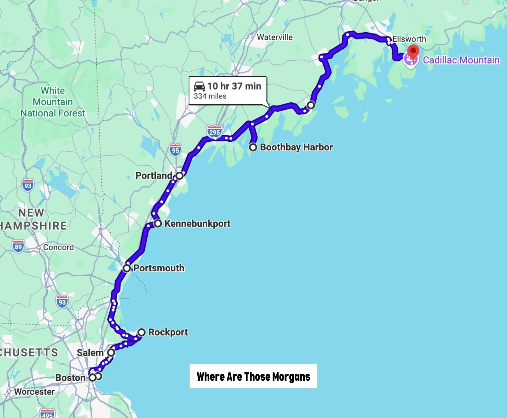
- Start: Boston, MA
- End: Bar Harbor, ME
- Distance: 334 miles
- Days: 5+
- Season: Late May to mid-October
Boston is the most common start and end point for foliage road trips through New England in the fall specifically, but it’s also popular for another famous road trip that runs right through the summer and early fall – town hopping along the New England coastline. The great thing about this route is that it’s so open to interpretation, there’s no one-size-fits-all itinerary.
Now, we wouldn’t spend a single minute in Boston if we flew in for the fall foliage road trip, that would be wasted time when chasing peak colors. But the coastal New England road trip is different, there’s no hurry, so we’d definitely spend two days in Boston walking around the Historic Downtown area, before heading up the coastline to Salem, Portsmouth, the cluster of southern Maine towns, Portland and Bar Harbor. We’d try to allow for at least 5 days for the coastal drive, not including Boston.
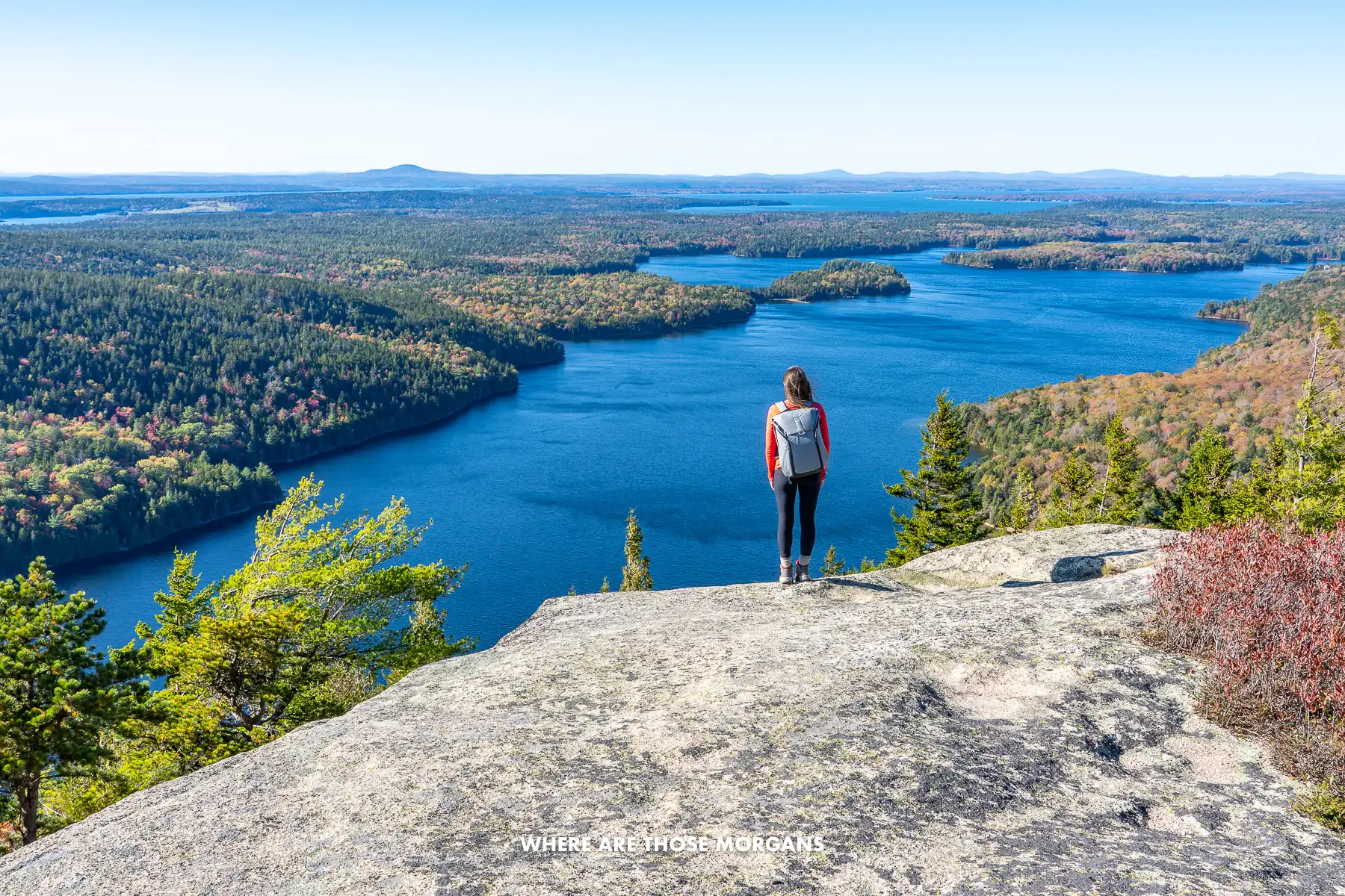
It was back in October 2019 when we drove a portion of coastal New England and knew we needed to go back later in life to do it properly over a longer period. We were bang smack in the middle of a fall foliage road trip, when we drove from Mt Washington to Acadia, spent 3 days hiking, then hopped down the coastline to Boothbay Harbor and Portland, before tracking back inland to pick up our fall foliage route.
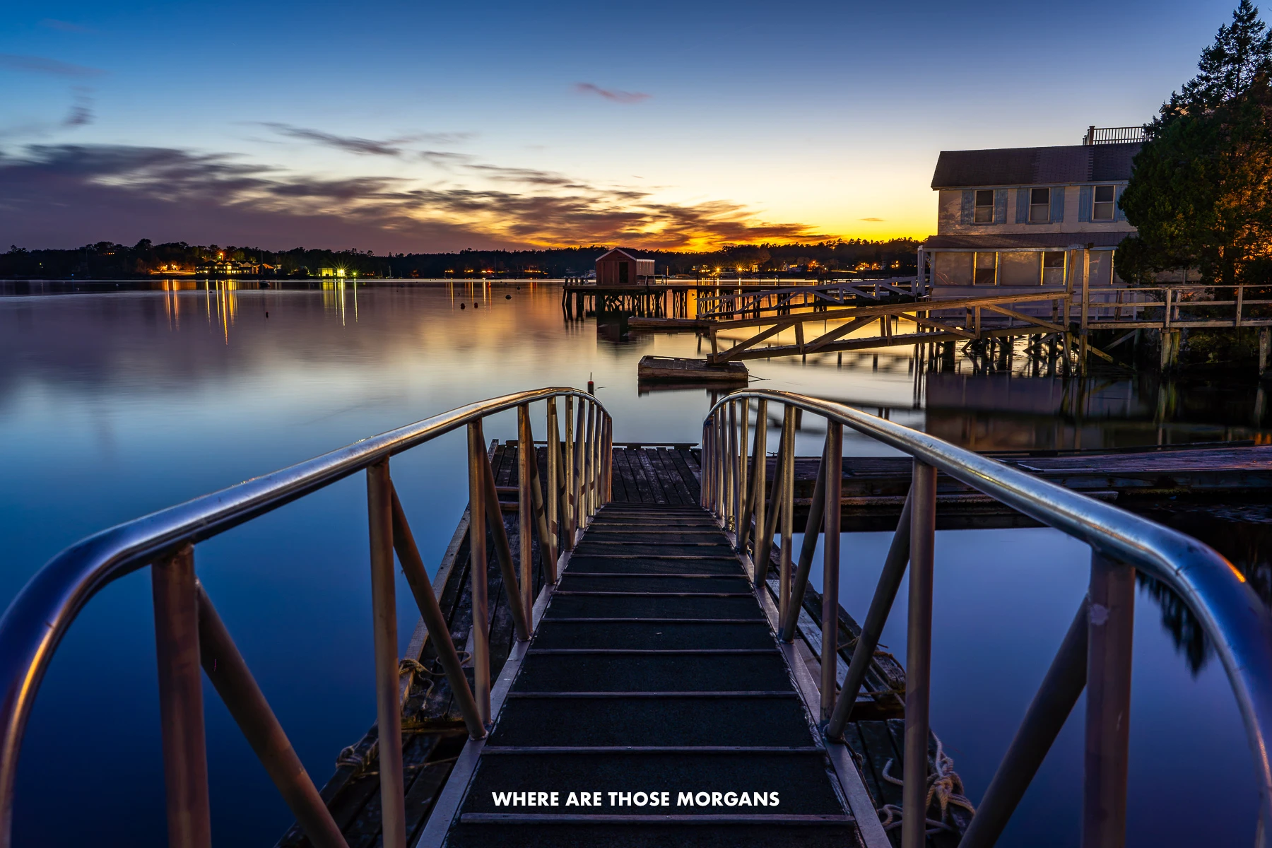
We really enjoyed the slower change of pace on the coast. It felt less chaotic and intense, instead being more sleepy and easy going. We think this is a road trip for relaxing in quaint coastal towns, breathing in crisp air, eating nothing but fresh seafood, and actually feeling like you’re taking a vacation. Acadia would add an element of adventure, but skipping the hikes there wouldn’t make or break this route. Finally, for the ultimate New England road trip, we’d love to combine the fall foliage spots with the coastal towns at the end, but it wouldn’t be cheap!
Our standout experiences from this route:
- Exploring Quincy Market in Boston
- Tasting beers in Portland
- Taking photos of Portland Head Light
- Relaxing in sleepy Boothbay Harbor
- Eating lobster rolls in upscale Bar Harbor
- Hiking in Acadia National Park
And here’s what we’ll prioritize when we drive the whole thing:
- Visiting Salem at Halloween
- Photographing Motif #1 in Rockport
- Seeing Castle Hill on the Crane Estate
- Walking around Newburyport
- Exploring Portsmouth NH
- Seeing Nubble Lighthouse in York
- Walking Marginal Way in Ogunquit at low tide
- Relaxing in Kennebunkport
- Taking a Whale spotting boat tour
If we weren’t driving our own vehicle, we’d rent a car from Boston airport round trip. The only alternative would be for anyone who goes up the coast first, but then also goes down the coast beyond Boston to Cape Cod, Rhode Island, and potentially even further down to Connecticut when Newport, New Haven or even NYC airports come into play.
Finger Lakes
Highlights: Letchworth, Corning Museum of Glass, Watkins Glen, Seneca Lake, Taughannock Falls, Skaneateles
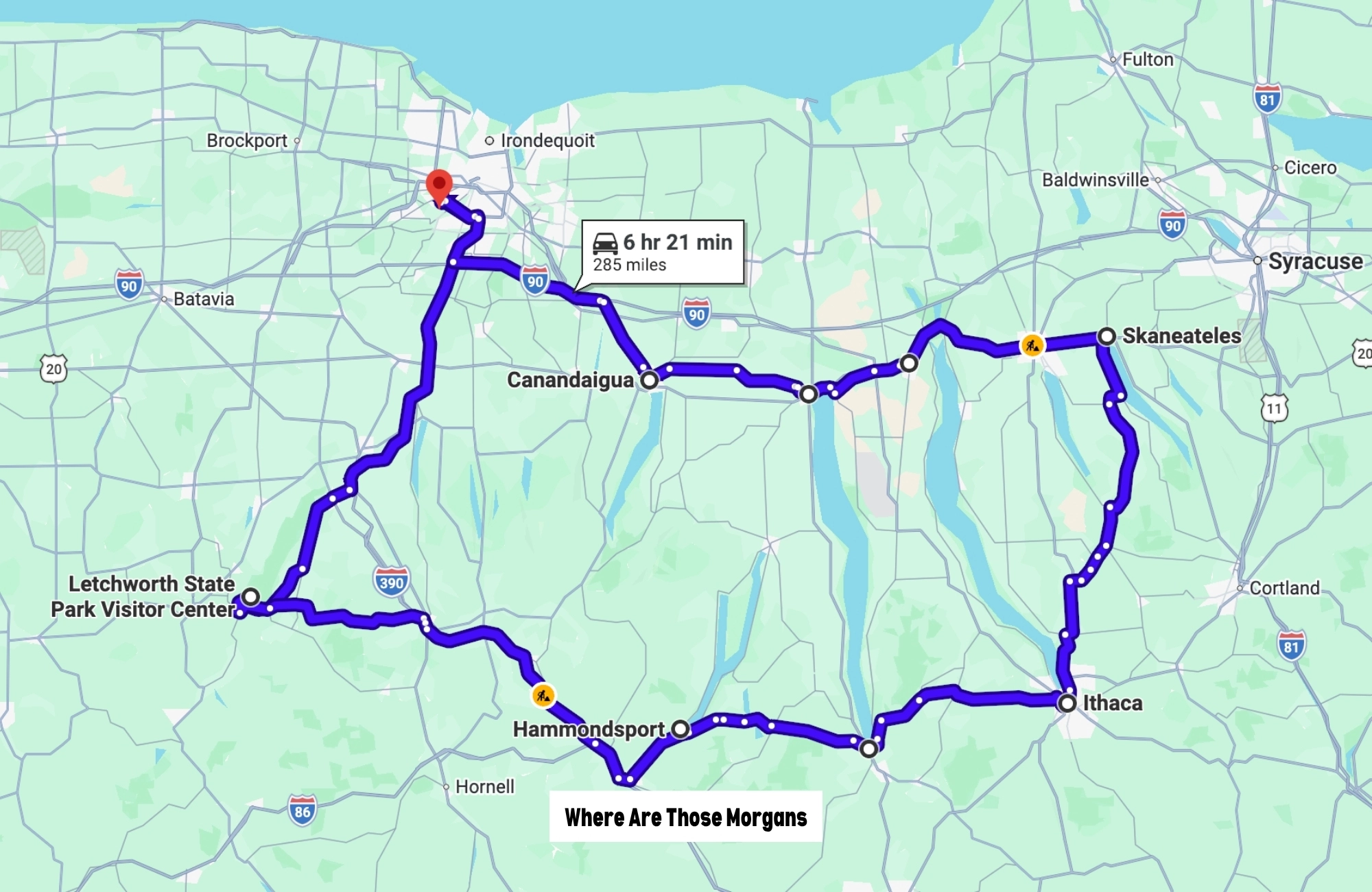
- Start: Rochester, NY
- End: Rochester, NY
- Distance: 285 miles
- Days: 6+
- Season: May to October
Our final route comes with a bit of regional bias. Kristen grew up in New York’s Finger Lakes region, and Mark has spent a lot of time there since moving to the US in 2019 – including a full year during covid lockdowns. We’ve explored the Finger Lakes area extensively, but we’ve also seen a massive amount of the rest of America so we have the reference points – and we think the Finger Lakes fully deserves a spot in this list.
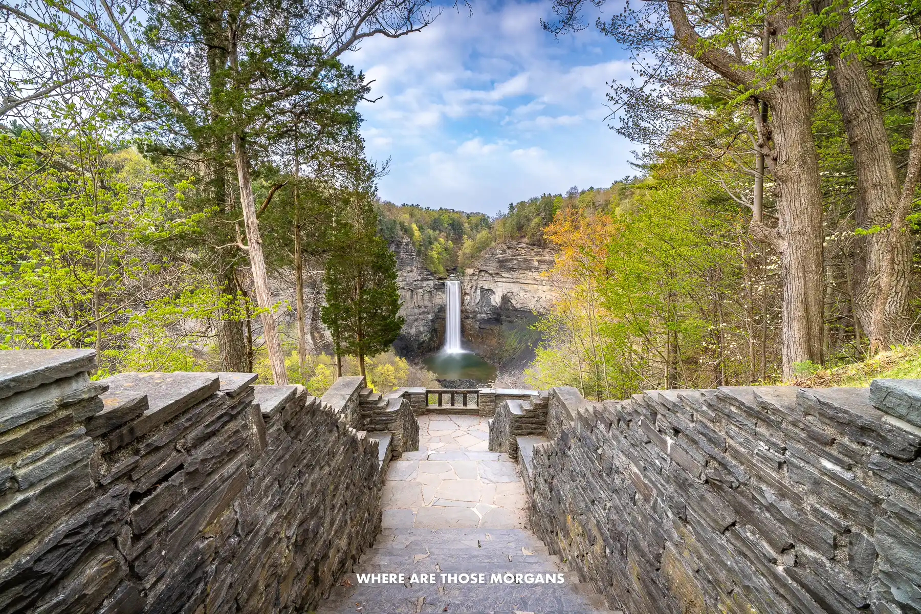
Wondering what’s so special about a long line of skinny finger-shaped lakes? The answer is gorges, waterfalls, and wine. More specifically, the glaciers that carved out the Finger Lakes left us steep-sided gorges and plunging waterfalls at places like Watkins Glen and Taughannock Falls, and well-drained shale and limestone soils that make the surrounding hillsides some of the best cool-climate wine country in America.
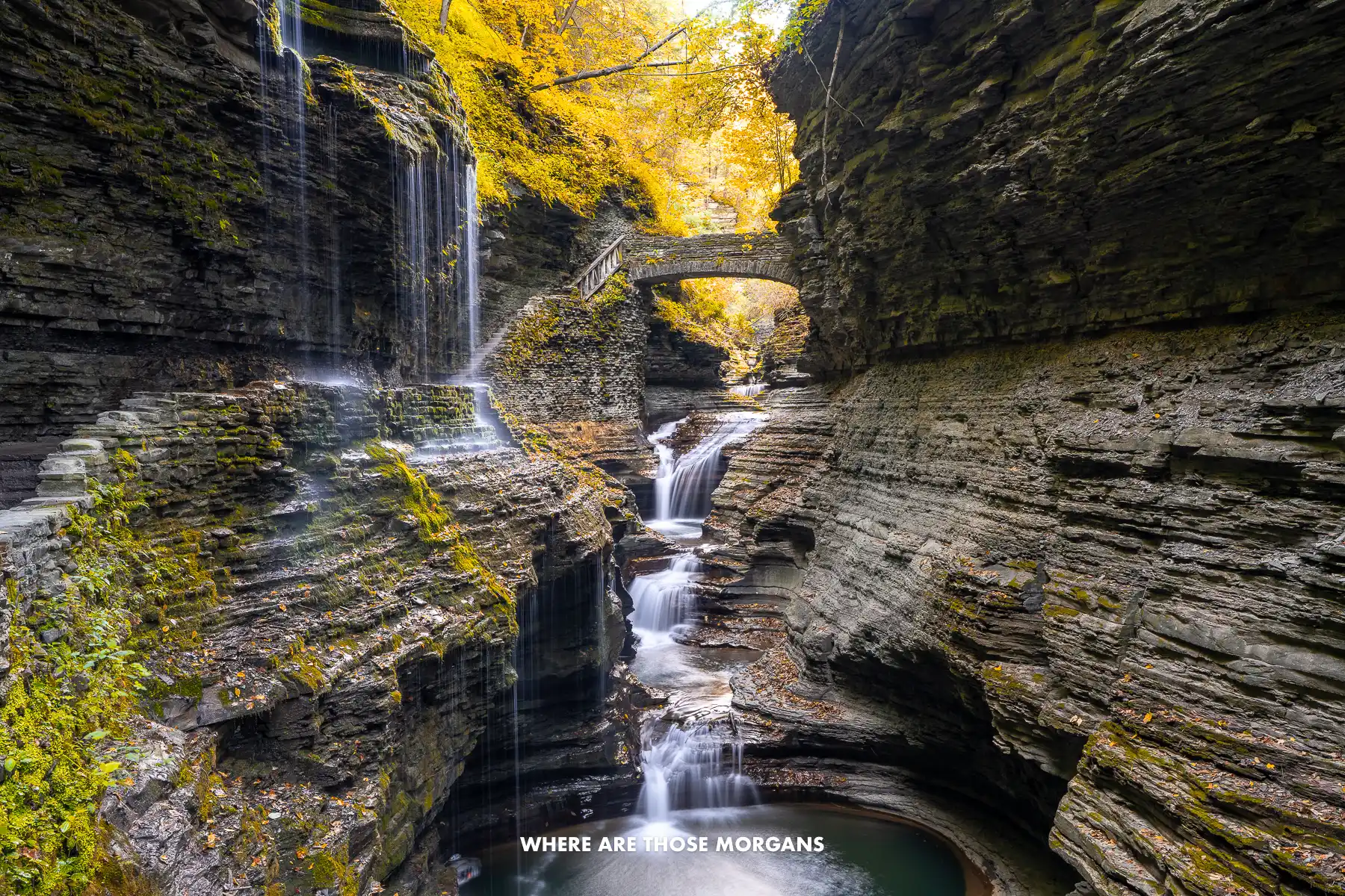
Ithaca is the typical base to use for a Finger Lakes road trip because it’s close to Taughannock Falls, Buttermilk Falls, and Robert H Treman – three fantastic state parks with hiking trails leading to waterfalls. But we also like Watkins Glen at the base of Seneca Lake for the unmissable state park and wine tasting around the lake. Our advice would be two nights in both Watkins Glen and Ithaca.
Outside of the two obvious places, we think Letchworth State Park is a must-visit despite the slight detour, Corning Museum of Glass is well worth the extra drive (especially for families), and Skaneateles is a lovely town to spend a night on the northern side of the lakes. This is a road trip for wine-lovers, hikers, waterfall-hunters, photographers, and anyone who likes getting off the beaten path compared to always-busy areas. We honestly think the Finger Lakes is a massively underrated US road trip destination.
Our standout experiences from this route:
- Seeing three waterfalls at Letchworth State Park
- Visiting the Glenn H Curtiss Museum
- Exploring the Corning Museum of Glass
- Hiking Watkins Glen gorge to Rainbow Falls
- Visiting wineries around Seneca Lake
- Seeing Taughannock Falls
- Visiting Robert H Treman State Park
- Hiking Buttermilk Falls State Park
- Finding waterfalls around Ithaca
- Hiking the Cascadilla Gorge Trail
- Relaxing in quaint Skaneateles
- Visiting Harriet Tubman Home
- Buying produce in Sauders Store
- Visiting Sonnenberg Gardens
- Eating Dinosaur BBQ in Rochester
If we weren’t driving our own vehicle, we’d rent a car at Rochester airport and use the same drop-off. Syracuse and Buffalo airports would work too if they had direct flights, but Rochester is likely the better option for most people. For West Coast or even international visitors, NYC airports are probably better, but it’s a good 3 hours 30 minutes drive from Newark airport to Ithaca.
Next Steps
We hope our favorite scenic drives in America help with choosing your next road trip adventure.
Please let us know if you have any questions in the comments box below, and remember you can schedule a travel planning call with Mark if you’d like expert help figuring out how to make the most of your road trip.
Still researching for the USA?
- These are our favorite hikes in the US.
- Here are the top US vacation spots.
- These are our favorite USA photo spots.
- Here are the best US national parks to visit.
Finally, if you’ll be heading upstate on the same trip, read our first-timer’s USA travel guide for more helpful tips and advice.
Happy Travels,
Mark and Kristen
Enjoy this guide? Pin it for later!


All Rights Reserved © Where Are Those Morgans, LLC. Republishing this article and/or any of its contents (text, photography, maps, graphics, etc.) in whole or in part is strictly prohibited.

Mark and Kristen spent 5.5 years traveling the world full time, visiting over 40 countries across 4 continents and more than 30 US states. They created Where Are Those Morgans in 2018 to help others plan the best possible vacations by writing authentic travel and hiking guides based on their real experiences.
Since the arrival of baby Maya in late 2024 and Kai in 2026, Mark and Kristen’s extensive travels have slowed down, but they still take plenty of trips each year. Where Are Those Morgans now helps millions of travelers each year to visit new places and hike new trails through information-packed blog posts, expert travel guidebooks, 1-on-1 trip planning consultations, and deep-dive YouTube videos. Read more about Mark and Kristen.