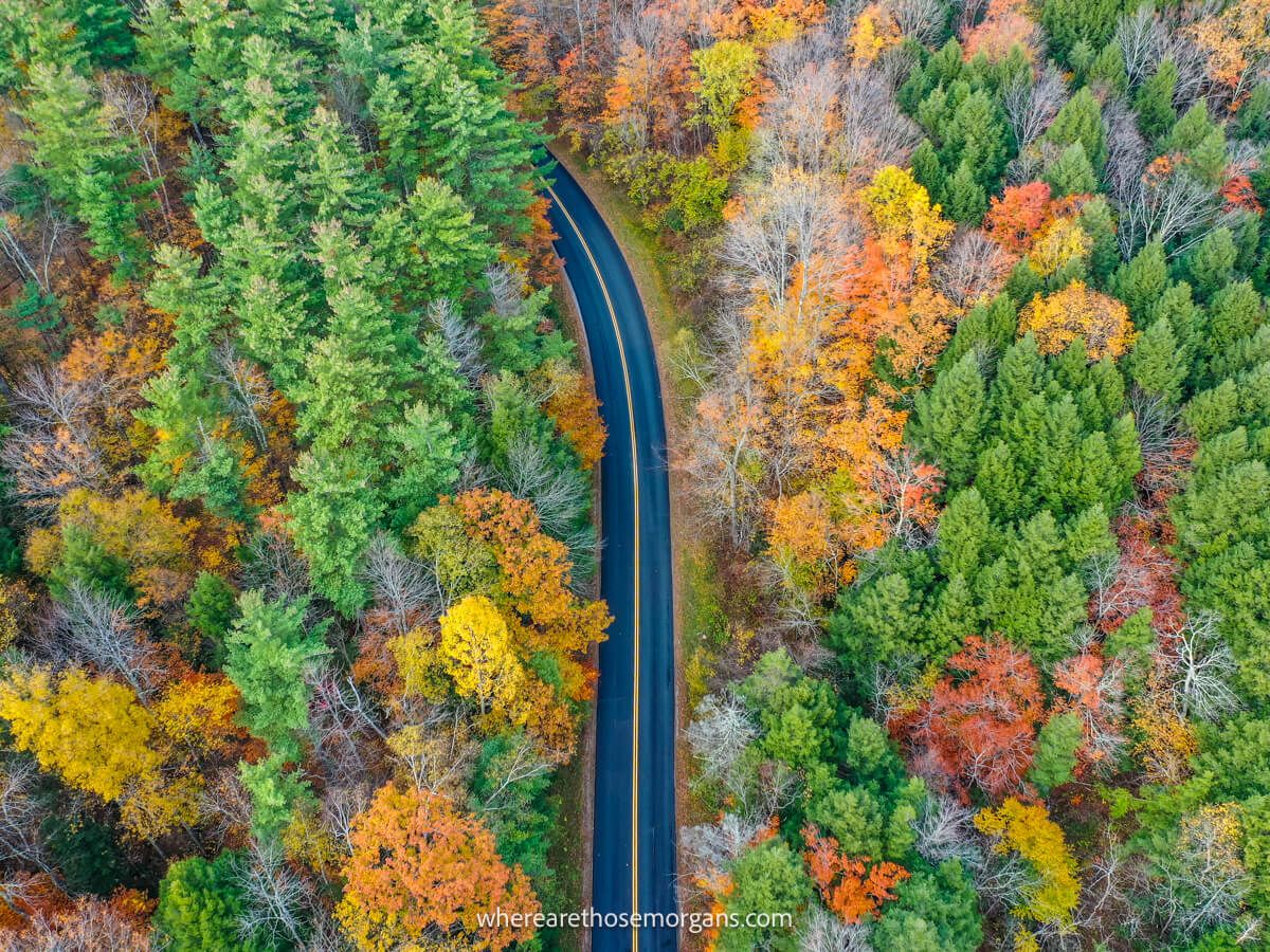
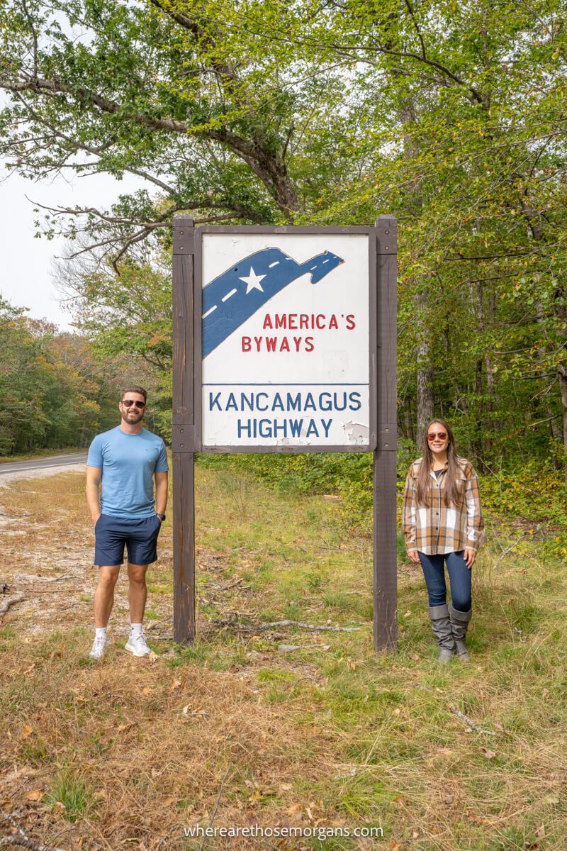
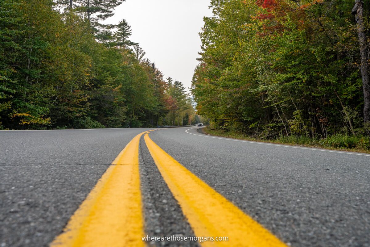
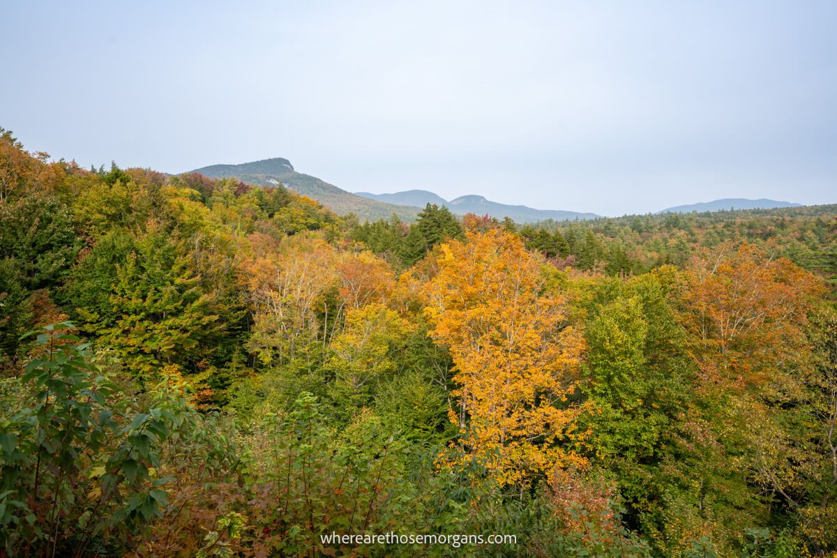
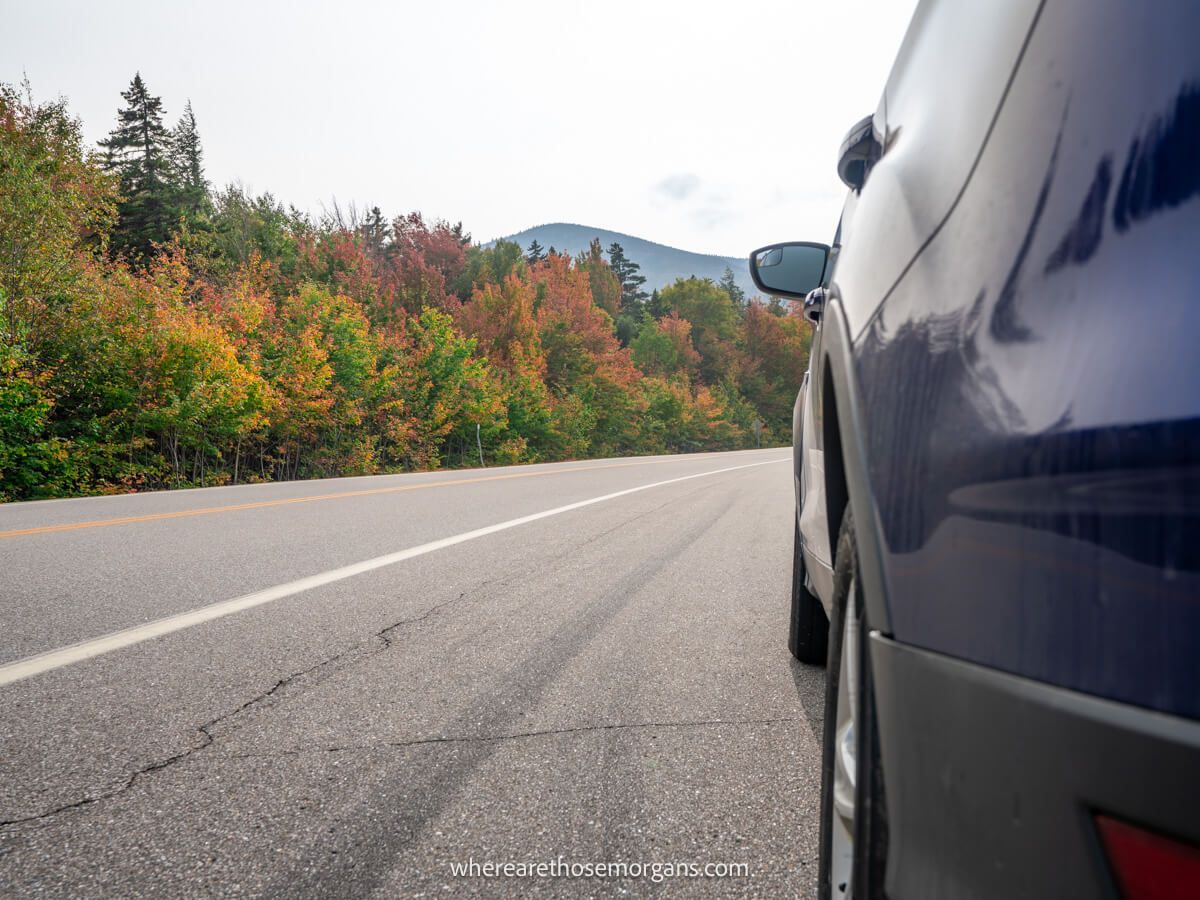
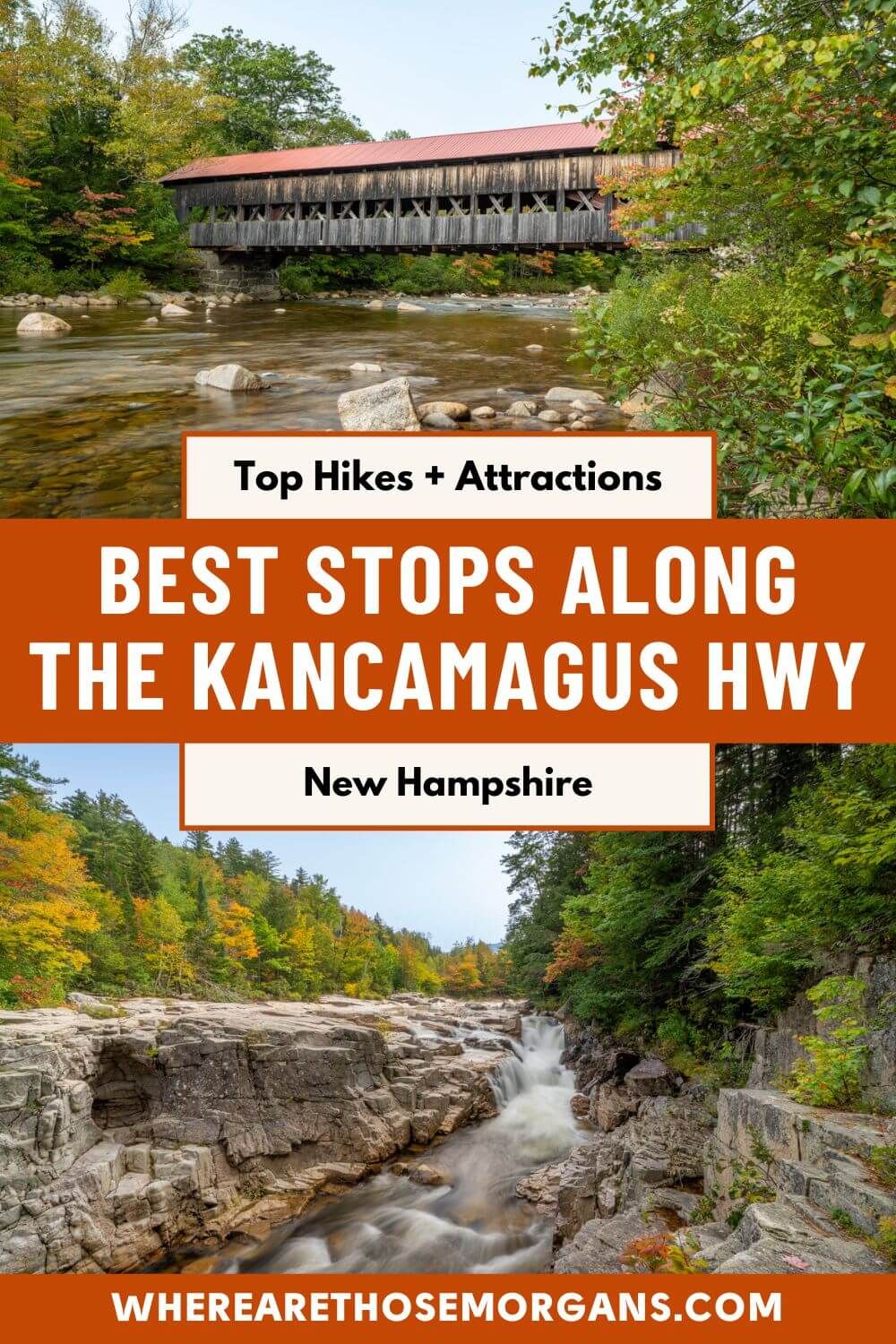
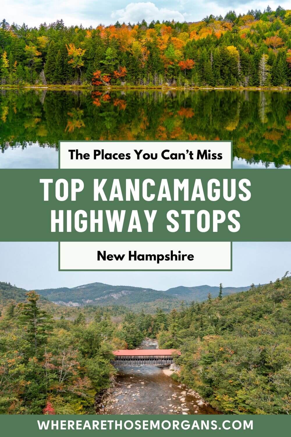
The Kancamagus Highway is a picturesque 35-mile scenic byway cutting through New Hampshire’s White Mountain National Forest between Lincoln and Conway. We’ve driven it in each direction on different fall road trips and we can’t recommend it highly enough. It’s a captivating route filled with stunning views and family friendly fun, so don’t miss it when you visit New England.
In this guide we show you the top hikes, overlooks, attractions and places to stop along the Kancamagus Highway scenic drive in New Hampshire, based on our experiences. Read more about us.
We first drove the Kancamagus Highway from west to east during our maiden New England fall road trip in 2020. It took us around 6 hours to drive the 35-mile road because we stopped at every overlook and took hundreds of photos. The second time we drove the Kancamagus Highway east to west during a 4-week New England road trip we took in the fall of 2023. This time it took us closer to 8 hours because we hiked more trails and took even more photos!
We’ve ticked off a lot of the famous fall spots around New England, but we have to say the Kancamagus Highway is right up there among our favorites. It’s short, simple and has incredible scenery throughout. But we think the best part is that it’s suitable for everyone. Hikers can hit trails, photographers can snap away and sightseers can take in its highlights from several overlooks. Even though we’ve done it twice already, we’d definitely do it again on our next road trip through New Hampshire.
We don’t think it matters which way you drive the route, but we’re going to show you the best places to stop on the Kancamagus Highway as though you’re driving it from west to east. (Oh, and don’t forget to take a look at our popular New England fall road trip guidebook if you’ll be visiting in autumn.) Okay, let’s begin!
Note: Our content is reader supported and contains affiliate links. If you make a purchase through one of these links, we may earn a small commission at no extra cost to you and it helps us keep this site running.
1. Lincoln
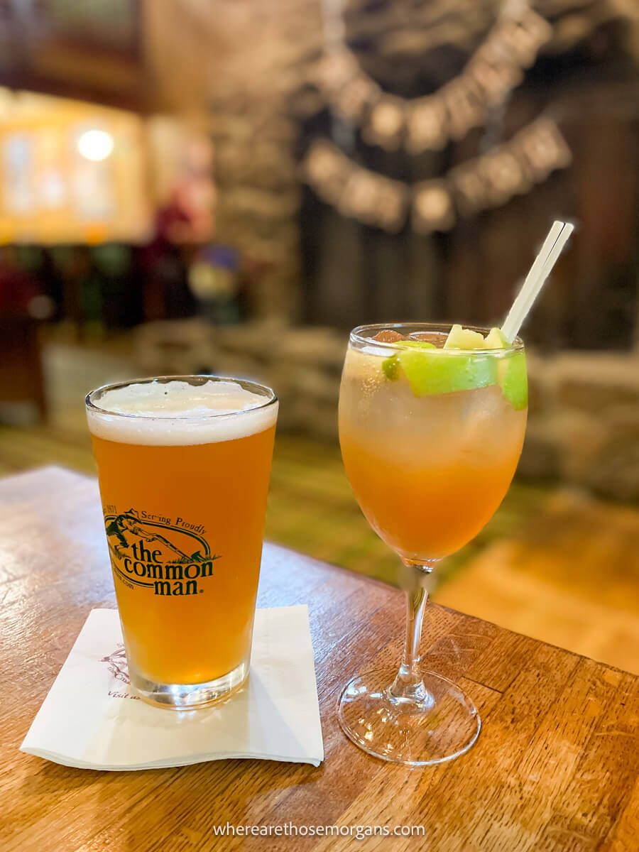
Lincoln is where you’ll start (or end) the drive. It’s on the west side of the byway and you won’t get another built up area until you reach the other side at Conway, so now is the time to fuel up. We’ve eaten breakfast at White Mountain Bagel and Flapjacks Pancake House, both were great. If you’re coming the other way, we’ve also eaten dinner at Black Mountain Burger and The Common Man, which was especially excellent.
The first place you’ll pass through heading east is Loon Mountain. This is where most people stay for skiing in winter because it has lots of resort style lodging options. We stayed at a resort in Loon Mountain the first time we drove the Kancamagus Highway because it was so convenient. Don’t forget to fill up with gas and grab some snacks before leaving Lincoln and Loon Mountain.
Here are some things you can do near Lincoln:
- Hike Artists Bluff Trail
- Walk around The Flume Gorge
- Visit Lost River Gorge
2. Lincoln Woods
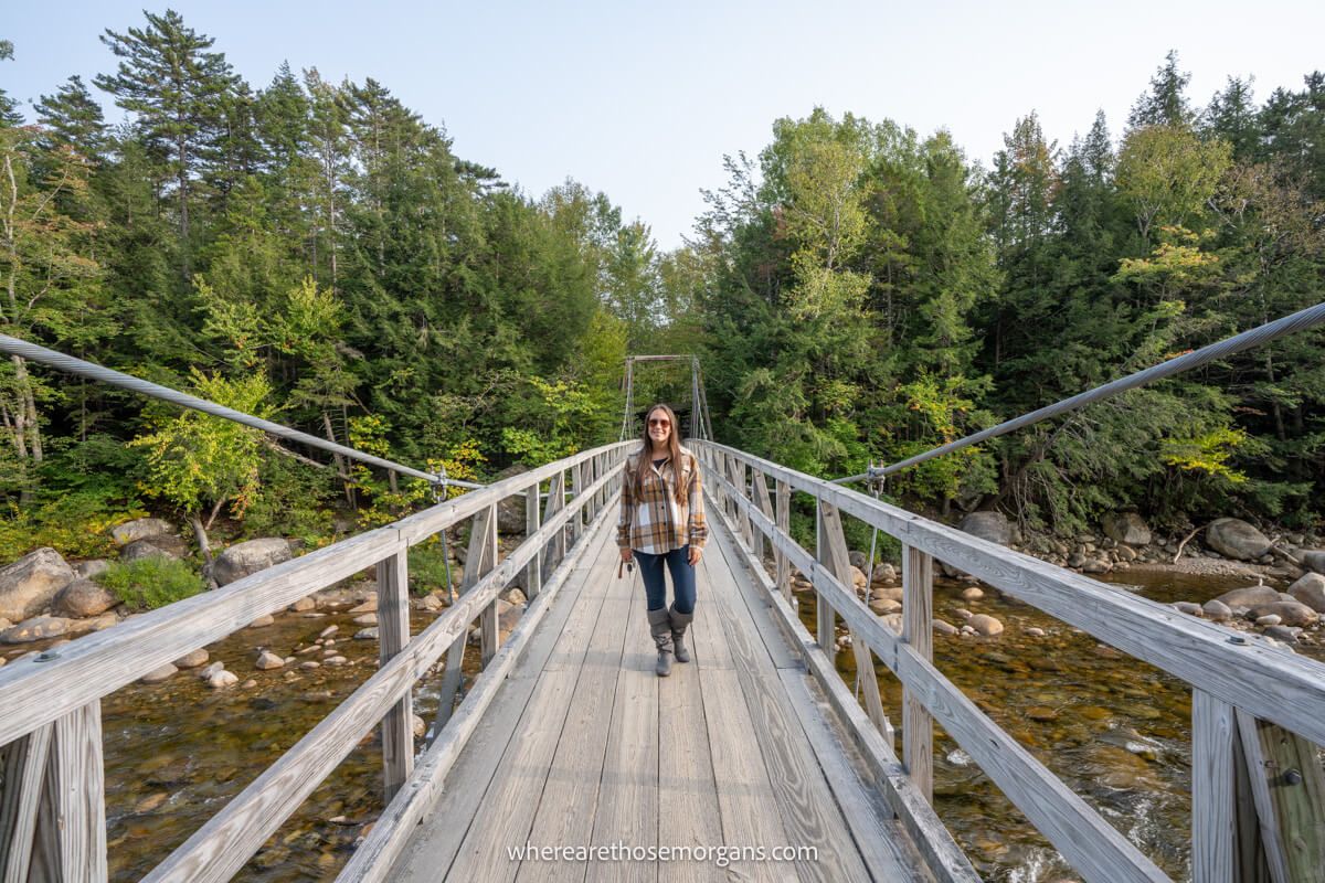
The first place you’ll reach on the scenic byway is Lincoln Woods. Here, you’ll find ample parking, a visitor center, restrooms and an attractive suspension bridge which is worth walking across for a quick photo. Go inside the visitor center to check up on current conditions, grab a route map and ask the rangers any questions you might have.
Optional: Backcountry hikers use this parking area to venture out into the alpine terrain of the Franconia Mountains. But an easier and more commonly used path is called Franconia Falls Trail, which is an easy and flat 6-mile roundtrip hike on an old logging road. To be honest, we avoided this hike because it’s not the best trail along the highway and it would have taken up a lot of time.
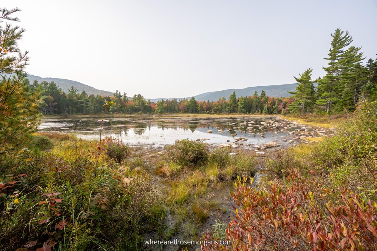
3. Otter Rocks
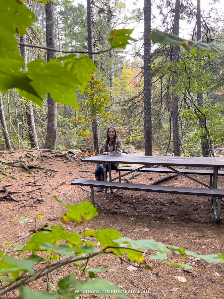
Continuing east you’ll next reach Otter Rocks, which is a lovely picnic spot if you decided to bring breakfast along in the car. You could skip Lincoln Woods and stop here instead. Walk through the trees beyond the benches so the kids (or adults!) can splash around in the water. If you don’t want to sit down on a bench or splash in the water, don’t stop here and carry on to the first overlook which comes next.
Optional: On the way to Otter Rocks you can stop at the Forest Discovery Trail, which is a 1.5-mile forest ecology interpretive loop with 200 feet elevation change. Again, we’ve avoided it both times because there are better things to see, but this could be a good one for the kids.
4. Hancock Overlook
The first stop with views on the Kancamagus Highway is called Hancock Overlook. It’s located on a tight U-bend so you can’t miss it, and it has a small parking lot in the middle of the bend. From here you’ll get your first southwest facing views over the Osceola Range, but unless you fly a drone it’s hard to see much of the U-bend.
Optional: Just before reaching the U-bend you can hike the moderately difficult 7-mile roundtrip Greeley Ponds Trail. Alternatively, right from the Hancock Overlook parking area you can hike the strenuous 9-mile roundtrip Hancock Trail with 2,500 feet elevation gain. We haven’t done either because they’d take up too much time.
5. Pemigewasset Overlook
This is where things start to get interesting. Continue climbing and twisting on the Kancamagus Highway until you reach the next stop called Pemigewasset Overlook. You’ll pull off the road into a large parking area, then walk down to a wooden pavilion shelter which has exceptional 180 degree views over Mount Osecola and its nearby peaks.
If you’re running shorter on time, we recommend you skip everything up to this point and make Pemigewasset Overlook your first stop of the morning. There are no optional hikes to consider here, it’s a really easy and quick stop with great views.
Need help planning your New England road trip?
Our popular New England fall travel guidebook helps you with planning every aspect of your road trip, including the best places to stop, where to see fall colors, where to eat and stay, itinerary ideas and map!
View Guidebook
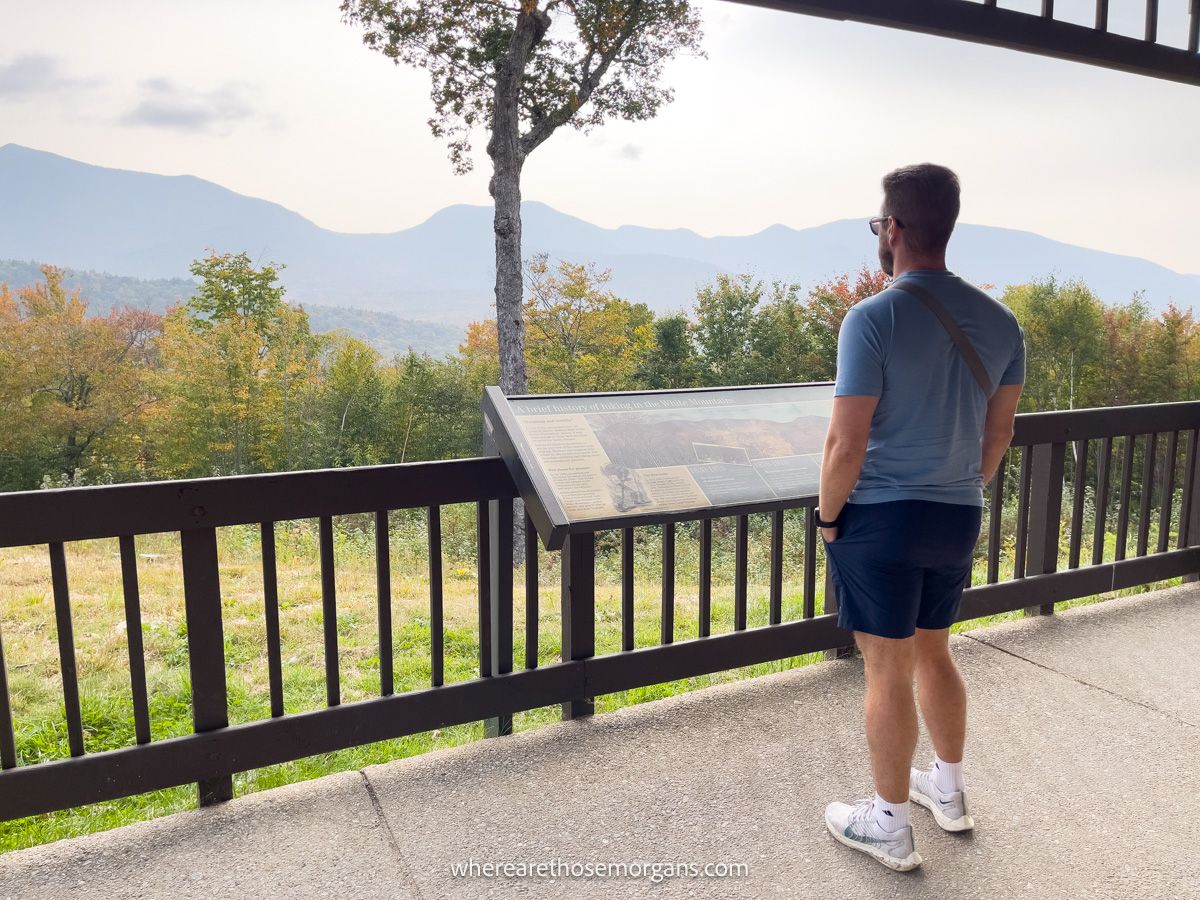
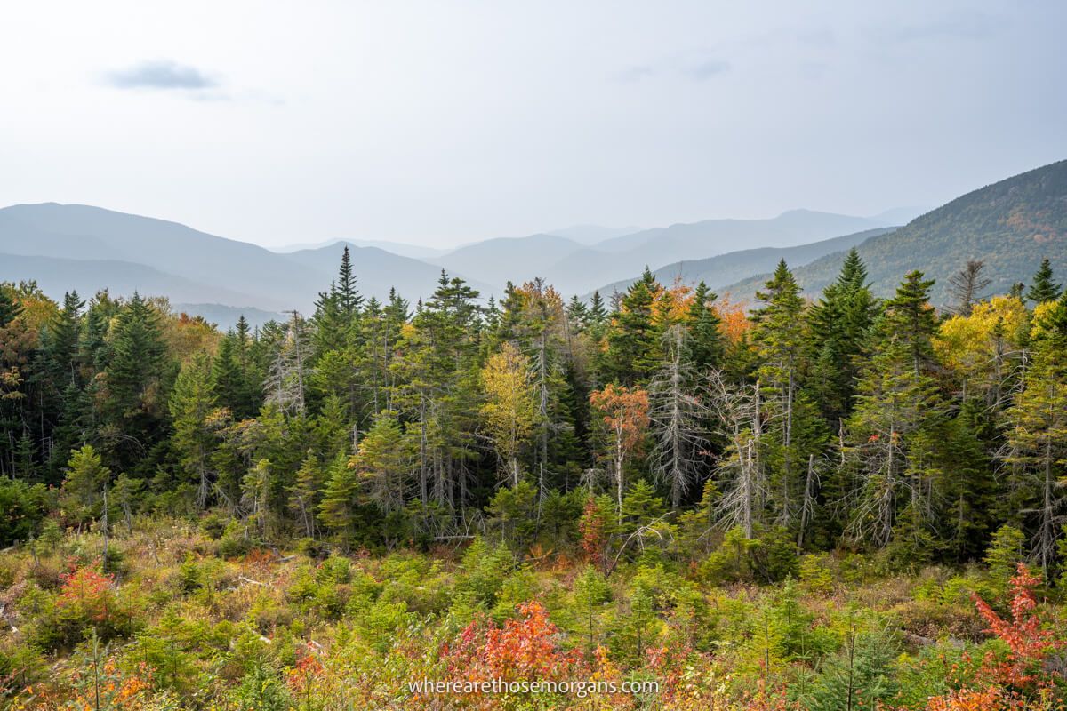
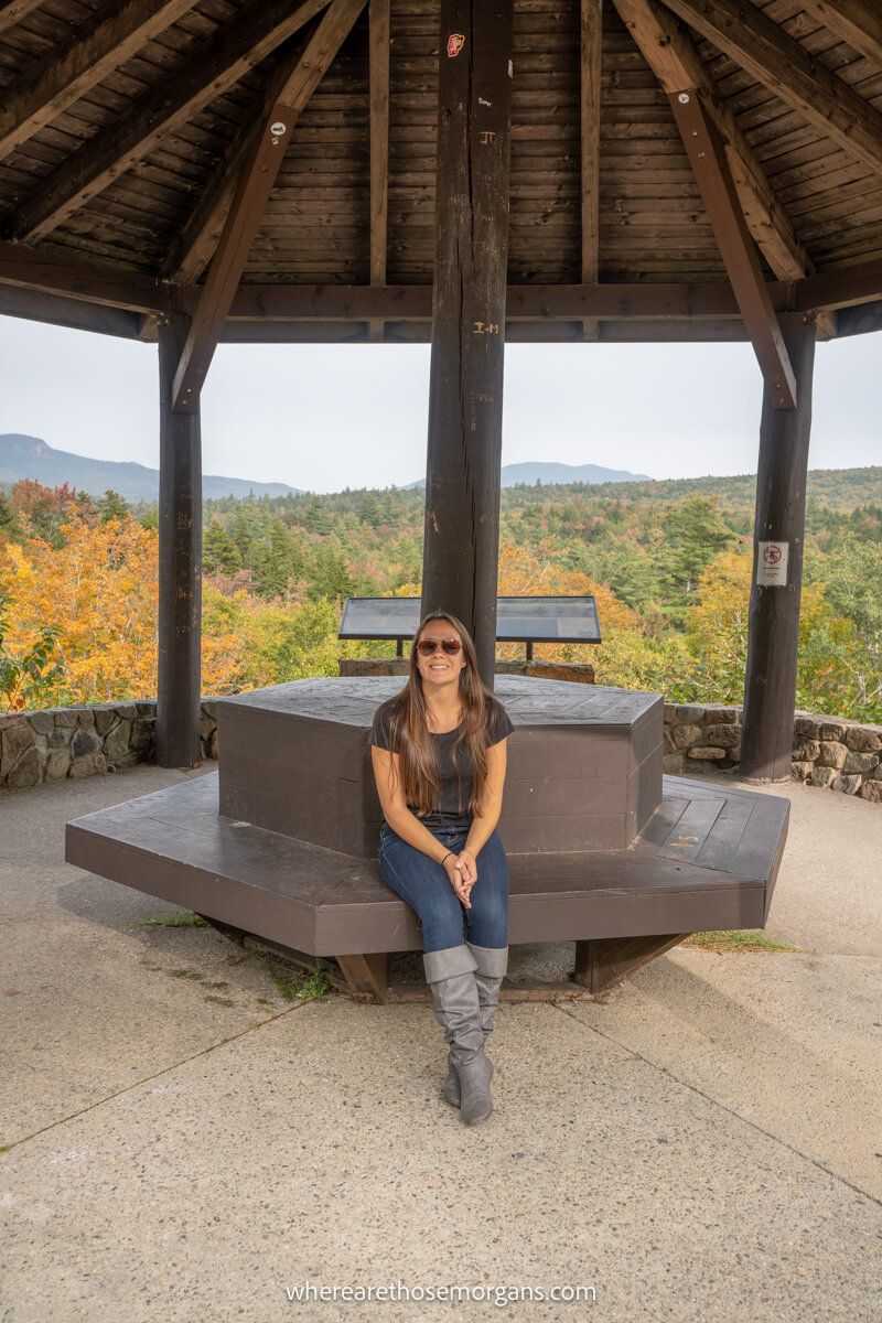
6. CL Graham Wangan Overlook
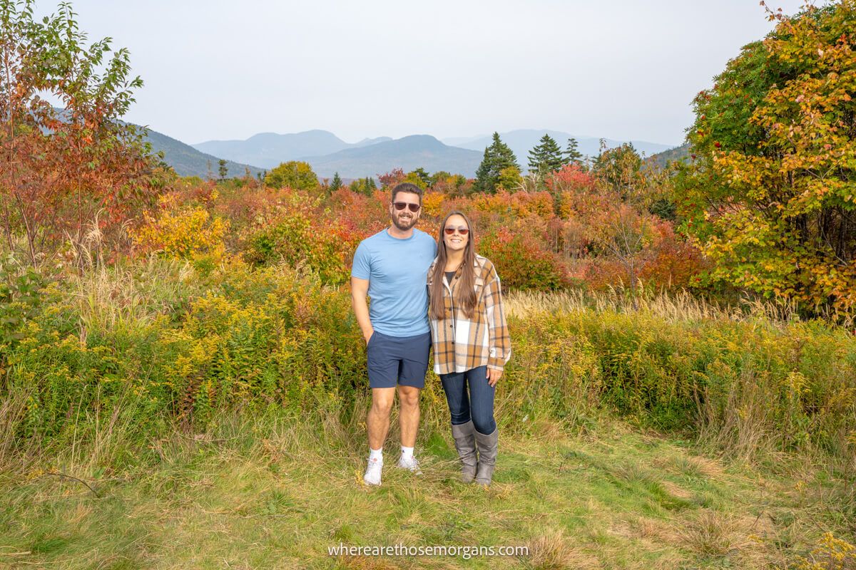
Your next stop is just 1 minute or 0.2 miles away, but first you’ll drive over the summit of Kancamagus Pass at 2,855 feet elevation. A few seconds after beginning your descent you’ll turn left into CL Graham Wangan Overlook. We think this is one of the best Kancamagus Highway stops because it has spectacular far reaching views looking northeast over the Swift River and rolling hills covered in trees.
Tip: Walk a hundred feet or so to the right side of the wooden pavilion so you can take photos of your group with a much more attractive background, which you can see in our photo above.
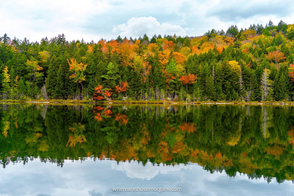
7. Lily Pond
Your next stop is a roadside pullover with a very short walk to Lily Pond. It’s not essential, but we do recommend stopping if you visit during peak fall foliage colors because it’s an easy-to-get photo of a still pond surrounded by trees. The rangers told us this was a good place to spot moose but we thought the only way that would happen is if we arrived super early in the morning. Low and behold, we didn’t see a moose!
Tip: Don’t bother with any of the trails here like Livermore or Sawyer River because there’s a great hike coming soon.
8. Sugar Hill Overlook
The last viewpoint you should definitely stop at on the Kancamagus Highway is called Sugar Hill Overlook. By now you’ll have dropped down significantly in elevation, but the northeast facing views are still magnificent. Don’t drive too fast downhill or you might miss the parking lot!
This is the final place you can gaze across miles of colorful forest leaves from an elevated vantage point. So get all the photos you need here before continuing to descend further.
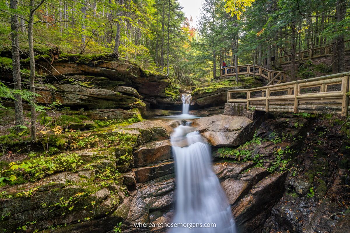
9. Sabbaday Falls
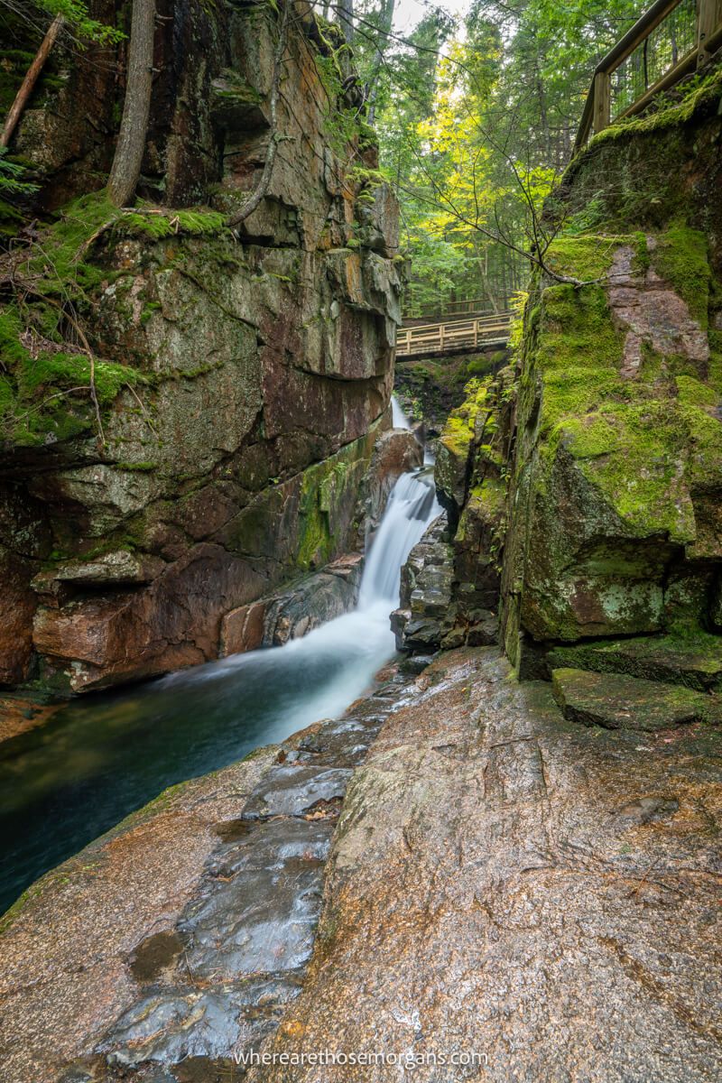
Sabbaday Falls is one of the most visited waterfalls in New Hampshire and we think it’s probably the most popular stop along the Kancamagus Highway. Frustratingly, there’s not a huge amount of parking at the trailhead, so you might struggle to park if you visit on weekends, holidays or during peak fall foliage season. But it’s definitely worth visiting, so you might just have to be patient.
Once we parked it was a very easy 15 minute walk along a flat gravel-packed track to reach Sabbaday Falls, a 45-ft series of cascades crashing through a narrow flume. The path is semi-accessible for strollers and wheelchairs but it’s not smooth. At the flume, we found a great viewpoint from the bottom, but then we had to climb lots of wooden steps and walk around a boardwalk to see the cascades.
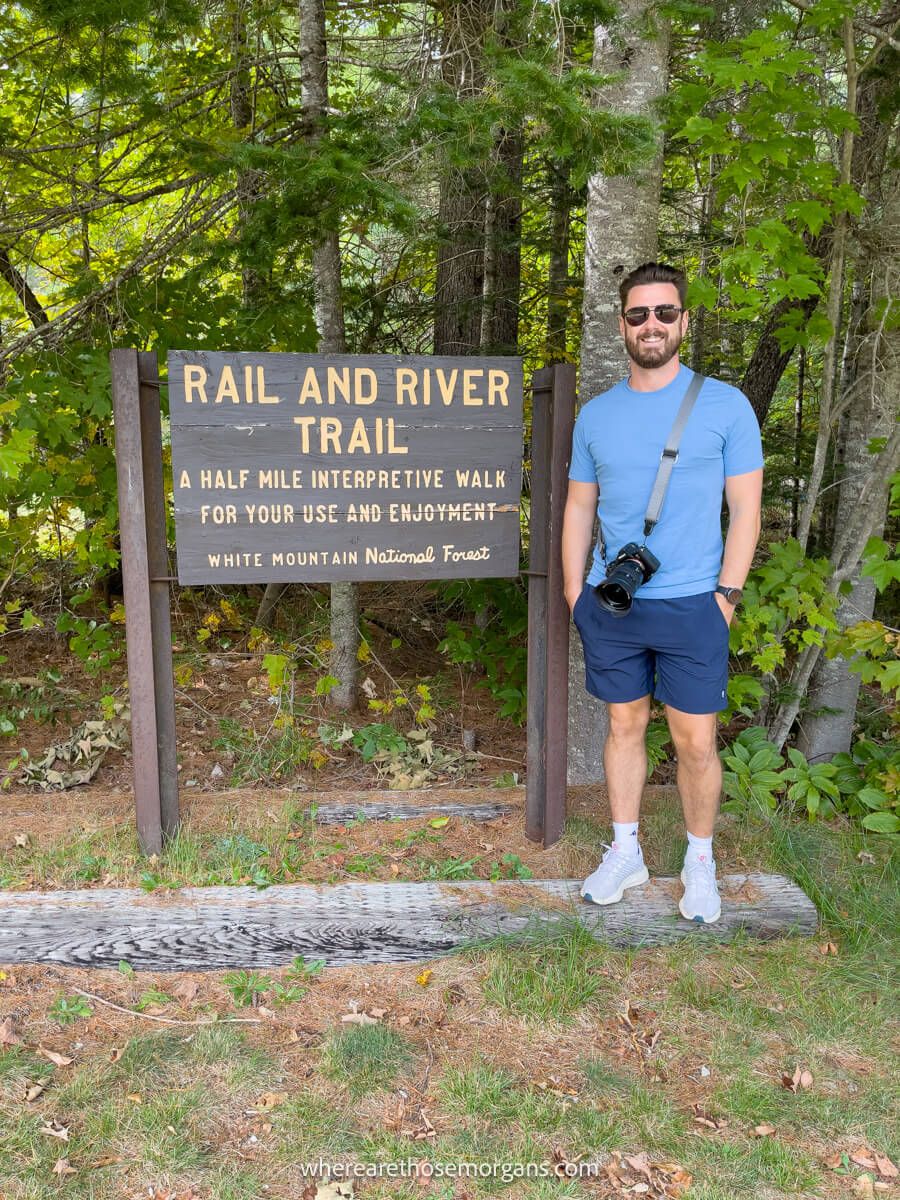
10. Russell-Colbath House
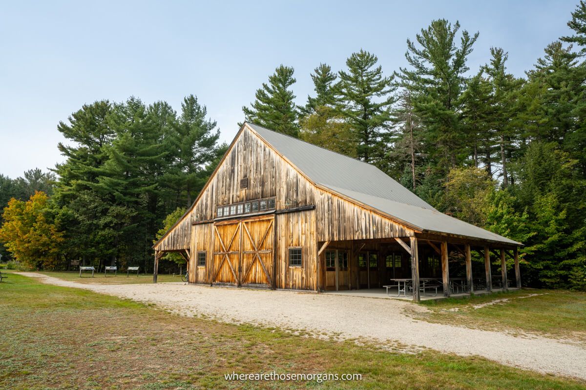
One of our personal favorite stops along the Kancamagus Highway is Russell-Colbath House Historic Site. You’ll find a small house which was built in 1832 that’s the only remaining original structure from Passaconaway Village. It has interpretive signs, but sometimes a ranger will be on site to explain more. Next door is the Russell-Colbath Barn which we think is the most photogenic building along the route.
Optional: You can also walk an easy interpretive 0.5-mile path called Rail and River Trail behind the historic buildings. This is a great hike for younger kids because it leads to the Swift River and contains educational information boards explaining logging in the area.
11. Champney Falls
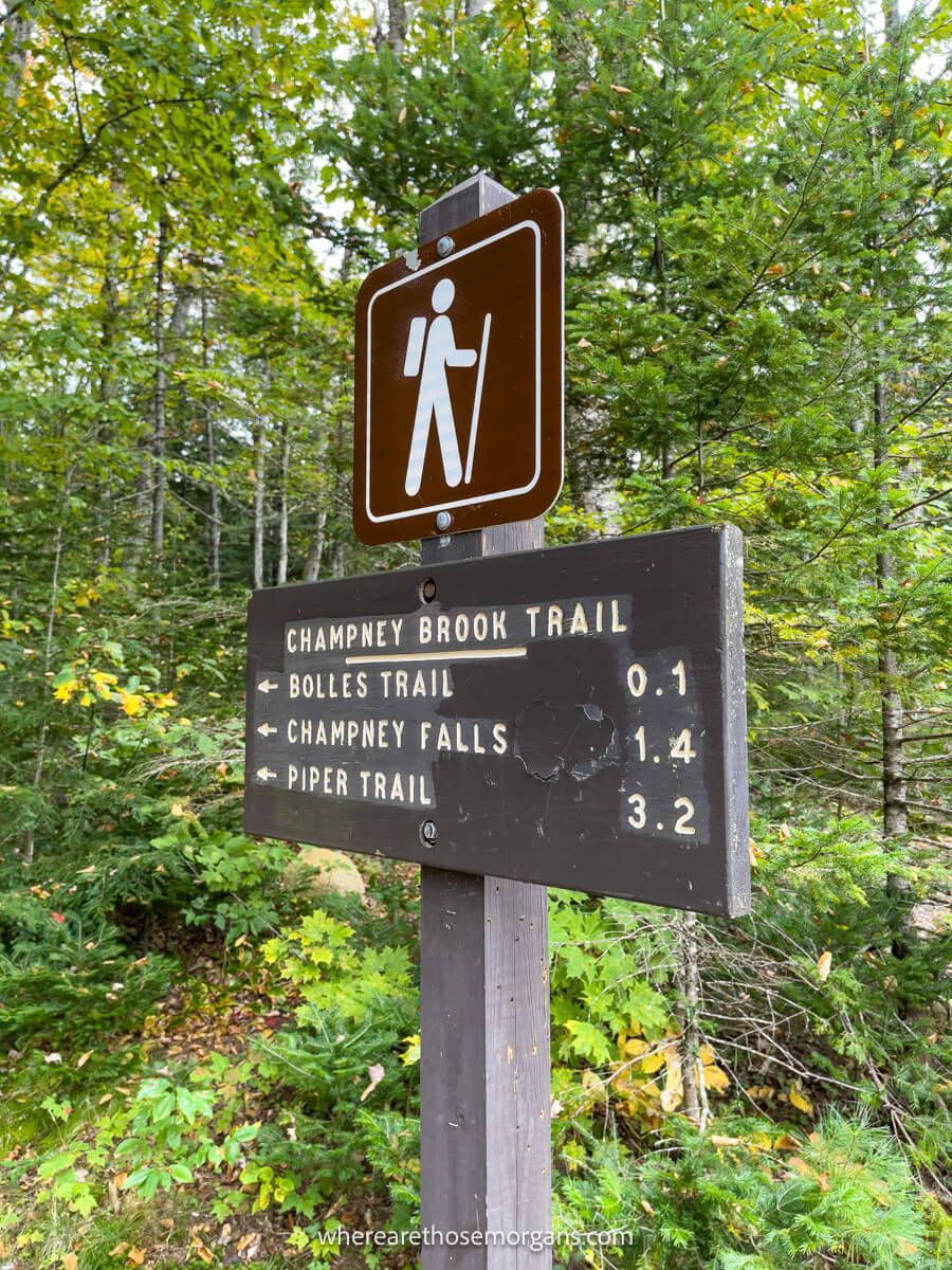
Champney Falls is one of the more popular Kancamagus Highway hikes. You can either choose a moderate 3.1-mile roundtrip to Champney Falls or a hard 8-mile roundtrip to Mt Chocorua. The waterfall at Champney Falls is a photogenic 70-ft cascade and Mt Chocorua has some of the best 360 panoramic views in the White Mountains.
We parked to hike Champney Falls but when we read the information sign it stated that the waterfall is meager during dry periods, and fall is about dry as it gets. Next time we drive the Kancamagus Highway we’ll definitely hike to both Champney Falls and Mount Chocorua because those summit views look incredible.
Optional: If you’d prefer to get off the beaten path on a challenging trail, drive up nearby Bear Notch Road to hike Table Mountain via Attitash Trail instead.
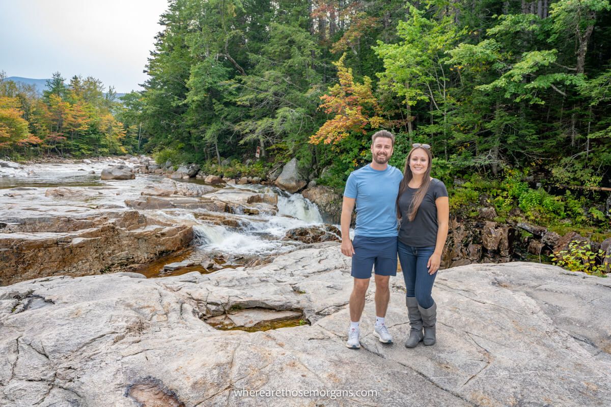
12. Rocky Gorge Scenic Area + Falls Pond
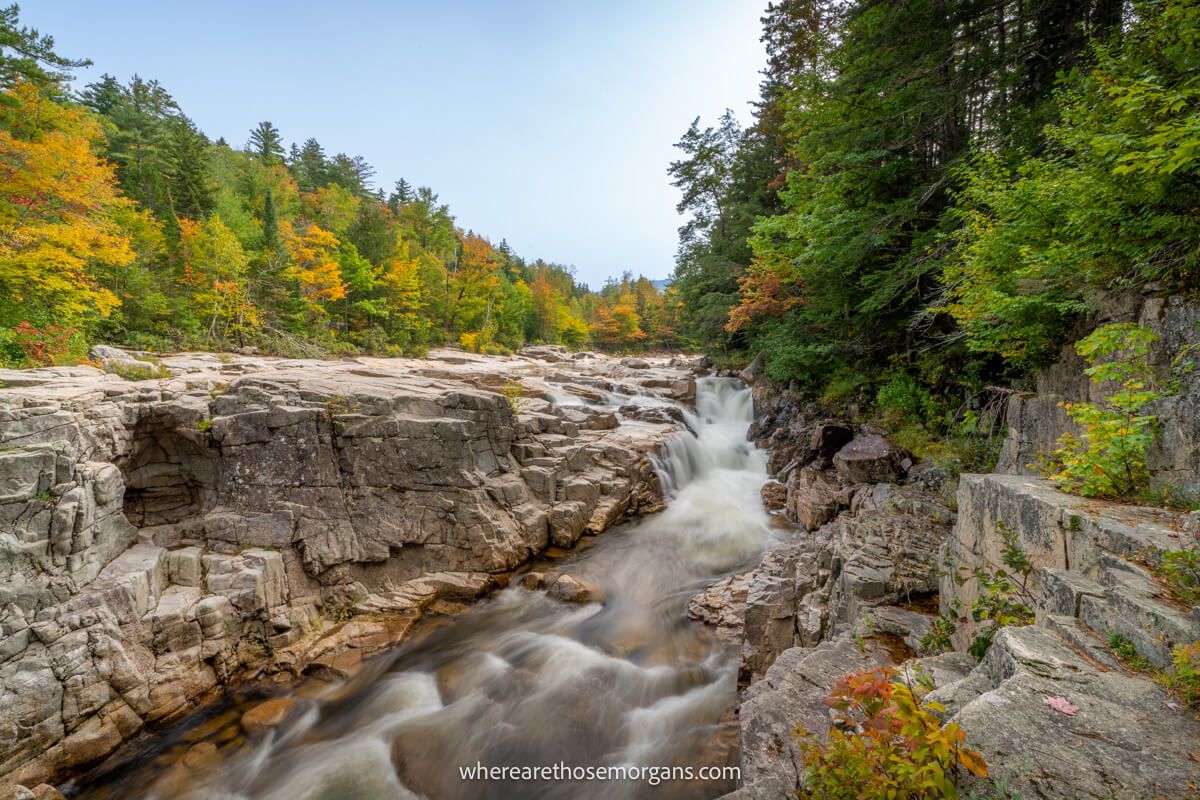
We think Rocky Gorge Scenic Area is another of the better stops to make on the Kancamagus Highway. You should cross the Rocky Gorge footbridge above narrow flumes in the Swift River for some really great photos. Then continue into the forest until you reach Falls Pond which looks stunning when it’s surrounded by fall foliage colors.
Optional: Once you reach Falls Pond you can hike a reasonably flat 1-mile forest trail around the pond called Lovequist Loop. It’s peaceful and we’d even go as far as saying romantic here, so couples might want to prioritize this tranquil walk in the woods.
13. Lower Falls
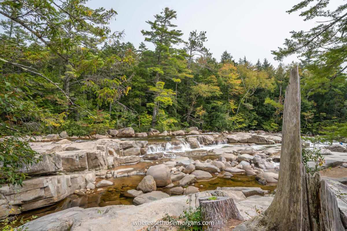
Lower Falls is a popular recreation area near the eastern side of the Kancamagus Highway with plenty of parking, restrooms and picnic benches. It’s essentially a wide part of the Swift River with water rushing through lots of large rocks and boulders. In spring and summer you can see the waterfalls from a viewing area, but in fall when the water levels are low you can actually climb around the boulders and swim in natural pools.
Both our trips were in the fall so we were able to carefully climb around the rocks to get some fun photos. Not many people were swimming because it was cold, but maybe around the end of August and all of September it would be safe and not so cold to swim.
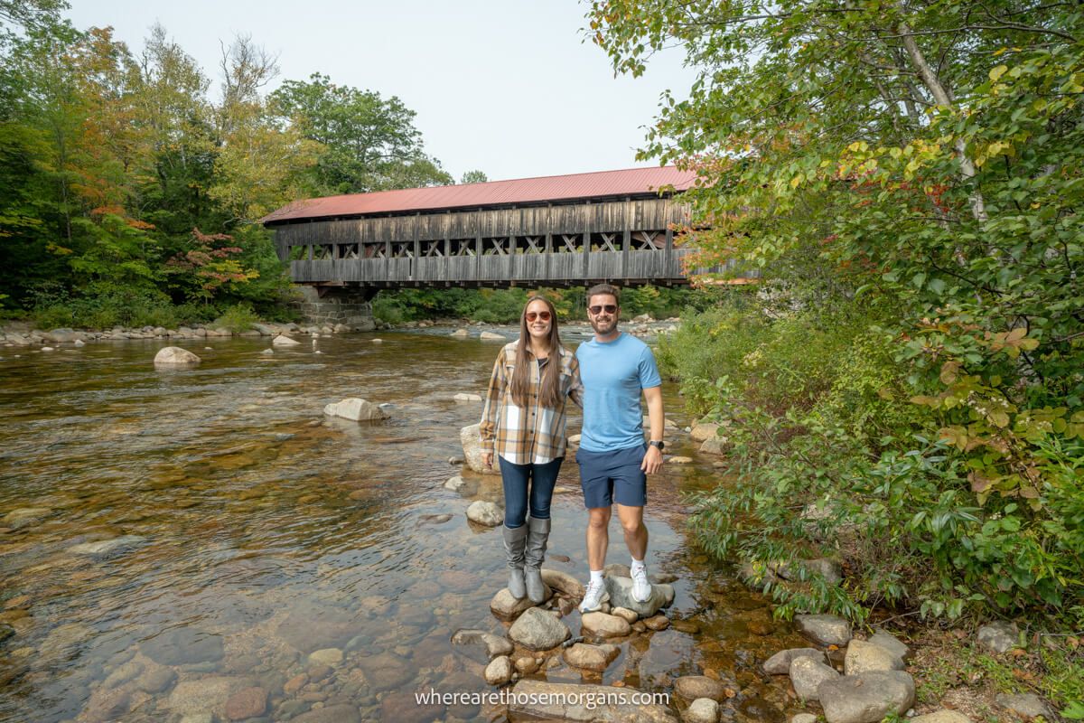
14. Albany Covered Bridge
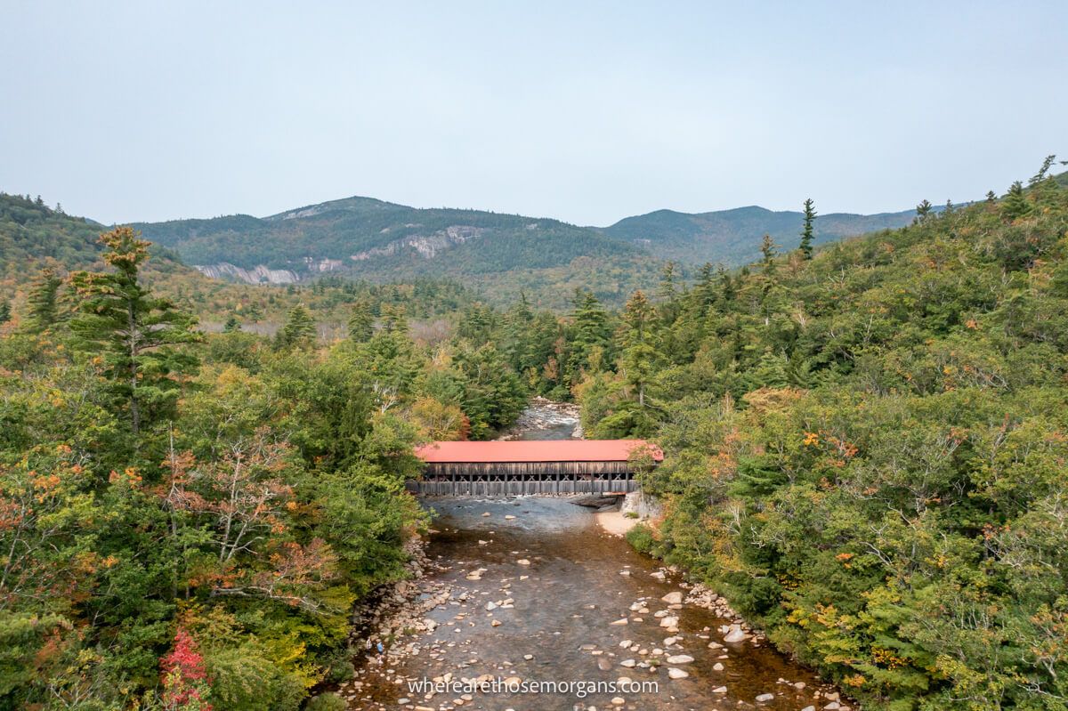
We think the Albany Covered Bridge is the best photo spot and also one of the top attractions along the Kancamagus Highway. Originally built in 1858, the gorgeous Albany Covered Bridge has had several restorations and repairs, but you can still walk or drive your car through it today. We walked down to the river banks to take photos looking back up at the bridge on an angle, and we also flew our drone to get photos of the bridge from above.
Optional: You can hike a 3.1-mile trail with 950 feet elevation gain called Boulder Loop Trail which leads to awesome views of Mt Chocorua. It begins on the far side of the covered bridge, which is also the starting point for the Nanamocomuck ski trail if you’ll be visiting in winter.
15. North Conway
After all that action, you’ve still only driven 35 miles! Now, once you reach the end of the Kancamagus Highway you’ll find yourself in Conway. Take Main Street and turn onto Washington Street to cross Saco Covered Bridge and Swift River Covered Bridge. Next, continue to North Conway, where you’ll probably stay the night (before or after).
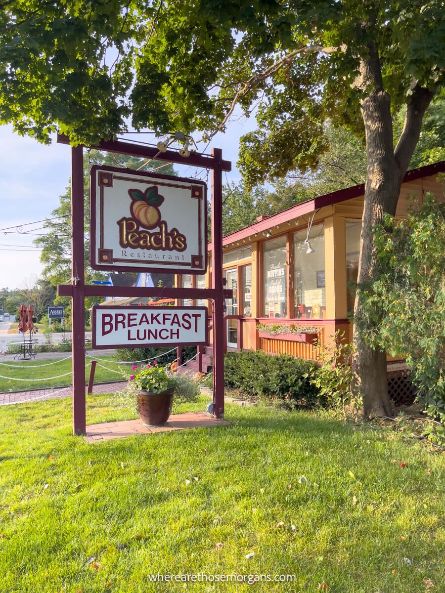
We’ve stayed at two hotels in North Conway and think it’s the best place to stay on the east side of the scenic byway. We enjoyed breakfast at Peach’s and Banners, as well as dinner at Delaney’s Hole in the Wall and Moat Mountain Smokehouse.
Here are some things you can do in North Conway:
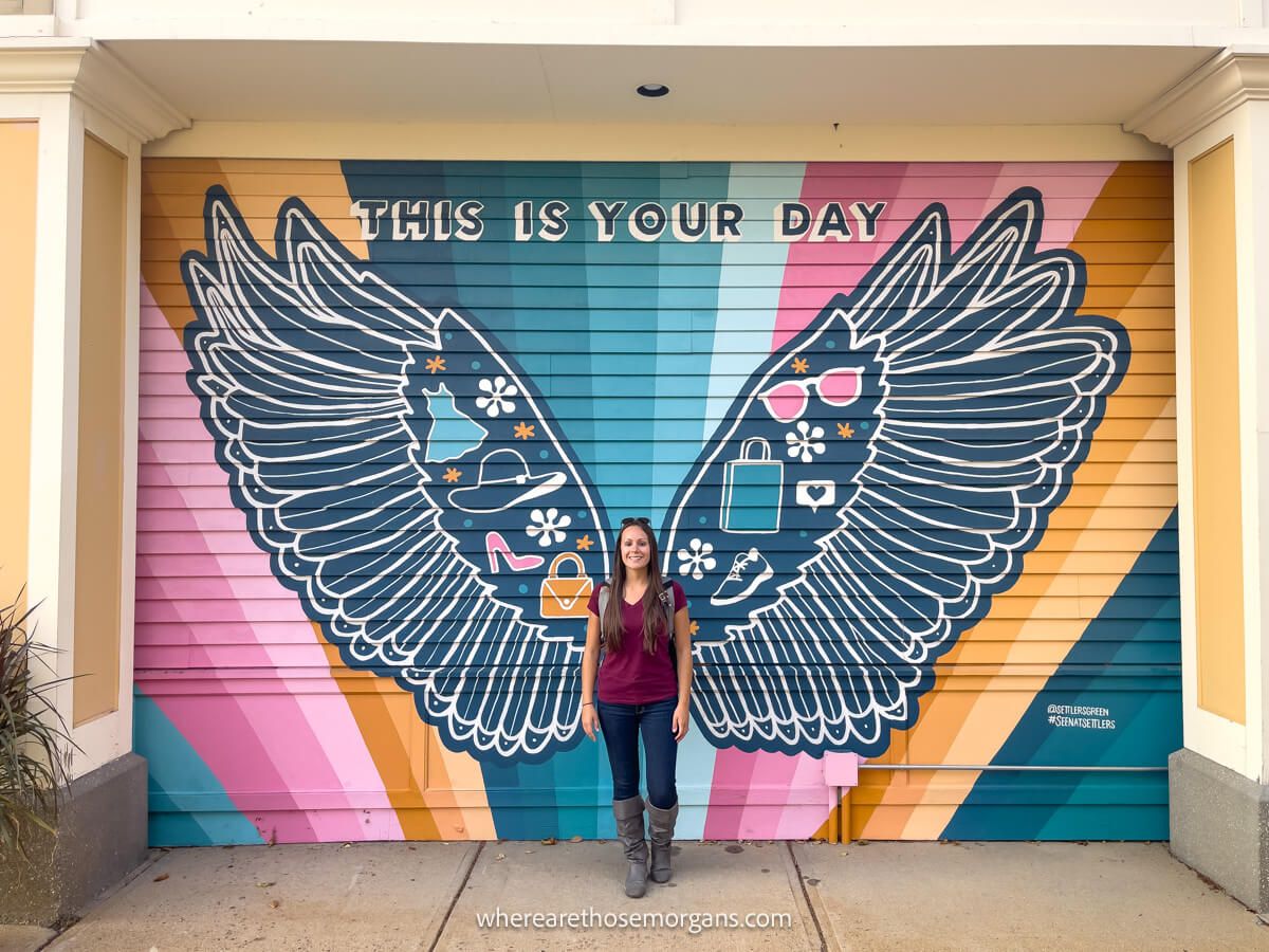
- Tax free shopping – Tax free clothing retail outlet called Settlers Green.
- Conway Scenic Railroad – Old fashioned train rides (the fall foliage special is good).
- Diana’s Baths – Half mile hike to a series of small waterfalls (worth it).
- Cathedral Ledge Lookout – 700-ft tall viewpoint with views.
Kancamagus Highway Attractions Map
Click or touch the map below to activate, zoom in and out, and scroll around. If you’d like to see a bigger version, click the “view larger map” icon in the top right, and if you’d like to see anything specific, click the arrow and square icon in the top left.
Map key:
- Red – Viewpoints
- Blue – Recreation areas
- Orange – Hikes
- Green – Restaurants
What You Need To Know
Here are some important things you should know before driving the Kancamagus Highway:
- There are no gas stations between Lincoln and Conway. Fill up at whichever side you begin the road trip.
- Cell service is non-existent so download any maps you need and make any reservations for dinner or hotels before starting.
- There are no restaurants along the main stretch of the scenic byway so eat breakfast before beginning.
- Bring a packed lunch if you plan to take on any longer hikes.
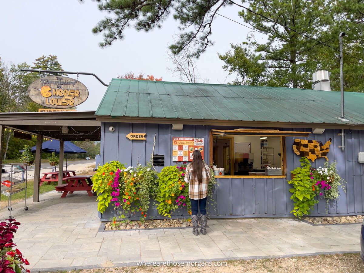
- We ate a quick brunch of tomato soup and grilled cheese at The Cheese Louise Commissary very close to the east terminus of the highway and it was great. It’s open 11.00am-5.00pm daily.
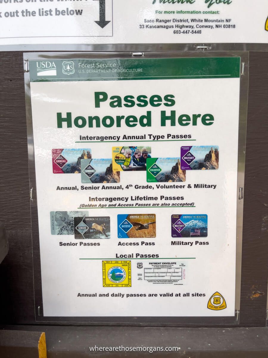
- Parking along the Kancamagus Highway costs $5 per vehicle per day.
- But you can use your America the Beautiful pass instead, so don’t forget it.
- You’ll need to pack bug spray and sunscreen if you visit in summer.
- It’s also known as The Kanc, and the name is correctly pronounced Kan-kah-mah-gus.
When To Drive The Kancamagus Highway
The Kancamagus Highway is open year round but its busiest periods are summer and the first two weeks of October during peak fall foliage season in the White Mountains. We’ve driven it twice in the fall and we highly recommend you do the same if it’s your first time driving the scenic byway because autumn is when the region is most beautiful.
It would be nice and quiet in spring with high water levels once the snow melted. Summer would bring the crowds, heat, bugs and emerald green leaves. Fall is when The Kanc really comes into its own with a dazzling earthy light show. And finally winter would be very quiet but you might not be able to do much. Plus, Bear Notch Road which connects the highway to the town of Bartlett closes in the winter.
Where To Stay
Unless you plan to drive through the Kancamagus Highway in the middle part of your day, you’ll likely need to stay either in North Conway on the east side or Lincoln on the west side. Be aware that there are no hotels directly along the Kancamagus Highway.
We stayed in Loon Mountain the night before our first time on The Kanc. We got an early start, spent the day stopping along the route and then spent that night in North Conway. When we returned in 2023 we stayed in North Conway the night before, drove the scenic byway and then stayed in Lincoln that night. Both ways worked just fine.
Here’s where you can stay in Lincoln or Loon Mountain:
Here’s where you can stay in North Conway:
If you really want to stay right on the scenic byway, there are 6 campgrounds you can book along the Kancamagus Highway. Here they are from west to east:
Our Favorite Photos
The Kancamagus Highway is exceptionally photogenic and we could have included so many more photos in this guide. Here are just a few more of our favorites:
The Morgan Conclusion
What we like: We love how many excellent viewpoints, hikes and attractions are packed into just 35 miles of driving. We’re travel photographers and The Kanc is one of the most visually stunning places to visit in New England in the fall, so it’s a match made in heaven for us.
What we don’t like: It’s hard for us to think of any strong dislikes for The Kanc. But if we had to nitpick (just to find some faults) we’d say it could have better amenities and the parking at certain trailheads could be increased. Otherwise, it’s a pretty great place to visit.
Is the Kancamagus Highway worth it? Yes! The Kancamagus Highway is a pin up for New England fall foliage destinations for a reason. It’s easy for anyone to visit, it’s free, it has amazing viewpoints and hiking trails, and it’s visually stunning. After driving it twice, we believe the Kancamagus Highway is one of the best bang for your buck mini-road trips in the US.

More From New England
- How to visit the Flume Gorge NH
- How to hike Artists Bluff Trail NH
- Fun things to do in Burlington VT
- Top things to do in Woodstock VT
- What you can’t miss in Lake Placid NY
- Unmissable things to do in Stowe VT
- Top things to do in Manchester VT
- Fun Acadia National Park activities
- Hikes you can’t miss in Acadia
We hope our guide to driving the Kancamagus Highway helps with planning your visit to New Hampshire!
Please let us know if you have any questions in the comments below.
Happy Travels,
Mark and Kristen
Was this guide helpful? Pin it for your visit!
All Rights Reserved © Where Are Those Morgans, LLC. Republishing this article and/or any of its contents (text, photography, maps, graphics, etc.) in whole or in part is strictly prohibited.

Mark and Kristen spent 6 years traveling the world, visiting over 40 countries across 4 continents and more than 30 US states. They created Where Are Those Morgans in 2018 to help others plan the best possible vacations by writing authentic travel and hiking guides based on their real experiences.
Since the arrival of baby Maya in late 2024, Mark and Kristen’s extensive travels have slowed down but they still take plenty of trips. Where Are Those Morgans now helps millions of travelers each year to visit new places and hike new trails through information-packed blog posts and expert travel guidebooks. Read more about Mark and Kristen.
Thank you for your blog. We are visiting NH in September and staying in N Conway. Trying to decide, if we drive the Kancamagus east to west, what do we do when we get to Lincoln? Drive up to Hwy 3 and take 302 through the mountains back to N Conway? It doesn’t seem to make sense to turn around and drive the Kanc back. Or drive it west to east, but still need a way to get to Lincoln. What would you suggest?
Hi Faye, glad to hear you are planning to drive the Kancamagus Highway this fall. We agree, driving back on the Kanc is not the best way to do it. Drive it east to west, then go straight to Flume Gorge, followed by a very short hike to Artists Bluff. Both are fantastic. After that, take 3 to 302 and stop around the Mt Washington area, maybe even take the cog railway to the summit if you have time. From there it’s just a short drive back to N Conway. Have a great time!
I’m wondering about scenic areas we could. Drive into without any walking.
Hi Gina, the entire drive is scenic as the road passes through the White Mountains. There are plenty of roadside pull overs and parking areas with vista points requiring no walking at all. Have a great trip!