
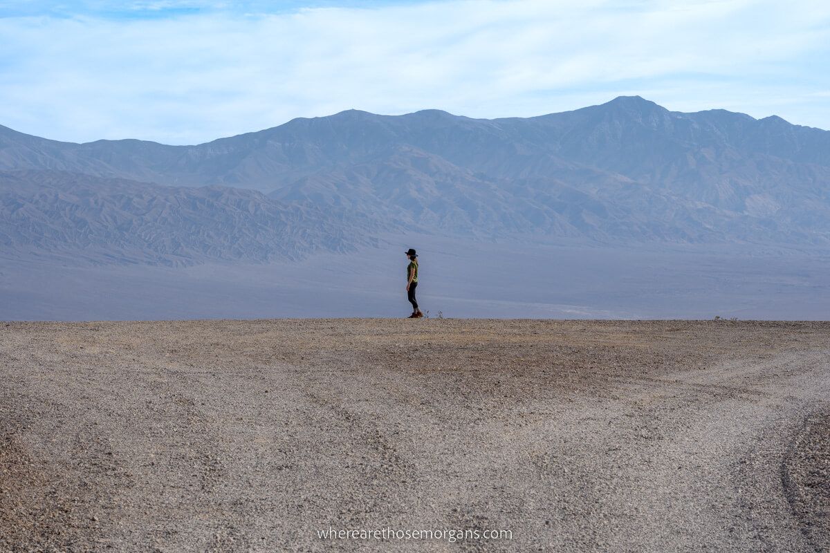
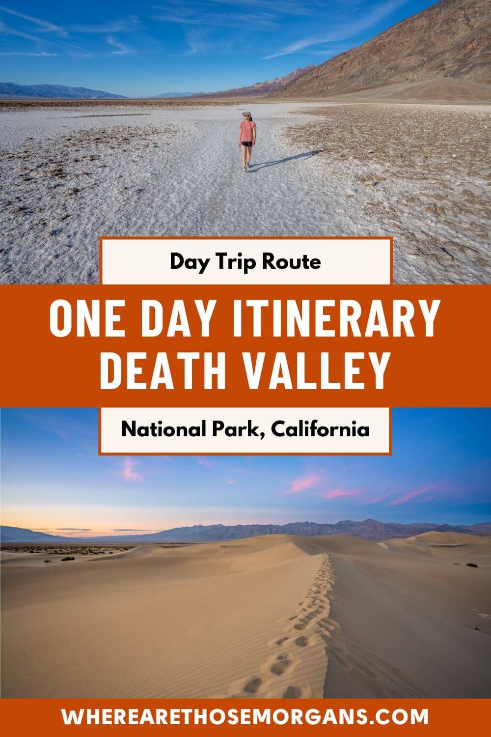
After taking two trips to Death Valley, we can honestly say it’s one of the most underrated national parks in America. Despite it’s ominous sounding name, it is in fact a spectacular landscape loaded with diverse topography, scenic hikes and unique photo spots. You really need three days to see it all, but you can quite easily see Death Valley’s major highlights in just one day.
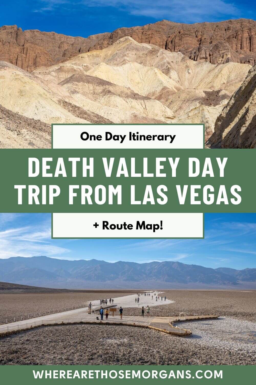
In this guide we show you how to plan the perfect Death Valley day trip from Las Vegas, based on our experiences. And at the end we’ll show you how to spend on day in the park if you enter from the west instead. Read more about us.
We first visited Death Valley after leaving Las Vegas back in October 2019. It was a full 3 day trip with 2 nights in our tent at Texas Springs Campground in Furnace Creek. Despite our tent (and every other tent) collapsing at 2:00am in a dust storm, we had a fantastic time exploring sand dunes, 4WD roads, ghost towns, salt flats and unique hiking trails.
Our second trip to the park was for 2 full days in December 2021, entering from the west after leaving Lake Tahoe and exiting through the east for Las Vegas. We learned our lesson about camping, so we stayed at hotels in Lone Pine, Beatty and Pahrump instead. We’ve driven both directions through the park, and we know how to make a great itinerary either way.
Note: Our content is reader supported and contains affiliate links. If you make a purchase through one of these links, we may earn a small commission at no extra cost to you and it helps us keep this site running.
Death Valley Day Trip Itinerary Map
Click or touch the map below to activate, zoom in and out, and scroll around. If you’d like to see a bigger version, click the “view larger map” icon in the top right, and if you’d like to see any specific attraction or route directions, click the arrow and square icon in the top left.
Map key:
- Red icons – Places you should visit
- Blue line – Exact route to follow
One day isn’t much time, so it’s important to create an efficient itinerary that puts you in the right places at the right times. Our itinerary enters the park through Death Valley Junction and leaves through Beatty at the end of the day. We highly recommend you leave Las Vegas very early in the morning and be prepared to return back to your hotel late to make the most of your day.
Okay, let’s get into the itinerary!
Zabriskie Point
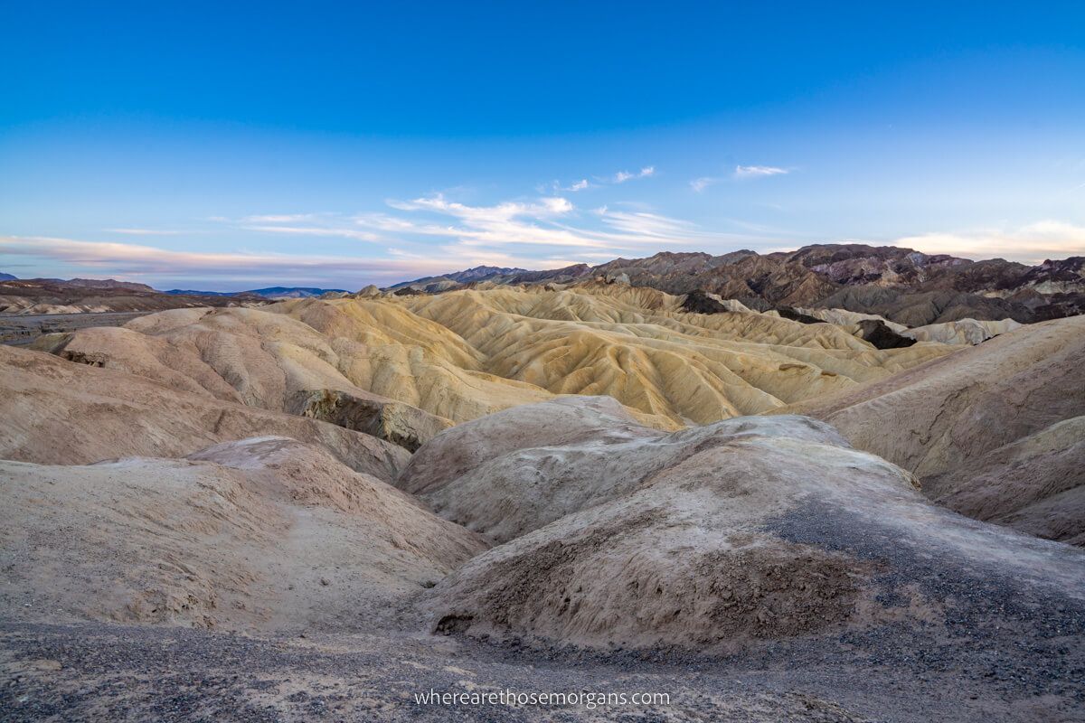
Zabriskie Point is one of the most popular viewpoints in Death Valley. It’s a wide open vista overlooking colorful undulating mounds and dramatic mountain ranges in all directions, and this is where you’ll start your day. The viewpoint has a large parking area and it’s easy to access, but it gets busy. Sunrise and sunset are the best times of day to visit Zabriskie Point when the light is soft and the mounds are vibrant.
We did sunset because we stayed at Furnace Creek, but on a day trip we recommend starting here with sunrise. Check sunrise times for the park the night before you leave Las Vegas. It’s a 2 hour drive from the Vegas Strip to Zabriskie Point so you’d have to leave early but it’s well worth the effort. Your alternative is to drive straight from Vegas to Dante’s View for sunrise, which looks incredible but it’s higher in elevation and it’s harder to reach.
- Zabriskie Point: Maps location
Badwater Basin
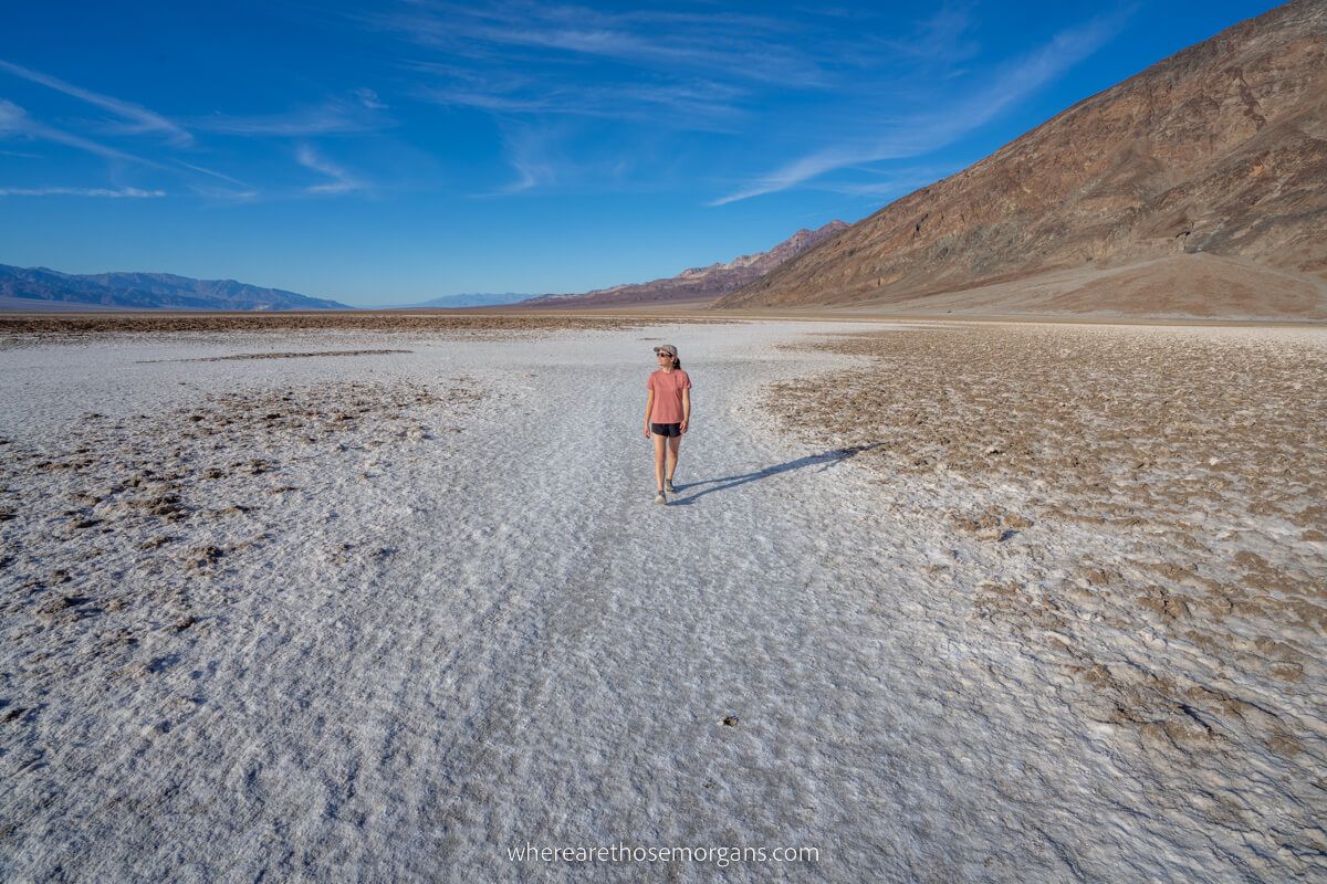
After leaving Zabriskie Point, drive all the way down Badwater Road passing by all other attractions until you reach the parking area for Badwater Basin, the lowest point in the contiguous 48 states of America at 282 ft below sea level. It’s the most popular place in the park, which is why we advise going here straight after sunrise before it gets too crowded.
Depending on the time of year you visit, Badwater Basin could have photogenic hexagonal salt crystal patterns, be covered in a shallow layer of water for awesome reflection photos, or be somewhere in between. During both our trips to Death Valley, the salt flats were dried up and had no shape which was disappointing. Don’t forget to take some fun perspective photos!
- Badwater Basin: Maps location
Natural Bridge
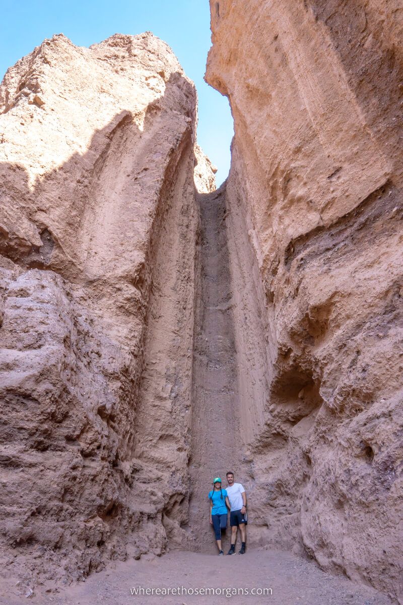
Turn around and drive 3.5 miles back up Badwater Road. Take a right turn onto Natural Bridge Road, cut through desert for 1.5 miles on a dirt road and park in the large lot at the end. Natural Bridge Trail is a moderately difficult 2-mile roundtrip hike that carves through a canyon to a bridge-like rock formation and a handful of dried out waterfalls.
The trail is wide and has a gradual elevation gain throughout. You’ll pass underneath the natural bridge, see a tall dry waterfall and end at another wider dry waterfall with multiple tiers. It’s not the best hike in the park so we don’t think it’s essential, but it’s a good one to blow the cobwebs off early in the morning and get a taste for hiking in the park’s harsh conditions.
- Natural Bridge Trail: Maps location
Devil’s Golf Course
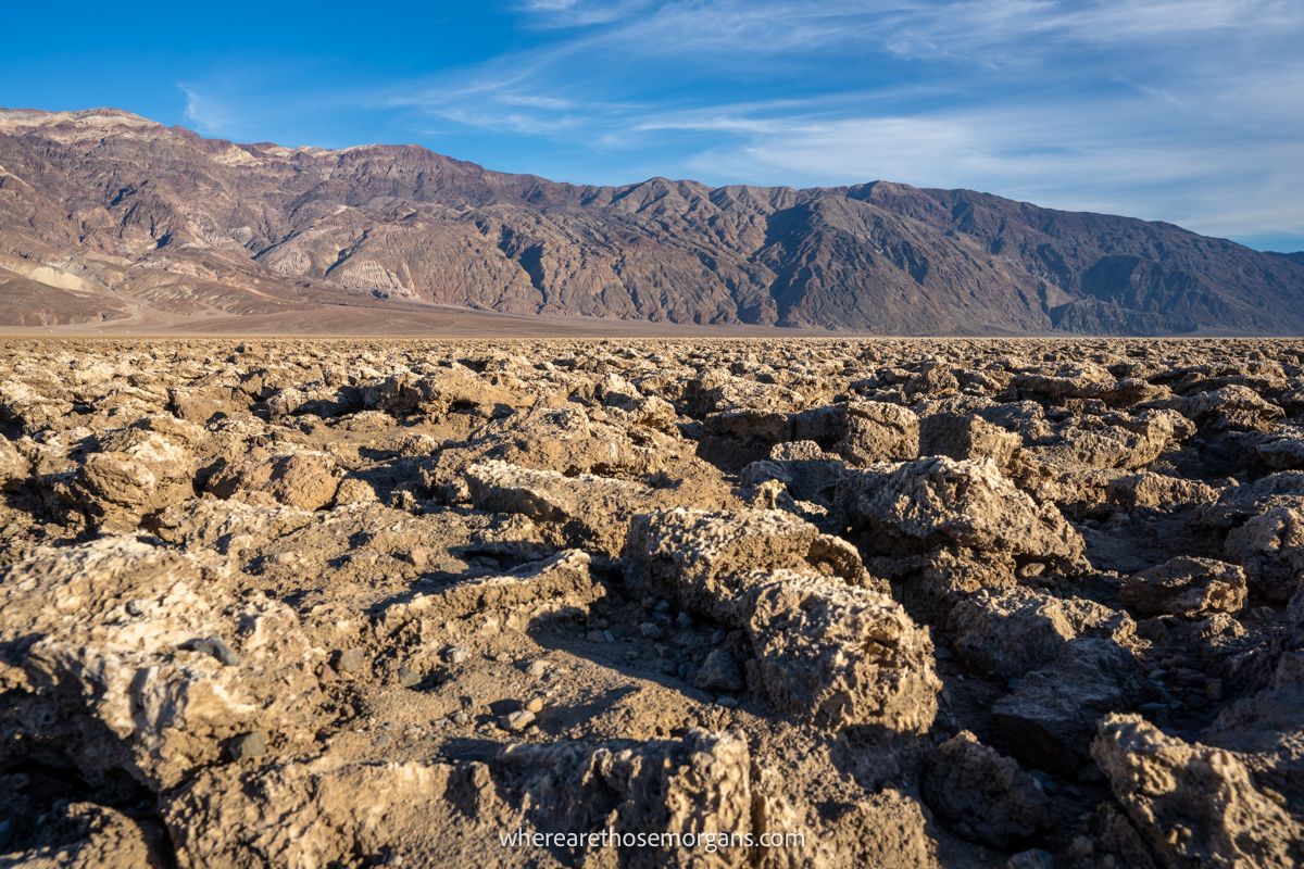
Just 2 miles further north your next stop is a left turn onto Salt Pool Road for the Devil’s Golf Course, a massive dried up salt pan that looks as though it belongs in a sci-fi movie. It’s a wide open expanse filled with shallow jagged rocks as far as the eye can see. Only the devil could play golf in a place like this, which is how it got its name.
We actually skipped this spot first time but we’re glad we visited during our second trip. It’s a very unique area of the park, it’s easy to access and it’s great for photos.
- Devil’s Golf Course: Maps location
Artists Palette
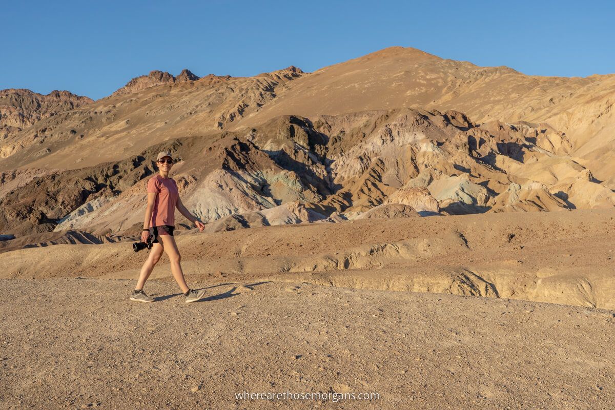
Get back on Badwater Road heading north and take a right turn onto the one-way Artists Drive just 2.5 miles later. This loop drive is one of our favorite spots in Death Valley because it’s scenic, the road is fun to drive and it leads to Artists Palette which has some of the most colorful mounds in the park.
We recommend you spend 10-20 minutes walking around this area to enjoy the colorful oxidized rock formations. You’ll see lots of pinky-purples and light blues.
- Artists Palette: Maps location
Golden Canyon
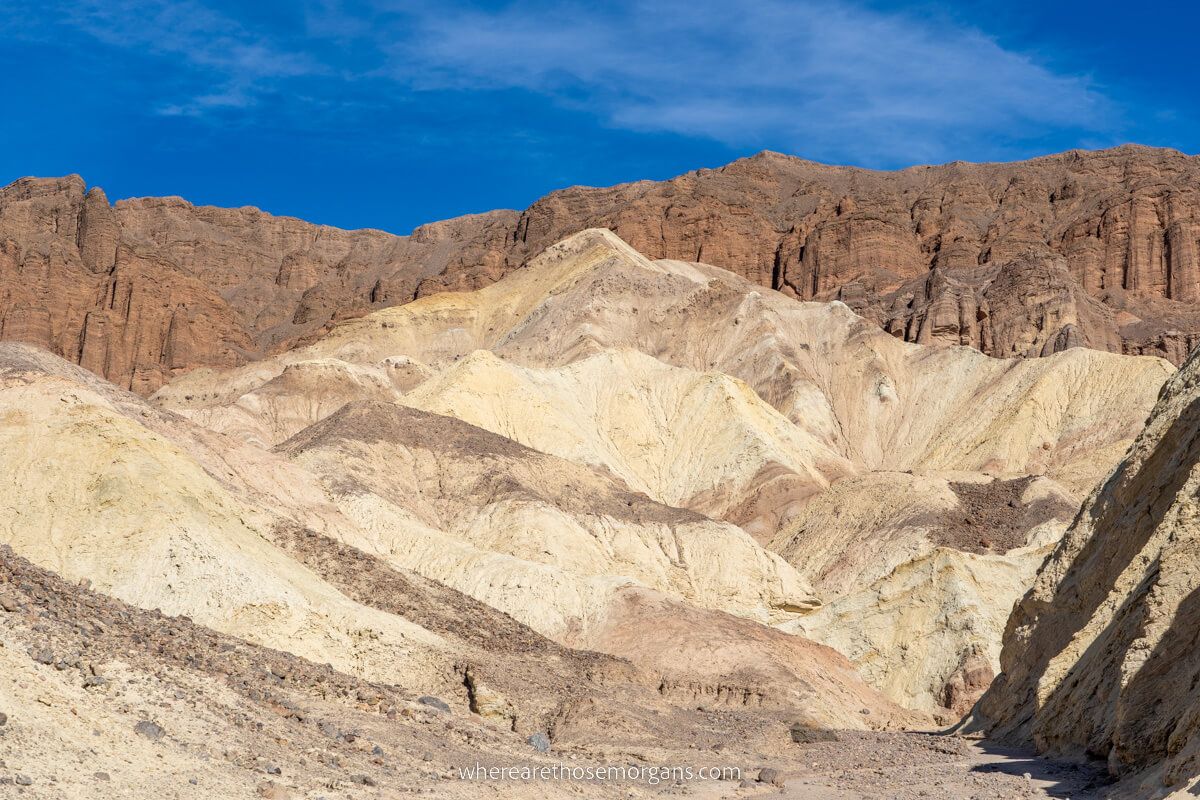
Drive another 3 miles up Badwater Road and stop at Golden Canyon Trailhead for our second favorite hike in Death Valley. There are several trail variations you can hike depending on time, heat and how much distance you want to walk. For a shorter and easier hiker, just go to Red Cathedral and back. Or for a more challenging and scenic route, you could hike the full loop to Red Cathedral, Zabriskie Point, Badlands Loop and Gower Gulch.
It’ll be around midday by now if you follow this itinerary exactly, which means the heat could be getting dangerous depending on when you visit. Only take on the full loop route if it’s not dangerous, you have plenty of water and you’re a strong hiker. It’s a fantastic trail with lots of amazing photo spots, but we were exhausted by the end because of the heat, even in December.
- Golden Canyon Trail: Maps location
Furnace Creek
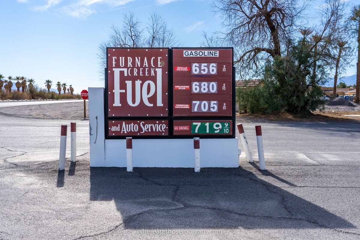
After the hike it’s time to cool off, get some food and take things a bit easier for a few hours. Drive up to Furnace Creek and check out the visitor center area.
If you didn’t fill your car before entering the park, you can get gas at Furnace Creek. There’s not much to do here, but it’s a good time to grab snacks, water and recharge for a few minutes before continuing.
- Furnace Creek: Maps location
Harmony Borax Works
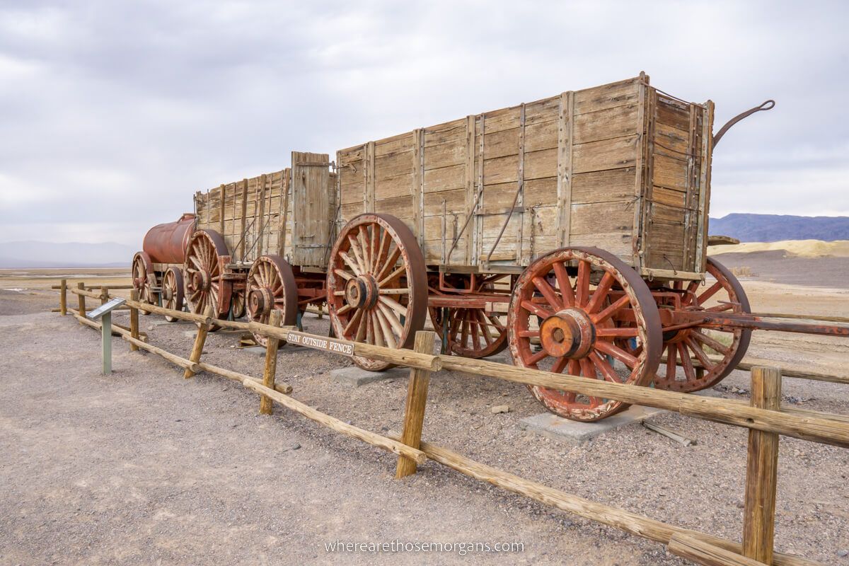
Head north on CA-190 until you reach Harmony Borax Works, the site of a late 1800’s plant from which borax was extracted and sent to markets by large teams of mules pulling wagons.
There’s a small interpretive trail leading to information boards explaining its historical significance. Drive through the aptly named Mustard Canyon to rejoin the main road after finishing up here.
- Harmony Borax Works: Maps location
Salt Creek
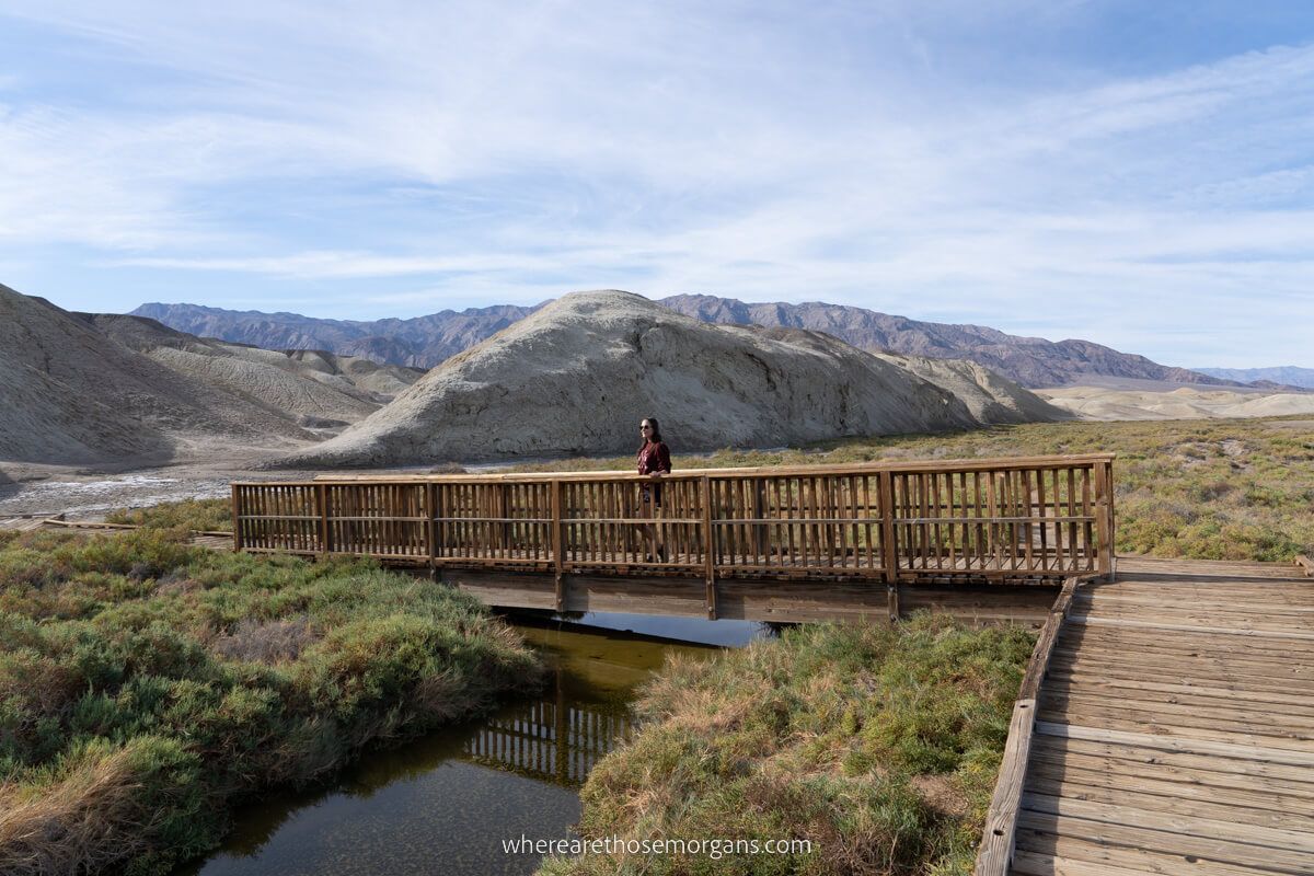
Continue driving north for 11 miles until you reach the Salt Creek Interpretive Trail. This is one of the only places in Death Valley where you’ll see green vegetation, water and wildlife if you visit in the winter months.
It has a 0.5-mile wooden boardwalk that you can follow alongside the creek, but you must be extremely careful because the environment here is fragile. (Note: Salt Creek has been closed since 2022 due to flooding).
- Salt Creek: Maps location
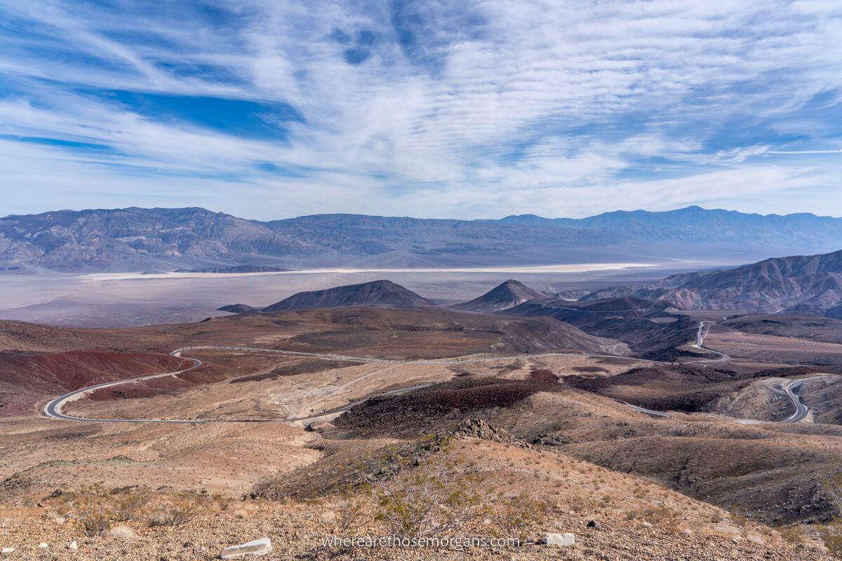
Titus Canyon
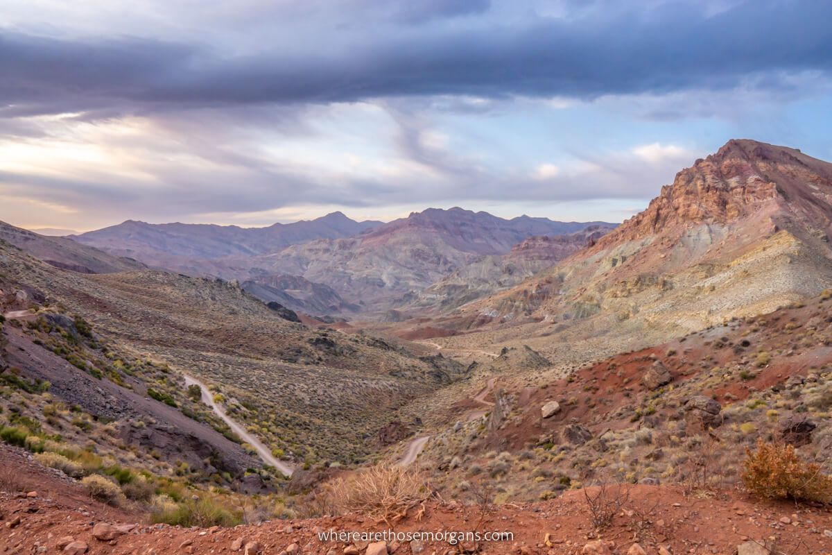
If you’re visiting Death Valley with a high clearance vehicle, we can’t recommend driving Titus Canyon highly enough. It’s the most popular backcountry road in the park thanks to stunning views and an exciting driving route. The last 3 miles in particular are so much fun. We had the whole thing to ourselves and we finished just in time before it got too dark, which was equal parts eerie and awesome!
This will only work if you have the right vehicle and you might need to cut a hike or attraction so you have enough time. It took us around 2 and a half hours. To reach the one-way road head northwest on CA-190, take a right onto Scotty’s Castle Road and then another right onto Daylight Pass Road. Cross over the mountains and into Nevada, then take a left turn onto Titus Canyon Road.
- Titus Canyon Trailhead: Maps location
Mosaic Canyon
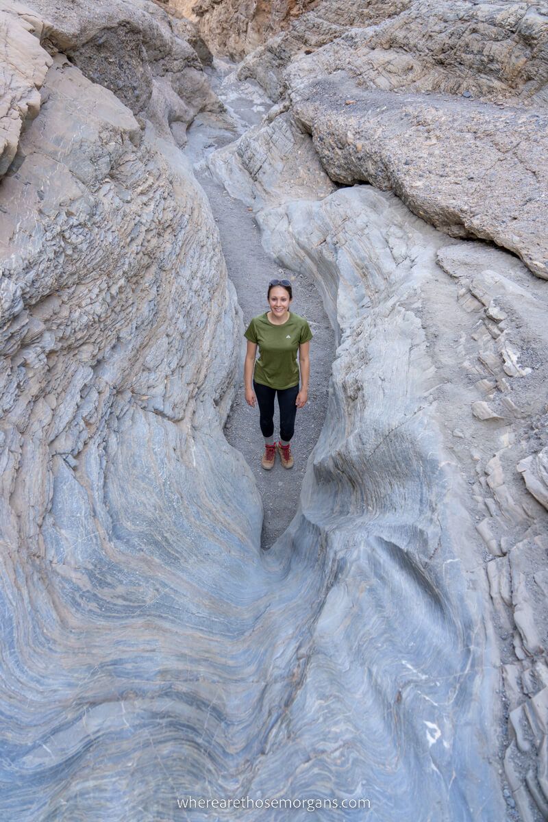
Are you up for another hike? Avoid the temptation to stop at Mesquite Flat Sand Dunes and continue to Stovepipe Wells so you can drive a long dirt road to Mosaic Canyon Trailhead, our favorite hike in the park. Golden Canyon is more scenic and photogenic, but Mosaic Canyon is more fun and adventurous thanks to some light scrambling and pathfinding elements.
Part of the thrill on this maze-like hike is figuring out how to advance at dead ends until eventually reaching a point where you actually can’t go any further. If you’re a keen hiker or you’re getting short on time, we recommend you prioritize this trail over earlier stops like Harmony Borax and Salt Creek.
- Mosaic Canyon: Maps location
Mesquite Flat Sand Dunes
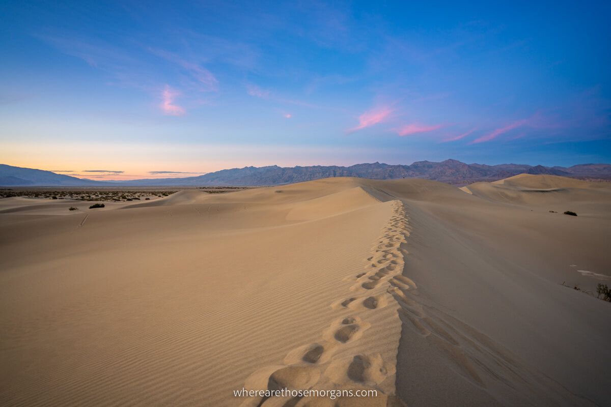
Now drive back to Mesquite Flat Sand Dunes and walk out as far as you feel comfortable in time for sunset. The dunes closest to the parking lot will be busy, so you might need to stretch your legs and put in a big step count if you want some isolation.
We did our very best roadrunner impression to escape the crowds before the sun disappeared. Here’s a tip to remember based on our experience – walking on sand dunes is tiring work, so give yourself enough time!
- Mesquite Flat Sand Dunes: Maps location
Rhyolite Ghost Town
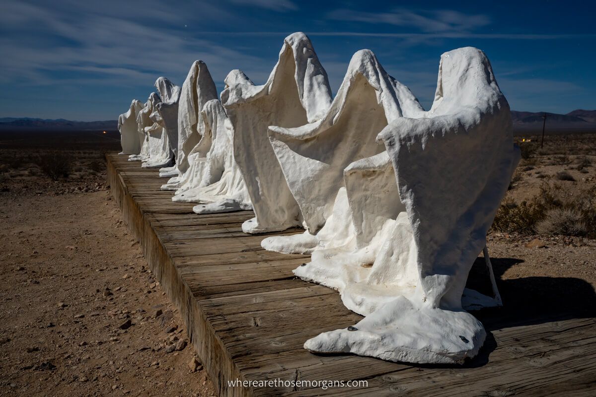
It’s likely you didn’t drive Titus Canyon earlier, so once you’re finished at Mesquite Flat Sand Dunes, cross the mountains into Nevada and eventually you’ll reach Rhyolite Ghost Town. This once thriving mining town is now arguably the best place in Death Valley for night photography. And you can’t visit a ghost town during the day, so it’s only fitting to end your day trip here in the darkness.
From Rhyolite Ghost Town you’re almost in Beatty which is just 1 hour 45 minutes from Las Vegas on US-95. It’s almost like you planned it to be so efficient!
- Rhyolite Ghost Town: Maps location
Death Valley Tours From Las Vegas
If you don’t have a car during your visit to Las Vegas but you still want to see the harsh and hostile desert landscape, there are plenty of tour options available each day. We’ve taken a look through all of the best tours and picked out three with the highest ratings from previous visitors:
Viator
1. Full Day – This full day 10-12 hour coach tour from Las Vegas is top rated and affordable. You’ll see the top highlights, with hotel pickup and drop off, plus brunch and all entry fees included.
2. Small Group – This 10 hour small group guided tour travels from Las Vegas by SUV or mini-bus and covers double the amount of sights in the park. It’s more expensive but you’d have a more immersive experience.
Get Your Guide
1. Full Day – This 10 hour tour is highly rated and it’s the cheapest option to see Death Valley from Las Vegas. You’ll visit the top highlights, with hotel pickup and drop off, plus lunch and all entry fees included.
West To East Itinerary
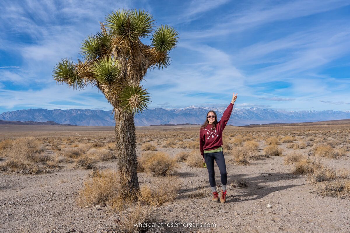
What if you want to plan a one day Death Valley itinerary if you’ll be entering from the west instead of the east?
Well, plenty of people each year visit the park after leaving the likes of Yosemite and Lake Tahoe (including us!), so here’s a summarized version of how you can plan your day trip:
- Stop at Father Crowley Overlook
- Enjoy incredible valley views until Panamint Springs
- Optional hike to Darwin Falls
- Hike Mosaic Canyon
- Grab food at Stovepipe Wells
- Walk out into Mesquite Flat Sand Dunes
- Optional drive to Rhyolite Ghost Town and Titus Canyon (high clearance)
- Walk around Salt Creek
- See Harmony Borax Works
- Drive down to Badwater Basin
- Optional hike to Natural Bridge
- See the Devil’s Golf Course
- Drive to Artists Palette
- Hike Golden Canyon Trail
- Stop at Zabriskie Point for sunset on the way out towards Las Vegas
The Morgan Conclusion
What we like: We think this national park is massively underrated. There’s a bunch of unique things to see and do, the hikes are short and fun, and the photo spots are awesome. But most importantly, it’s achievable to include lots of top activities and attractions into a one day Death Valley itinerary.
What we don’t like: With just one day you’ll need a very early start and a late finish. Plus, the drive between Las Vegas and Death Valley is longer than you might think, so the number of attractions you can reach is limited. But the biggest drawback is of course excessive heat in certain months which can make hiking dangerous. Even when we visited Death Valley in December the heat was intense during the day.
Is it worth spending one day in Death Valley? Yes! It’s well worth planning for a day in the hottest recorded place on Earth, whether you’re visiting Las Vegas or driving through the park as part of a wider road trip. We’re confident you’ll be pleasantly surprised at how varied and diverse the hostile landscape is in person, and at how much you can tick off in just one day.
More From Las Vegas
- Top things to do in Las Vegas
- The Las Vegas shows you can’t miss
- Visiting the Seven Magic Mountains
- Las Vegas to Hoover Dam day trip
- Visiting Las Vegas in November
- The Las Vegas Strip hotels ranked
- Las Vegas secret food tour review
Want more Nevada content? Head over to our Nevada Travel Guides to explore State Parks, beautiful landscapes and the best things to do in Las Vegas.
We hope our one day in Death Valley itinerary helps with planning your visit to California!
Please let us know if you have any questions in the comments below.
Happy Travels,
Mark and Kristen
Enjoy this guide? Pin it for later!
All Rights Reserved © Where Are Those Morgans, LLC. Republishing this article and/or any of its contents (text, photography, maps, graphics, etc.) in whole or in part is strictly prohibited.

Mark and Kristen spent 6 years traveling the world, visiting over 40 countries across 4 continents and more than 30 US states. They created Where Are Those Morgans in 2018 to help others plan the best possible vacations by writing authentic travel and hiking guides based on their real experiences.
Since the arrival of baby Maya in late 2024, Mark and Kristen’s extensive travels have slowed down but they still take plenty of trips. Where Are Those Morgans now helps millions of travelers each year to visit new places and hike new trails through information-packed blog posts and expert travel guidebooks. Read more about Mark and Kristen.
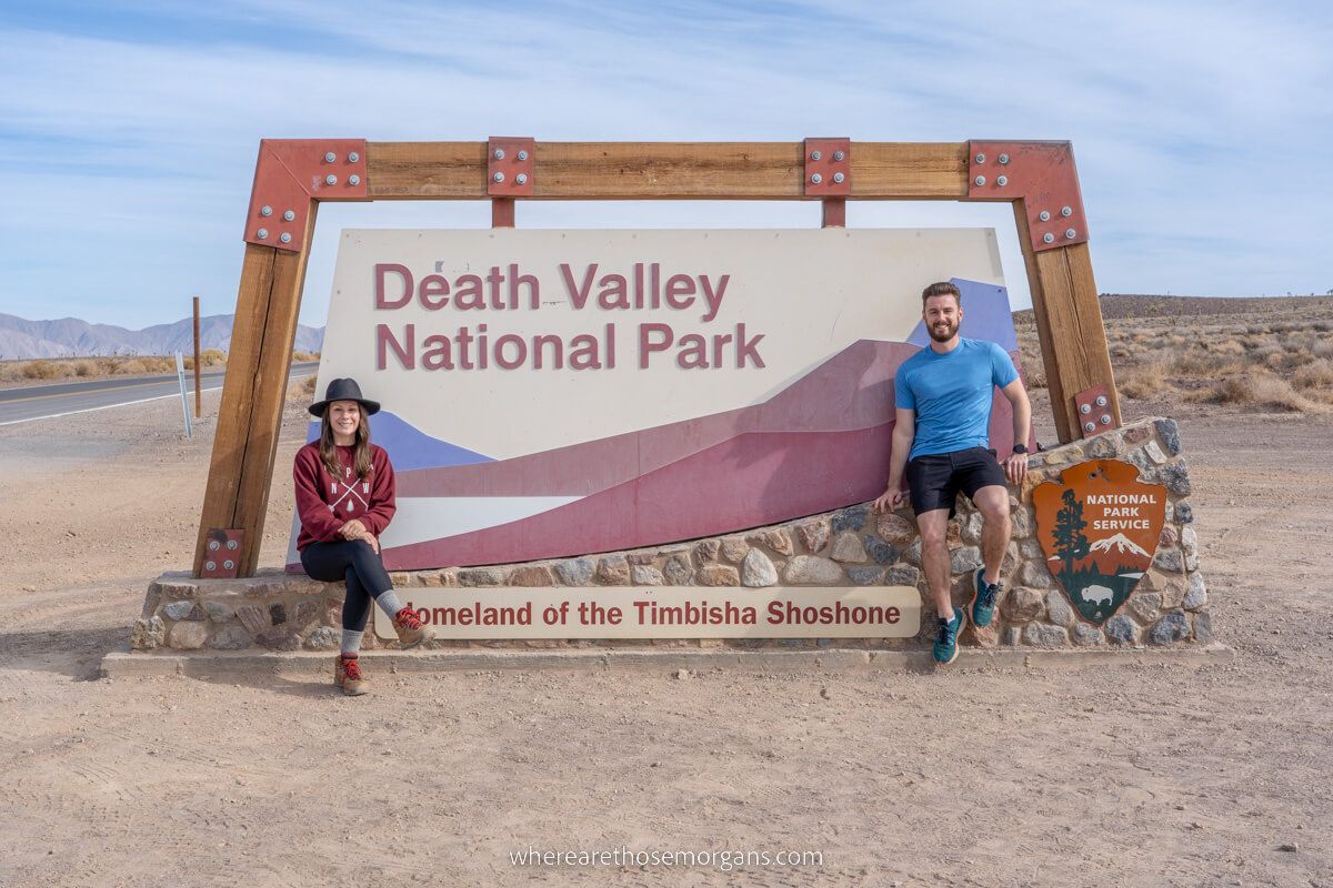
Thanks for great information. This article has helped me map my death valley trip from Vegas. 1 question do we get to see the death valley national park sign when Entering Via Death Valley Junction
Hi Hema, yes you will drive right past the Death Valley National Park sign around half way between Death Valley Junction and Furnace Creek on 190. Here is the exact location of the sign to open in Google Maps. Have a fantastic trip!
Wow Death valley looks like an amazing place, great information and photos. Unbelievable heat but I think I would put up with it for that scenery.
Thank you Graham, it’s easy to write about awesome landscapes such as Death Valley. It was hot and hostile when we visited in October, got caught in a massive dust storm but that added to the Death Valley experience!