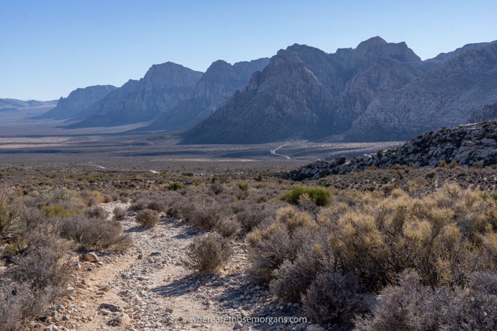
Red Rock Canyon is a rugged national conservation area near Las Vegas that’s filled with adventurous hikes. The trails vary in difficulty, so it’s a great place for the whole family to enjoy. We spent a day hiking a range of fun trails in the canyon, and honestly we think it’s a bit of a hidden gem in the American southwest.
After spending 3 full days in Death Valley we stayed at a hotel in Pahrump so we could wake up early, drive to Red Rock Canyon, spend the day hiking and then continue on to Vegas later that evening. Half a day was enough time to tick off the short and mid-length trails, but we didn’t have enough time for the longer hikes.
Our expectations were unfairly low for the canyon, but it’s because we hadn’t heard much about it before we arrived. And it turned out to be awesome, so we’d happily go back to hike the trails we missed first time round the next time we need to blow the Vegas strip cobwebs off! Read more about us.
In this guide we show you 10 hikes you can’t miss in Red Rock Canyon, based entirely on our experiences. Let’s begin!
Note: This article may contain affiliate links. If you make a purchase using one of these affiliate links, we may earn a small commission at no extra cost to you. Thank you!
Summary
With no clear standout “bucket list level” trail, the title of best hike in Red Rock Canyon is up for debate. If pushed, we’d say Calico Tanks is the best overall trail for most visitors because it’s a good challenge but it’s not too hard, and it leads to a spectacular vista ending overlooking Las Vegas.
Here are our recommendations:
- Easy – Pine Creek Canyon
- Moderate – Calico Tanks
- Hard – Turtlehead Peak
- Families – Lost Creek + Petroglyph Wall
- Adventure – Ice Box Canyon
- Busiest – Calico Hills
- Hidden Gem – Kraft Boulders
- Our Favorite – Ice Box Canyon
Okay, let’s get into the hikes! We’re ordering based on trail difficulty, from easy through hard.
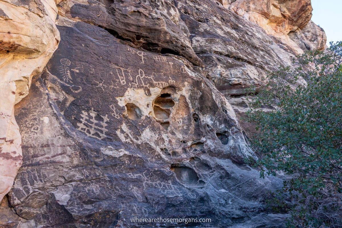
1. Lost Creek Trail
- Difficulty: Easy
- Distance: 1 mile roundtrip
- Elevation: 100 ft
- Time: 1 hour
- Trailhead: Rocky Gap
If you’re visiting with younger kids who are more suited to short and easy trails, there’s 2 great hikes for families and they’re located next to one another on Rocky Gap Road. Technically, they’re separate hikes and you’ll have to drive a short distance between the trailheads, but together they only total 1 mile of hiking so we didn’t want to list them separately.
Starting with Petroglyph Wall, you’ll cross a wash and find a cliff wall filled with rock art which is partially hidden behind a juniper tree. Next, Lost Creek is a fun easy hike because it features several plant species, cultural sites and after rainfall there may even be a picturesque waterfall on the trail.
Our experience: We hiked to Petroglyph Wall first because it was the further away trailhead, and the rock art was clear and interesting to see. For us, Lost Creek is the better of the two easy trails in this area, but there was no recent rainfall so we didn’t see a waterfall.
2. Pine Creek Canyon Trail

- Difficulty: Easy
- Distance: 3 miles roundtrip
- Elevation: 300 ft
- Time: 1.5-2 hours
- Trailhead: Pine Creek
Pine Creek Canyon is a great hike for the whole family because it has creeks, light scrambling, optional bouldering elements, small waterfalls after rainfall and non-stop mountain views. In spring you’ll find wildflowers on the trail, but it can become overgrown in late summer and fall so you’ll need to watch your footing.
The canyon features open desert, an old homestead site and a further optional figure eight loop called Fire Ecology which cuts through an area of ponderosa pine after a prescribed fire. This trail begins near the very end of the one-way loop road running through the canyon, so save it for last.
Our experience: We had to miss this hike because we finished hiking Ice Box Canyon (the trail before this one on the loop road) as it was beginning to get dark.
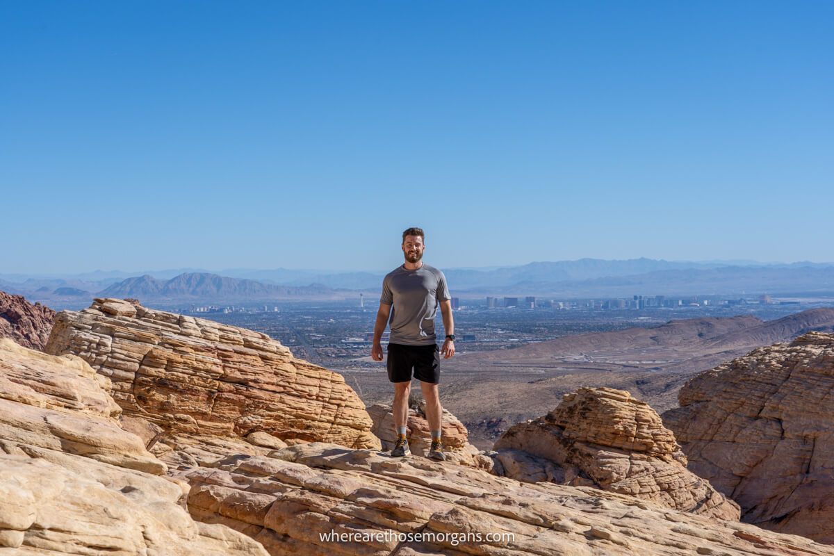
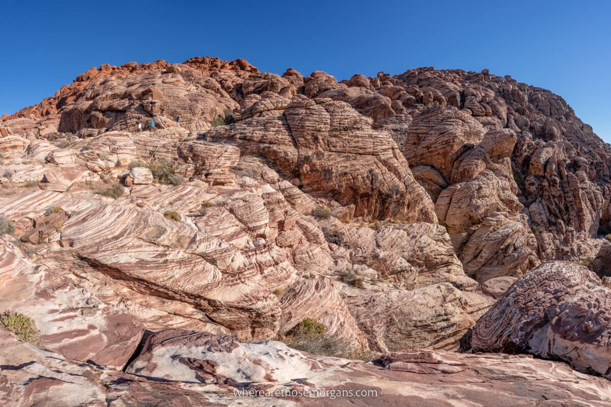
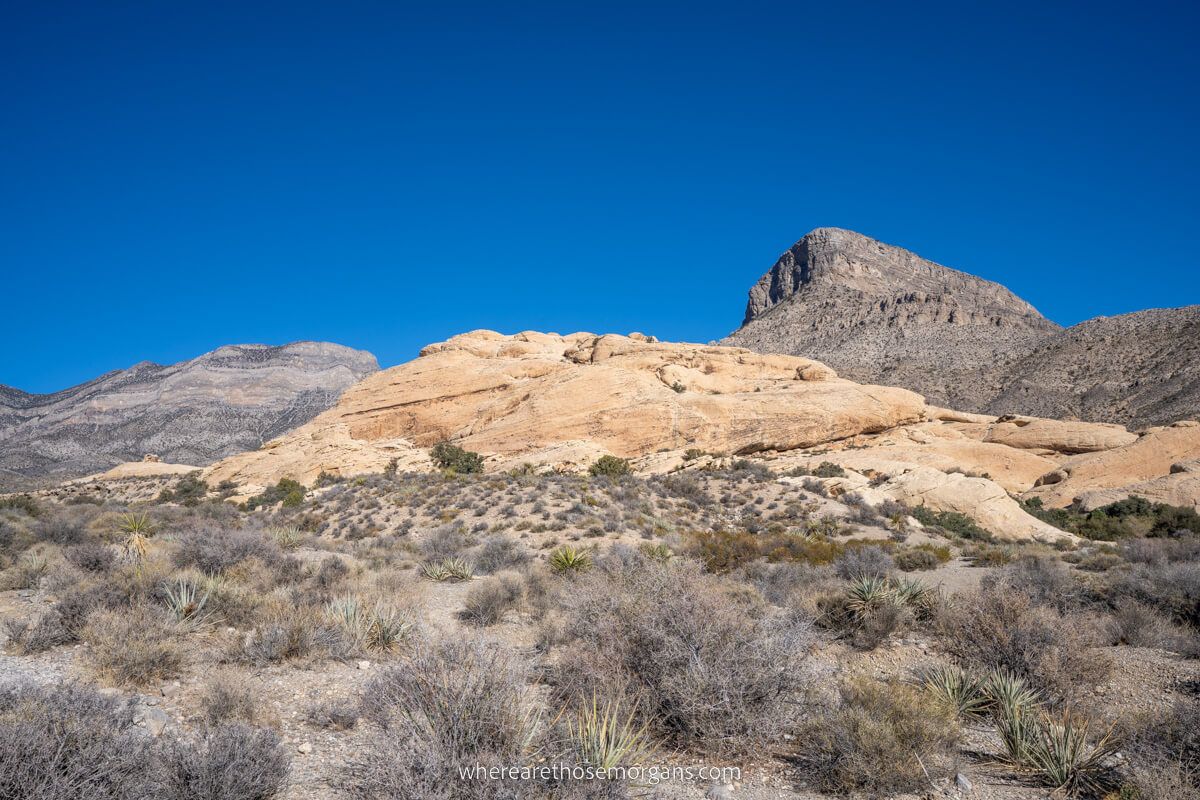
3. Calico Hills Trail (Calico I and Calico II)
- Difficulty: Moderate
- Distance: 2-6 miles roundtrip
- Elevation: ~400 ft
- Time: 1-3 hours
- Trailhead: Calico I and Calico II
Calico Hills is a long formation consisting of tall and rugged red rock cliffs, walls and eroded rock formations. It’s split up into Calico I and Calico II, which basically means the south and north ends of the rock formation. You can park at either trailhead, but we recommend you start at Calico I immediately after entering Red Rock Canyon.
You’re permitted to hike or climb anywhere you like around Calico Hills. If you want to make it easier, you can hike between Calico I and Calico II on a flat trail. But if you want a challenge you can forge your own route up, down or through the rugged rock hills.
Our experience: We parked at Calico I and turned right onto Lower Calico Hills Trail, dropped into a ravine and climbed around on the rocks for half an hour. Then we drove to Calico II and hiked around the area for about another 15 minutes. We though Calico I was the more fun area to explore.
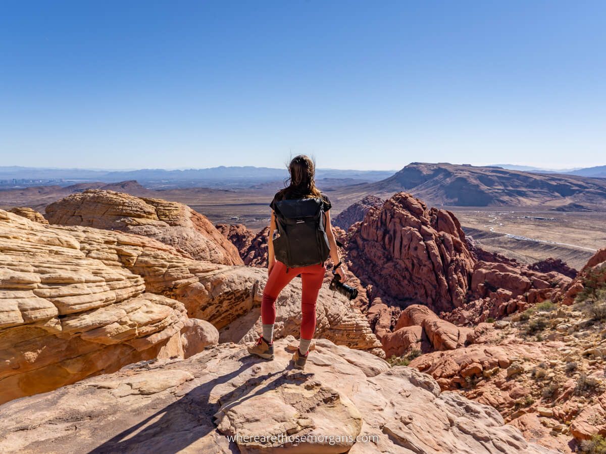
4. Calico Tanks Trail

- Difficulty: Moderate
- Distance: 2.5 miles roundtrip
- Elevation: 450 ft
- Time: 2 hours
- Trailhead: Sandstone Quarry
Calico Tanks is the most popular hike in Red Rock Canyon, and we have to say we think it’s the best all-round trail for the majority of visitors. You’ll walk through sand, navigate tricky slick rock faces, climb a few small sections with your hands and end at a seriously awesome vista overlooking the famous Las Vegas Strip casino hotels.
Our experience: We really enjoyed hiking Calico Tanks and it’s definitely our top recommendation if you’re a frequent hiker. But there were some narrow sections of the trail that bottlenecked with hikers, so we had a few instances of having to wait around. It’s worth it though for the immense summit view!
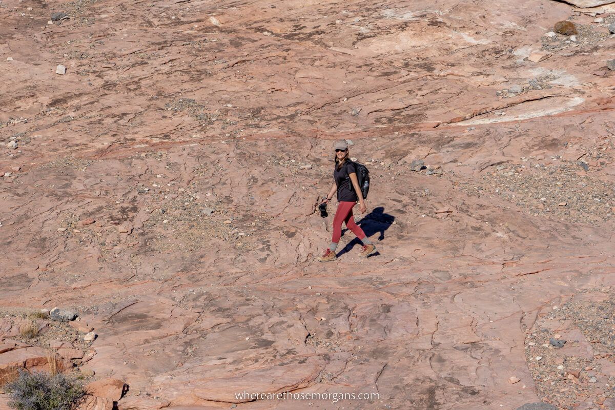
5. Keystone Thrust Trail
- Difficulty: Moderate
- Distance: 2.2 miles roundtrip
- Elevation: 400 ft
- Time: 1.5 hours
- Trailhead: Upper White Rock
Keystone Thrust is a quiet hike leading to elevated views over the canyon’s red and white rock formations. It also leads to two exposed tectonic plates at the Keystone Thrust Fault, and you can stand with one foot on each plate, which can seldom be done anywhere else in the world. The trail splits near the end and leads into a kind of mini-canyon, which is where you’ll find the geologic feature.
Our experience: We liked that this hike was deserted, but it definitely wasn’t the most exciting trail we did in the canyon. It’s also completely exposed and the road to reach the trailhead was pretty bouncy. We’d say this is a good one if you want to escape crowds or if you’re a return visitor.
6. First Creek Trail
- Difficulty: Moderate
- Distance: 3 miles roundtrip
- Elevation: 300 ft
- Time: 2 hours
- Trailhead: First Creek
First Creek Trail is located 2.6 miles southwest of the canyon’s exit, but it’s a great hike to tag onto the start or end of your day if you have time. You’d walk a mile towards the red rock cliff walls before turning into First Creek Canyon. Once inside, you can see two hidden waterfalls and a grotto if you visit after rainfall.
Our experience: It was already dark by the time we left the canyon so we didn’t even see the trailhead for this hike. But we’re sure it would be a great way to escape the crowds.
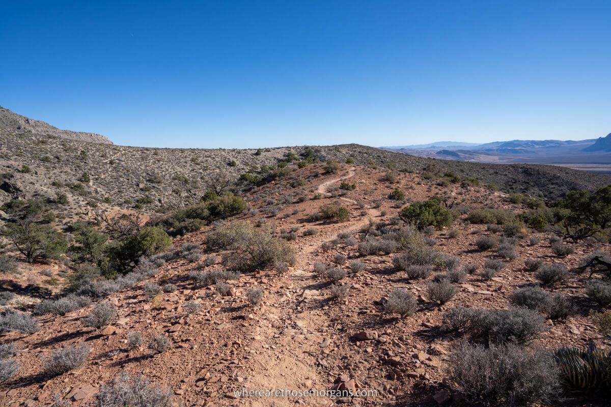
7. White Rock Mountain Loop Trail
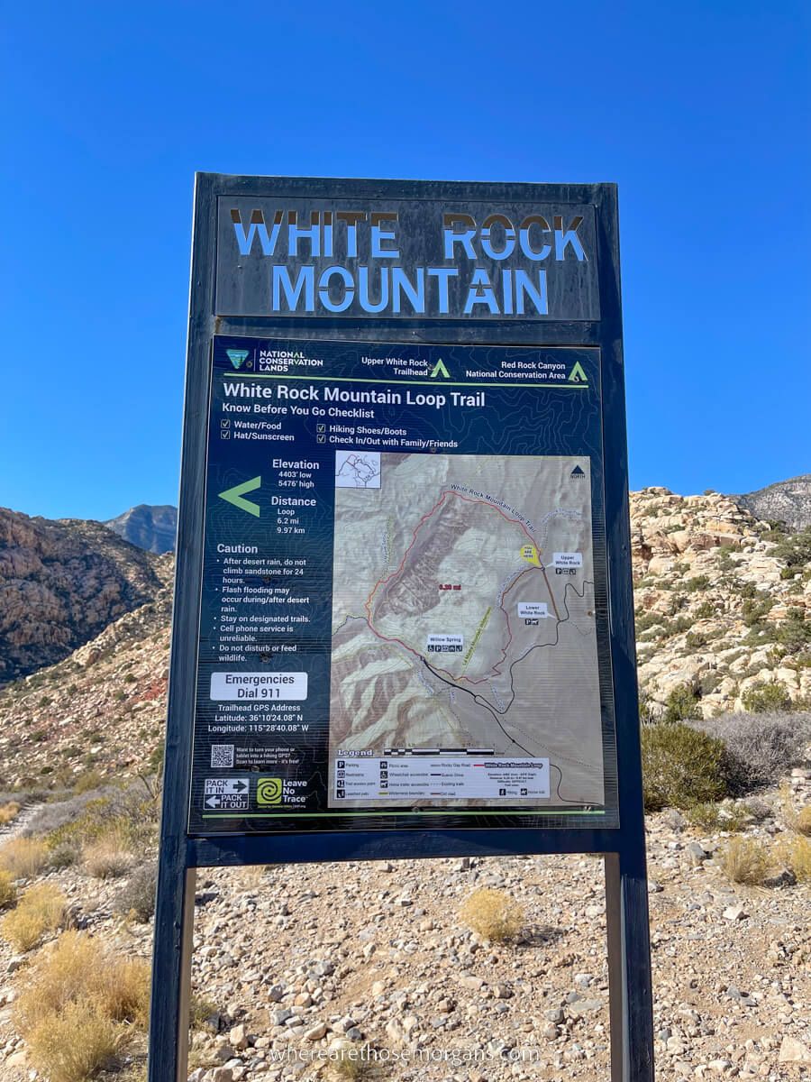
- Difficulty: Moderate
- Distance: 6 mile roundtrip
- Elevation: 890 ft
- Time: 2.5-3.5 hours
- Trailhead: Upper White Rock or Willow Springs
White Rock Mountain Loop is a moderately challenging 6-mile roundtrip hike with 900 feet elevation if you do the whole loop. But you could also hike a small portion down into Willow Creek and back, or even up to elevated views before turning around.
If you do the loop you’ll hike a portion of La Madre Spring Trail, which has a year round water source and attracts bighorn sheep. There’s also a hidden pinyon and juniper forest that you can’t see from the loop road.
Our experience: We hiked a small portion of the trail down towards Willow Creek, immediately after we’d finished Keystone Thrust. Next time we’re in the canyon we’ll do the full loop.
8. Turtlehead Peak Trail
- Difficulty: Hard
- Distance: 5 miles roundtrip
- Elevation: 2,000 ft
- Time: 3-4 hours
- Trailhead: Sandstone Quarry
Turtlehead Peak is the hardest hike in Red Rock Canyon and it looks awesome. This is the hike to do if you want a challenging trail to blow the cobwebs off and get away from the crowds. And you’ll be rewarded with incredible summit views overlooking the entire region. But it’s no joke, so it should only be attempted if you’re a strong hiker, and you must take plenty of water.
The trail leads through a wash, sandstone formations, a gulch, a saddle and a summit. Then you return the exact same way. In just 2.5 miles you’d climb 2,000 feet in elevation, so it’s certainly a thigh burner!
Our experience: We only had one day in the canyon so we couldn’t hike every trail, but this is the one we regret missing the most. So we’ll prioritize this hike the next time we’re in Red Rock Canyon.
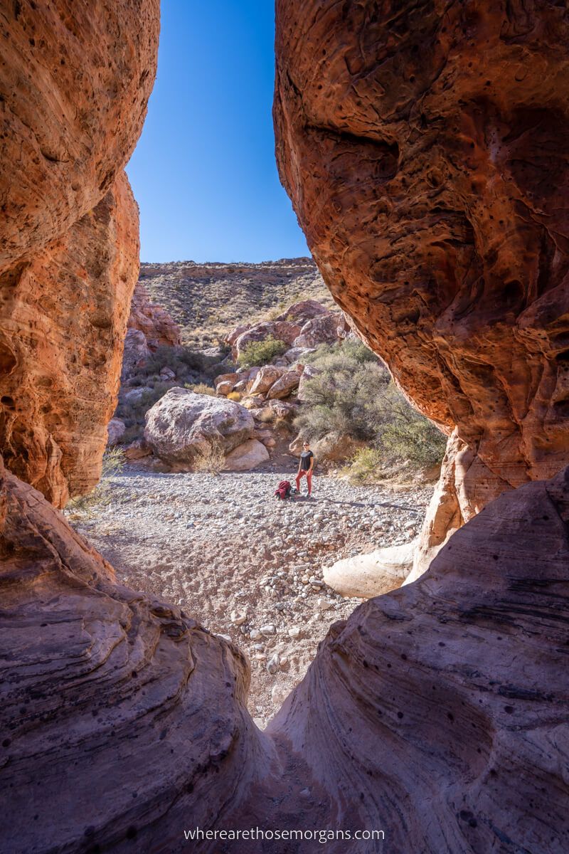
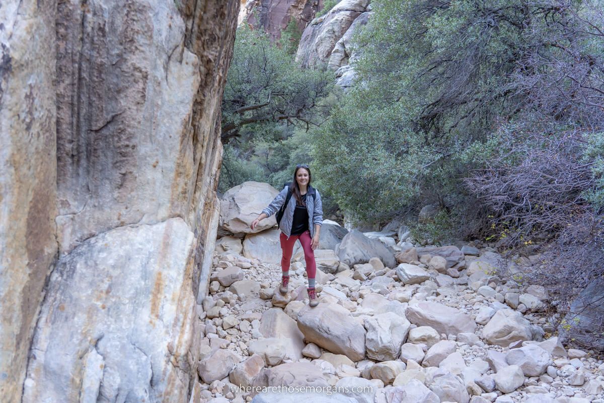
9. Ice Box Canyon Trail
- Difficulty: Hard
- Distance: 2.6 miles roundtrip
- Elevation: 300 ft
- Time: 2 hours
- Trailhead: Ice Box Canyon
Ice Box Canyon is a short but fun hike with lots of boulders, rocks and scrambling. It begins in open desert covered in vegetation, before entering a very narrow canyon with tall cliff walls. Once inside the canyon, you’re essentially boulder hopping the entire way to a two-tiered waterfall climax. You’ll scramble, duck and weave through thick tree trunks, climb over huge rocks and even scale a waterfall at the end if you feel comfortable.
Our experience: Of the hikes we were able to do, Ice Box Canyon was our favorite because we enjoy getting off-trail. We made it all the way up to the upper waterfall area but there wasn’t much water because it was the end of November. And we only just made it back to our car before it got dark!
10. Kraft Mountain Loop Trail
- Difficulty: Hard
- Distance: 3.5 miles roundtrip
- Elevation: 600 ft
- Time: 2-3 hours
- Trailhead: Kraft Mountain
Kraft Mountain Loop Trail is our hidden gem hike in Red Rock Canyon. We actually did it before entering the canyon earlier in the morning, firstly because we’d read that it was a fun trail, and secondly because parking fills quickly (it’s not in the canyon, so there’s no fee). There’s some light scrambling and rock climbing sections, so you might have to give your kids or even your dog a boost at times!
Our experience: We really enjoyed hiking Kraft loop, and we’d say it was probably our second favorite trail after Ice Box Canyon. The trail markings weren’t great, but we hiked it counter-clockwise and there was a steep hill with a bit of scrambling, but once we were up it became much more relaxing.
Trailheads Map
Click or touch the map below to activate, zoom in and out, and scroll around. If you’d like to see a bigger version, click the “view larger map” icon in the top right, and if you’d like to see any specific trail, click the arrow and square icon in the top left.
Map key:
- Blue – Scenic drive
- Purple – Easy trails
- Orange – Moderate trails
- Red – Hard trails
- Brown – Trails outside the canyon
Trailhead Parking
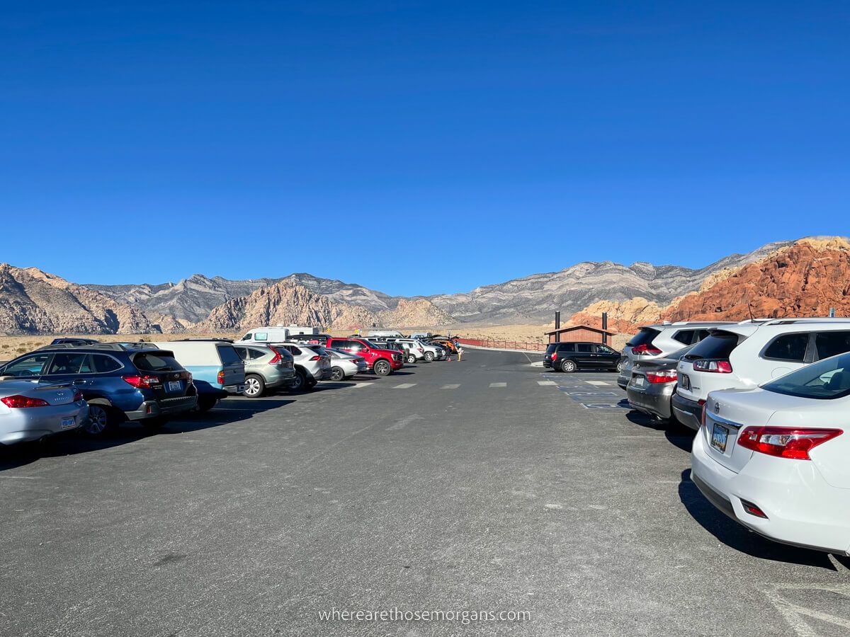
Parking at hiking trailheads in Red Rock Canyon can be challenging during peak times between 10:00am-3:00pm on weekdays, all day on weekends and during holidays in particular. We recommend arriving early in the morning to get parked at your preferred trailheads.
The loop road is a one-way system, so if you skipped Calico I and II first thing in the morning, you’d already be ahead of the rush. Our advice is to try staying ahead of the rush because it’s a pain when trailhead parking lots are full.
Passes And Fees
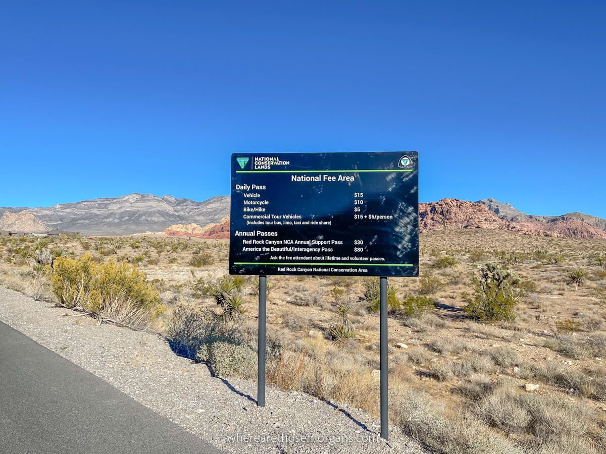
You can hike Kraft Mountain Loop and First Creek Trail without entering Red Rock Canyon, so you wouldn’t have to pay to hike them. But in order to hike any other trail listed in our guide, you’ll have to pass through a multi-lane fee kiosk, which is like a freeway toll.
Day use fees are as follows:
- Car/Truck – $15
- Motorcycle – $10
- Bicycle/Pedestrian – $5
- More about fees
Do you own an America the Beautiful Pass? If so, you can use it to enter Red Rock Canyon because it’s a national conservation area. Bonus!
IMPORTANT: On top of paying for entry, you also need to book a timed entry reservation for $2/vehicle if you visit Red Rock Canyon between October 1st and May 31st.
The Morgan Conclusion
Red Rock Canyon has a range of fun hiking trails with adventurous elements and fantastic views. Lost Creek is a great easy hike and Calico Tanks is a superb moderate hike, but it’s in the hard category that Red Rock Canyon excels because Ice Box Canyon, Kraft Mountain and Turtlehead Peak are all excellent trails.
Valley of Fire and Red Rock Canyon are often compared, and after visiting both places, we’d say Valley of Fire has better easy hikes, but Red Rock Canyon has better hard hikes. So this is the place to come if you need a day away from the Vegas Strip to blow the cobwebs off!
More From Las Vegas
- What to see in Valley of Fire
- Las Vegas secret food tour review
- How to see Seven Magic Mountains
- Las Vegas to Hoover Dam guide
- Vegas shows you can’t miss
- Vegas day trip destinations
- Top Las Vegas attractions
- Las Vegas Strip hotels ranked
Want more Nevada content? Head over to our Nevada Travel Guides to explore State Parks, beautiful landscapes and the best things to do in Las Vegas.
We hope our guide to hiking in Red Rock Canyon helps with planning your visit to Nevada!
Please let us know if you have any questions in the comments below.
Happy Travels,
Mark and Kristen
Enjoy this guide? Pin it for later!


All Rights Reserved © Where Are Those Morgans, LLC. Republishing this article and/or any of its contents (text, photography, maps, graphics, etc.) in whole or in part is strictly prohibited.

Mark and Kristen spent 6 years traveling the world, visiting over 40 countries across 4 continents and more than 30 US states. They created Where Are Those Morgans in 2018 to help others plan the best possible vacations by writing authentic travel and hiking guides based on their real experiences.
Since the arrival of baby Maya in late 2024, Mark and Kristen’s extensive travels have slowed down but they still take plenty of trips. Where Are Those Morgans now helps millions of travelers each year to visit new places and hike new trails through information-packed blog posts and expert travel guidebooks. Read more about Mark and Kristen.
Thank you for your great article, for once it’s really up to date. Thanks again
We’re glad to hear, thank you!