Utah is home to some of the most famous adventure hikes in the United States, including Angels Landing and The Narrows in Zion, and Devils Garden in Arches. But there are many more excellent trails in between Utah’s national parks and also near Salt Lake City that are perfect for all hiking abilities. We’ve hiked tons of amazing trails in Utah and we can’t wait to show you what’s in store for your visit.
In this guide we show you 25 awesome Utah hikes to add to your bucket list, based on real hiker reviews and our own extensive experiences. Read more about us.
We first experienced Utah’s unique hiking trails in October 2019 when we drove from Yellowstone and Grand Teton in Wyoming to Utah’s famed Mighty 5 national parks. Then in April 2021 we returned for a second Utah road trip, this time spending more time hiking in the southwest around Zion and Kanab. After two visits, we can honestly say that Utah is one of our favorite places to hike in the US.
We’ve ticked off most of southern Utah’s bucket list trails like The Wave, Delicate Arch, Devils Garden, The Narrows, Angels Landing and The Subway. But our biggest regret was passing through Salt Lake City without hiking in the nearby Wasatch Mountains. We’ve included hikes near SLC in this guide because they’re among the top rated trails in Utah, and they’re at the top of our own wishlist. Trail are listed in order of difficulty from easiest to hardest. Okay, let’s begin!
Note: Our content is reader supported and contains affiliate links. If you make a purchase through one of these links, we may earn a small commission at no extra cost to you and it helps us keep this site running.
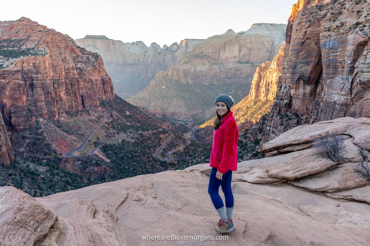
1. Canyon Overlook Trail
- All Trails: 4.8/5
- Google: 4.9/5
- Location: Zion
- Difficulty: Easy
- Distance: 1 mile roundtrip
- Type: Out and back
- Elevation: 160 ft
Canyon Overlook Trail is a popular family friendly hike in Zion National Park. It’s one of our top recommendations if you’re looking for easy hikes in Utah because it’s short, fun and leads to a spectacular viewpoint overlooking Pine Creek Canyon.
We’ve hiked Canyon Overlook for sunset in both April and October, and it’s a stunning spectacle. The downside is that trailhead parking can be a real problem during busy periods. We recommend hiking early or late in the day to avoid the midday rush.
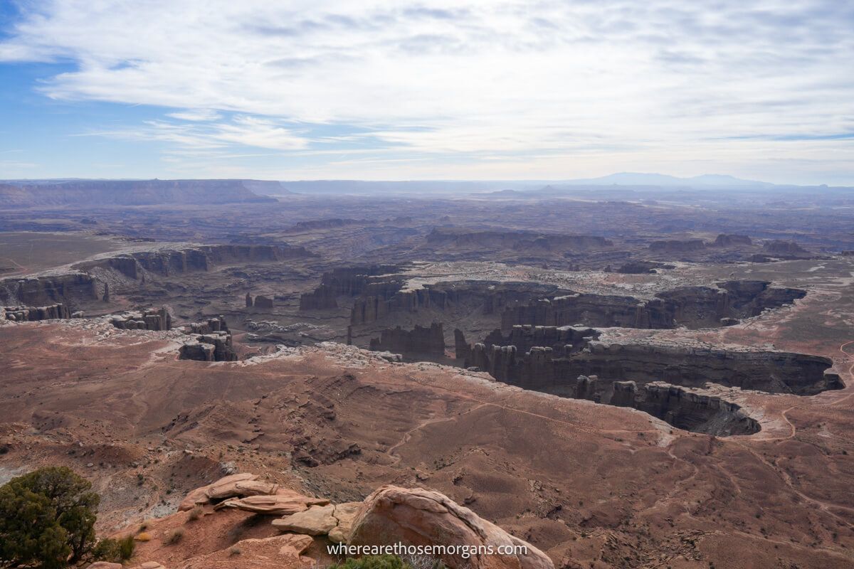
2. Grand View Point Trail
- All Trails: 4.7/5
- Google: 4.9/5
- Location: Canyonlands
- Difficulty: Very easy
- Distance: 1.8 miles roundtrip
- Type: Out and back
- Elevation: 70 ft
Grand View Point Trail is one of the easiest and most picturesque hikes in the Islands in the Sky district of Canyonlands National Park. It’s a flat trail featuring unobstructed views over dramatic canyons throughout, so you get a lot of bang for your buck.
When we hiked Grand View Point we commented that it looked like Monument Valley had been picked up and dropped inside a deep rugged canyon. It’s a hike you can’t miss when you’re in Moab.
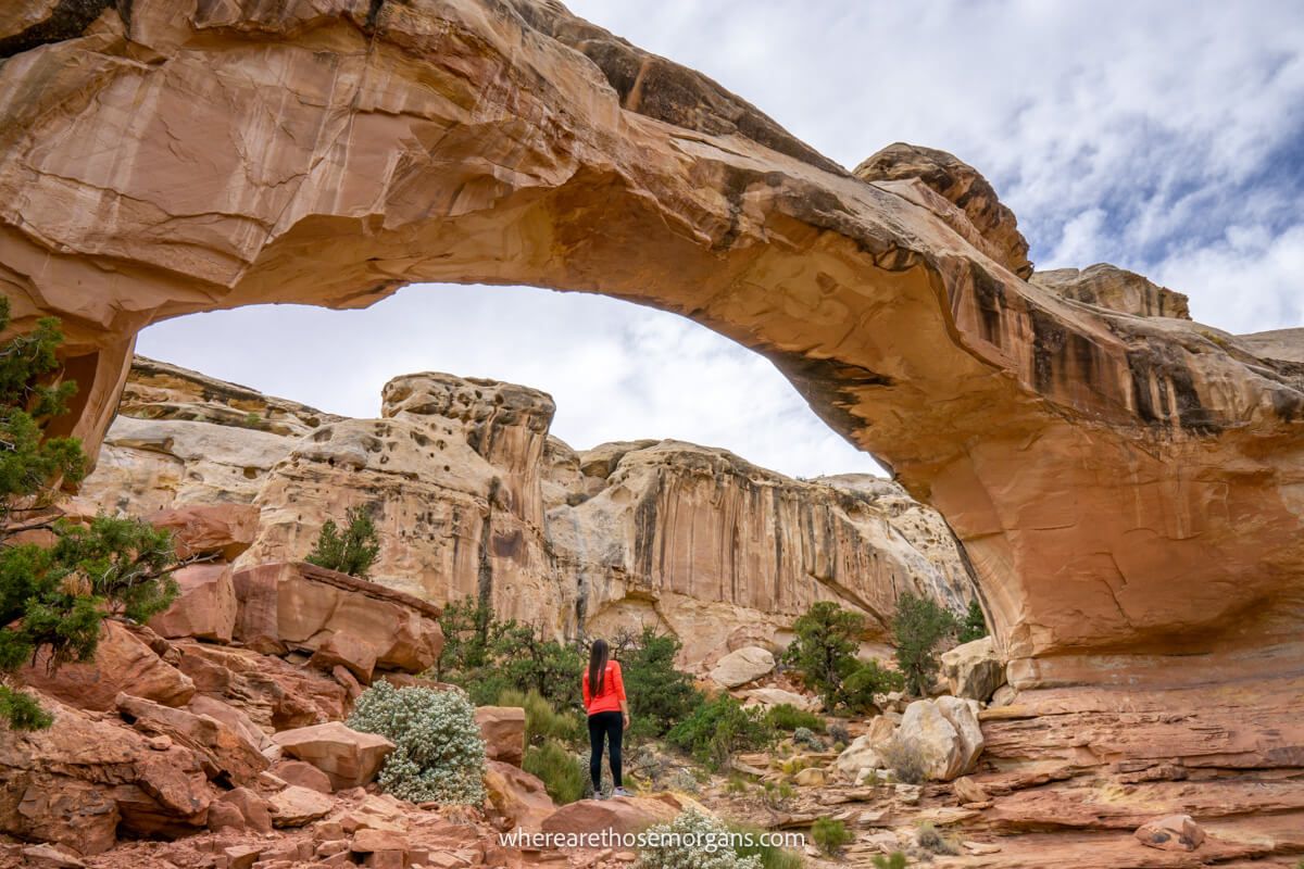
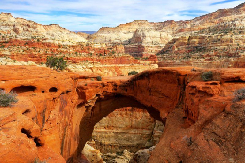
3. Hickman Bridge Trail
- All Trails: 4.7/5
- Google: 4.8/5
- Location: Capitol Reef
- Difficulty: Easy
- Distance: 1.8 miles roundtrip
- Type: Out and back
- Elevation: 400 ft
Hickman Bridge Trail is the most popular hike in Capitol Reef National Park. It’s a fun and easy trail with plenty of cool eroded formations and a huge arch, so it’s perfect for families.
We were surprised by how much we enjoyed hiking Hickman Bridge. We found it to be a breath of fresh air because it was quiet, calm and photogenic.
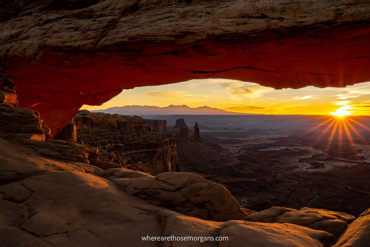
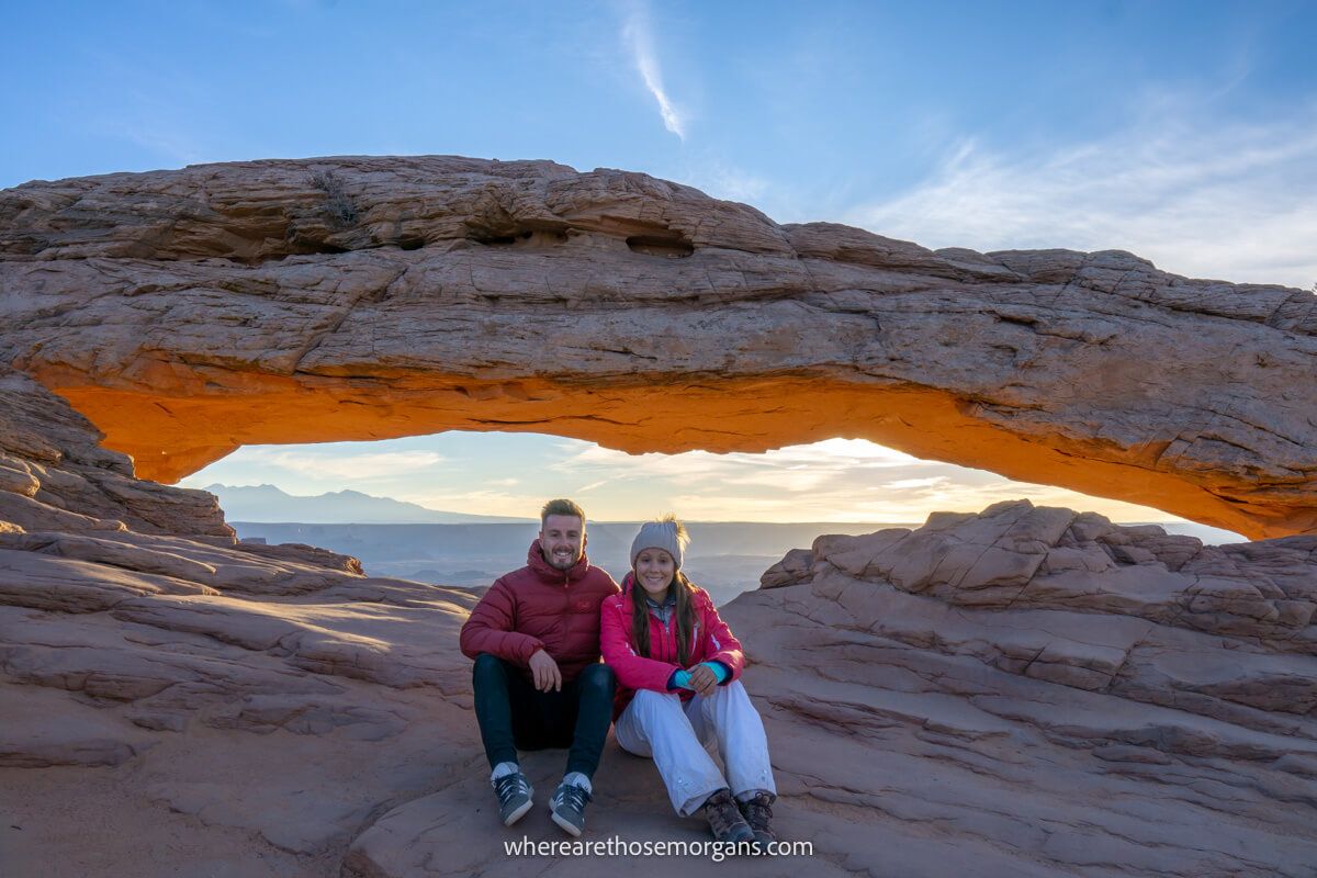
4. Mesa Arch Trail
- All Trails: 4.7/5
- Google: 4.9/5
- Location: Canyonlands
- Difficulty: Very easy
- Distance: 0.6 miles roundtrip
- Type: Out and back
- Elevation: 50 ft
Mesa Arch Trail is the most popular hike in Canyonlands. The trail itself is incredibly short and easy, but what makes this hike so famous is its unique arch with far-reaching views over canyons and mountains.
We hiked to Mesa Arch for sunrise for the famous “sunrise through the arch” photo and we have to say it was extraordinary. It doesn’t matter if you can’t make it for sunrise because it still has sensational views.
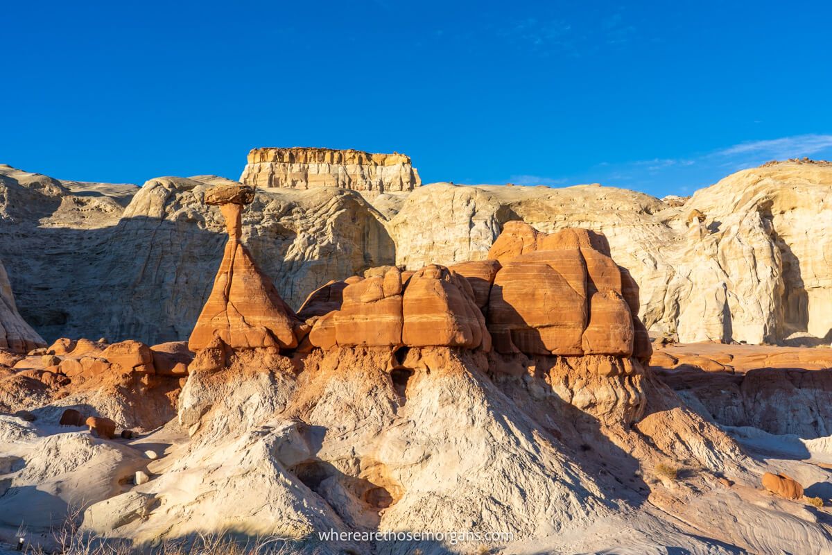
5. Toadstool Hoodoos Trail
- All Trails: 4.5/5
- Google: 4.7/5
- Location: Grand Staircase-Escalante
- Difficulty: Very easy
- Distance: 1.6 miles roundtrip
- Type: Out and back
- Elevation: 140 ft
Toadstool Hoodoos Trail is one of the most interesting hikes in Utah. As you drive between Kanab and Page, take an hour to hike the easy trail which eventually leads to unique mushroom-shaped rock formations.
We hiked Toadstool Hoodoos after hiking The Wave earlier in the day. It made for the perfect warm-down in the late afternoon and it had completely unexpected photo opportunities.
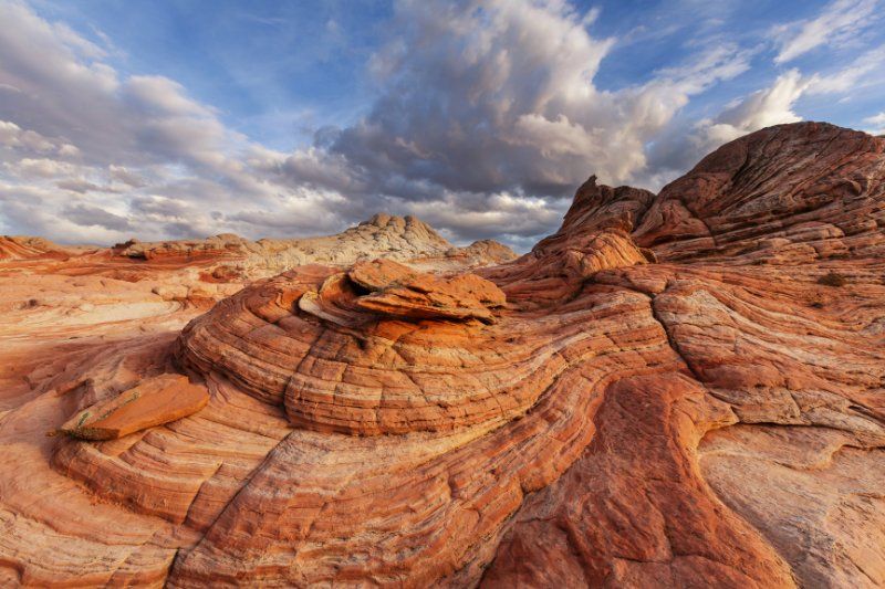
6. White Pocket Trail
- All Trails: 4.8/5
- Google: 4.8/5
- Location: Vermilion Cliffs
- Difficulty: Very easy
- Distance: 1.5 miles roundtrip
- Type: Open
- Elevation: 150 ft
White Pocket Trail is one of the most unique and off the beaten path hikes near Kanab. Technically, White Pocket is just over the border into Arizona but it’s accessed from Utah.
We haven’t had chance to visit White Pocket yet because we hiked The Wave instead. One way to look at White Pocket is that it’s the perfect backup option to The Wave if you can’t get a permit, and it’s almost as striking in appearance anyway.
7. Bell Canyon Trail
- All Trails: 4.7/5
- Google: 4.7/5
- Location: Uinta-Wasatch-Cache National Forest
- Difficulty: Moderate
- Distance: 5 miles roundtrip
- Type: Out and back
- Elevation: 1,500 ft
Bell Canyon Trail is a hugely popular hike starting near Granite in southeast Salt Lake City. The trail ultimately leads to Bell Canyon waterfall before returning to the trailhead.
It’s rocky, it’s steep at the end, the bugs can be bad and parking is a challenge. But Bell Canyon has gorgeous wildflowers, a picturesque waterfall and it’s so easy to access from Salt Lake City.
8. Cassidy Arch Trail
- All Trails: 4.8/5
- Google: 4.8/5
- Location: Capitol Reef
- Difficulty: Moderate
- Distance: 3 miles roundtrip
- Type: Out and back
- Elevation: 650 ft
Cassidy Arch Trail is a fantastic hike to include on your itinerary if you have more time and you like to get off the beaten path. The trail is accessed via Capitol Reef’s scenic drive and it has a steep beginning before leveling out.
After following cairns, you’ll arrive at a picture-perfect arch which would be amazing at sunrise. Cassidy Arch is a hike we’ll certainly complete the next time we’re in Utah.
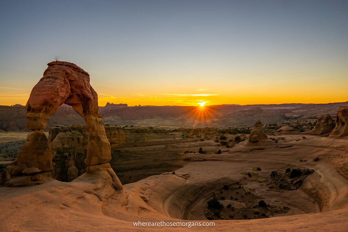
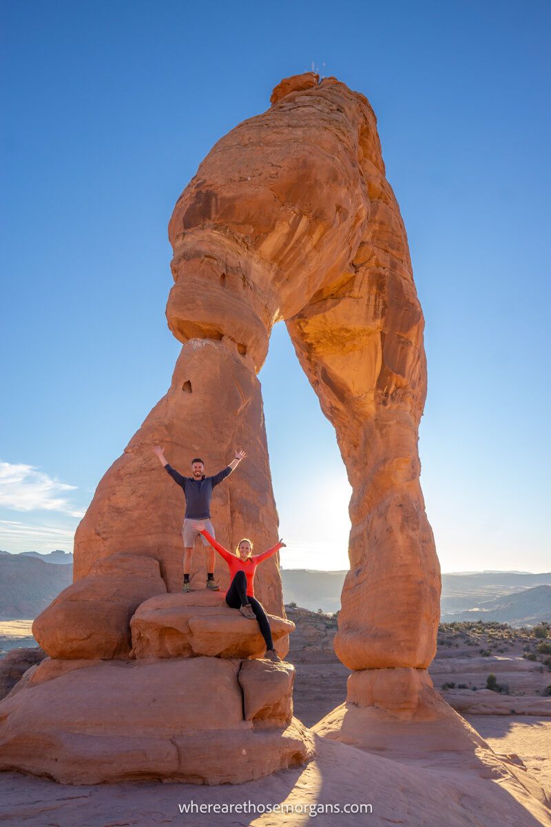
9. Delicate Arch Trail
- All Trails: 4.8/5
- Google: 4.9/5
- Location: Arches
- Difficulty: Moderate
- Distance: 3 miles roundtrip
- Type: Out and back
- Elevation: 480 ft
Delicate Arch Trail is the quintessential hike in Arches National Park and we think it’s one of the best overall Utah hikes. The trail is fun, picturesque and even has some small elements of adventure, but the unique arch and it’s bowl-shaped depression are what make this hike so popular.
We have to say the outstanding sunset and Milky Way display we watched at Delicate Arch remains one of our personal favorite US travel experiences to date. Next time we’re in Arches, we’ll unquestionably be heading back up for another sunset.
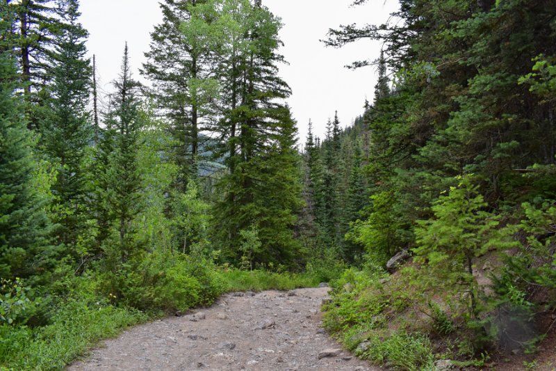
10. Donut Falls Trail
- All Trails: 4.6/5
- Google: 4.7/5
- Location: Uinta-Wasatch-Cache National Forest
- Difficulty: Moderate
- Distance: 3 miles roundtrip
- Type: Out and back
- Elevation: 550 ft
Donut Falls Trail is another incredibly popular hike near Salt Lake City. It has thousands of reviews on All Trails with countless positive comments about the picturesque drive from SLC, the trail and the donut shaped waterfall.
After a steep final climb, you’ll see Donut Falls by looking up from a cave into a circular hole with water pouring through. It’s a fantastic hike to take the older kids on, but snow is common even in early June so your window is small.
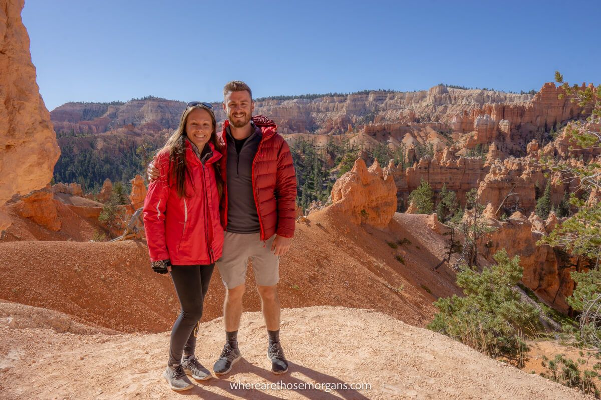
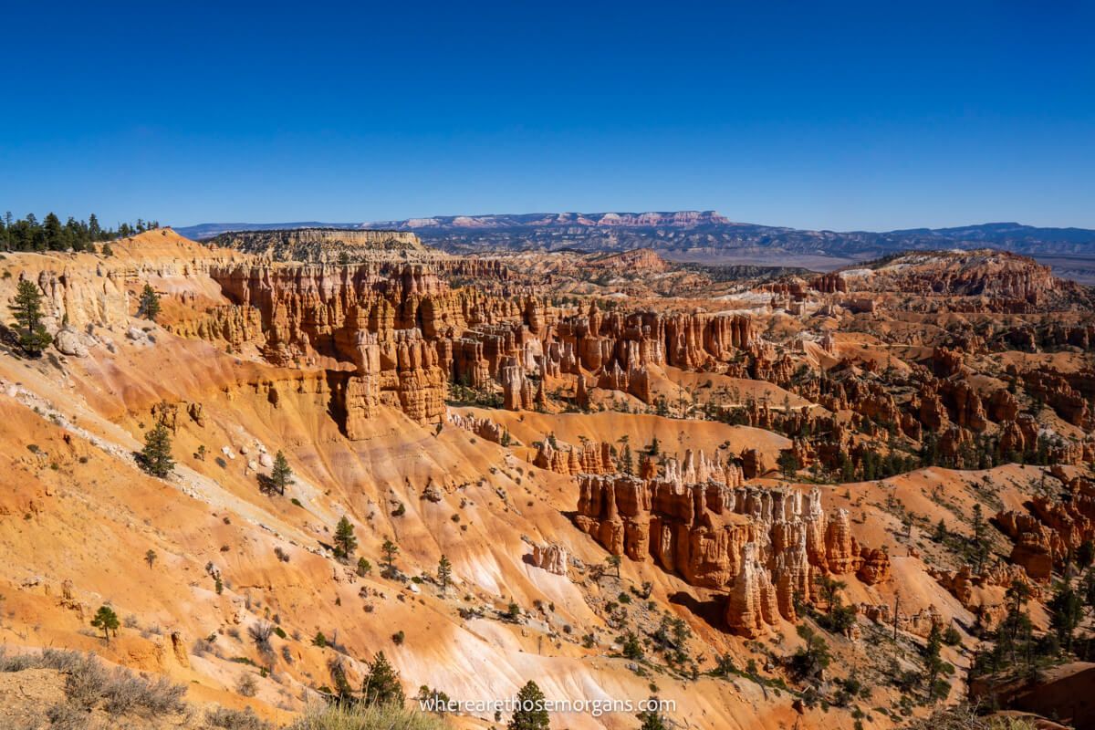
11. Fairyland Loop Trail
- All Trails: 4.9/5
- Google: 4.9/5
- Location: Bryce Canyon
- Difficulty: Moderate
- Distance: 8 miles roundtrip
- Type: Loop
- Elevation: 1,500 ft
Fairyland Loop Trail is one of the top rated hikes in Bryce Canyon. It’s a popular hike, but it’s not as heavily trafficked as Queens Garden, which means you can find some respite from the crowds.
The length and elevation gain on Fairyland Loop can be challenging for a hike rated as moderately difficult, especially when hot. But it’s endlessly picturesque and you get to pass through famous Bryce Canyon hoodoos.
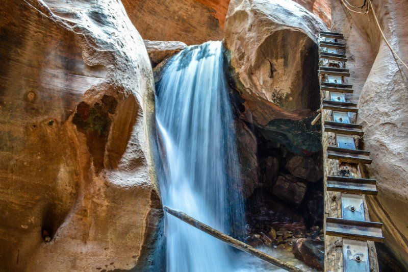
12. Kannara Falls Trail
- All Trails: 4.8/5
- Google: 4.7/5
- Location: Kanarraville, UT
- Difficulty: Moderate
- Distance: 4 miles roundtrip
- Type: Out and back
- Elevation: 650 ft
Kanarra Falls Trail is of the best river slot canyon hikes in Utah and it’s far less crowded than The Narrows in Zion. Only 150 hikers are allowed each day, and you can buy permits in advance or on the day if any remain.
Neoprene socks, waterproof shoes and hiking poles are recommended for this popular slot canyon because it’s filled with water and ladders. Don’t forget you can turn around whenever you feel comfortable!
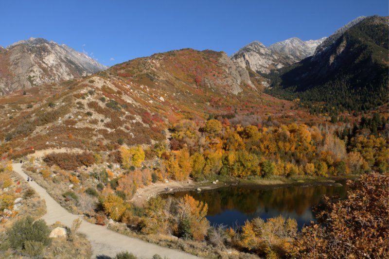
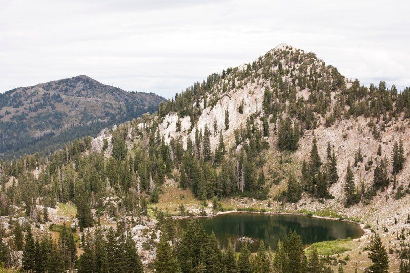
13. Lake Catherine via Brighton Lakes Trail
- All Trails: 4.7/5
- Google: 4.8/5
- Location: Uinta-Wasatch-Cache National Forest
- Difficulty: Moderate
- Distance: 4.5 miles roundtrip
- Type: Out and back
- Elevation: 1200 ft
Lake Catherine via Brighton Lakes Trail is yet another exceptionally popular hike found near Salt Lake City. The trail begins at Brighton Resort and passes by the three Brighton Lakes before arriving at Lake Catherine.
The best time to hike Lake Catherine is early to mid-October when fall colors are popping and the crowds are at a minimum. This trail is on our wishlist for next time we’re in SLC.
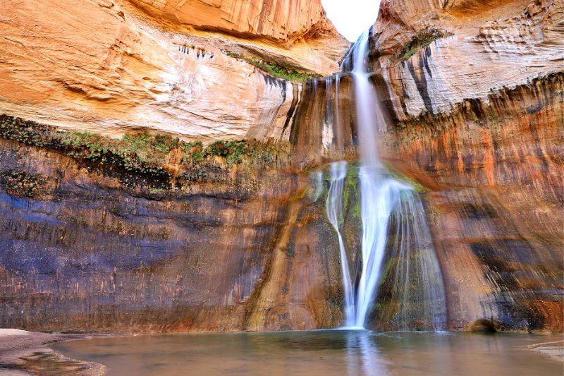
14. Lower Calf Creek Falls Trail
- All Trails: 4.8/5
- Google: 4.9/5
- Location: Grand Staircase Escalante
- Difficulty: Moderate
- Distance: 6 miles roundtrip
- Type: Out and back
- Elevation: 500 ft
Lower Calf Creek Falls Trail is one of the best hidden gem hikes in Utah. You shouldn’t miss this fun waterfall trail located along the super-scenic byway 12 between Capitol Reef and Bryce Canyon.
It’s a sandy hike and it’s quite a long slog so it pays to begin early, especially if you take your dog on the trail. At the end you get to see a wispy waterfall cascading down slick rock through a gap in the cliff above.
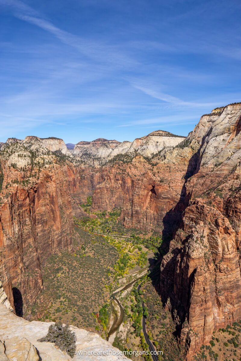
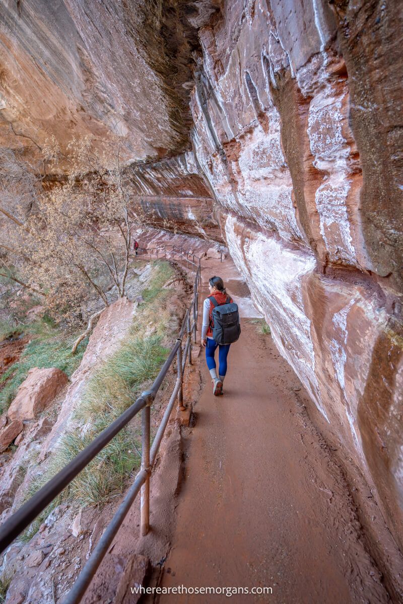
15. Observation Point via East Mesa Trail
- All Trails: 4.8/5
- Google: 4.8/5
- Location: Zion
- Difficulty: Moderate
- Distance: 7 miles roundtrip
- Type: Out and back
- Elevation: 700 ft
Observation Point via East Mesa Trail is one of those hikes was once classed as a hidden gem. But since the traditional route up to Observation Point closed, the East Mesa route has come far more popular.
Accessing the East Mesa trailhead is challenging and the hike itself is quite boring by Zion’s standards, but it’s all worth it at the end for elevated views over Angels Landing and all of Zion Canyon.
- All Trails: 4.9/5
- Google: 4.9/5
- Location: Bryce Canyon
- Difficulty: Moderate
- Distance: 3 miles roundtrip
- Type: Loop
- Elevation: 650 ft
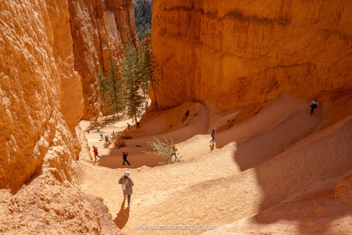
Queens Garden Navajo Loop Trail is the most popular hike in Bryce Canyon we think it’s one of the most unique hikes in Utah. It has sky high user ratings and the photo ops you’ll get on this hike are relentless!
We hiked the Queens Garden Navajo Loop twice when we visited Bryce Canyon. Its famous switchbacks leading down into the canyon are incredibly picturesque, Wall Street is awesome and the hoodoos look even better from close up.
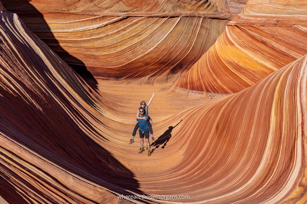
17. The Wave Trail
- All Trails: 4.9/5
- Google: 4.7/5
- Location: Vermilion Cliffs
- Difficulty: Moderate
- Distance: 6 miles roundtrip
- Type: Out and back
- Elevation: 450 ft
The Wave Trail is a truly special hike in Utah and Arizona. Permits are notoriously hard to win because it has a limit on daily hikers and exceptionally high demand, but it’s definitely one of our top recommendations so get that permit application in today!
We were genuinely blown away by the sheer beauty at The Wave. Its alien landscape is fascinating, mind boggling and beyond photogenic. You can find some of our photos from The Wave on sale in our gallery.
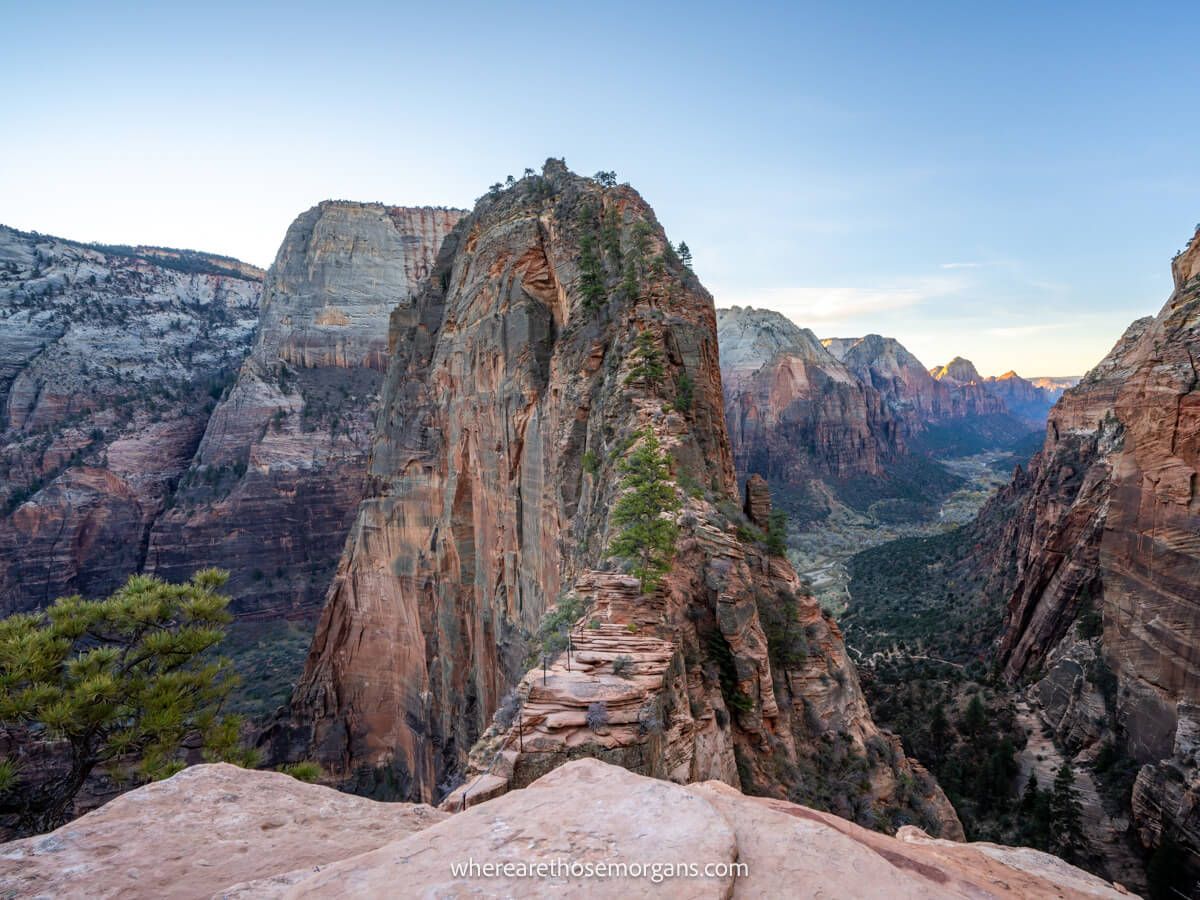
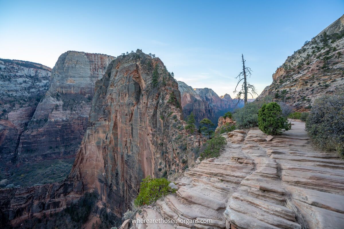
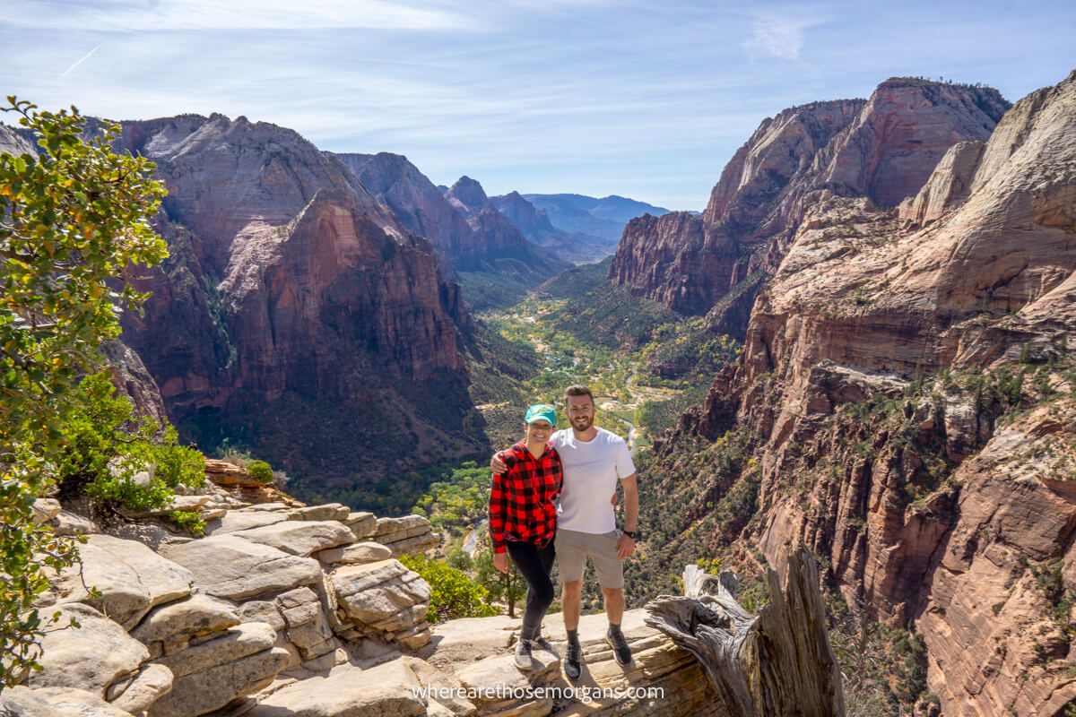
18. Angels Landing Trail
- All Trails: 4.9/5
- Google: 4.9/5
- Location: Zion
- Difficulty: Very hard
- Distance: 5.4 miles roundtrip
- Type: Out and back
- Elevation: 1,500 ft
Angels Landing Trail is the most famous and exciting adventure hike in Utah. The trail to Scout Lookout is a calf-burner, and then the narrow climb to Angels Landing is equal parts exhilarating and terrifying.
We’ve climbed Angels Landing twice, once during the day when it was far too overcrowded and once for sunrise as the only two hikers at the summit which was incredible. It’s a truly amazing and unique hike, but man is it scary!
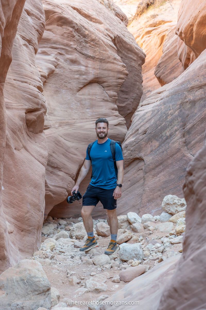
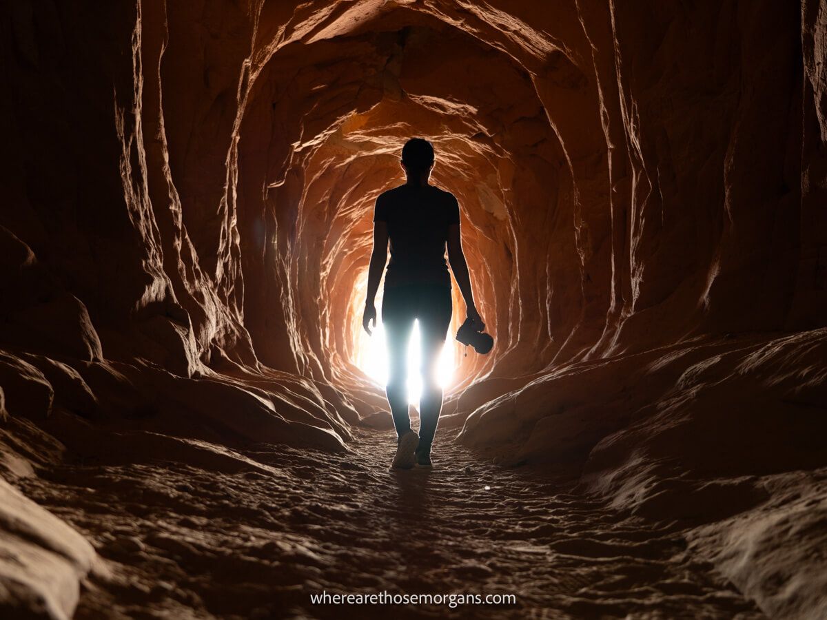
19. Buckskin Gulch via Wire Pass Trail
- All Trails: 4.8/5
- Google: 4.8/5
- Location: Paria Canyon-Vermilion Cliffs
- Difficulty: Hard
- Distance: Open ended
- Type: Out and back
- Elevation: N/A
Buckskin Gulch Trail is the longest slot canyon in the US and you can actually hike the entire 40-mile length from Wire Pass to Lees Ferry as part of a multi-day hike. But we recommend you take on the first few miles for a roundtrip distance of about 5 or 6 miles.
We hiked a little over 2 miles into Buckskin Gulch when we visited Kanab and it was so much fun. Carving through the narrow slot canyon was such a unique experience for us, and we hike a lot!
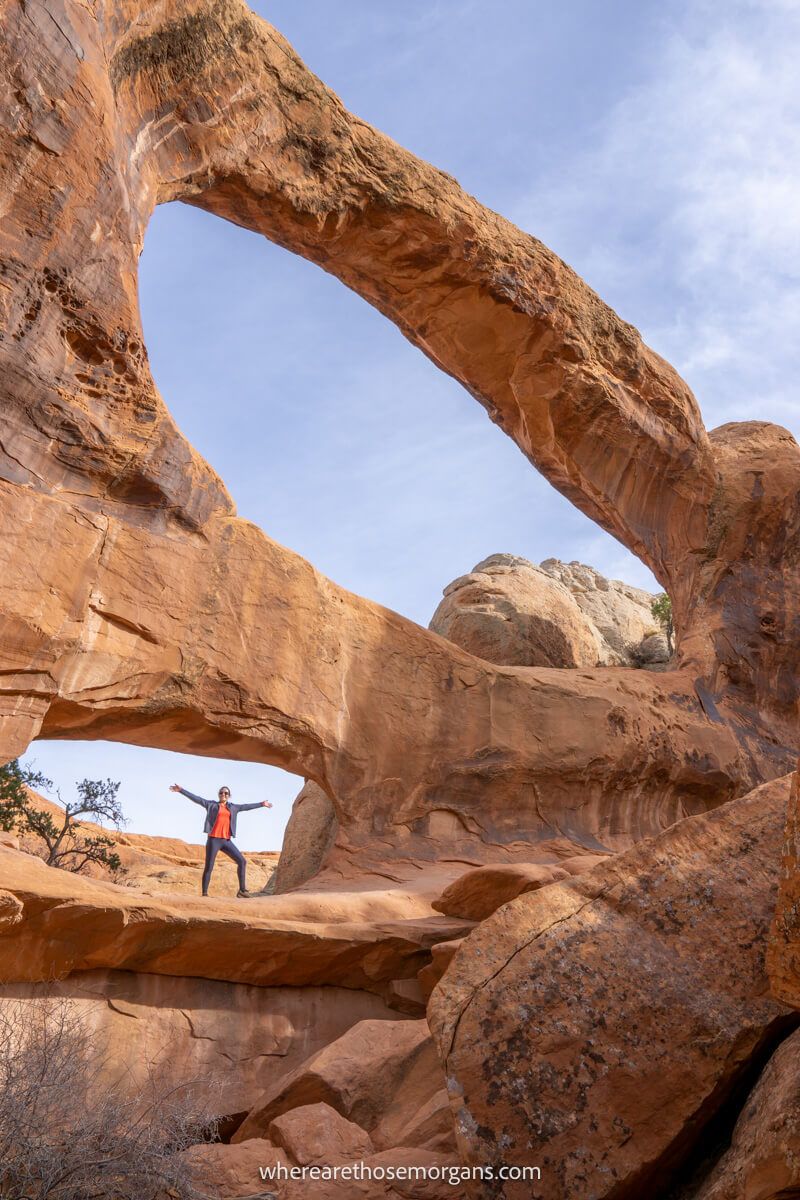
20. Devils Garden Trail
- All Trails: 4.8/5
- Google: 4.9/5
- Location: Arches
- Difficulty: Hard
- Distance: 8 miles roundtrip
- Type: Loop
- Elevation: 1,000 ft
Devils Garden Trail is the most thrilling hike in Arches National Park. You can navigate the trail in various ways, but the iconic route is to complete a clockwise loop with stops at 7 arches and one spire.
We really enjoyed Devils Garden, it’s exactly the sort of hike we enjoy with challenging off-trail sections and non-stop photo spots. If you’re seeking an adventure trail, don’t miss this one in Arches.
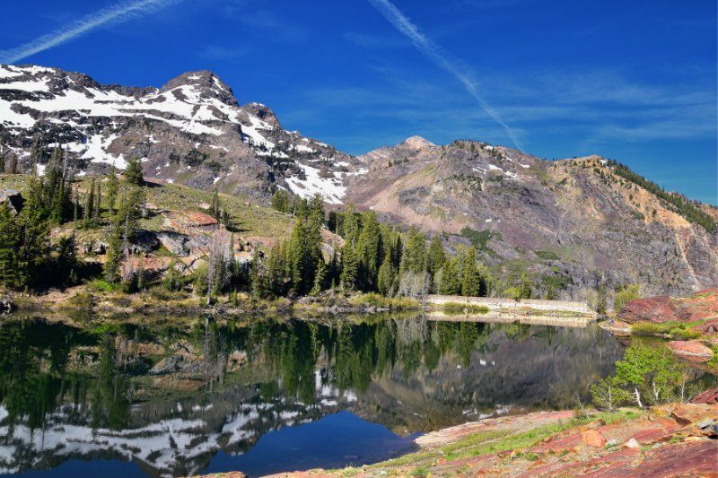
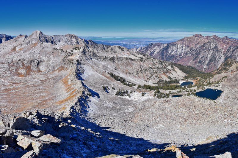
21. Lake Blanche Trail
- All Trails: 4.8/5
- Google: 4.8/5
- Location: Uinta-Wasatch-Cache National Forest
- Difficulty: Hard
- Distance: 7 miles roundtrip
- Type: Out and back
- Elevation: 2,800 ft
Lake Blanche Trail is another incredibly popular hike near Salt Lake City. It has lots of elevation gain but it’s a relatively steady climb until it reaches three lakes called Lillian, Florence and Blanche.
It’s one of the better hikes in Twin Peaks Wilderness and it’s great if you’re looking for a challenging trail with a big pay off near SLC. We’ve got this one firmly on our radar for next time.
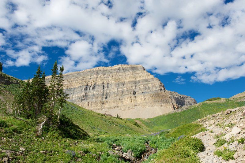
22. Mount Timponogos Trail
- All Trails: 4.8/5
- Google: 4.8/5
- Location: Uinta-Wasatch-Cache National Forest
- Difficulty: Very hard
- Distance: 14 miles roundtrip
- Type: Out and back
- Elevation: 4,500 ft
Mount Timponogos Trail is a beast of a hike leading to a mountain summit. We recommend starting early and taking Timpooneke Trail from north trailhead for a long 14-mile roundtrip trek.
It’s an achievable day hike and it’s perfect if you’re seeking a really tough challenge. We can’t wait to take on the hike to Mt Timponogos when we’re next in Salt Lake City. It’s right up our alley!
23. Pfeifferhorn via Red Pine Lake Trail
- All Trails: 4.8/5
- Google: 4.8/5
- Location: Uinta-Wasatch-Cache National Forest
- Difficulty: Very hard
- Distance: 11 miles roundtrip
- Type: Out and back
- Elevation: 4,000 ft
Pfeifferhorn via Red Pine Lake Trail is another epic day hike near Salt Lake City if you’re craving a real challenge. The first part of the hike is easy enough, but it becomes much harder and you’ll have to scramble near the summit.
The final ascent has steep drops, so it might be one to miss if you suffer from vertigo (even if you’re a strong hiker). But look how dramatic and spectacular the Pfeifferhorn summit looks. It reminds us of The Enchantments in Washington.
24. The Narrows Trail
- All Trails: 4.8/5
- Google: 4.9/5
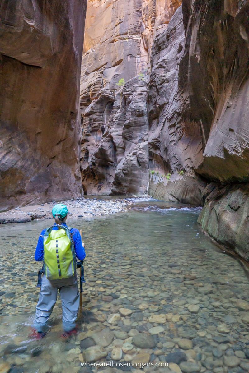
- Location: Zion
- Difficulty: Hard
- Distance: 9.4 miles roundtrip maximum
- Type: Out and back
- Elevation: 500 ft
The Narrows Trail is one of the most enjoyable hikes we’ve ever done, and we think it’s the best hike in Utah. Where else can you walk knee and waist deep in water for miles through a narrow slot canyon?!
We hiked the entire way from Temple of Sinawava to Big Springs (the furthest you can hike on the bottom up version of The Narrows with no permit) and it was truly outstanding. Do not miss this one!
25. The Subway
- All Trails: 4.7/5
- Google: 4.7/5
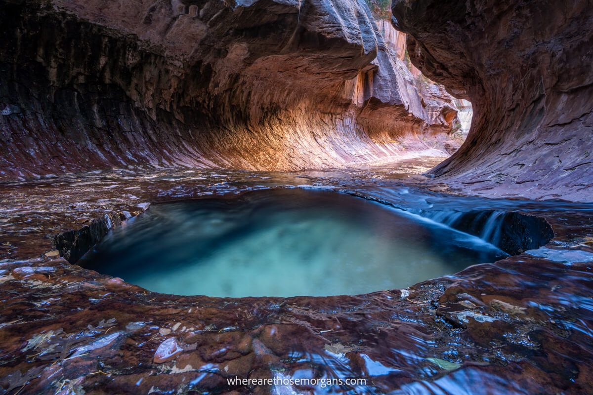
- Location: Zion
- Difficulty: Hard
- Distance: 9 miles roundtrip
- Type: Out and back
- Elevation: 1,300 ft
The Subway Trail is the best off the beaten path hike in Zion but it requires a permit. After descending into a canyon, you must forge your own path up the Left Fork of North Creek until you reach The Subway.
What we love about hiking The Subway is the lost world feel you get because daily hiker numbers are limited. We enjoyed carving our own path through the creek, over banks and through formations. And The Subway itself is amazing!
Utah Hiking Hotspots
There’s several pockets around the state that are home to clusters of incredible hiking trails. And you can tick off almost all of the popular hikes just by staying at hotels in the following 4 places:
- Springdale (Zion)
- Kanab
- Moab
- Salt Lake City
In the south you’ll find desert, sandstone, canyons, arches, hoodoos and sand dunes. Conversely, in the north you’ll find mountains, snow, valleys and forests. So head for the south if you want to hike into deep canyons and slot canyons, or head for Salt Lake City if you prefer mountain peaks and forest trails.
In an ideal world you’ll be able to tick off the top trails in one amazing road trip. But a more realistic likelihood is that you’ll split them up into a southern Utah trip and a Salt Lake City trip, similarly to us.
Hiking Permits
There’s a handful of ultra-popular hikes in Utah that require a permit. And acquiring these hiking permits will undoubtably be the most frustrating part of planning your itinerary. But you have no choice, so it’s better to get organized and apply for your permits as soon as you know your travel dates.
1. The Wave
The Wave is the hardest permit to win in the entire United States. You can apply either months in advance or for two days ahead. Chances of winning are very low, so consider planning your Utah hiking itinerary around winning this permit. We won a next day permit in person in Kanab, but it’s all online now. Apply for your permit at Recreation.gov.
2. The Subway
The Subway in Zion can be hiked top-down or bottom-up. Both are amazing and both require a permit that you must win. You can apply months in advance or for the next day, and you stand a better chance in the off season. We won a next day walk-in permit during our visit to Zion in December. Apply for your permit at the NPS.
3. The Narrows
The Narrows in Zion can also be hiked top-down or bottom-up. But only the top-down version requires a permit. Apply for your top-down permit at the NPS. It’s important to know that you can day hike The Narrows bottom up without a permit and it’s still an extraordinary experience.
4. Angels Landing
Angels Landing now requires a time-slot permit. You can choose before 9:00am, 9:00am-12:00pm or after 12:00pm, but it’s important to know that you won’t be able to hike to Angels Landing if you don’t get a permit for one of these three time slots. Apply for your permit at the NPS.
Note: Technically, you also need this permit to hike Buckskin Gulch and this permit to hike Kanarra Falls. But these permits can be bought on the day, so you don’t have to “win” them like the others.
Fees And Passes
Many of the trails listed in this guide are located inside national parks, which have varying entry fees ranging from $20-35 per vehicle. Entrance passes are valid for 7 consecutive days.
Park entry prices:
- Zion – $35
- Bryce Canyon – $35
- Arches – $30
- Canyonlands – $30
- Capitol Reef – $20
If you’re planning to visit all 5 national parks, you should buy a National Parks Pass for $80. Not only will you save $70 at these parks, but you’ll also have free entry to all US national parks for 365 days. It’s a no-brainer!
Hiking Apps
Hiking apps are fantastic resources for planing and tracking your GPS location with offline maps when hiking in new places, especially when landscapes are harsh and hostile like they can be in Utah.
We recommend using one of the best hiking apps to track your hike on The Subway, The Wave, Devils Garden and every other hike outside of a national park. And if you plan to go into the backcountry in a place like Grand-Staircase Escalante, you really must use offline maps so you don’t get lost.
All Trails is our go-to for looking at recent comments from other hikers in case of any last minute warnings about conditions. Then we use our Gaia GPS Premium account to plot our route, follow our live location and track our hiking statistics.
Gaia GPS is great for hiking in remote places, and you can use our exclusive Gaia GPS 10% discount to get instant access to this awesome hiking navigation app today.
Hiking Tips
Don’t underestimate the harsh elements and unpredictable weather conditions when hiking in Utah. It’s a hostile environment and conditions can turn life threatening if you don’t prepare properly.
In addition to reading our day hike packing essentials guide, keep these important tips in mind:
- The best times to hike in Utah are spring, fall and winter. Extreme high temperatures in summer can lead to dehydration, heat exhaustion and heat stroke.
- Snowmelt and thunderstorms in spring and early summer can quickly cause flash flooding in slot canyons (including The Narrows) so it’s vital you check live weather reports before entering.
- Carry plenty of water and never depend on water sources. Always have a way to filter and purify water incase you run out. We always carry a LifeStraw on every hike.
- Keep track of your time, especially if hiking in the winter when daylight hours are shortest, or if you hike into the backcountry.
- Always carry a fully charged headlamp in case you end up hiking in the dark. Do not rely solely on your phone flashlight in case your battery runs out.
The Best Hikes In Utah Ranked
Are you curious to know which Utah hikes are rated as the best by other hikers?
We’ve rounded up the top five trails with the highest review ratings and scores left by thousands of real hikers from All Trails, Google and Tripadvisor.
All Trails
According to hiker ratings on All Trails, the top 5 trails in Utah are:
- Angels Landing (4.9/5)
- Navajo Loop and Queens Garden (4.9/5)
- Delicate Arch (4.8/5)
- Lake Blanche (4.8/5)
- Scout Lookout via West Rim (4.8/5)
According to hiker review scores on Google, the top 5 trails in Utah are:
- Angels Landing (4.9/5)
- The Narrows (4.9/5)
- Zion Canyon Overlook (4.9/5)
- Devils Garden (4.9/5)
- Delicate Arch (4.9/5)
Tripadvisor
According to hiker reviews on Tripadvisor, the top 5 trails in Utah are:
- The Narrows (5/5)
- Angels Landing (5/5)
- Navajo Loop and Queens Garden (5/5)
- Zion Canyon Overlook (5/5)
- Buckskin Gulch (5/5)
Note: You should always take ratings at face value because they’re incredibly subjective, they change frequently and they might not align with your hiking ability.
Our Favorite Utah Hikes
And what about our opinion? Well, we don’t have any ratings but we do have lots of real-world experiences.
Here are the 5 hikes that we recommend to our family and friends when they visit Utah, based on the trails we’ve personally completed:
- The Narrows
- The Wave
- Angels Landing
- Devils Garden
- Buckskin Gulch
Before you head straight down to our comments section, we know The Wave is technically in Arizona, but the hike does begin and end in Utah so it counts!
The Wave is a wonderful hike with an extraordinary climax but we still think The Narrows is our favorite hike in Utah. We day hiked The Narrows bottom up all the way to Big Springs and it’s just so unique, challenging and fun.
We had Buckskin Gulch and Queens Garden Navajo Loop tied in fifth spot. Both are totally unique trails but we went with Buckskin Gulch because it’s the longest slot canyon in America, and it’s like nothing we’ve ever done before.
Trailheads Map
Click or touch the map below to activate, zoom in and out, and scroll around. If you’d like to see a bigger version, click the “view larger map” icon in the top right, and if you’d like to see any specific trail, click the arrow and square icon in the top left.
Map key:
- Red – Easy trails
- Blue – Moderate trails
- Purple – Hard trails
The Morgan Conclusion
To wrap things up, we think Utah has some of the very best hiking trails in America for all hiking abilities. In the south you’ll find fun trails leading through unique rock formations to dramatic viewpoints, and near Salt Lake City you’ll find forest trails leading to waterfalls or mountain peaks. So there’s lots of variation.
If it’s your first time in Utah and you want to experience those famous adrenaline pumping hikes, you should take on Angels Landing, The Narrows, The Subway, Devils Garden and Buckskin Gulch. Whereas if you’re a beginner hiker, you shouldn’t miss both Zion Canyon Overlook and Mesa Arch.
More US Southwest
- Las Vegas to Death Valley day trip itinerary
- Best things to do in Grand Canyon South Rim
- Sunrise and sunset at Horseshoe Bend
- Best things to do in Las Vegas
- How to visit Coral Pink Sand Dunes
- The best things to do in Sedona AZ
- Best things to do in Valley of Fire State Park
- Best ways to visit Zion in one day
Want more Utah content? Head over to our Utah Travel Guides to explore the Mighty Five National Parks and beyond.
We hope our guide to the best hikes in Utah helps with planning your visit to the American southwest!
Please let us know if you have any questions in the comments below.
Happy Hiking,
Mark and Kristen
Enjoy this guide? Pin it for later!

All Rights Reserved © Where Are Those Morgans, LLC. Republishing this article and/or any of its contents (text, photography, maps, graphics, etc.) in whole or in part is strictly prohibited.

Mark and Kristen spent 6 years traveling the world, visiting over 40 countries across 4 continents and more than 30 US states. They created Where Are Those Morgans in 2018 to help others plan the best possible vacations by writing authentic travel and hiking guides based on their real experiences.
Since the arrival of baby Maya in late 2024, Mark and Kristen’s extensive travels have slowed down but they still take plenty of trips. Where Are Those Morgans now helps millions of travelers each year to visit new places and hike new trails through information-packed blog posts and expert travel guidebooks. Read more about Mark and Kristen.