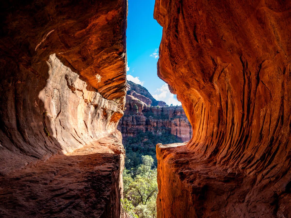
Boynton Canyon Trail is popular hike in Sedona, Arizona. It’s a moderately difficult 7.5-mile hiking trail with a total elevation gain of 1,250 feet when combined with the secret Subway Cave and Boynton Canyon vortex site. The Subway Cave is located at the end of a short spur trail which begins 2 miles into the Boynton Canyon hike.
In this guide, we’ll explain everything you need to know about hiking Boynton Canyon Trail and show you exactly how to get to the Sedona Subway Cave based on our own experiences.
Our Sedona Subway Cave Experience
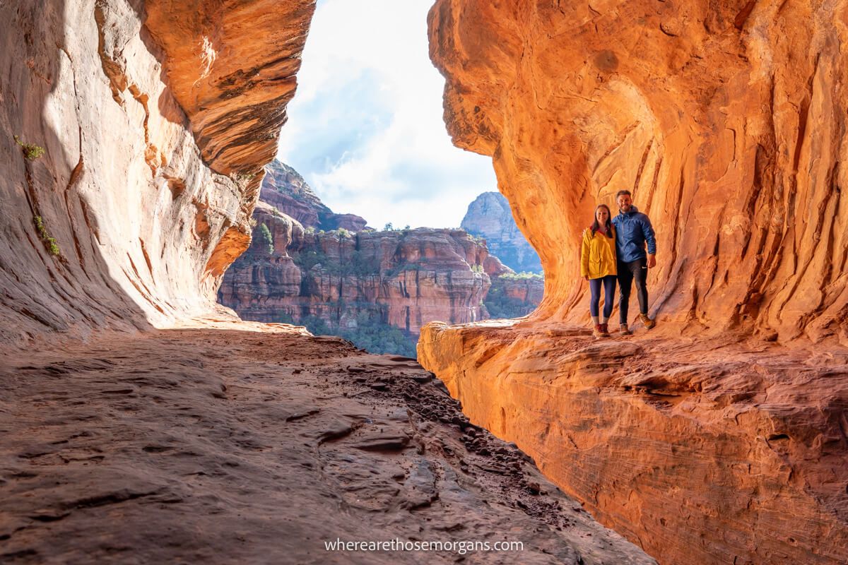
We hiked the entire Boynton Canyon Trail as far as its end of trail sign during our week long visit to Sedona at the end of 2021. And half way along Boynton Canyon we took the spur trail leading to the spectacular Sedona Subway Cave.
Because we visited Sedona in December, we had the entire Subway Cave to ourselves for the 30 minutes we spent inside. At the end of the hike we spent a few minutes at Boynton Canyon vortex site.
What we can tell you after hiking almost all of the best trails in Sedona is that Boynton Canyon with the Subway Cave is unmissable. But without the cave, we think there are much better trails you should prioritize in Sedona.
Hiking Statistics
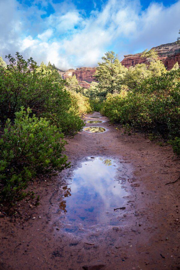
You can hike Boynton Canyon Trail in three different ways:
- Boynton Canyon Trail Only (without Subway Cave or Vortex Site)
- Subway Cave Only
- Boynton Canyon Trail, Subway Cave + Vortex Site
Let’s take a quick look at trail distance, elevation gain, hike difficulty and time required for the three hiking options you have on the Boynton Canyon hike in Sedona.
1. Boynton Canyon Trail Only (Without Subway Cave Or Vortex Site)
- Trail Distance: 6.5 miles
- Elevation Gain: 750 feet
- Hike Difficulty: Easy / Moderate
- Time Required: 3 hours
2. Subway Cave Only
- Trail Distance: 5 miles
- Elevation Gain: 600 feet
- Hike Difficulty: Moderate
- Time Required: 3 hours
3. Boynton Canyon Trail, Subway Cave + Vortex Site
- Trail Distance: 7.5 miles
- Elevation Gain: 1,250 feet
- Hike Difficulty: Moderate
- Time Required: 5 hours
Boynton Canyon Trail And Subway Cave Map
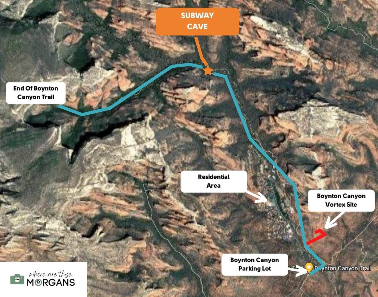
The map above shows exactly what you can expect when hiking Boynton Canyon to the Subway Cave and vortex site.
Map key:
- Yellow Icon – Boynton Canyon parking
- Blue Line – Boynton Canyon Trail
- Red Line – Boynton Vortex site
- Orange Star – Turn off for Subway Cave
- Orange Line – Subway Cave Trail
Hiking Tip: If you’re trying to visit as many Sedona caves as possible, don’t miss the spur trail leading to Kachina Cave not long after passing through the residential area.
How Do You Get To The Subway Cave In Sedona?
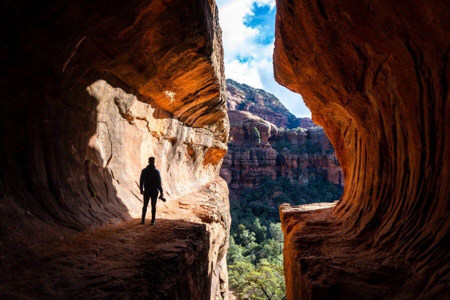
Sedona’s Subway Cave is accessed by taking a spur trail around 2 miles into the Boynton Canyon hike. A huge black and gray burned tree is the turn-off landmark to look out for.
You’ll pass by multiple spur trails after starting the hike and wonder if you should turn or not. Do not turn off until you reach the large burned tree on the left side of the trail. This tree marks the exact place you need to turn right.
Find the tree, look to the right and you’ll see a wide opening leading across a creek. When we hiked to Subway Cave, another hiker had made an arrow out of logs pointing the way off Boynton Canyon.
It is essential you tread carefully, respect the nearby ancient ruins and do not touch or move anything you find around the Subway Cave.
Hiking Tip: When exploring outdoors, be sure to always practice the seven principles of Leave No Trace to preserve natural beauty so others can enjoy the same environments.
Hiking Walkthrough
Let’s get into a detailed Boynton Canyon and Sedona Subway Cave hiking walkthrough. We’re going to show you the entire trail step-by-step so you know exactly what to expect.
Don’t forget you can use our photos below throughout your hike to keep track of where you are in relation to the turn off for accessing the Subway Cave.
1. Park Up And Display Or Buy A Pass
Park at Boynton Canyon Trailhead parking lot. We recommend arriving around first light to guarantee a spot.
Display your America the Beautiful pass or Red Rock Pass. If you don’t have either, buy a 1 day or 7 day pass at the ticket machine in the lot or buy one online at recreation.gov.
2. Take Boynton Canyon + Deadmans Pass Trail
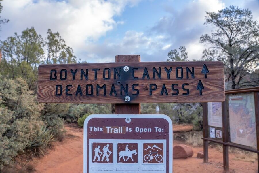
Parking is by far the hardest part of this hike, so once you have a spot it’s time for the fun part!
Head directly for Boynton Canyon Trail and Deadmans Pass Trail. You won’t be on this connecting path for long.
3. Turn Left Onto Boynton Canyon
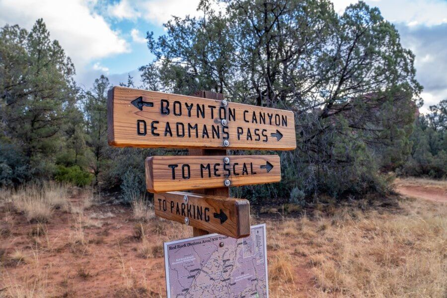
At the first split take the left turn onto Boynton Canyon.
A right turn here would lead you along Deadmans Pass to join Mescal or Long Canyon trails which spread out further to the east.
4. Enter Red Rock Wilderness
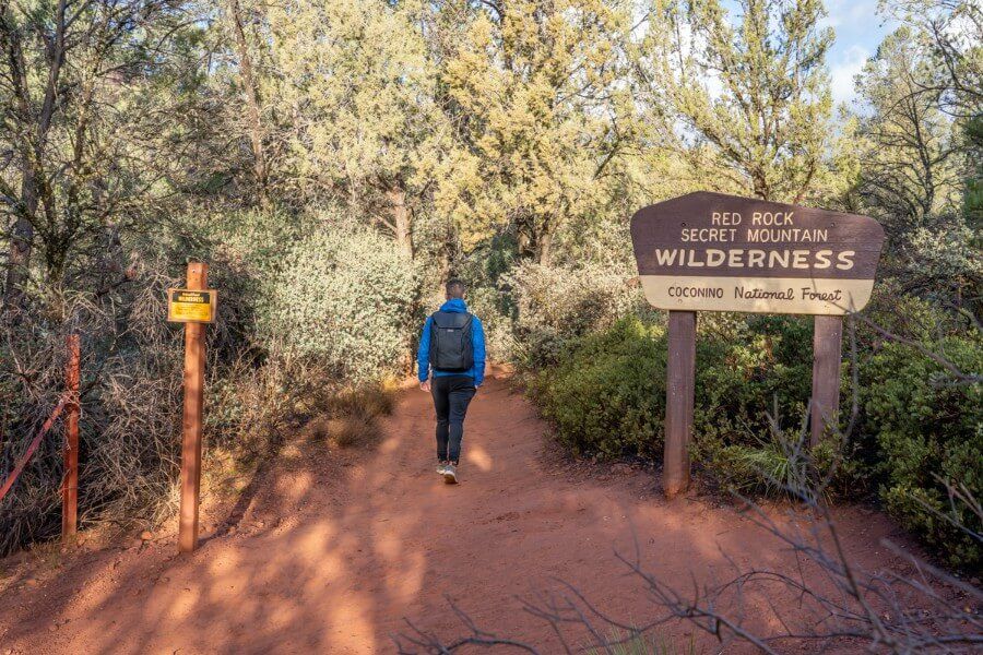
You will be walking through Red Rock Secret Mountain wilderness in the Coconino National Forest during your hike through Boynton Canyon and the Subway Cave.
The dirt path is compact and very easy to walk on at this early stage of the hike.
5. Residential Area
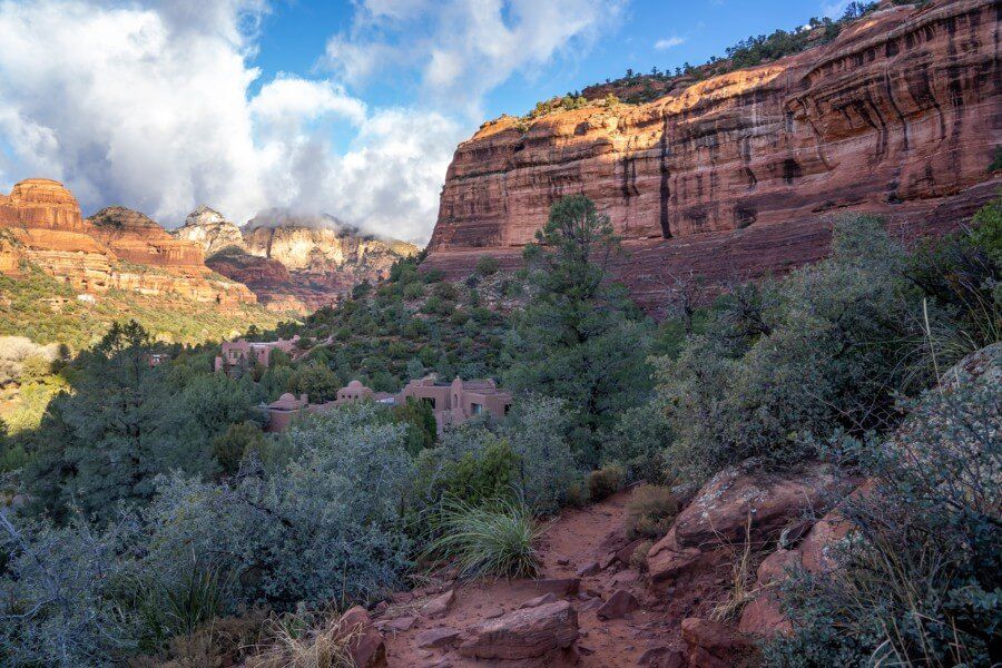
Pass by the right turn leading to Vista Point and the location of Boynton Canyon Vortex. You can stop at the vortex site on the way back. The reason to do it later is so that you avoid the Subway Cave being busy.
The next part of the trail passes by a residential area. You will gain a little elevation and walk on a narrow dirt path as you flank red adobe buildings with smooth lines and rounded edges native to Sedona.
6. Views Begin To Open Up
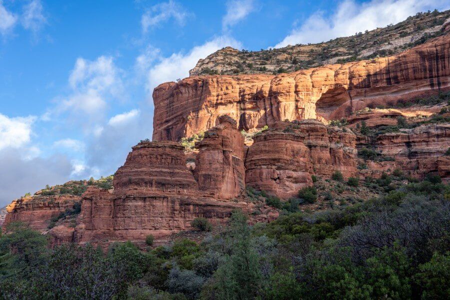
The trail undulates with short climbs and dips on stone steps. After a dozen or so turns and bends surrounded by vegetation and enormous cliff walls, you will pass by old ruins with bricked entrances.
Now you are getting further into the canyon, red rock formations begin to burst into the sky and you quickly forget about the residential area.
7. Don’t Take Any False Trails
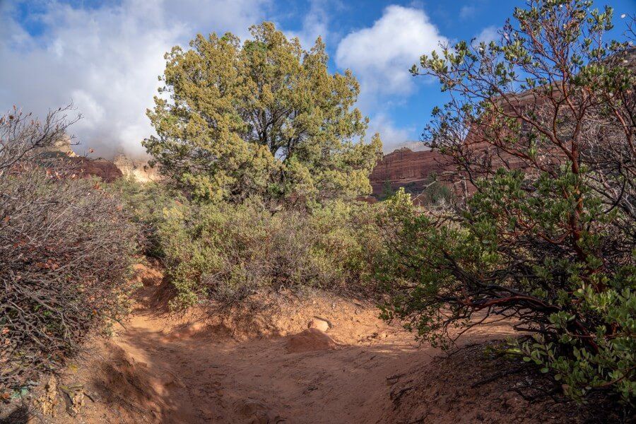
Continue to follow the most obvious beaten path. At times the trail narrows into a single track just wide enough for one hiker but the beaten path remains clear.
Ignore any potential turn off points in which you might think is this where I turn? It isn’t. Not yet.
8. Walk Through Light Forest
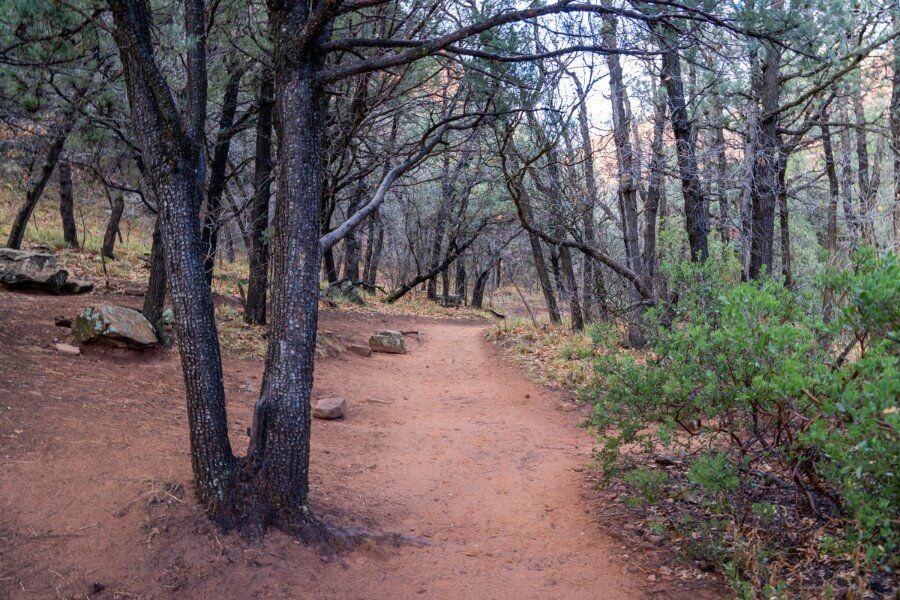
Next, you will enter a lightly forested area. The trees had no leaves when we hiked Boynton Canyon Trail in December 2021, which made navigation simple.
If you hike Boynton Canyon in summer when the trees here are filled with leaves, just keep heading straight on the dirt trail and don’t turn off until you reach a very obvious tree with a thick set trunk.
9. Find The Subway Cave Turnoff Tree
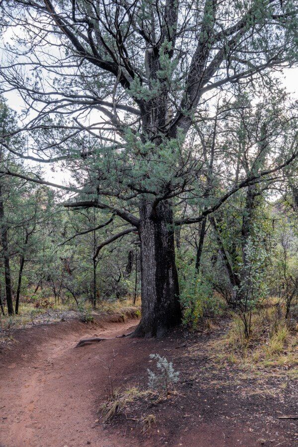
The photo above shows the huge Alligator Juniper tree you need to use as the turnoff point for finding the Subway Cave. It is obviously larger than any other tree you have passed on the edge of the trail up to this point.
Important – We took the photo above from the opposite side looking back. As you hike up Boynton Canyon Trail, this tree will be on your left side as you come around the corner.
The tree is even more apparent when looking back, so keep looking backwards for this tree if you think you’ve gone too far.
10. Look For The Wide Opening
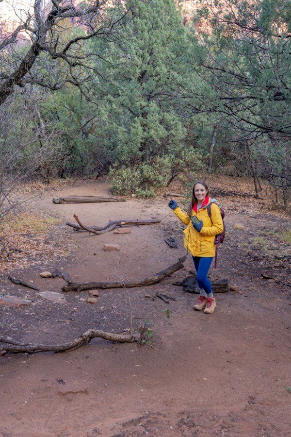
Directly opposite to the tree you will notice a wide opening which may have large branches on the ground like in the photo with Kristen above.
This is the way to Subway Cave and you can see this track from the main Boynton Canyon Trail. It is hard to miss once you know what you’re looking for!
11. Follow The Narrow Trail
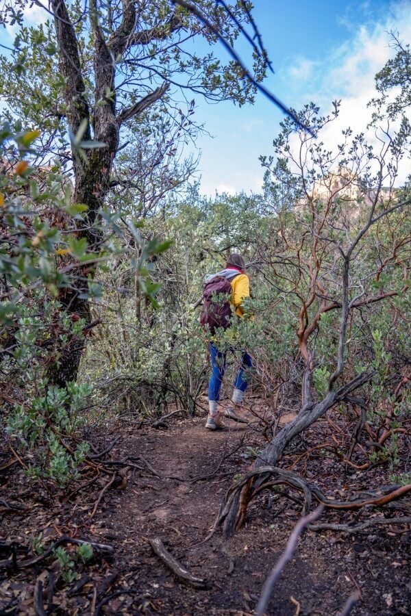
Now you’re on the short spur trail to the Subway Cave. The trail turns narrow with tons of shoot offs, tree roots and vegetation. Keep following the most obvious path with the least resistance.
This is unmaintained and you are in delicate wilderness so it is important to remember the principles of leave no trace. You should always leave these areas exactly as you found them.
12. Spot The Subway Cave
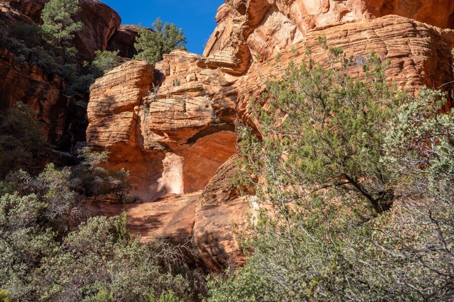
At this point you might feel unsure if you are on the right path. But as long you keep heading in the same direction and gain some slight elevation, you really can’t go wrong.
Eventually you reach a point with an opening in the trees and you can look up to see your first glimpse of the Subway Cave.
13. Climb The Steep Bank
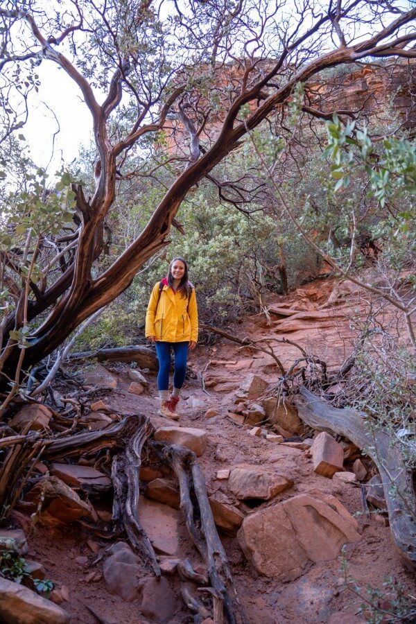
You have two choices when it comes to accessing the Subway Cave on Boynton Canyon Trail:
- Pictured above – Your first option is a left turn and climb up a steep bank which may require use of your hands to help. This is the easiest and safest way in.
- Pictured below – Your second option is a straight ahead climb through a narrow gap between two canyon walls. It doesn’t look it in the photo below but this way is very steep and unsafe.
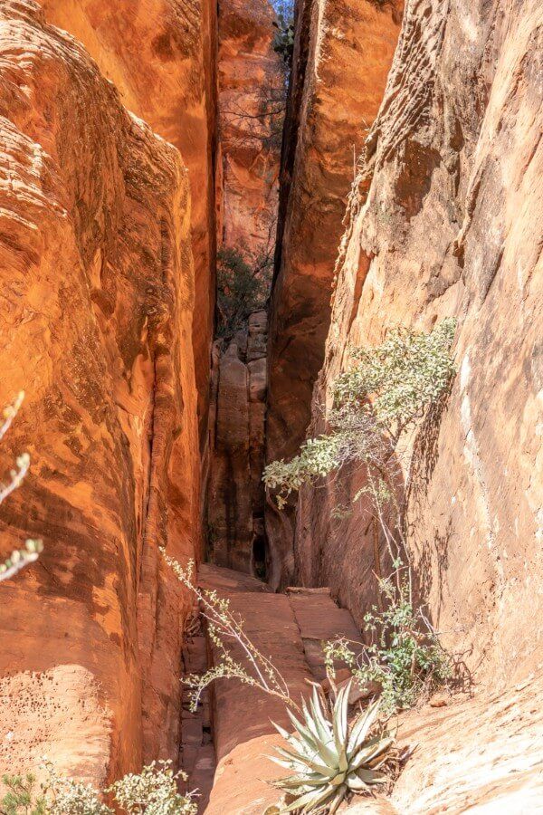
The angle of incline is incredibly steep if you take the direct route up slick rock. It is sandy and slippery.
We advise against trying to enter the Subway Cave this way. Instead take the left turn and climb the steep bank, which leads you to a ledge.
14. Walk Around The Curving Ledge
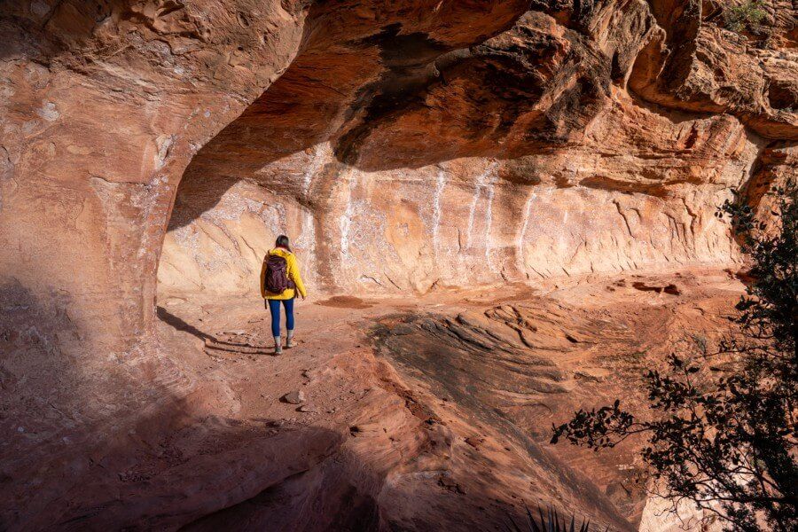
After climbing the bank you will reach a cliff wall and take a right turn. Carefully walk around bushes and vegetation to reveal a flat curving ledge.
You need to walk with caution as you hug the inner wall of the ledge here. It is quite a steep drop off so take extra care.
15. Navigate The Narrow Cave Entrance
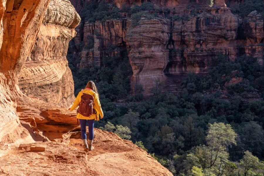
At the end of the curving ledge you will come to a left turn which will take you into Subway Cave. Again, the ledge here is narrow and the drop is quite significant so you have to be careful.
Hug the wall closely and take a big step inside. You might have to contend with a line of other people here if you hike to the Subway Cave during a busy period.
16. Enter The Subway Cave
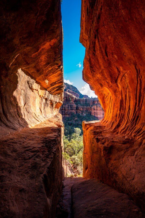
Once you’re inside the Subway Cave you will know why it’s so popular. We took the photo above from the very back of the cave with a wide angle lens. You enter and leave to the right side of the cave.
Sedona’s Subway Cave is named so because it looks like you’re standing inside a subway station. We have to say it also looks a bit like a keyhole, but do not confuse this cave with the enormous Keyhole Cave, which is also in Sedona.
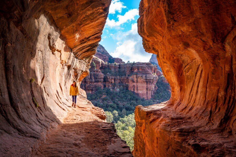
Snap your photos but also stop for a minute to appreciate how awesome nature, erosion and geological process are for carving out such great places for us to visit.
We arrived into the cave around 9:00am in December. Ideally, we would have arrived earlier in the morning so the cave was illuminated more by light. A few hours later and the cave would be completely in shadow.
17. See The Small Ruins
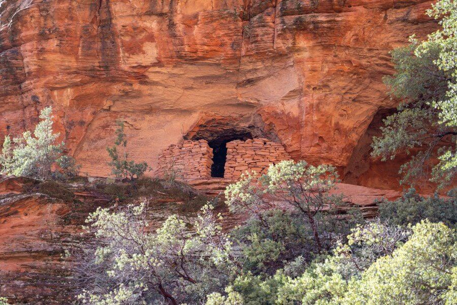
On the way back out of Subway Cave after you walk the ledge and arrive at the top of the steep bank, continue straight instead of going down the bank.
You will very quickly reach a small ruin as you can see in the photo above. Inside the bricked entrance you can see lightly carved petroglyphs.
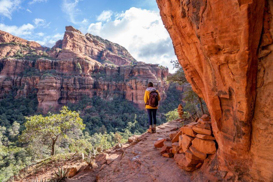
The view from the ruin entrance over Boynton Canyon, Sedona’s red rocks and an endless sea of tree canopies is wonderful.
Important – Don’t touch anything inside or around the ruin, the remains are very delicate. There have been instances of people negatively impacting the well-preserved site and that is not acceptable.
18. Get Back On Boynton Canyon Trail
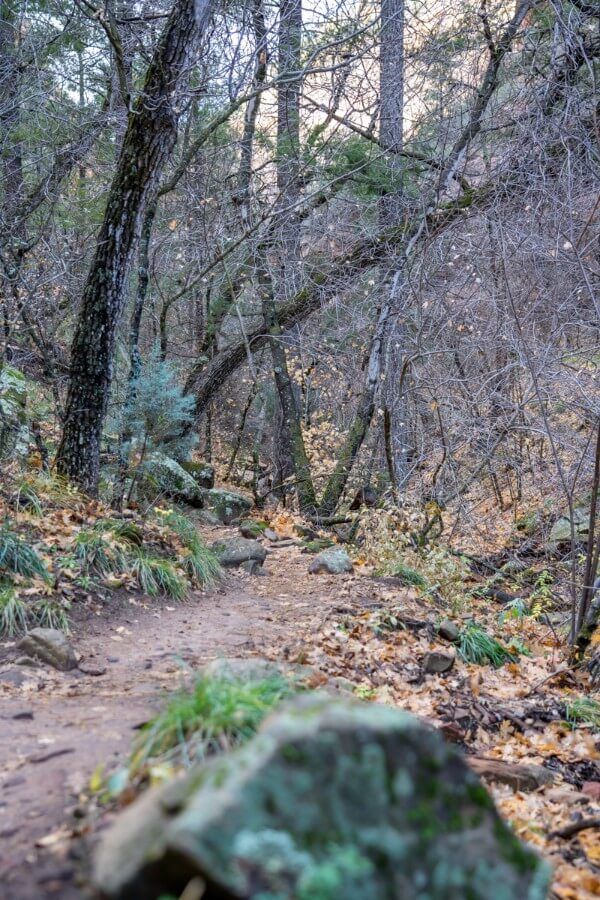
Take the same route back down to Boynton Canyon Trail. Now, you can either take a left turn at the big tree to go back to the trailhead or take a right turn to head for the end of Boynton Canyon.
Assuming you take the right, you will start out on a gradual incline and enter dense forested area. This very quickly turns into a steeper gradient and you will climb a lot of steps.
19.Steep Climb To The End Of Trail Sign
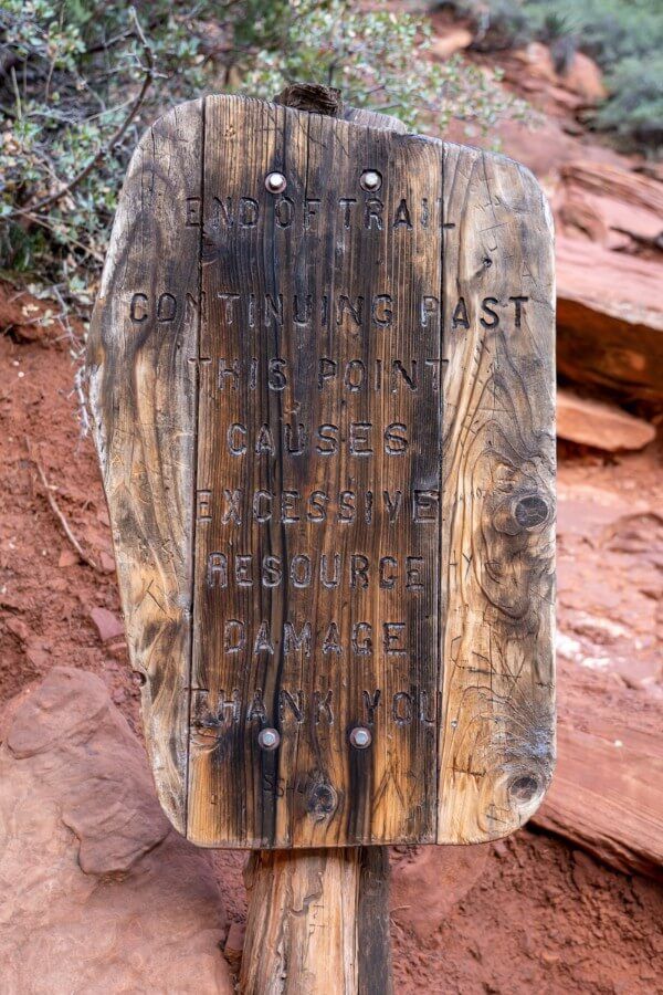
After you’ve worked up a bit of a sweat you will reach an even steeper section of trail with narrow, twisting and irregular stone steps.
Once you summit these steps you will be welcomed by an end of trail sign as you can see in the photo above. Going further beyond this point will cause damage to the environment and there is no designated trail of any sort.
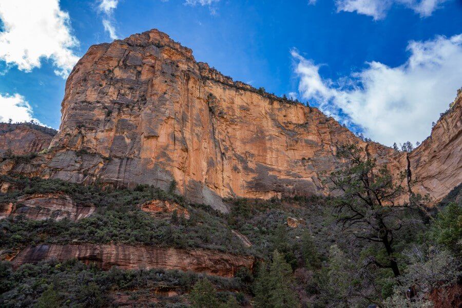
The summit view at the end of Boynton Canyon Trail is picturesque but it is by no means one of the best in Sedona. You will look back down the canyon from a slightly elevated position and see the tall cliff in the photo above.
Our advice would be to hike the full trail if you have plenty of time in Sedona or you have already hiked lots of other trails in the area. Otherwise, head back after Subway Cave and get onto the next hike.
20. Boynton Canyon Vortex Site
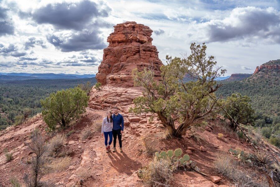
Boynton Canyon Vortex is one of the 4 most powerful vortex sites in Sedona. Don’t miss it as you head back toward the trailhead.
Hike until you see the sign for Vista Point and follow the curving gradual incline until you climb the far side of this shallow formation.
Enjoy more stunning views and see if you can feel an energy force.
Further Reading: Top 50 hiking trails in the US
Pros And Cons
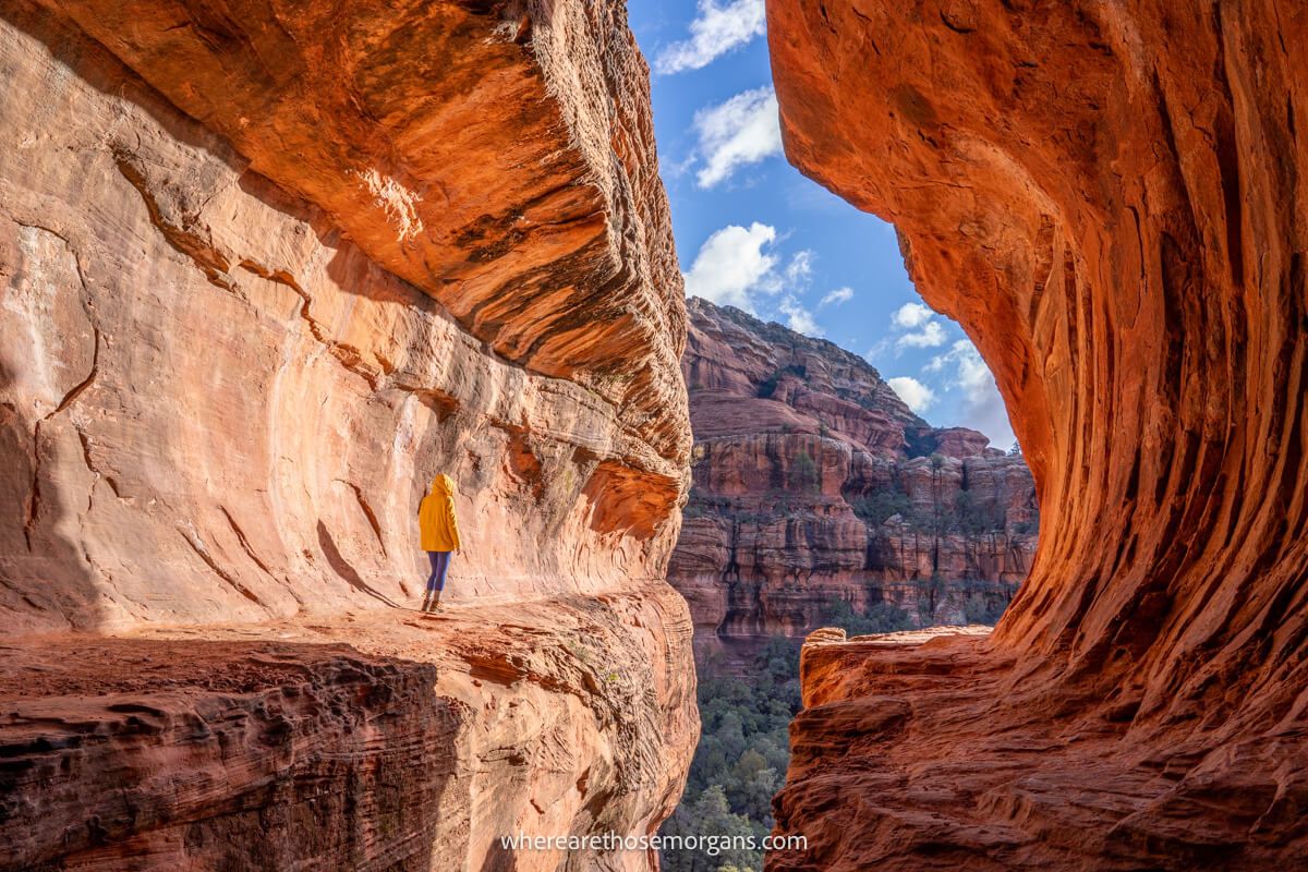
Let’s take a quick look at some of the pros and cons to hiking Subway Cave and Boynton Canyon in Sedona. Our opinions here are based on having hiked almost every popular trail in Sedona.
Pros:
- Subway Cave is one of the most photogenic landmarks in Sedona
- Perfect for families with older kids
- Four other popular hikes nearby with connecting trails
Cons:
- Parking is almost always a problem
- Boynton Canyon Trail climax is nice but not the best in Sedona
- The Subway Cave is often overcrowded
Boynton Canyon Trailhead Parking
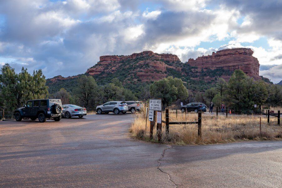
Boynton Canyon Trail has its own designated parking lot on Boynton Canyon Road. The parking area is small and it fills very quickly year round, but particularly during spring, summer and fall when Sedona is busiest.
How to get to Boynton Canyon parking lot from Sedona:
- Take Dry Creek Road (which transitions into Boynton Pass Road) for 4.6 miles from downtown Sedona.
- Turn right onto Boynton Canyon Road and park at the first lot on the right hand side after 0.2 miles.
If the lot is full, try parking at Fay Canyon or Doe Mountain which connect to Boynton Canyon via Aerie Trail.
Parking Passes
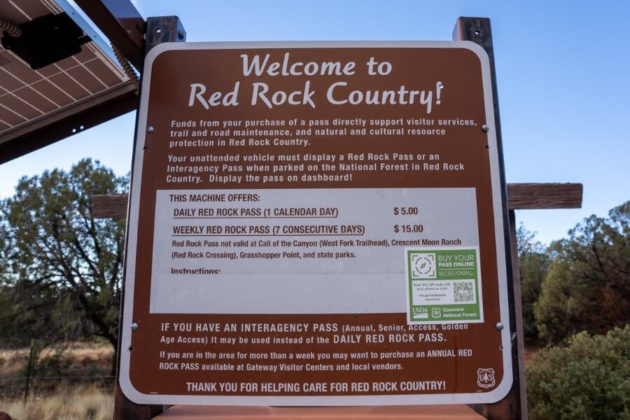
Yes, you need to display either a Red Rock Pass or America the Beautiful Interagency Pass on your vehicle dashboard before hiking Boynton Canyon and the Subway Cave in Sedona.
You can buy a Red Rock Pass at this recreation.gov page in advance, or you can buy a pass at a ticket machine when you arrive in person.
Red Rock Pass options include:
- 1 Day Red Rock Pass – $5
- 7 Day Red Rock Pass – $15
- Red Rock Annual Pass – $20
Do you have an America the Beautiful National Parks Pass? You can use it instead of a Red Rock Pass at these trailheads in Sedona.

Best Time To Hike The Subway Cave And Boynton Canyon Trail
The ideal to hike Boynton Canyon Trail would be early morning on a weekday in spring or fall so you can benefit from perfect hiking and light conditions, but also get a coveted parking spot and enjoy a relatively crowd free hike.
Best Season
If you visit Sedona in spring or fall when it is at peak tourist season, you simply have to be out early at trailheads or you’ll have problems getting parked.
Winter and summer to a lesser extent offer quieter periods in Sedona, which means you have more chance getting parking spaces without issue. It’s less about temperatures and busy trails in Sedona, but more about finding free parking spots at trailheads like Boynton Canyon.
No matter which season you hike the Subway Cave Trail, try to avoid weekends, holidays and the 10:00am to 2:00pm rush.
Best Time Of Day
The best time of day to hike Boynton Canyon is early morning because the Subway Cave is southeast facing, which means the subway tunnel shaped formation floods with light. Plus, the cave will be less crowded earlier in the day.
By late afternoon the sun will have moved so far around to the southwest that the cave will not illuminate and radiate its iconic deep orange color. The crowds inside Subway Cave will also be much larger in the afternoon.
What To Pack

- Footwear – Footwear with good grips and traction are going to help you climb up steep banks and reduce slipping on sandy rocks accessing the Subway Cave.
- Water – Even if you just go to the Subway Cave it is going to be a 3 hour hike, which means you’ll need to take water. Summer months require more water and even electrolyte drinks.
- Sun protection – Sunglasses, sun hats, long layers and sunscreen are vital if you are visiting Sedona in summer. Most of the Boynton Canyon Trail is shaded by trees but there are exposed sections.
Our Top 5 Tips
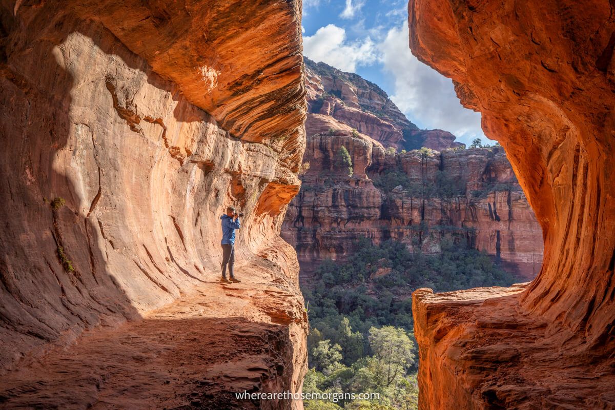
- Parking at Fay Canyon trailhead and walk Aerie Trail if Boynton Canyon lot is full
- Don’t turn off Boynton Canyon Trail until you reach the big burnt Alligator tree
- Take the bank climb, not the even steep rock climb for cave access
- Get into the cave early morning for the best light and fewest crowds
- Don’t complete the whole trail if you are short on time because there are better hikes
Do you like to track your hikes using any of the best hiking apps?
We always use Gaia GPS offline maps for navigation and tracking our speed, elevation and time on hikes. If you’ve been thinking about getting a hike tracker, here’s an exclusive way you can get Gaia with our exclusive 20% discount.
We used our offline GPS to track our position on the Boynton Canyon Trail which made it much easier for us to know when to turn off for the Subway Cave.
In Conclusion
Boynton Canyon Trail is one of the most popular hikes in Sedona. Previous hikers rate it at 4.7 / 5 on All Trails. It has a major vortex site, two caves and a viewpoint at the end of the box canyon. Subway Cave is among the most famous Sedona landmarks on social media channels like Instagram and Tik-Tok, so arrive early to beat the crowds.
Is the Subway Cave worth visiting in Sedona?
Yes! The secret Subway Cave is one of our favorite photo spots in Sedona and it’s definitely worth visiting. We enjoyed hiking Boynton Canyon Trail but there are much better hikes in Sedona. Our advice is to prioritize the Subway Cave, and only hike the rest of the trail if you have plenty of time.
More Sedona Hikes
- Cathedral Rock Trail
- Bell Rock Trail
- Devils Bridge Trail
- West Fork Trail
- Birthing Cave Trail
- Soldier Pass Cave Trail
- Airport Mesa Vortex Trail
More From Sedona
- The best things to do in Sedona
- Best Sedona itineraries
- 20 amazing hikes in Sedona
- 4 most powerful vortexes in Sedona
- 9 best Sedona jeep trails
- The best places to stay in Sedona
Want more Arizona content? Head over to our Arizona Travel Guides to explore the best of Grand Canyon, Sedona and beyond.
We hope this guide to hiking the Subway Cave on Boynton Canyon Trail helps with planning your visit to Sedona, Arizona!
Please let us know if you have any questions about how to find the Subway Cave, hiking Boynton Canyon Trail or your visit to Sedona in the comments below.
Happy Hiking,
Mark and Kristen
Was This Hiking Guide Helpful? Pin It For Your Visit To Sedona!
Note: This article contains affiliate links. When you make a purchase using one of these affiliate links, we may earn a small commission at no extra cost to you.
All Rights Reserved © Where Are Those Morgans, LLC. Republishing this article and/or any of its contents (text, photography, maps, graphics, etc.) in whole or in part is strictly prohibited.
Mark and Kristen Morgan are travel, hiking and photography experts. Over the last 6 years traveling full time, they have explored more than 40 countries and 30 US states.
Where Are Those Morgans has been featured in USA Today, Gestalten, Get Your Guide, CityPASS and Condé Nast Traveler along with various other publications. Read more about us.

