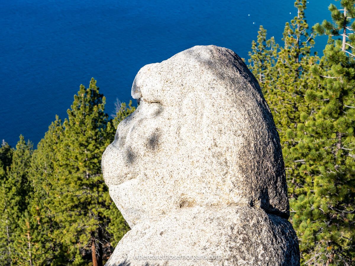
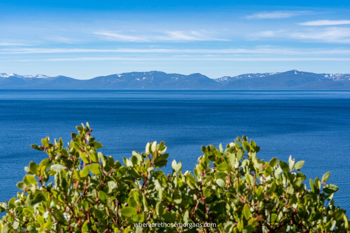
Monkey Rock Trail is a moderately difficult 2.5-mile roundtrip hike with 500 feet elevation gain on the Nevada side of Lake Tahoe. The trail starts out flat and easy, before turning steeper until it reaches a hidden viewpoint and a rock shaped like the head of a monkey. We hiked to Monkey Rock out of intrigue more than anything, and we’re glad we did because it turned out to have some seriously awesome views over Lake Tahoe.
In this guide we walk you step-by-step through hiking Monkey Rock Trail in Lake Tahoe, based on our own experiences. Read more about us.
We hiked to Monkey Rock on a sunny afternoon in November 2021 during our road trip from Seattle to Sedona. We’d already spent 6 days hiking fantastic trails on all sides of the lake, but we wanted to squeeze one final hike in before we left for Lone Pine and Death Valley.
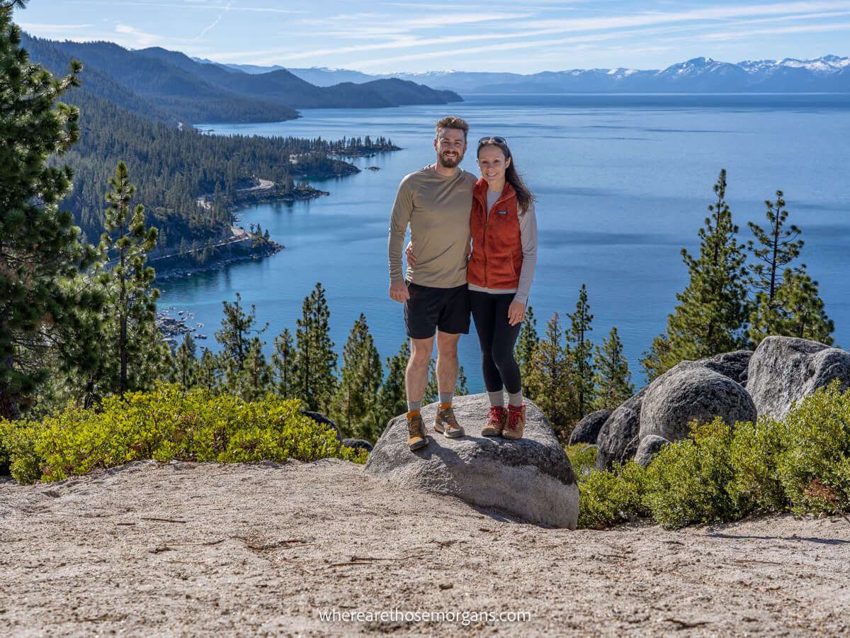
And Monkey Rock turned out to be a great final trail for us because the summit views were outstanding. We were less concerned about the monkey shaped rock and more blown away by Lake Tahoe. Trust us, those elevated lake and mountain vistas never get old. Okay, let’s begin!
Note: Our content is reader supported and contains affiliate links. If you make a purchase through one of these links, we may earn a small commission at no extra cost to you and it helps us keep this site running.
Trail Information
- Distance: 2.5 miles roundtrip
- Elevation gain: 500 feet
- Time: 2-3 hours
- Difficulty: Moderate
Monkey Rock Trail is perfect if you’re looking for a short-middle distance hike with enough elevation gain to work up a sweat but without being too intense. The trail starts out on a road, before continuing on a flat dusty path that turns into a steep ascent until reaching a turn-off to Monkey Rock viewpoint.
Monkey Rock Trailhead Parking
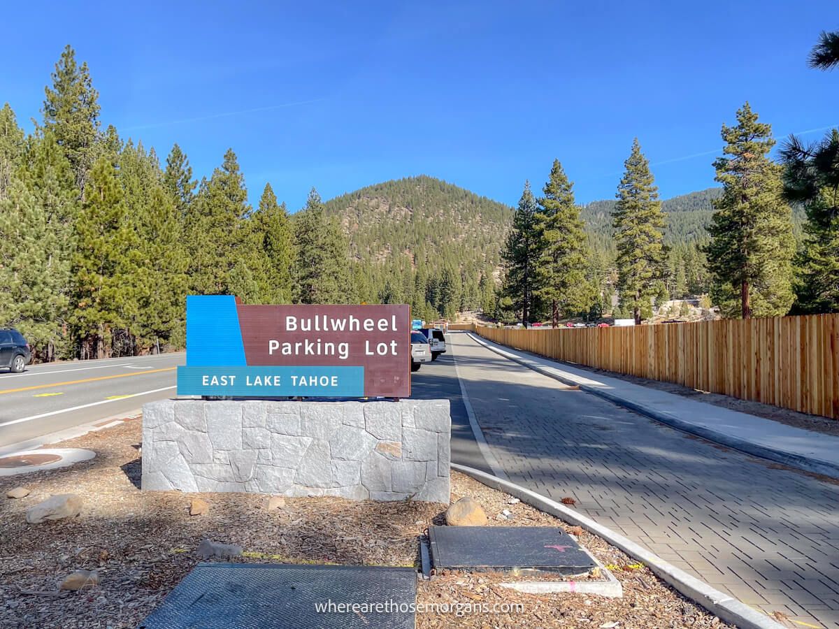
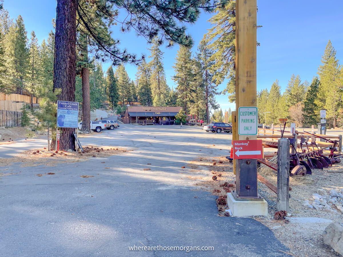
The trailhead for Monkey Rock is located at Bullwheel parking lot on the side of highway 89 near Incline Village on the northeastern shores of Lake Tahoe.
Open this Google Maps location into your smartphone and click directions to reach the trailhead’s roadside parking area. There’s room for around 35 vehicles to park. If you visit in a busy period and can’t get a spot in Bullwheel, you can park further up the road in Bonanza parking lot instead.
Distances from popular areas:
- Incline Village – 1.8 miles
- Tahoe City – 17.5 miles
- South Lake Tahoe – 25 miles
Fees
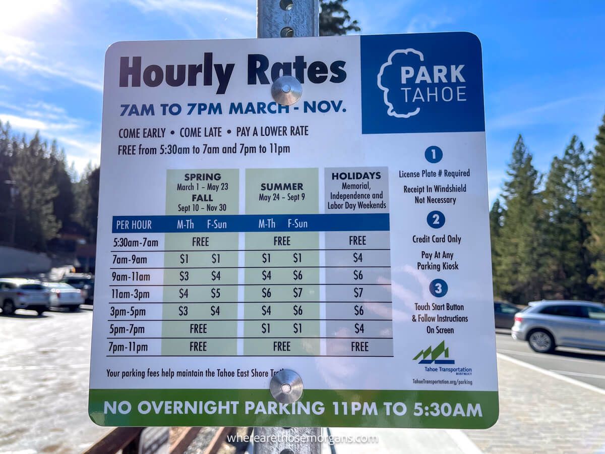
You must pay parking fees of $1-7 to park in Bullwheel or Bonanza parking lot, depending on the time of day and season you hike Monkey Rock Trail (see photo above for prices). We don’t mind incentives like this encouraging people to hike earlier or later in the day to reduce congestion on roads and trails.
And it’s important to know you’ll pay a separate $2 fee in cash (per hiker) once you reach Spooner Backcountry, which is around half a mile into the hike. It’s the only trail we hiked in Lake Tahoe that had parking fees and hiking fees, but it was worth it.
Monkey Rock Trail Walkthrough
Next, we’re going to walk you through the hike from start to finish so you know what to expect. You’ll see our own photos from the hike and we’ll describe the trail exactly as it was for us.
1. Starting The Hike
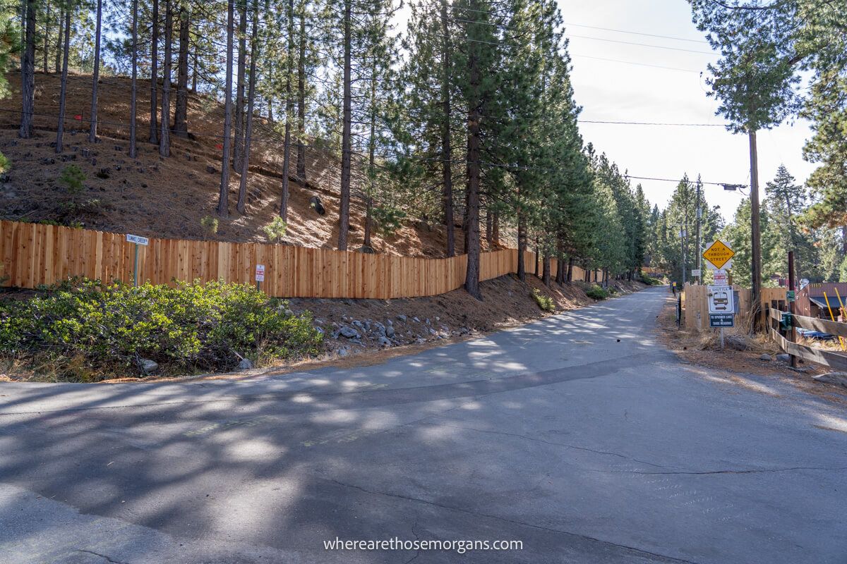
We parked at Bullwheel, paid our parking fee, walked to the south end of the lot and took a left turn followed immediately by a right turn. This took us onto a long and gradually inclining tarmac road and we passed by a sign stating “To Spooner Lake and Tahoe Meadows.”
2. Entering Spooner Backcountry
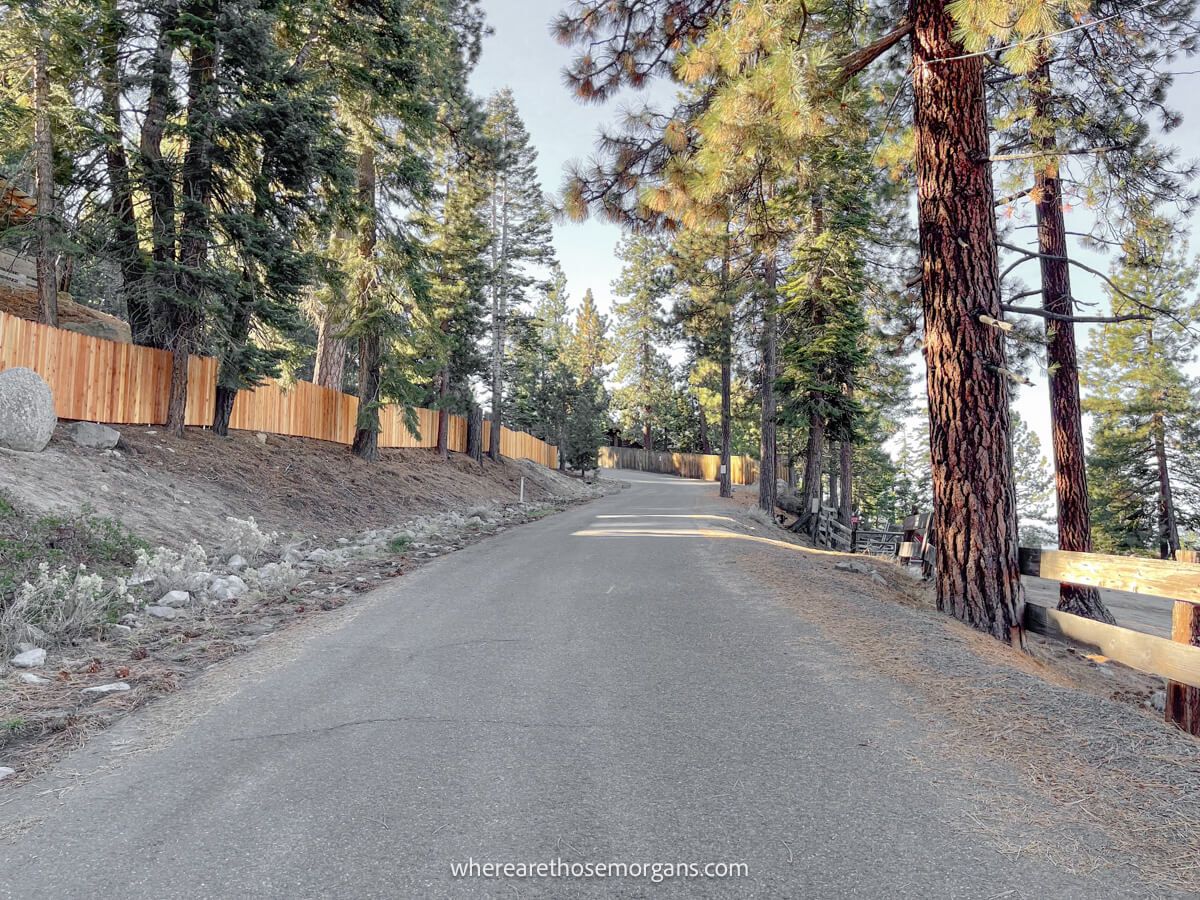
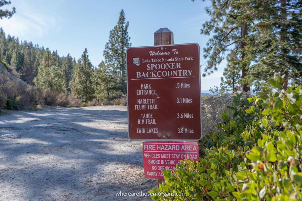
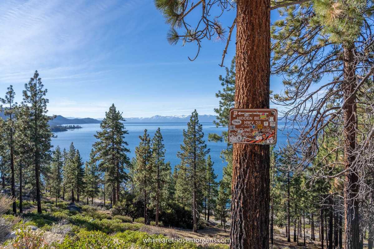
At the top of the tarmac road we joined a flat dusty trail and passed by a sign showing Spooner Backcountry with distances to landmarks. This section of the hike is nice and easy with occasional views of the lake appearing through clusters of trees. We paid our $2 each at the box and continued.
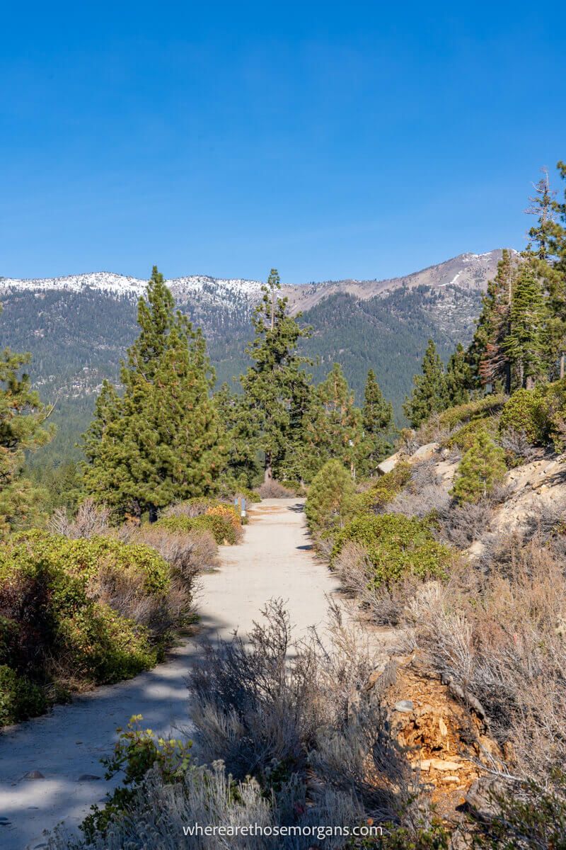
3. Gaining Elevation
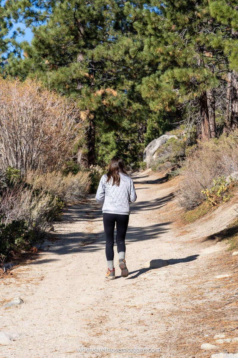
As the trail began to curve around to the left we noticed two different paths splitting. The left was much shorter but steeper, and the right was longer but more gradual. It turned out the steeper left side was a shortcut that wasn’t supposed to be used by hikers, so avoid that path when you hike to Monkey Rock.
4. Turning At The Trail Marker
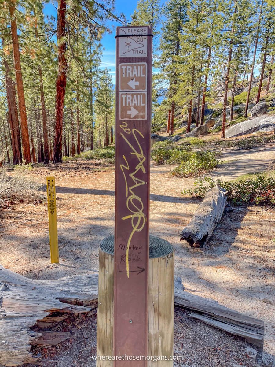
The trail turned steeper but it was gradual so we never felt too out of breath. And just as our thighs and calves started to really loosen up, we reached a metal trail marker attached to a wooden pole stating to turn for Monkey Rock. So that was the end of the ascent.
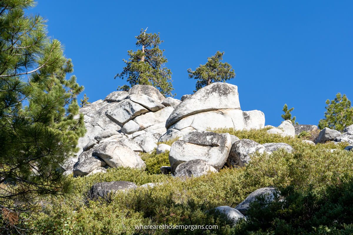
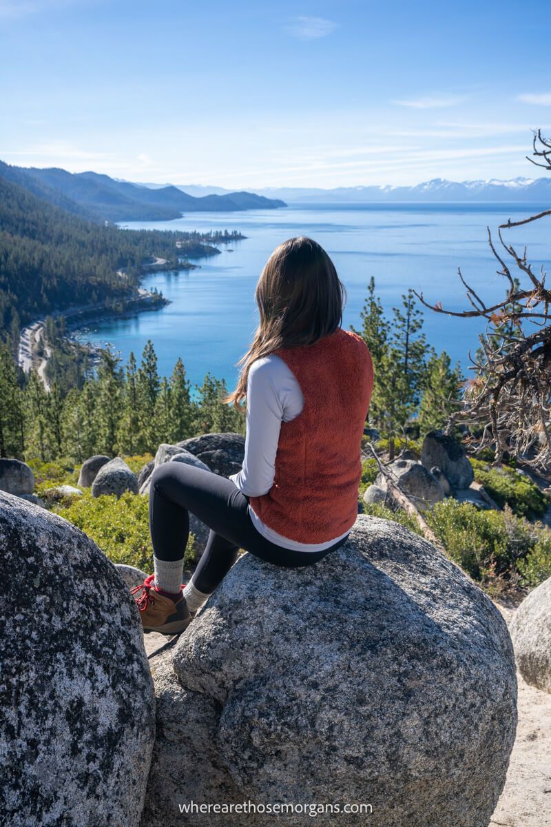
5. Arriving At The Summit
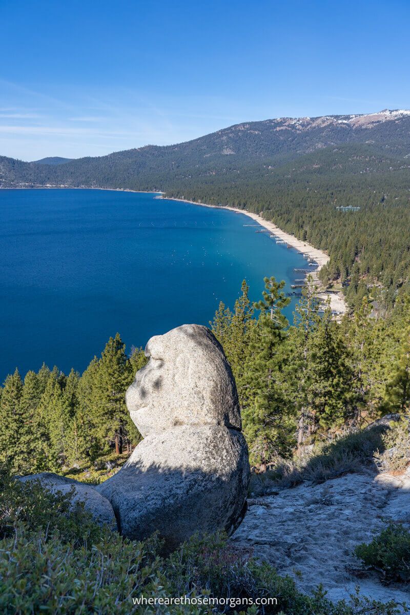
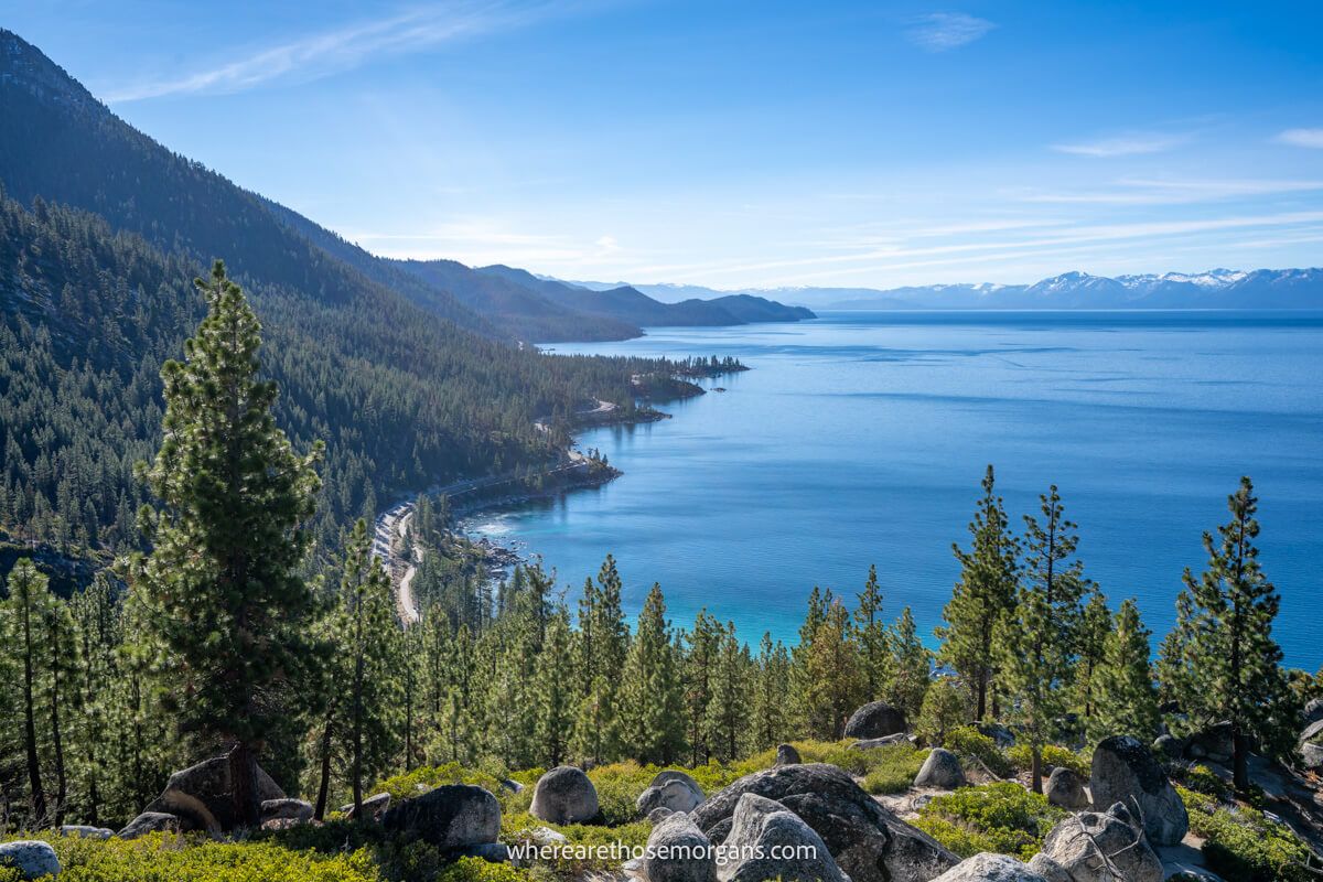
After just a minute on flatter terrain, we arrived at a cluster of rocks and boulders. The far reaching views over Lake Tahoe to the north and south were outstanding, and half hidden away down to the right side of us was the monkey shaped rock gazing out to the water and mountains.
Route Map
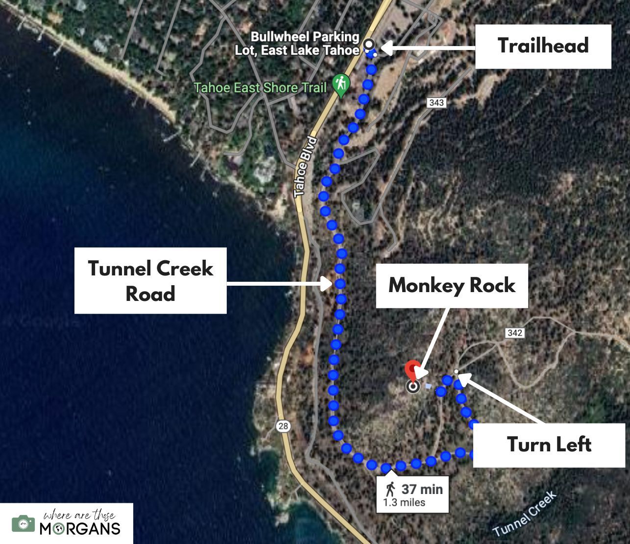
Use our route map above to familiarize yourself with the trail. You can see the trailhead at Bullwheel parking lot, the long and flat hike along Tunnel Creek Road, taking the right path at the trail split and where to turn left so you can reach Monkey Rock.
Leave No Trace
Please take great care not to disturb formations, vegetation or wildlife when you hike Monkey Rock Trail. It’s a beautiful place to visit and we all have to keep it that way for future generations to enjoy.
Remember and follow these 7 principles of leave no trace when hiking in Lake Tahoe:
- Plan ahead and prepare
- Travel and camp on durable surfaces
- Dispose of waste properly
- Leave what you find
- Minimize campfire impacts
- Respect wildlife
- Be considerate of others
Best Time To Hike Monkey Rock Trail
We think the best time to hike Monkey Rock Trail is late afternoon or even for sunset, preferably on a weekday in late spring or early fall. That way you’d benefit from the best light conditions and fewer crowds. Just remember to take a headlamp in case it’s getting dark on the way down.
Because we visited Lake Tahoe in November, we saw maybe 2 or 3 other hikers the entire time we hiked this trail. But we know it gets busy in peak seasons, so we recommend hiking early in the morning to beat the crowds if you visit in summer.
What To Pack
Monkey Rock Trail is mostly soft and hard packed dirt, so your shoes and socks will be dusty by the end of your hike. In good conditions it isn’t essential to wear serious hiking gear but we still recommend wearing a sturdy pair of shoes or boots with good tread. You might also want to read recent comments from other hikers if you visit in the off season.
The most important thing to pack is plenty of water because the summit area is totally exposed. Even if it’s a cool day, you’re still hiking at around 6,500 feet above sea level so you need to stay hydrated. You can pack snacks and sandwiches for lunch, but remember to carry out anything you take in.
More Hikes In The Area
Are you planning to hike as many trails as possible during your visit to Lake Tahoe? Here are some of our favorite hikes for you to try in the area:
- Mt Tallac Trail
- Eagle Rock Trail
- Chimney Beach Trail
- Cave Rock Trail
- Bonsai Rock Trail
- Castle Rock Trail
- Eagle Falls Trail
- Tahoe Rim Trail
The Morgan Conclusion
We think Monkey Rock is a great hike to include on your Lake Tahoe itinerary if you prefer easy to moderate trails, or you just want to see awesome views over the lake. You have to pay for parking and to hike the trail, but the viewpoint is worth it.
Overall we think it’s a fantastic hike for the whole family, but if we hiked it again we’d definitely want to summit around one hour before sunset because it has a superb southwest facing vista.
More From Lake Tahoe
- Emerald Bay State Park attractions
- Visiting Lake Tahoe in November
- Best Lake Tahoe photo spots
- Best hotels in North Lake Tahoe
- Where to stay in South Lake Tahoe
- Best hotels in Tahoe City CA
Want more California content? Head over to our California Travel Guides to explore national parks, popular road trips and things to do in major cities of the sunshine state.
We hope our guide to hiking Monkey Rock Trail helps with planning your trip to Lake Tahoe!
Please let us know if you have any questions in the comments below.
Happy Hiking,
Mark and Kristen
Enjoy this guide? Pin it for later
All Rights Reserved © Where Are Those Morgans, LLC. Republishing this article and/or any of its contents (text, photography, maps, graphics, etc.) in whole or in part is strictly prohibited.

Mark and Kristen spent 6 years traveling the world, visiting over 40 countries across 4 continents and more than 30 US states. They created Where Are Those Morgans in 2018 to help others plan the best possible vacations by writing authentic travel and hiking guides based on their real experiences.
Since the arrival of baby Maya in late 2024, Mark and Kristen’s extensive travels have slowed down but they still take plenty of trips. Where Are Those Morgans now helps millions of travelers each year to visit new places and hike new trails through information-packed blog posts and expert travel guidebooks. Read more about Mark and Kristen.