
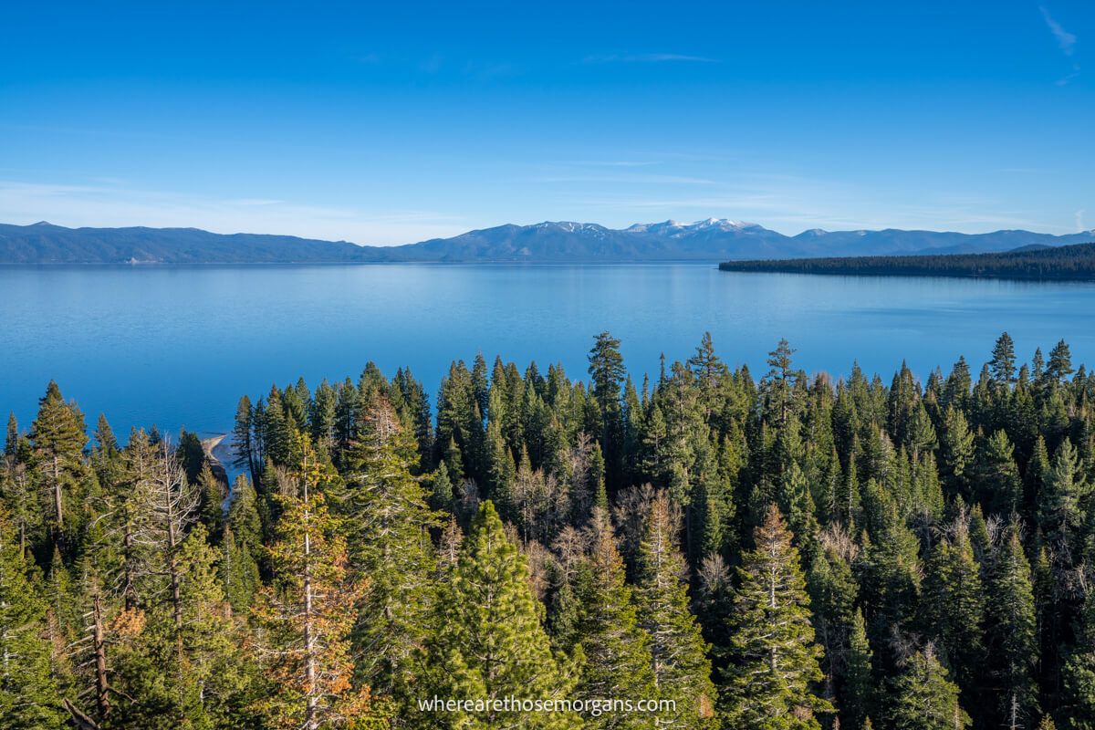
Eagle Rock Trail is a relatively unknown 0.8-mile roundtrip hike with just 250 feet elevation gain on the western shores of Lake Tahoe, California. It’s an easy hike overall but it has a steep climb up uneven rocks near the summit. We hiked to Eagle Rock with no expectations and ended up being blown away by magnificent east facing views over Lake Tahoe. It’s the epitome of a hidden gem.
In this guide we walk you step-by-step through hiking Eagle Rock Trail in Lake Tahoe, based on our own experiences. Read more about us.

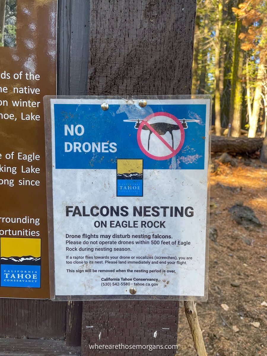
We hiked Eagle Rock Trail on a cool but sunny afternoon in November 2021 and it turned out to be one of our favorite Lake Tahoe hiking experiences. Parking was easy, we had the trail to ourselves, the views were outstanding and we even saw peregrine falcons circling around the summit. So all in all, it was a great hike!
We spent a good half hour soaking up the summit views on a lovely and calm afternoon, with little haze and clear blue skies. For us, Eagle Rock has one of the best vistas in all of Lake Tahoe because it’s easy to access, few know about it and it has unobstructed 180 degree views. The late afternoon is good time to hike Eagle Rock Trail, but we think summiting in time for sunrise would be even better. Okay, let’s begin!
Note: Our content is reader supported and contains affiliate links. If you make a purchase through one of these links, we may earn a small commission at no extra cost to you and it helps us keep this site running.
Trail Information
- Distance: 0.8 miles roundtrip
- Elevation gain: 250 feet
- Time: 1 hour
- Difficulty: Easy
Eagle Rock Trail is very easy for the majority of the hike, but you’ll have to navigate a steeper section with lots of uneven and sharp rocks on the final approach to the summit. The summit is a bit like a table-top but it’s very rocky and uneven, so you’ll need careful foot placements.
It’s less than a mile roundtrip, so it’s a perfect hike to do if you’re short on time, or you want to watch a sunrise or sunset without having to hike a long trail in the dark. Our total hiking time was around 30 minutes, but we spent 30 minutes soaking up the amazing summit views.
Eagle Rock Trailhead Parking
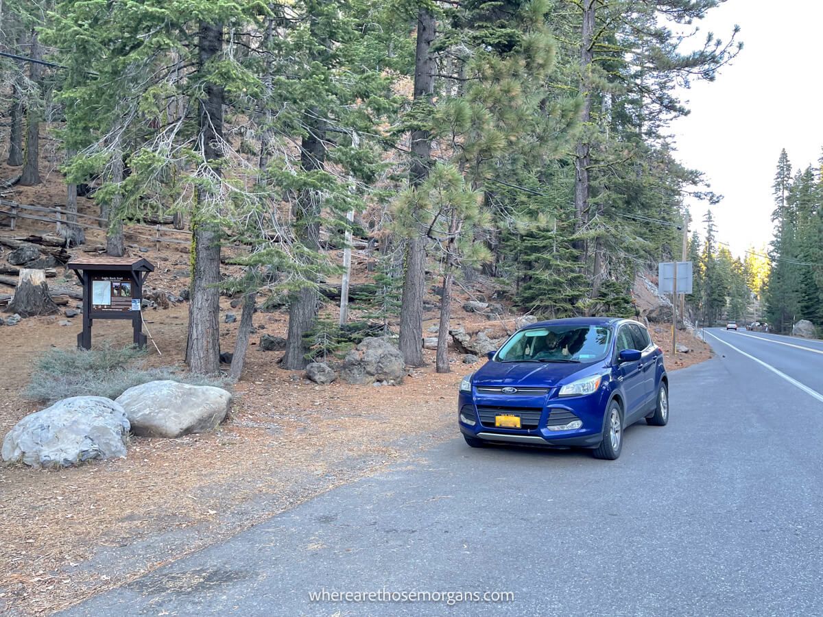
The trailhead for Eagle Rock is located in a wooded area next to a small roadside pullover on highway 89 near Tahoe Pines on the central-western shores of Lake Tahoe.
Open this Google Maps location into your smartphone and click directions to reach the trailhead’s roadside parking area. There’s room for around 15-20 vehicles to park.
Distances from popular areas:
- Tahoe City – 4.6 miles
- Tahoe Vista – 12.7 miles
- Incline Village – 19.6 miles
- South Lake Tahoe – 25 miles
Eagle Falls Trail Walkthrough
Next, we’re going to walk you through the hike from start to finish so you know what to expect. You’ll see our own photos from the hike and we’ll describe the trail exactly as it was for us.
1. Starting The Hike
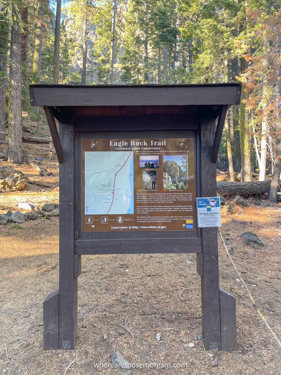
We were the only car parked in the half moon shaped parking area so we knew we’d have the trail to ourselves immediately. After reading the trailhead information board and learning about peregrine falcons nesting in the area, we set off on the springy wooded trail.
2. Forest Walk
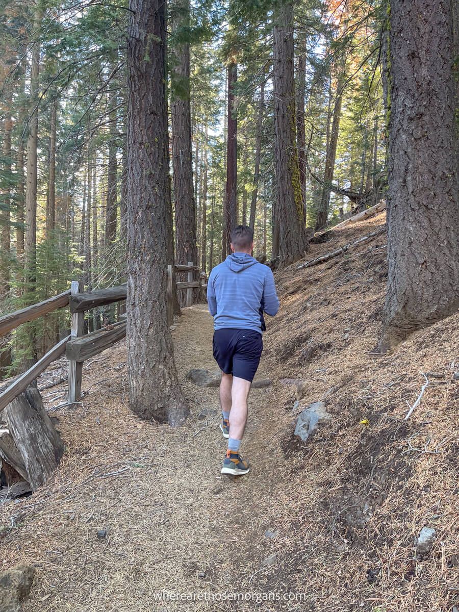
We gained very gradual elevation as we followed a wooden fence through the picturesque forest. This section of the hike was nice and easy underfoot because the hard mud was very bouncy. After heading northwest for around 5 minutes, we took a sharp right turn to the east.
3. Steep Climb To The Summit
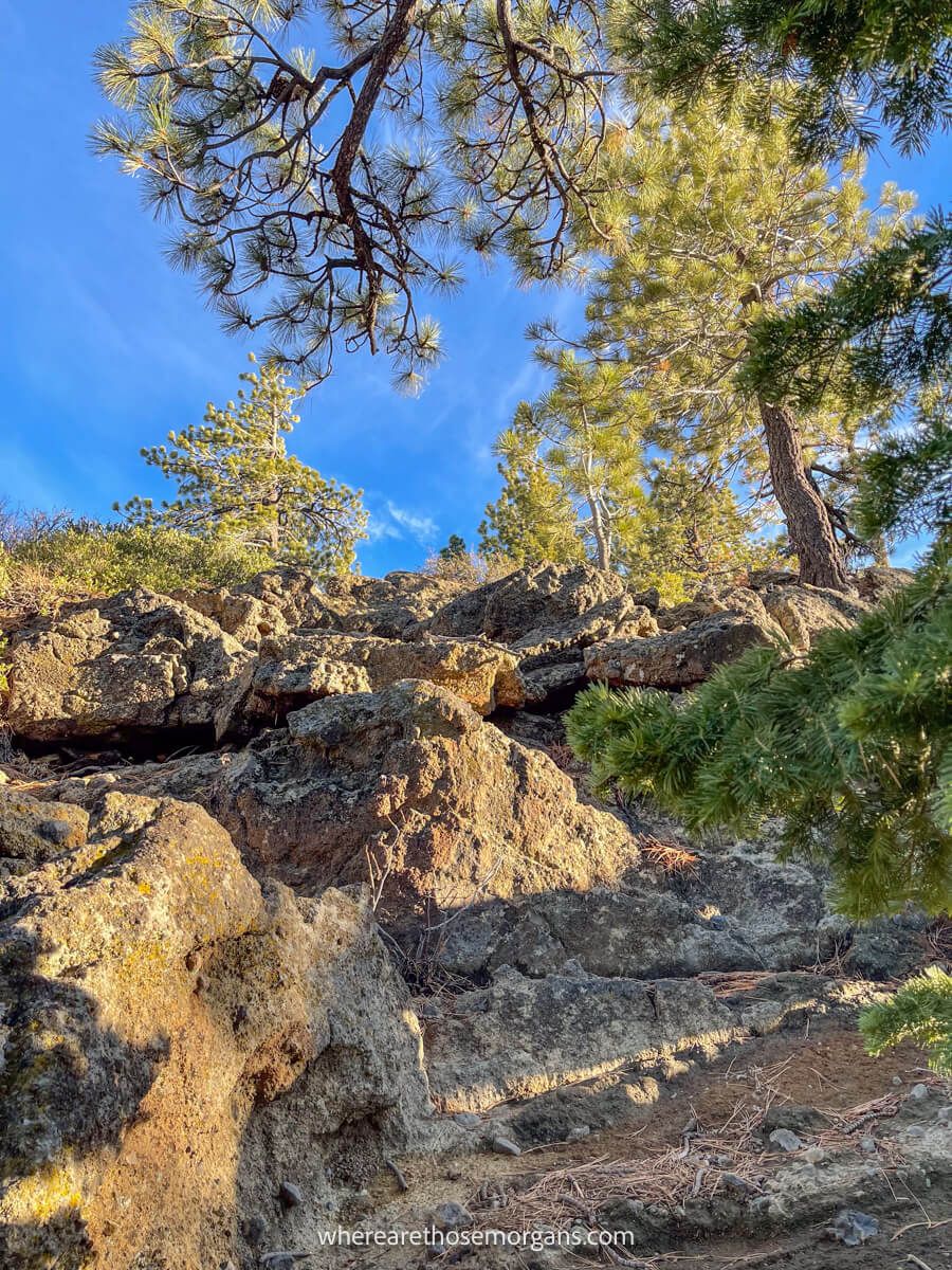
As soon as we’d taken the right turn, the trail turned into a straight ascent climb. We navigated rugged rocks of different shapes and sizes, slippery stones and forged our own path because there was no designated route. It was steep, but it was very short so we were at the summit in no time.
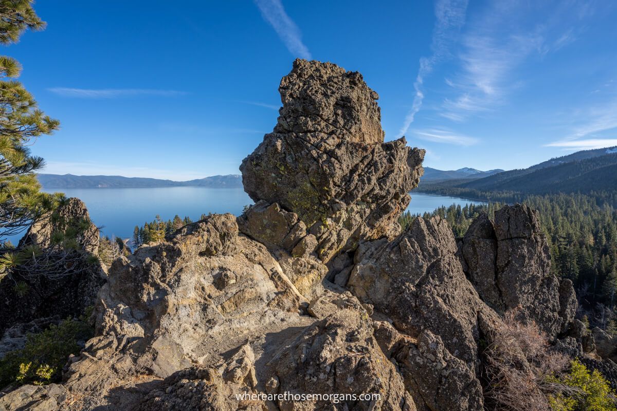
4. Eagle Rock Summit
There are two major areas you can walk around at the Eagle Rock Trail summit. The first is to the right side and it ends at large jagged rock (you can’t get any further on this side). To the left you’ll find a much larger and more open expanse where you can find a spot to relax or take some fun perspective photos.
Leave No Trace
Please take great care not to disturb formations, vegetation or wildlife when you hike Eagle Rock Trail. It’s a beautiful place to visit and we all have to keep it that way for future generations to enjoy.
Remember and follow these 7 principles of leave no trace when hiking in Lake Tahoe:
- Plan ahead and prepare
- Travel and camp on durable surfaces
- Dispose of waste properly
- Leave what you find
- Minimize campfire impacts
- Respect wildlife
- Be considerate of others
Best Time To Hike Eagle Rock Lake Tahoe
We think the best time to hike Eagle Rock Trail is either in time for sunrise or much later in the afternoon, preferably on a weekday in late spring or early fall. That way you benefit from the best light conditions and fewer crowds.
Even though it’s a relatively unknown hike, we still think Eagle Rock would be much busier in the summer months, just by the law of averages.
If we hike this trail again, we’ll do it one hour before the sunrise time in May, June, September or October. It was a warm afternoon when we hiked it during our visit to Lake Tahoe in November, but we think sunrise would be fantastic because the view is directly east facing.
What To Pack
Eagle Rock Trail is mostly rocks and dirt packed forest trail. In good conditions it isn’t essential to wear serious hiking gear but we still recommend wearing a sturdy pair of shoes or boots with good tread. And don’t forget to take flashlights and headlamps if you hike early or late in the day.
The most important thing to pack is plenty of water because the summit area is totally exposed. Even if it’s a cool day, you’re still hiking at around 6,500 feet above sea level so you need to stay hydrated. You can pack snacks and sandwiches for lunch, but remember to carry out anything you take in.
More Hikes In The Area
Are you planning to hike as many trails as possible during your visit to Lake Tahoe? Here are some of our favorite hikes for you to try in the area:
- Mt Tallac Trail
- Chimney Beach Trail
- Monkey Rock Trail
- Cave Rock Trail
- Bonsai Rock Trail
- Castle Rock Trail
- Eagle Falls Trail
- Tahoe Rim Trail
The Morgan Conclusion

We think Eagle Rock is one of the best hidden gem hikes in Lake Tahoe. It’s short, easy and leads to some of the most incredible elevated views over the lake for very little effort. As far as we’re concerned, it’s a no-brainer to add to your Tahoe hiking list.
We recommend sunrise as the best time for photographers to hike the trail, otherwise leave it until later in the afternoon so the sun is behind you. It’s a great all-round hike for families, groups, solo visitors and couples alike.
Want more California content? Head over to our California Travel Guides to explore national parks, popular road trips and things to do in major cities of the Golden state.
We hope our guide to hiking Eagle Rock Trail helps with planning your trip to Lake Tahoe!
Please let us know if you have any questions in the comments below.
Happy Hiking,
Mark and Kristen
Enjoy this guide? Pin it for later!


All Rights Reserved © Where Are Those Morgans, LLC. Republishing this article and/or any of its contents (text, photography, maps, graphics, etc.) in whole or in part is strictly prohibited.

Mark and Kristen spent 6 years traveling the world, visiting over 40 countries across 4 continents and more than 30 US states. They created Where Are Those Morgans in 2018 to help others plan the best possible vacations by writing authentic travel and hiking guides based on their real experiences.
Since the arrival of baby Maya in late 2024, Mark and Kristen’s extensive travels have slowed down but they still take plenty of trips. Where Are Those Morgans now helps millions of travelers each year to visit new places and hike new trails through information-packed blog posts and expert travel guidebooks. Read more about Mark and Kristen.