Tolmie Peak Trail is one of our favorite hikes in Mt Rainier because it’s quiet, picturesque and it leads to an old fire lookout tower with spectacular views. But it has one major downside: a horrible 15-mile stretch of gravel road with countless potholes is the only way to reach the trailhead. Is it worth it? Oh yes!
In this guide we explain everything you need to know about hiking Tolmie Peak Trail in Mount Rainier, based on our experiences. Read more about us.
We hiked countless trails around Washington State when we lived near Seattle for 6 months in the summer of 2021. But the one place we kept going back to was Mt Rainier. It’s Kristen’s favorite national park and we managed to hike most of the popular trails. We read about the awful road leading to Mowich Lake, but we drove it anyway so we could tick off Tolmie Peak and Spray Park Trail.
Both hikes turned out to be awesome. We really enjoyed Tolmie Peak because it was much quieter than other areas in the park, it was a good middle distance at 7 miles and it only had 1,300 ft elevation gain so it didn’t feel too steep. Plus, it led to a gorgeous lake, an old wooden fire tower and of course magnificent Mt Rainier views. Okay, let’s begin!
Note: Our content is reader supported and contains affiliate links. If you make a purchase through one of these links, we may earn a small commission at no extra cost to you and it helps us keep this site running.
What You Need To Know
Okay, let’s dive right in. Here are the most important things you need to know about hiking Tolmie Peak Trail:
- It’s a moderately difficult hike with mostly gradual elevation gain.
- Half of the hike is on the famous Wonderland Trail.
- The trail is snow free mid-July through mid-October.
- Wildflowers are best here late-July through mid-August.
- Parking is at the end of the road near the campground.
- You don’t need specialist hiking gear.
- But wearing robust trail shoes is a good idea.
- Large parts of the trail are under cover of trees.
- You can’t stay in the fire lookout tower.
- Use restrooms at the campground before starting.
- Don’t forget a swimsuit for the lake on a hot day.
- Tolmie Peak Trail is not dog friendly.
Trail Statistics
- Distance: 7 miles roundtrip
- Type: Out and back
- Elevation Gain: 1,300 ft
- Difficulty: Moderate
- Time: 3-5 hours
- Trailhead: Mowich Lake
We thought the hike to Tolmie Peak fire lookout was moderately difficult because despite being 7 miles roundtrip, it was mostly gradual with just a few steep sections. In comparison, we thought the popular Skyline Trail was more challenging because it was steeper and had more elevation gain.
Tolmie Peak Trailhead Parking
Tolmie Peak Trailhead is located at the very end of Mowich Lake Road in the Carbon River region of Mount Rainier National Park. The parking area is small, rough and on both sides of the road as it dead-ends near the campground. It’s easier to hike alongside Mowich Lake than it is to walk back along the road to reach the trailhead from the parking area.
Carbon River is a much quieter area of the park and it doesn’t have a drive-through entrance kiosk, but you must still pay entrance fees of $30/vehicle for 7 days and display the ticket on your car dashboard. You can buy a pass online in advance or in person at Paul Peak Trailhead. Alternatively, you can display an America the Beautiful Pass if you have one instead.
Distances and average driving times from nearby cities:
- Seattle – 70 miles (2 hours 5 minutes)
- Bellevue – 69 miles (2 hours 5 minutes)
- Renton – 58 miles (1 hour 50 minutes)
- Everett – 96 miles (2 hours 35 minutes)
- Tacoma – 48 miles (1 hour 45 minutes)
- Portland – 186 miles (3 hours 45 minutes)
Three miles after leaving Carbonado, you’ll reach a fork in the road. Left is for Carbon River Road but you want the right to continue on Mowich Lake Road. After a minute or so, tarmac ends and the road turns to gravel, stones, dust and potholes. The rough surface lasts for around 15 miles and it’s all uphill with sharp bends, drop offs and teeth clenching moments every time you hit a pothole.
It took us around 55 minutes to drive up in darkness and around 45 minutes on the way down. We took it nice and easy, moving over for anyone who felt like blowing past, probably in a hire car! It’s important to know that the road closes in winter, so check live road conditions before you set off to make sure it’s open.
Trail Map
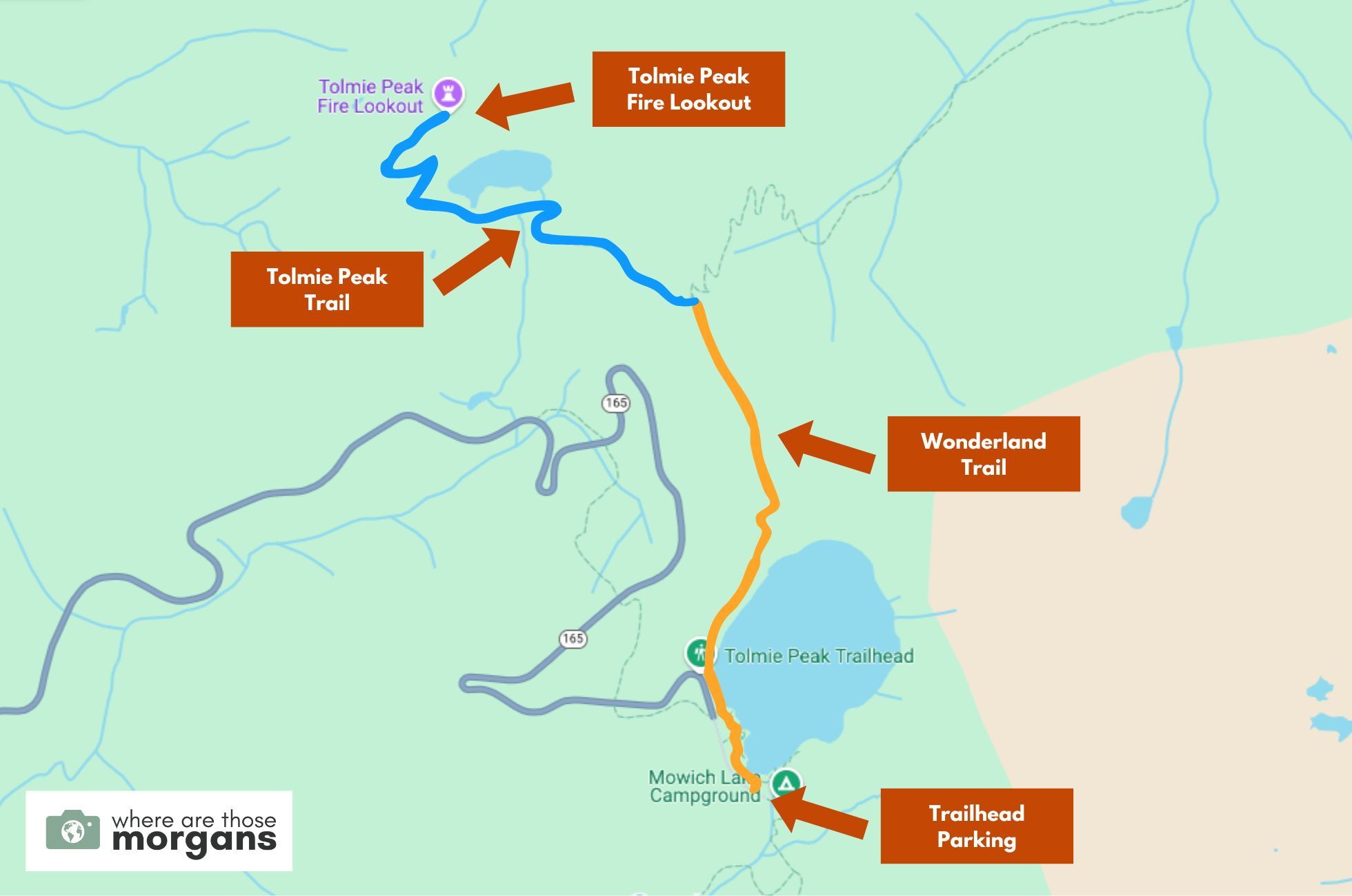
As you can see in the map we created above, after parking near the campground you’ll walk alongside Mowich Lake on Wonderland Trail (orange) before turning onto Tolmie Peak Trail (blue) near Eunice Lake.
From there, a few long and steeper switchbacks will lead you directly to the fire lookout tower. It’s a simple hike with no spur trails so you really can’t go wrong.
Trail Walkthrough
Next, let’s walk through the trail exactly as we hiked it so you know what to expect.
1. Begin The Hike
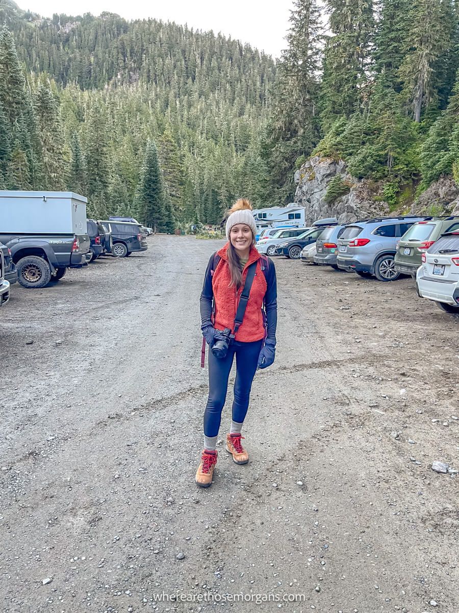
After setting an agonizingly early alarm, we drove to Mt Rainier (with lots of coffee!), made it up the awful pothole-laden road and parked on the roadside near Mowich Lake. Then we grabbed our gear, used a restroom in the campground and finally set off hiking at 7:00am. We got straight on Wonderland Trail and walked alongside Mowich Lake, which had an eerie veil of mist creeping across at dawn.
2. Follow Wonderland Trail
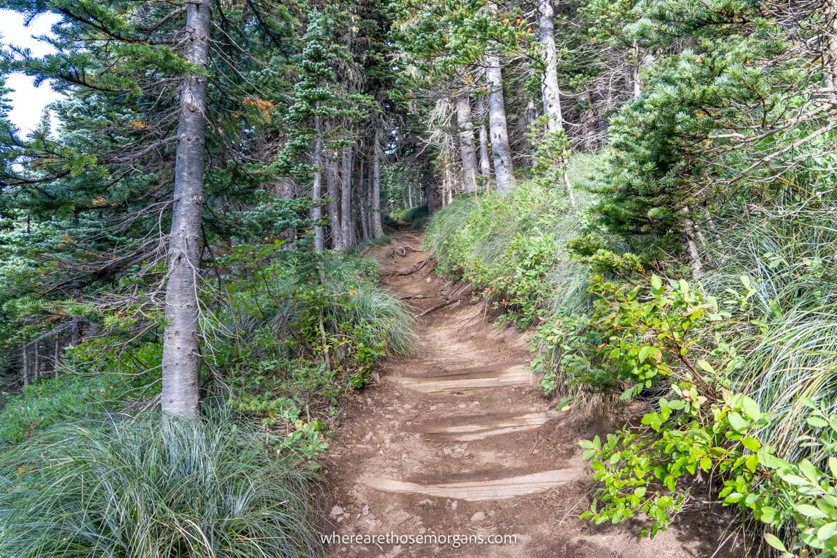
The first 1.5 miles of the hike followed Wonderland Trail (you can say you’ve hiked 1.3% of the famous trail after this section!) on a gradual climb mostly through forest. To the left we could see rolling hills covered in a blanket of trees, along with the valley we’d driven up that morning. We had the trail to ourselves with the exception of one serious looking trail runner who passed us.
3. Tolmie Peak Trail
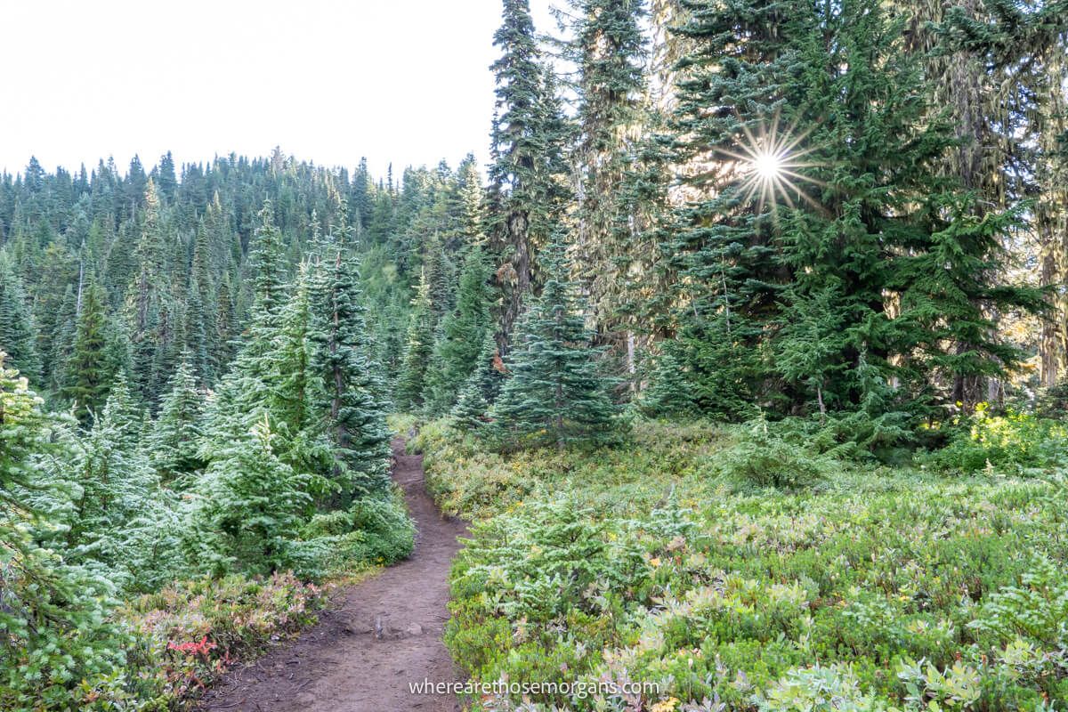
After climbing gradually through lowland forest and a handful of short but steep bursts, we reached the fork at which Tolmie Peak Trail broke off from Wonderland Trail. The next half a mile was undulating and passed through picturesque sub-alpine forest. Eventually, we reached a gorgeous flat area filled with emerald green trees and vegetation, and looking up we could see the fire lookout tower.
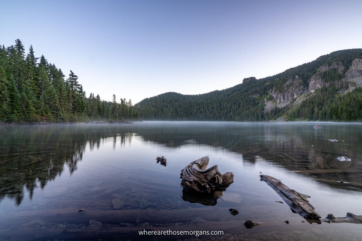
4. Eunice Lake
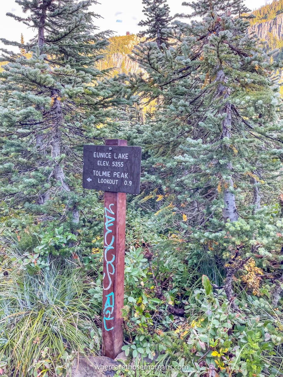
We saw a sign showing 0.9 miles to the summit, but the first 0.2 miles of that was walking along this flatter area through lush green meadows, so really it was just a 0.7-mile ascent. And this flat section before reaching Eunice Lake was our favorite part of the trail because it was incredible peaceful and it just felt like nature at its finest.
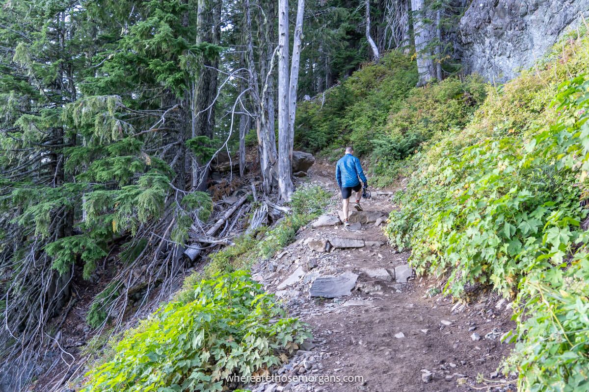
5. Final Steep Ascent
We stopped at Eunice Lake for a quick photo, then cracked on the final push to the summit. The climb was steep but every step we took made the views better and better. We took a few short breaks along the lung-busting, thigh-burning climb to appreciate the landscape opening up around us, and before we knew it the summit was in sight.
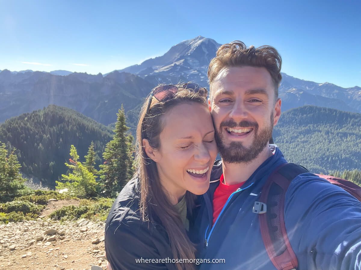
6. Soak Up The Views
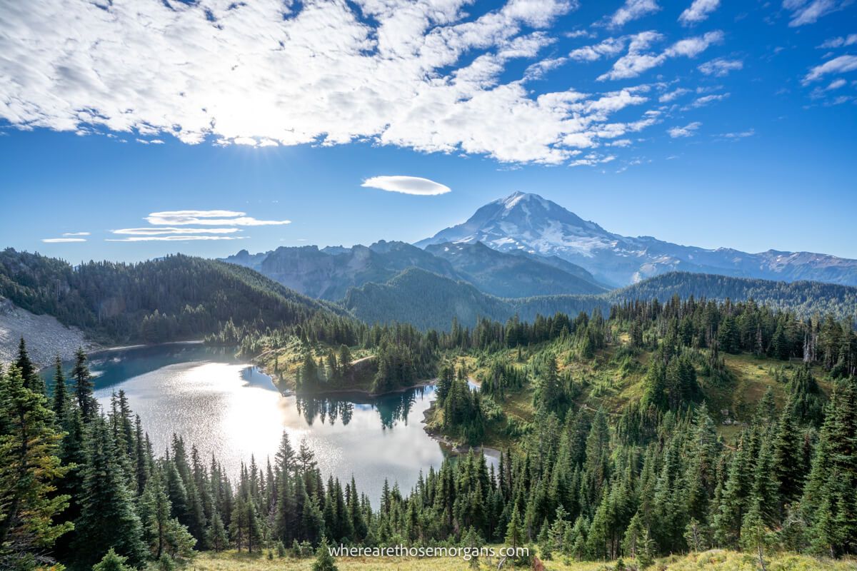
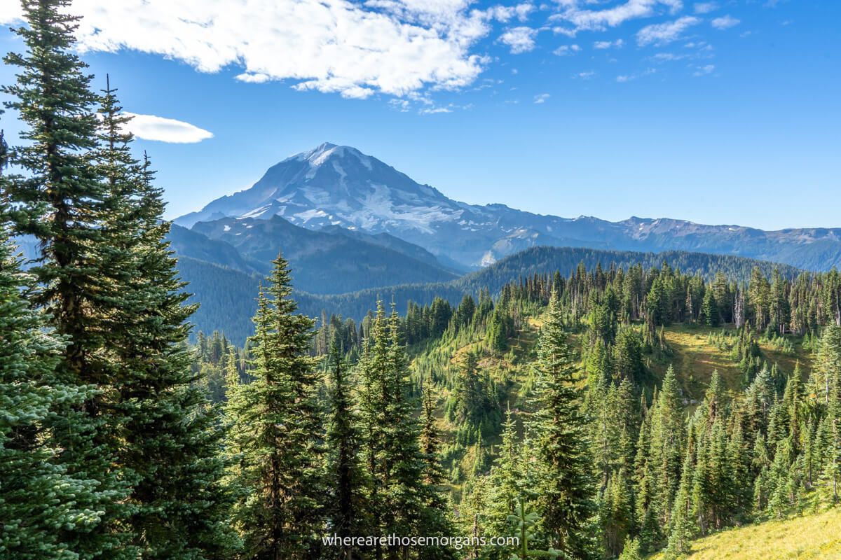
We approached the summit on a narrow ridge with Mt Rainier to our right side and views off to the left as far as the horizon. We thought the Mount Rainier view from Tolmie Peak was more photogenic (because of Eunice Lake) than from Mount Fremont Trail fire lookout, but the light is much better from Mt Fremont in the morning because it has a southwest facing line of sight to the volcano.
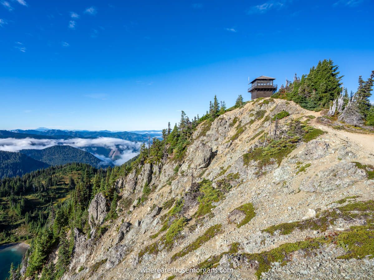
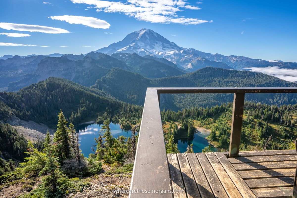
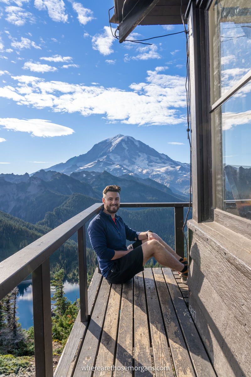
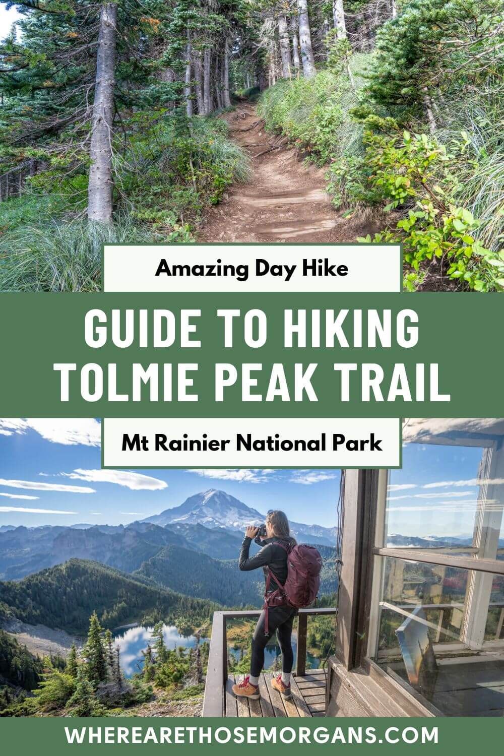
7. Tolmie Peak Fire Lookout Tower
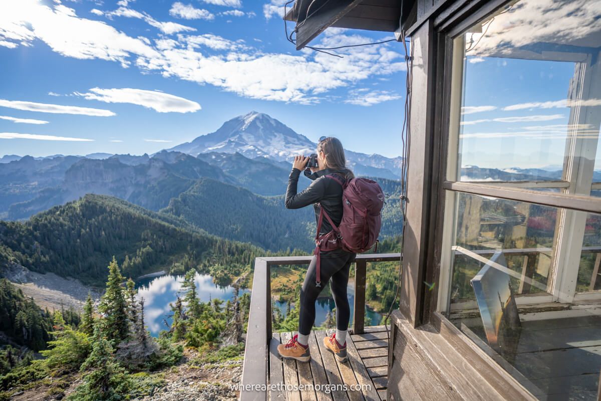
The view from the fire lookout tower was sublime. We could see clouds swirling in the valleys below, Eunice Lake below us now looking a lot smaller and directly ahead was the might snow capped Mount Rainier. We took a few minutes to walk around the fire lookout tower, grab some photos and soak up those views. The only downside? Mt Rainier is due south so the sun was dead-ahead.
8. Complete The Climb (Optional)
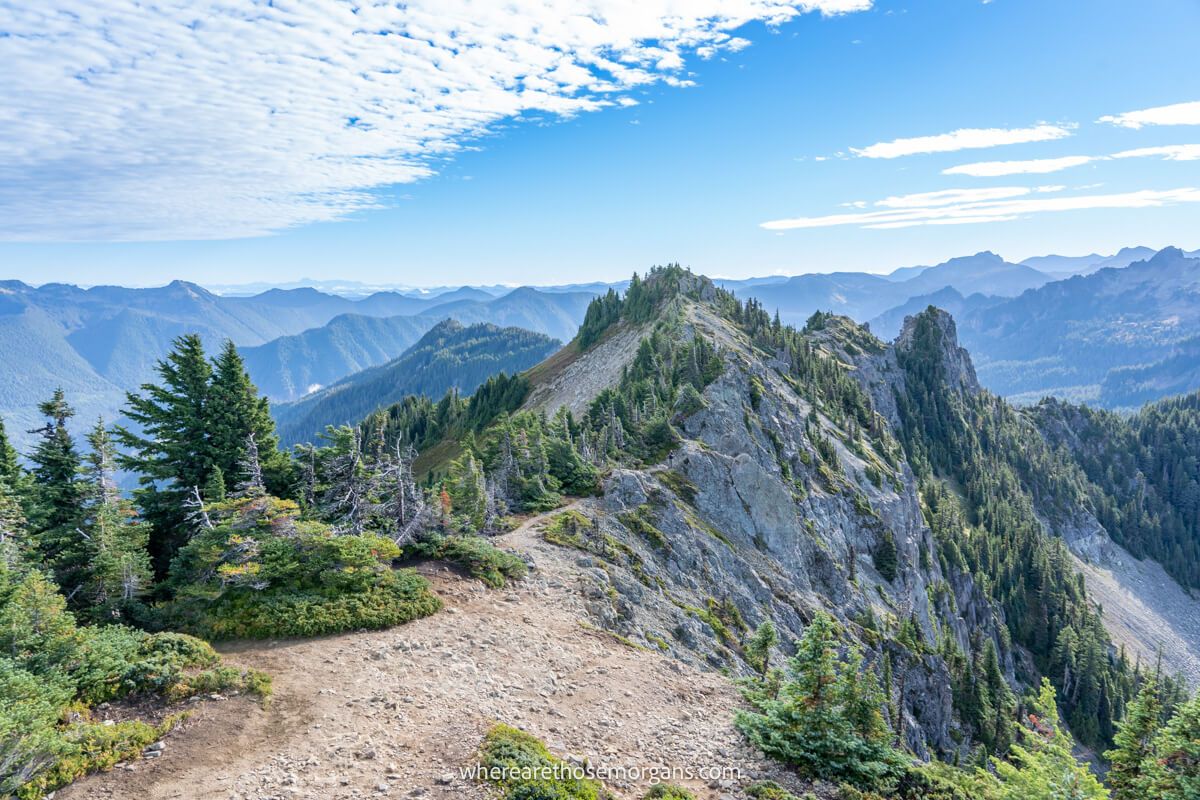
We expected the fire tower to be the summit, but the tallest point on the trail was actually a little further along a razor thin rocky ledge. So we continued hiking to the highest elevation and we were so glad we did because it gave us a better view of the fire tower looking backwards. But we don’t recommend this extra bit for families with younger kids or those with a fear of heights.
9. The Descent
The descent was nice and easy, and the sun was beginning to warm up the brisk morning. We noticed the trail was a lot busier because the mid-morning rush had arrived, so that early alarm was paying off. And once we got back to the main road we could see cars parked the whole way down. It was too cold to take a dip in Mowich Lake, plus we wanted to refuel and get straight onto Spray Park Trail!
The Morgan Conclusion
What we like: It’s a really nice middle distance hike with mostly gradual elevation gain. We loved the Mt Rainier views from the fire lookout tower and on a warmer day we would have taken a quick dip in the lake. It’s also perfect for doubling up with Spray Park, which we think is one of the better hidden gem trails in the park.
What we don’t like: Our major issue with this hike is the abysmal road quality leading to the trailhead. The parking could be much better, there are no amenities at Mowich Lake and there’s not much else to do other than hike the two trails.
Is Tolmie Peak Trail worth it? Yes! Tolmie Peak Trail is scenic, varied, gradual and leads to one of just four remaining fire lookout towers in Mt Rainier. If you’re looking for a summit with spectacular snow capped volcano views and you don’t mind putting up with a terrible 15-mile road to access the trailhead, you should add this hike to your itinerary.
We hope our guide to hiking Tolmie Peak Trail helps with planning your visit to Mount Rainier!
Please let us know if you have any questions in the comments below.
Happy Travels,
Mark and Kristen
Enjoy this guide? Pin it for later!
All Rights Reserved © Where Are Those Morgans, LLC. Republishing this article and/or any of its contents (text, photography, maps, graphics, etc.) in whole or in part is strictly prohibited.

Mark and Kristen spent 6 years traveling the world, visiting over 40 countries across 4 continents and more than 30 US states. They created Where Are Those Morgans in 2018 to help others plan the best possible vacations by writing authentic travel and hiking guides based on their real experiences.
Since the arrival of baby Maya in late 2024, Mark and Kristen’s extensive travels have slowed down but they still take plenty of trips. Where Are Those Morgans now helps millions of travelers each year to visit new places and hike new trails through information-packed blog posts and expert travel guidebooks. Read more about Mark and Kristen.