Poo Poo Point is a fantastic family friendly day hike near Seattle, Washington. In essence, it’s a moderately difficult 4-mile roundtrip forested trail leading to stunning views over Mount Rainier and a glider runway. We hiked a longer loop version of the trail, but we recommend you hike Chirico Trail out and back instead because it’s shorter and doesn’t require walking on busy roads.
In this guide we explain everything you need to know about hiking to Poo Poo Point, based on our experiences. Read more about us.
We lived near Seattle for 6 months in the summer of 2021, using our spare time to hike in the national parks and everywhere in-between. We’ll admit we couldn’t help but laugh when we saw a local hike close by called Poo Poo Point. But contrary to myth and legend (or was that just our own conversation?!), Poo Poo Point is not a place where hikers take a collective number two at the top of a hill!
It’s actually a really great day hike through a picturesque forest with seriously amazing views from the summit. We thought it was a nice middle distance and with 1,750 ft elevation gain it felt like a good workout without being too strenuous. The trail was jam-packed with hikers of all ages and abilities, and we saw more dogs than we could count which was awesome. Okay, let’s begin!
Note: Our content is reader supported and contains affiliate links. If you make a purchase through one of these links, we may earn a small commission at no extra cost to you and it helps us keep this site running.
What You Need To Know
Okay, let’s dive right in. Here are the most important things you need to know about hiking to Poo Poo Point:
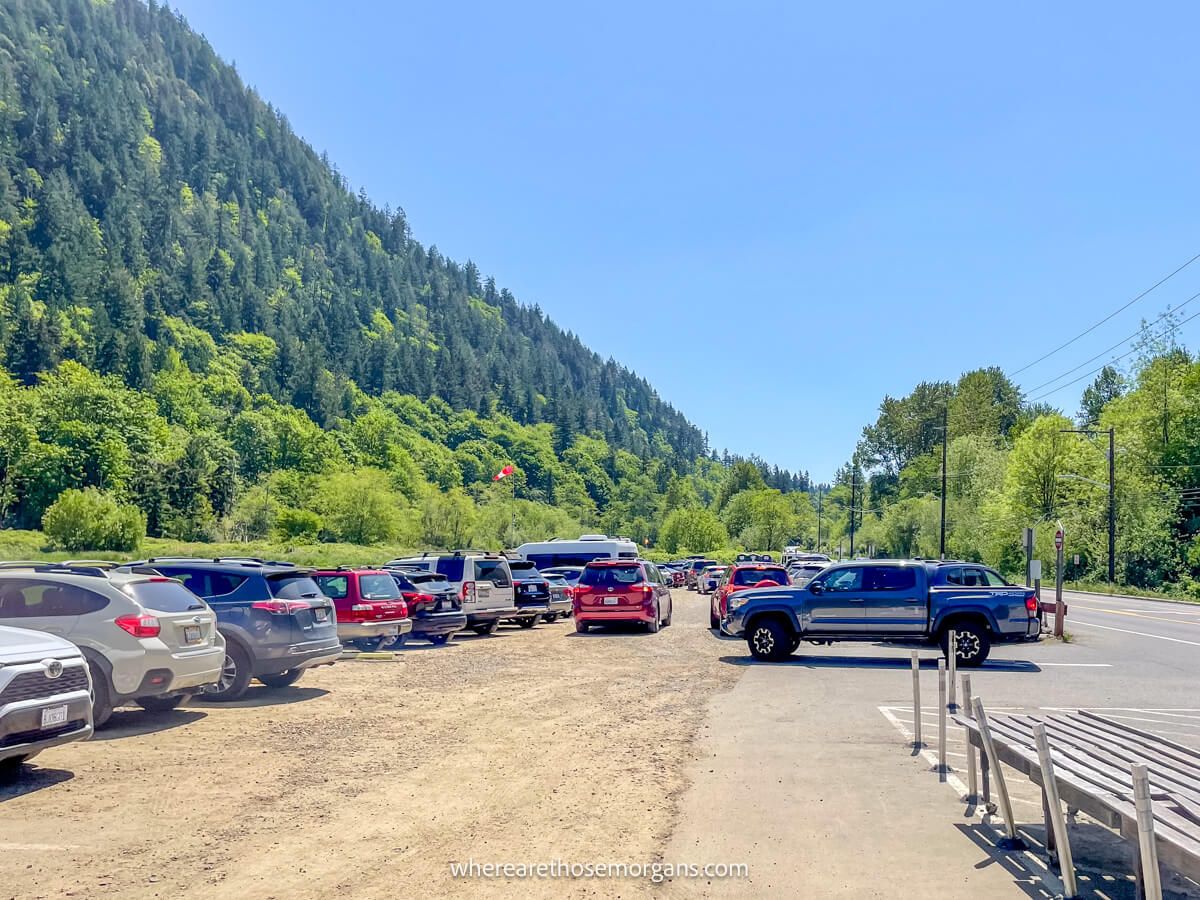
- Parking at the trailhead is difficult on weekends and holidays.
- There are some small backup parking areas you can use.
- Start very early or much later in the afternoon to avoid parking issues.
- Remove valuables from your car because break-ins are common.
- No hiking equipment or specialist gear is required.
- The area can be bad for bugs so don’t forget repellant.
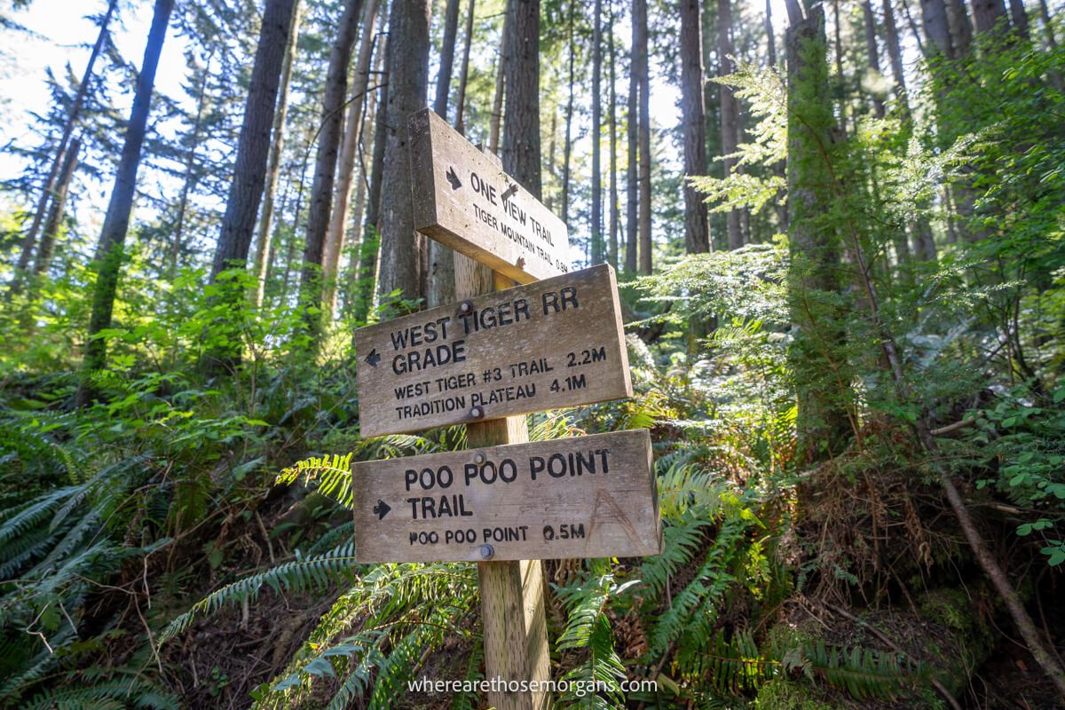
- The trails are well marked throughout.
- Poo Poo Point is a dog friendly trail.
- The trails are very dusty so expect to be covered in dirt by the end.
- Check recent comments on All Trails to read about conditions.
- “Poo Poo” whistle sounds blown by loggers gave it the name.
Most importantly, there are three different ways you can hike to Poo Poo Point. We hiked a loop on both Chirico Trail and High School Trail, but you can also hike High School Trail out and back or Chirico Trail out and back.
Confusingly, the most popular route (and the route we recommend you follow) begins and ends at Poo Poo Point Trailhead, but the trail is actually called Chirico Trail, not Poo Poo Point Trail. It’s the shortest, steepest and most scenic route, and if we were to hike this again, we’d go out and back on Chirico Trail.
Let’s take a look at the hiking statistics for each of the three trail versions:
Chirico Trail Out And Back
- Distance: 4 miles roundtrip
- Type: Out and back
- Elevation Gain: 1,750 ft
- Difficulty: Moderate
- Time: 1.5-3 hours
- Trailhead: Poo Poo Point Trailhead
High School Trail Out And Back
- Distance: 7 miles roundtrip
- Type: Out and back
- Elevation Gain: 1,800 ft
- Difficulty: Moderate
- Required: 2-4 hours
- Trailhead: 2nd Ave (off Front Street)
High School Trail and Chirico Trail Loop
- Distance: 6.5 miles roundtrip
- Type: Loop
- Elevation Gain: 1,750 ft or 1,800 ft
- Trail Difficulty: Moderate
- Time Required: 2-4 hours
- Trailhead: Either parking lot
Tip: The reason we don’t recommend the loop is because we spent the last 1.5 miles walking on the main road, mostly without sidewalks. It wasn’t much fun at all, and it would be worse if you hike as a family with younger kids.
Poo Poo Point Trailhead Parking
There are two places you can park to hike to Poo Poo Point:
- Poo Poo Point Trailhead – Large lot with around 60 spaces, free to park, vault toilets. This is the best place to park for the shorter and more popular Chirico Trail out and back. There’s also a small $10 lot on the other side of the road. Here’s the Google Maps location.
- High School Trailhead – Small lot with maybe 7 spaces, free to park, no restrooms. It’s technically for Rainier Trail, but that only lasts 0.2 miles before turning onto High School Trail. This is where we parked to hike the full loop. Here’s the Google Maps location.
Both trailheads are located a few miles south of Issaquah, Washington and they’re easy to access after leaving I-90 at exit 17 onto Front Street.
Distances and average driving times:
- Seattle – 19 miles (25 minutes)
- North Bend – 15 miles (20 minutes)
- Bellevue – 13 miles (20 minutes)
- Renton – 10 miles (20 minutes)
- Everett – 40 miles (50 minutes)
- Tacoma – 36 miles (45 minutes)
We hiked dozens of trails around Washington when we lived there and the one issue we almost always had was parking at trailheads. Plan to arrive either very early or much later in the afternoon if you want to avoid playing parking space roulette with a bunch of other circling cars. Also, avoid weekends and holidays if possible.
We arrived to the Poo Poo Point Trailhead parking lot to hike Chirico Trail at 7:00am on a Saturday morning in June and it was full. We weren’t aware of the nearby paid parking lot, so we drove 1.5 miles to High School Trailhead and luckily there was a spot open. Both lots were still full when we finished the hike at around 10:00am.
Trail Map
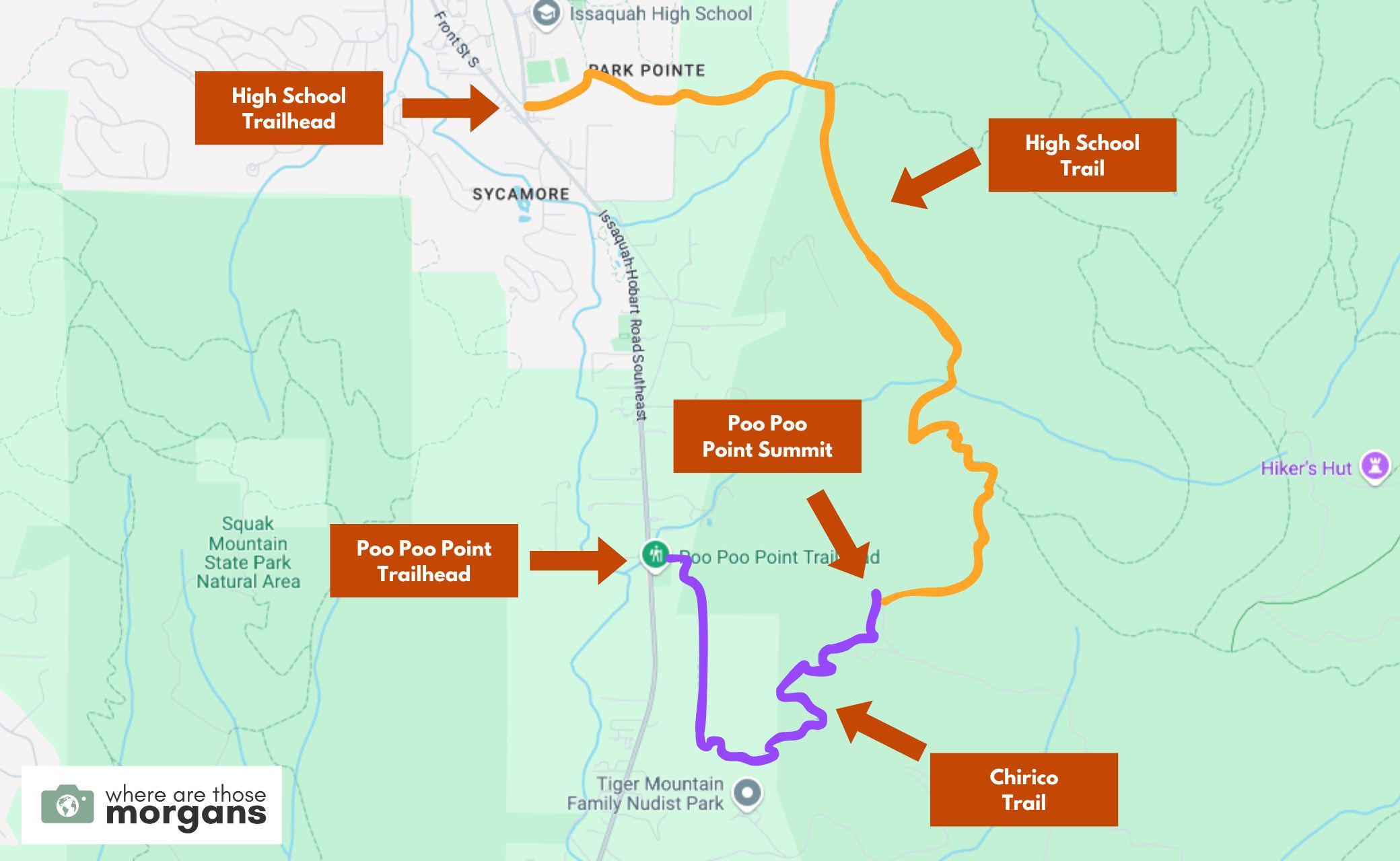
Map key:
- Purple – Chirico Trail
- Orange – High School Trail
As you can see in the map we created above, Chirico Trail is the shorter route to Poo Poo Point summit and High School Trail is a much longer route. The two trails have similar elevation gain, so Chirico Trail is steeper and High School Trail is more graudal.
Note: If you want to do the full loop, you can see on the map that you’d have to walk 1.5 miles on the busy Issaquah-Hobart Road.
Trail Walkthrough
Next, let’s walk through the trail exactly as we hiked it so you know what to expect.
1. High School Trail Ascent
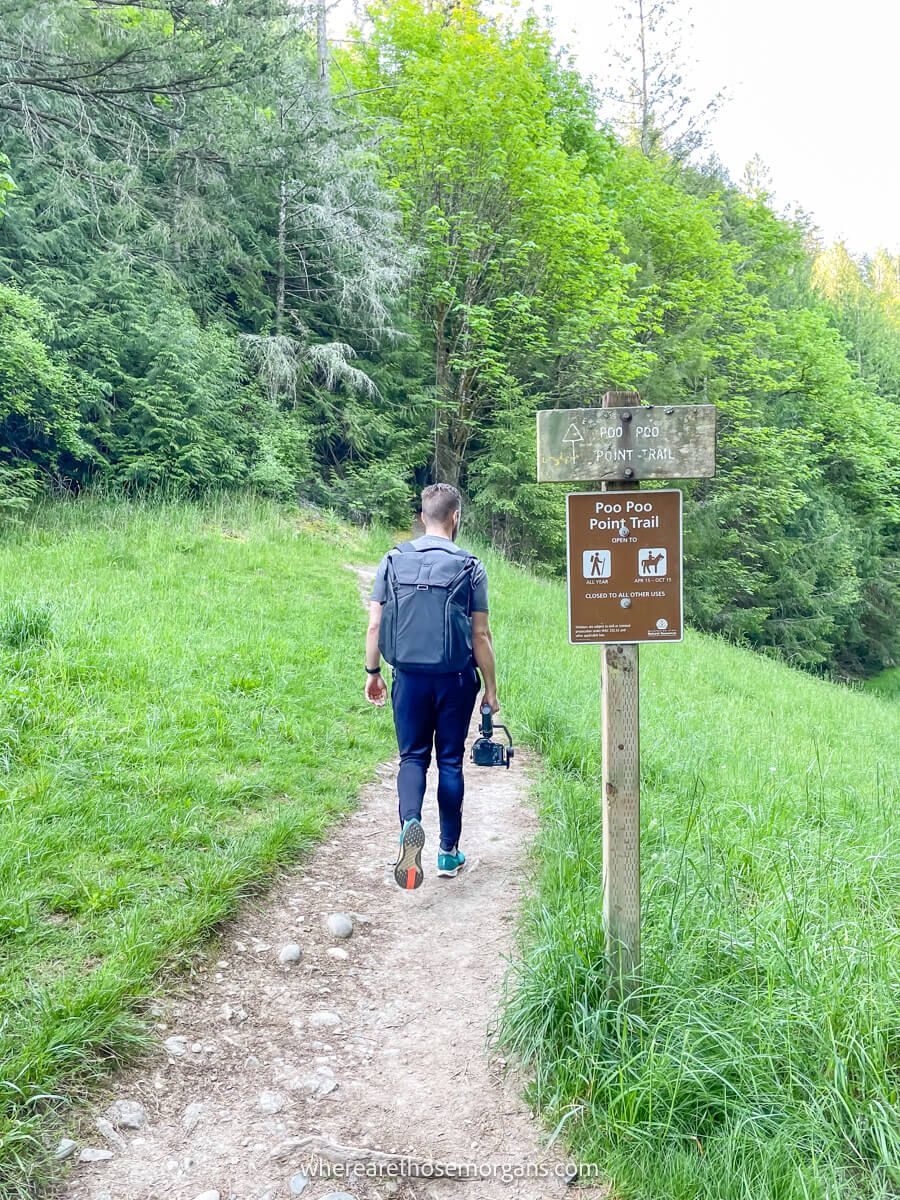
After arriving to a full Poo Poo Point Trailhead, we managed to snag a free spot at High School Trailhead. We walked along Rainier Trail for a few minutes before taking a right turn at the first fork. The narrow trail passed through light forest with tall trees and gained elevation gradually. Eventually the forest turned thicker with moss-clad trees and rocks, so it got more attractive later in the hike.
We crossed a few wooden bridges over creeks, hit a couple of short switchbacks and took a right turn at another fork heading for the summit. The trail didn’t change much until we finally arrived at a wide open dirt T-junction. We took a right turn and within a few seconds we’d arrived at the glider runway.
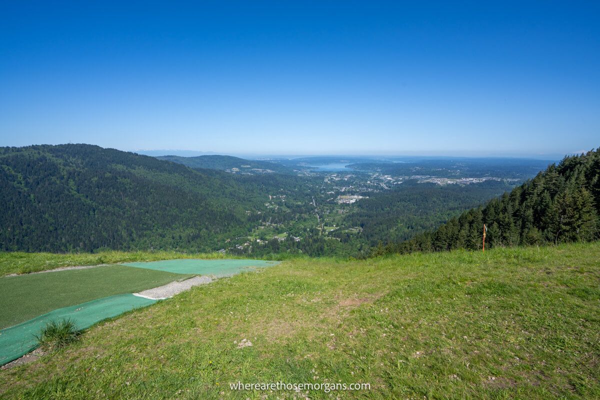
2. Poo Poo Point Summit
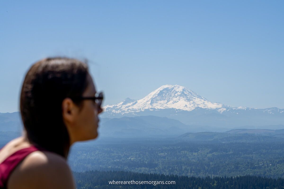
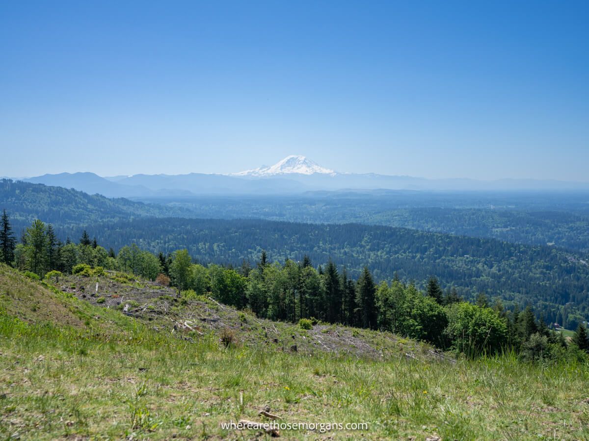
There were 15-20 hikers sat on various patches of grass eating lunch, enjoying the views and waiting for gliders to take off. The glider runway was artificial grass or astro turf, and it ran down a steep hill towards rolling hills, lakes and Issaquah. At the time we thought the view was okay, but nothing special. So we turned around and walked half a mile down Chirico Trail, and our impression quickly changed.
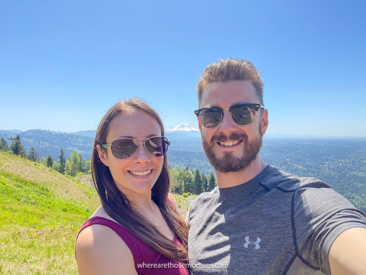
After walking through more dense forest, the trail suddenly opened up to far reaching and unobstructed views directly overlooking Mount Rainier, which dominated the skyline ahead to the south. Okay, now we get why this trail is so popular! So we pulled out our blanket, ate our lunch and took a bunch of photos (you really can’t get enough photos of Mt Rainier!).
Tip: There are restrooms at the summit, but not at the Mt Rainier facing viewpoint.
3. Chirico Trail Descent
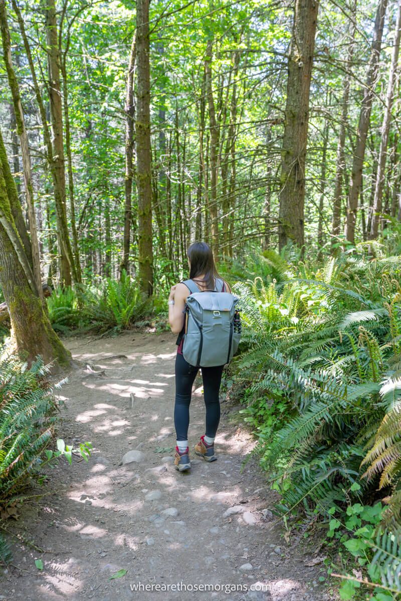
The descent took us around 45 minutes, but we like to go slower on the way down so we can really look around and enjoy nature. We saw lots of ferns glowing under sunlight, moss covered branches and even wildlife. Two things we instantly noticed were that Chirico Trail was much steeper and long stretches of the path were narrower. But it was very much the same type of forest scenery as our ascent.
After arriving back on flat ground, we read a sign saying look up for gliders landing on the path cutting through the field ahead. So we looked up and had to wait for a few to land before walking the path to reach Poo Poo Point Trailhead parking. But our car wasn’t there, and we had to walk 1.5 miles on the busy road to get back to our car at High School Trailhead. And it was the worst part of the hike.
Where To Eat And Stay
Most people treat Poo Poo Point as a standalone day hike. But here are the top rated places to eat and stay if you decide to take on more hikes around Issaquah, Squak Mountain or Tiger Mountain:
Restaurants:
- Breakfast – Issaquah Cafe
- Steakhouse – Jak’s Grill
- Food Truck Tacos – Xochi
- Sushi & Grill – Aji Sushi
Lodging:
- Budget – Motel 6
- Mid range – Hilton Garden Inn
- Mid range – SpringHill Suites
- Mid range – Homewood Suites
The Morgan Conclusion
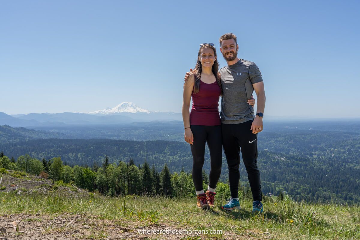
What we like: This is a classic Washington hike through picturesque forest leading to two far reaching vistas. The views of Mt Rainier are superb, and we think they’d be even better at sunrise or sunset. It’s also a very easy trail to access from Seattle and its surrounding urban areas, plus there’s a choice between hiking up a gradual or steep trail to the summit.
What we don’t like: Like most trails in the area, this hike can become extremely crowded on weekends and holidays. There’s quite a few parking spaces, but they fill early in the morning so finding somewhere to park can be a problem. We could hear road noise for most of the hike down Chirico Trail, and it would be great if a hiking path was created to connect the two trailheads for an easy way to do the full loop because the main road isn’t nice to walk along.
Is Poo Poo Point worth it? Yes, Poo Poo Point is definitely worth hiking! It’s a hugely popular day hike because it’s a good challenge without being too hard and it leads to a magnificent view of Mount Rainier. Also, it’s a family friendly and dog friendly hike so it’s really inclusive for most people. Overall, we think it’s a great trail for locals to try within the greater Seattle area.
More From Washington
- How to hike Rattlesnake Ledge Trail
- Top hikes in Mount Rainier
- How to hike Lake 22 Trail
- How to hike Mt Pilchuck Trail
- Hiking Wallace Falls State Park Trail
- How to visit Snoqualmie Falls
Want more Washington content? Head to our Washington Travel Guides to explore National Parks, popular day hikes and best things to do around Seattle.
We hope our Poo Poo Point hiking guide helps with planning your visit to Issaquah, Washington!
Please let us know if you have any questions in the comments below.
Happy Travels,
Mark and Kristen
Enjoy this guide? Pin it for later!
All Rights Reserved © Where Are Those Morgans, LLC. Republishing this article and/or any of its contents (text, photography, maps, graphics, etc.) in whole or in part is strictly prohibited.

Mark and Kristen spent 6 years traveling the world, visiting over 40 countries across 4 continents and more than 30 US states. They created Where Are Those Morgans in 2018 to help others plan the best possible vacations by writing authentic travel and hiking guides based on their real experiences.
Since the arrival of baby Maya in late 2024, Mark and Kristen’s extensive travels have slowed down but they still take plenty of trips. Where Are Those Morgans now helps millions of travelers each year to visit new places and hike new trails through information-packed blog posts and expert travel guidebooks. Read more about Mark and Kristen.