Skyline Trail is one of the most popular hikes in Mt Rainier and it’s among our personal favorites in Washington. We hiked the full loop and it was truly stunning from start to finish thanks to waterfalls, wildflowers, meadows and far reaching summit views over snow capped stratovolcanoes. Sounds pretty awesome, right? Trust us, it’s even better in person.
In this guide we explain everything you need to know about hiking the Skyline Loop Trail in Mount Rainier, based on our experiences. Read more about us.
When we lived near Seattle for 6 months in the summer of 2021, we hiked non-stop in Washington’s national parks and Cascade Mountains. But Mt Rainier was the one place we kept going back for more, there’s just something special about it. And the Skyline Trail was top of our bucket list.
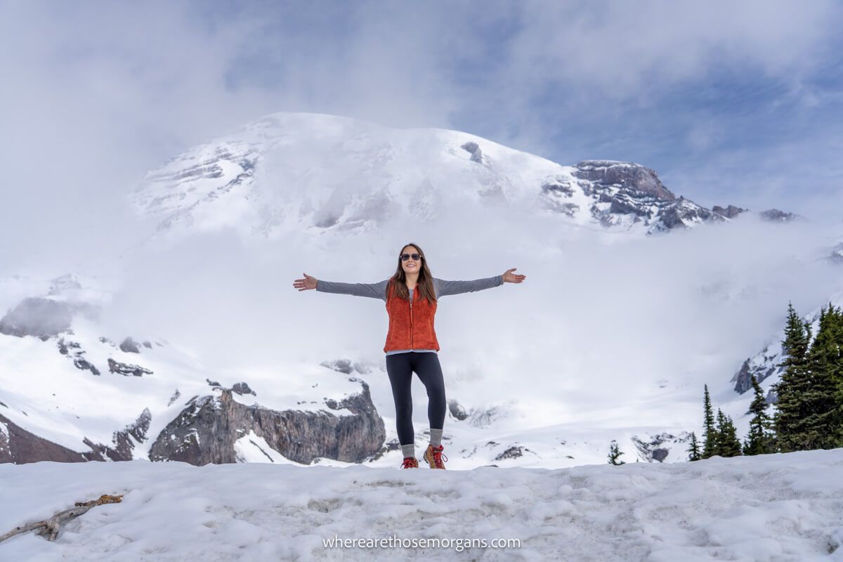
What we didn’t realize was that deep snow remains on the trail until well into July, so our first attempt in June was a total dud! The only people winning were downhill skiers. But we eventually timed it perfectly, setting off in a counter-clockwise direction at first light to beat the crowds. Our expectations were high, but this amazing trail easily surpassed them. Okay, let’s begin!
What You Need To Know
Okay, let’s dive right in. Here are the most important things you need to know about hiking Skyline Trail Loop:
- The full loop is a hard hike with steep elevation gain.
- You can choose either the “low” or “high” summit path.
- There are several spur trails to shorten the hike.
- The loop can be hiked clockwise or counter-clockwise.
- You don’t have to do a loop, there are out and back versions too.
- The trail is snow free mid-July through mid-October.
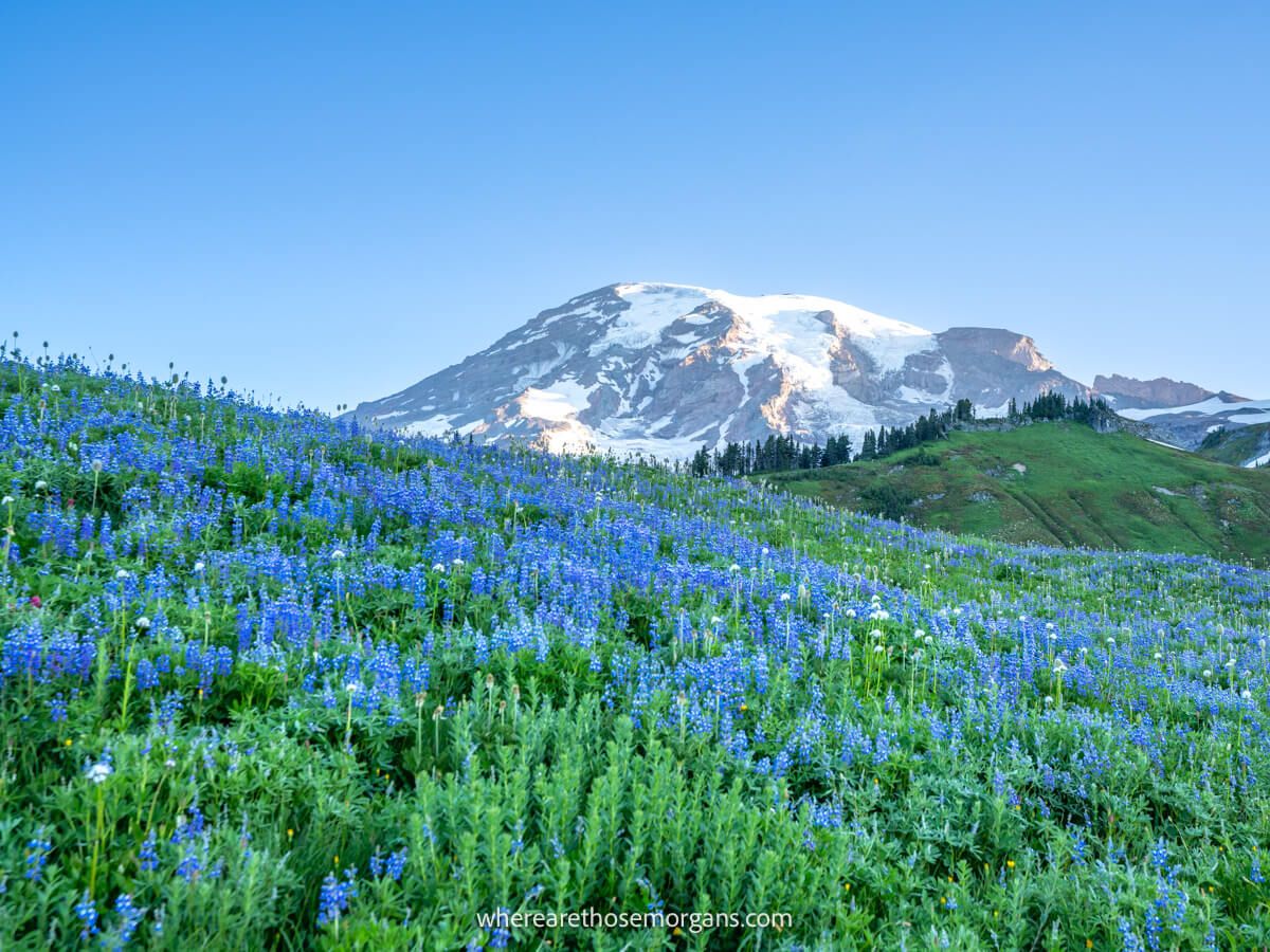
- Wildflower season is mid-July through mid-August.
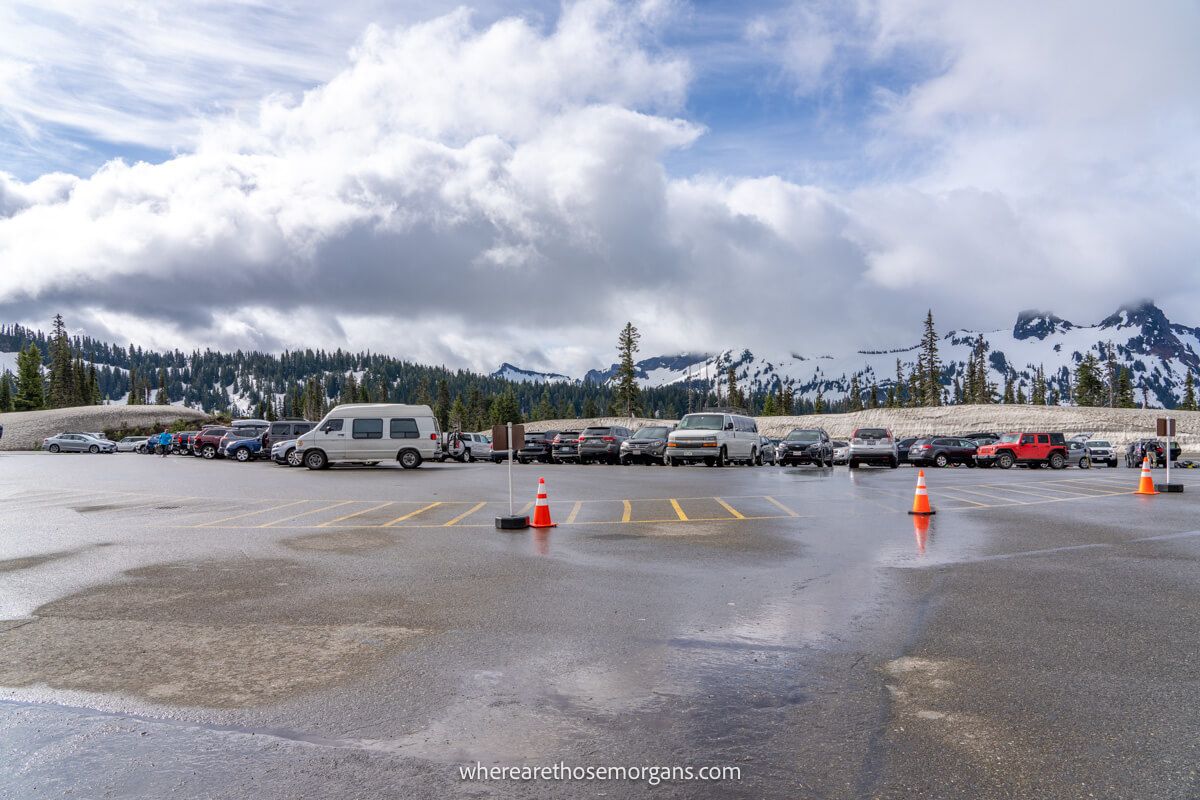
- There’s lots of parking but the lot frequently fills up.
- The trail is extremely busy in peak season.
- You don’t need specialist hiking gear.
- But wearing robust trail shoes is a good idea.
- Skyline Trail is not dog friendly.
Trail Statistics
- Distance: 5.5 miles roundtrip
- Type: Loop
- Elevation Gain: 1,700 ft
- Difficulty: Hard
- Time: 3-5 hours
- Trailhead: Jackson visitor center (Paradise)
Skyline Trail Trailhead Parking
Skyline Trail begins and ends at Jackson visitor center in the Paradise region of Mt Rainier National Park. It costs $30/vehicle for 7 consecutive days entrance to Mt Rainier, and you’ll pay at either Nisqually entrance (southwest) or Stevens Canyon entrance (southeast). Alternatively, you can use an America the Beautiful Pass to enter for free.
Nisqually entrance is more commonly used because it’s closest to Seattle, Tacoma, Portland and most other major urban areas. After entering the park, you’ll gain elevation until you reach 5,400 ft at the Paradise parking area which serves as Skyline Trail Trailhead.
Distances and average driving times from nearby cities:
- Seattle – 105 miles (2 hours 30 minutes)
- Bellevue – 102 miles (2 hours 30 minutes)
- Renton – 91 miles (2 hours 15 minutes)
- Everett – 129 miles (2 hours 55 minutes)
- Tacoma – 77 miles (1 hour 55 minutes)
- Portland – 156 miles (2 hours 55 minutes)
The thing we disliked most about hiking in Washington was the stress of getting parked at trailheads. We had issues at many other hikes in Mt Rainier, but Skyline Trail actually wasn’t too bad because it’s the park’s flagship hike so there were plenty of parking spaces available at the trailhead.
We recommend arriving before 7:30am to guarantee a spot. Once it’s full, you might have to wait a few hours for the early hikers to return. Lunch time onwards you shouldn’t have issues getting parked, unless it’s a busy weekend or holiday. Finally, surrounding the parking area you’ll find the Paradise Inn, the Henry M Jackson Visitor Center and public restrooms.
Trail Map
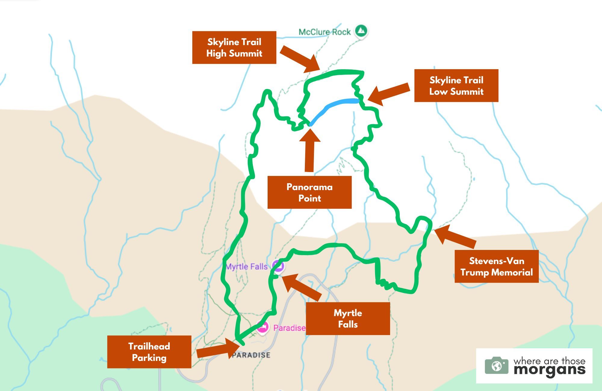
As you can see in the map we created above there are lots of spur trails and connecting trails around the loop, which can make things seem confusing. But trust us, you’ll have no issues following the correct loop path because it’s well signposted and very heavily trafficked. The only trail decision you have to make it whether to take the low summit (blue line) or high summit (staying on the green line).
Now, you can hike the loop in either direction:
- Clockwise – Steep ascent, gradual descent, better Mt Rainier views going up, busier.
- Counter-clockwise – Gradual ascent, steeper descent, much quieter.
We typically prefer to hike up steeper trails and down gradual trails, but we did the opposite on Skyline Trail. Why? Because clockwise is the most popular route and we wanted to avoid the crowds. And it worked like a charm! We didn’t see a single other hiker until we reached the summit ridge line.
Trail Walkthrough
Next, let’s walk through the trail exactly as we hiked it so you know what to expect.
1. Begin The Hike
After setting a horribly early alarm, we drove to Mt Rainier (with lots of coffee!) and parked as one of the only cars in the large Paradise lot. Then we grabbed our gear, used the restrooms and finally set off hiking at 6:00am. We chose to hike counter-clockwise, so we took a right turn at the T-junction and headed northeast for Myrtle Falls on a smooth, paved and accessible path.
2. Myrtle Falls
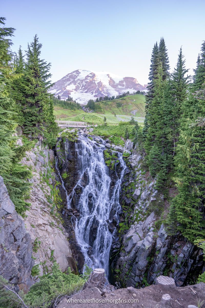
After walking just half a mile along the picturesque trail, we took a short but very steep spur path leading down to the right side. It turned left and opened up a postcard-worthy view of the 60 ft tall Myrtle Falls between rows of evergreen trees with the snow-capped Mt Rainier directly behind. And we had the whole thing to ourselves.
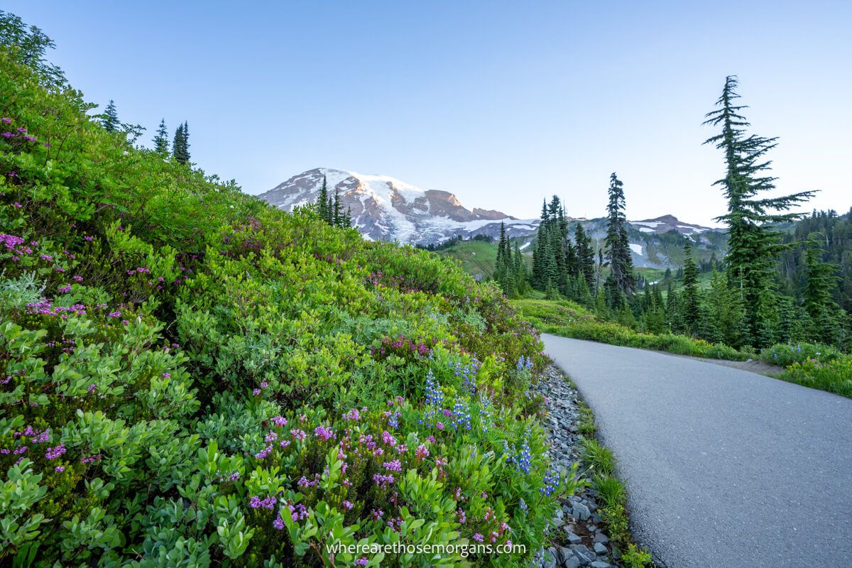
3. Climb Through Gorgeous Meadows
A wooden bridge crossing Edith Creek with immense Rainier views marked the end of the paved section. Less than a minute after the bridge we reached a fork in the path. Left was for Golden Gate Trail, but we wanted right for Skyline Trail. Next, we steadily climbed through lush meadows filled with a dozen varieties of wildflower spanning the color spectrum.
4. Stevens-Van Trump Historical Monument
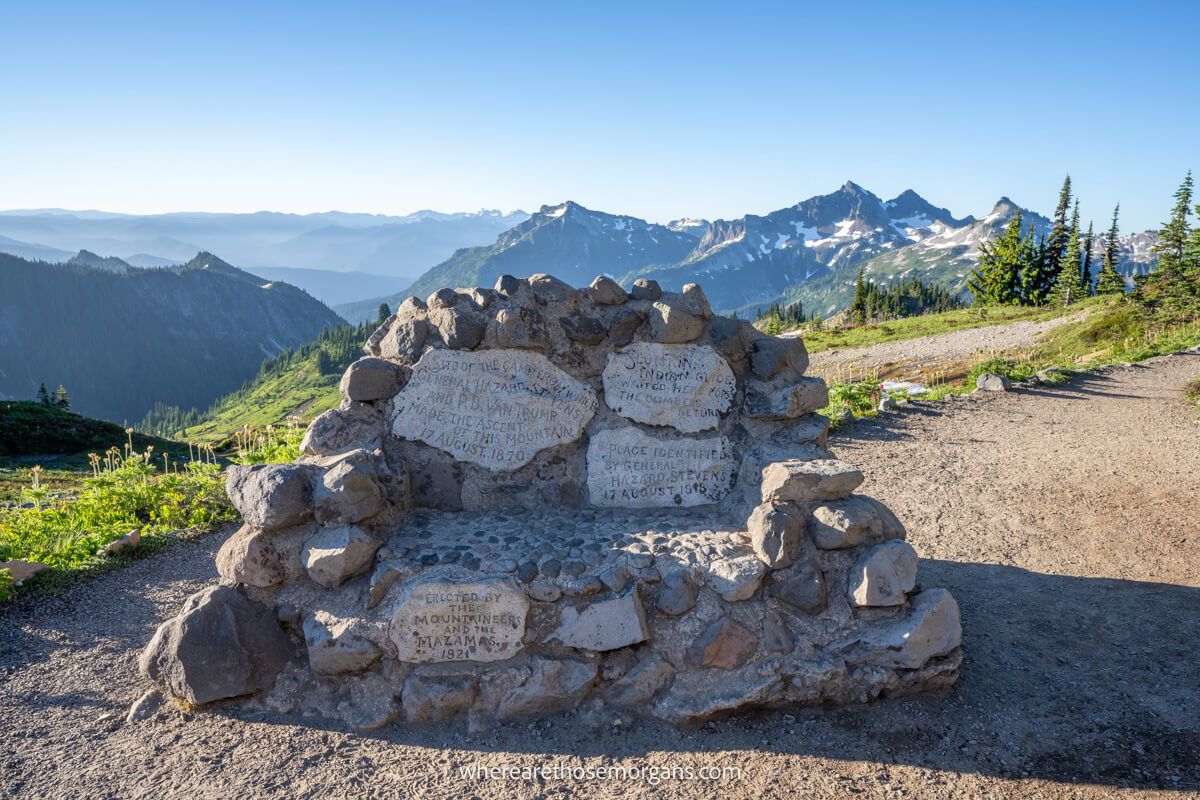
The next waterfall we passed was the 155 ft tall Sluiskin Falls but we couldn’t get a clear view from the path. By now mountain views behind were getting even better and the suns rays were finally beginning to warm us up. After 1.3 miles of sheer beauty, we reached Stevens-Van Trump Historical Monument, a small rock bench commemorating the guys who recorded the first ascent of Mt Rainier in 1870.
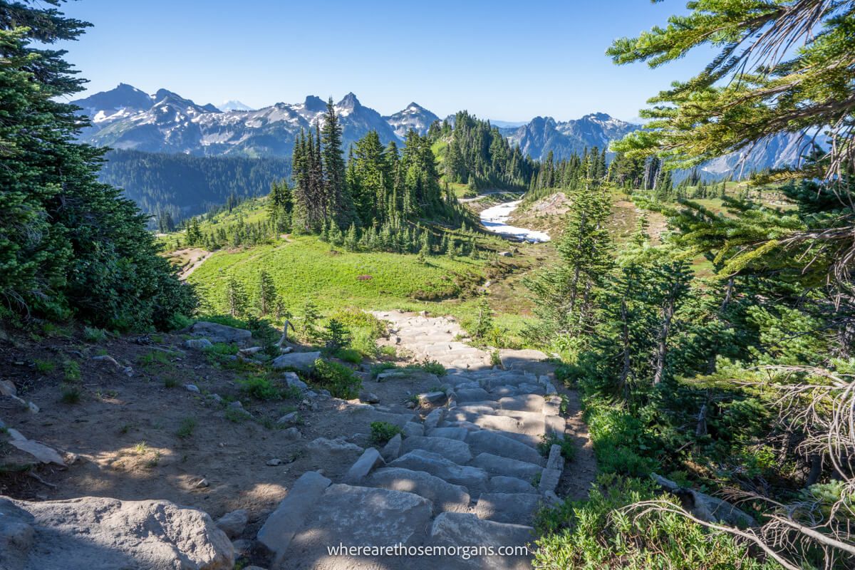
5. Long Climb To The Summit
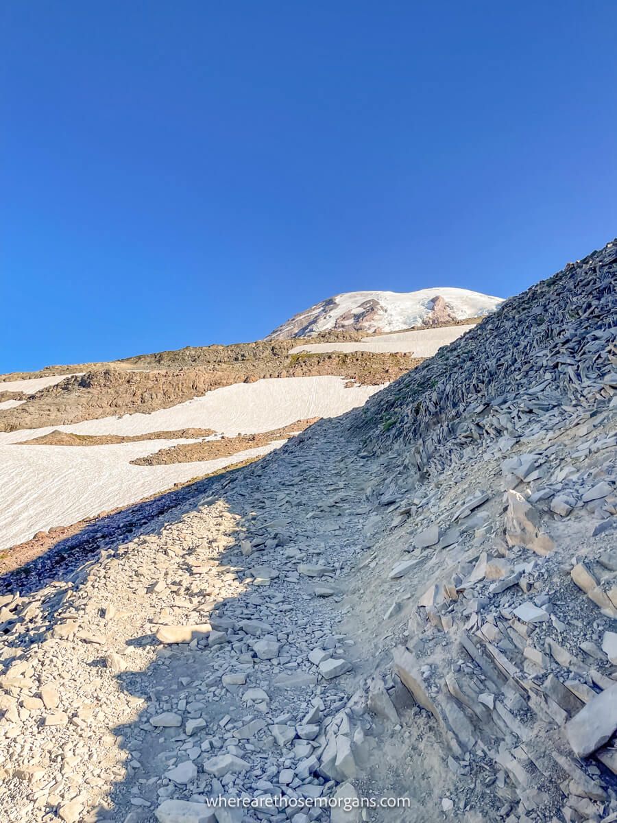
Next, we crossed a shallow section of the Paradise River using stones to keep our feet dry. Then we had to walk across a section of trail completely covered in snow and all of a sudden the rest of the climb was dusty, rocky and arid. It became a bit of a slog and it was way less attractive now. Eventually, we reached another fork for “low” and “high” Skyline. We took high and kept climbing.
6. Skyline Trail Summit
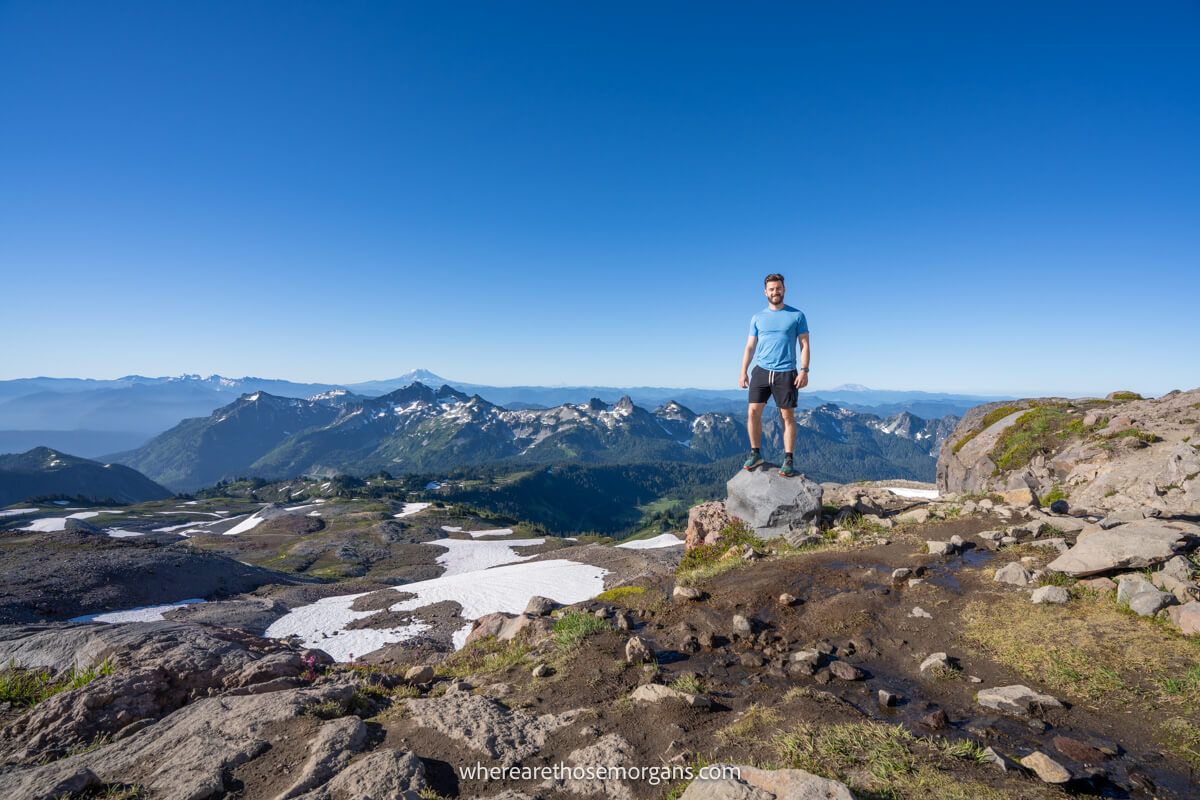
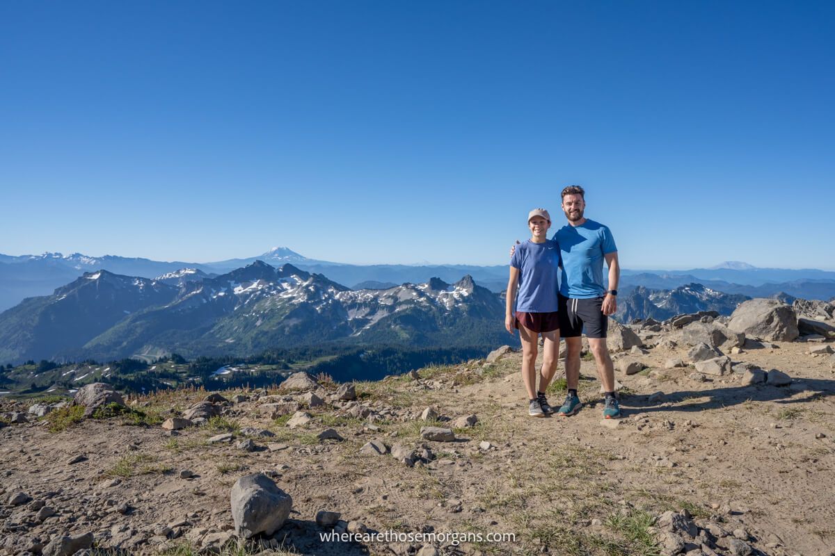
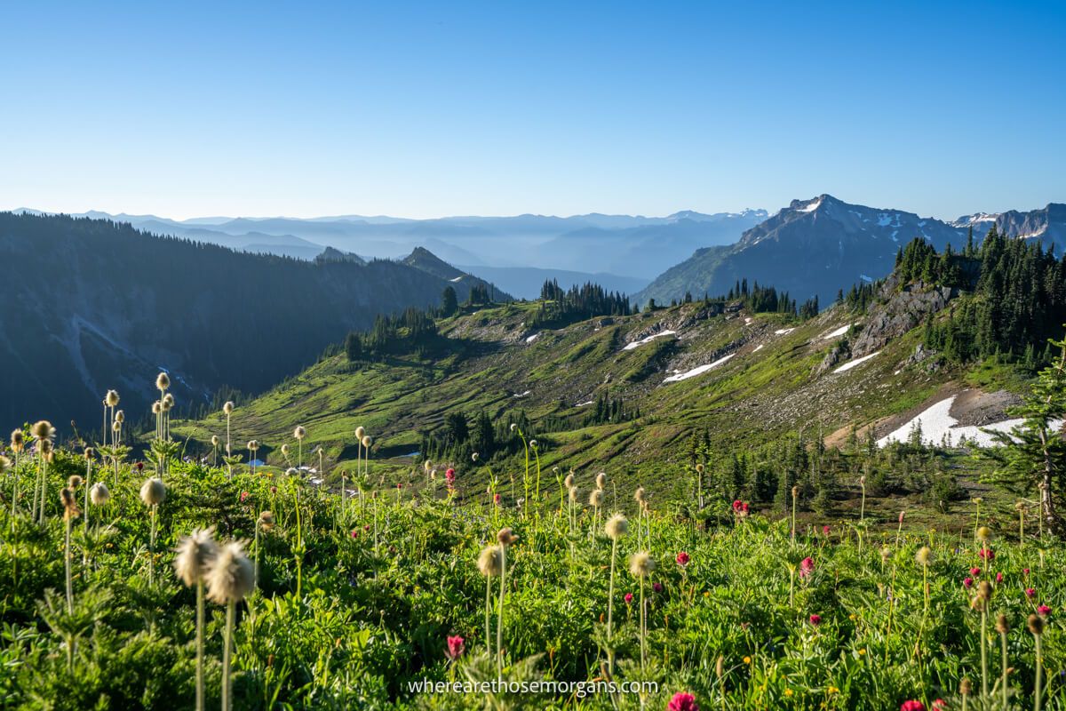
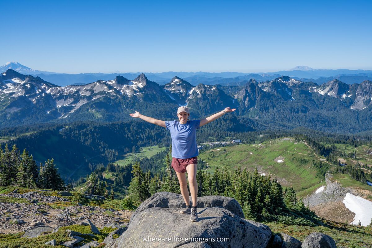
Not long after, we stopped gaining elevation and walked along a flat ridge line at the summit. We stopped at a rock pile which marked the unofficial summit of Skyline Trail, along with a few other hikers who had climbed the other side of the loop. The views over Mt Adams, Mt Hood and Mt St Helens among others were incredible. And behind us we were staring straight at the summit of Mt Rainier.
7. Panorama Point
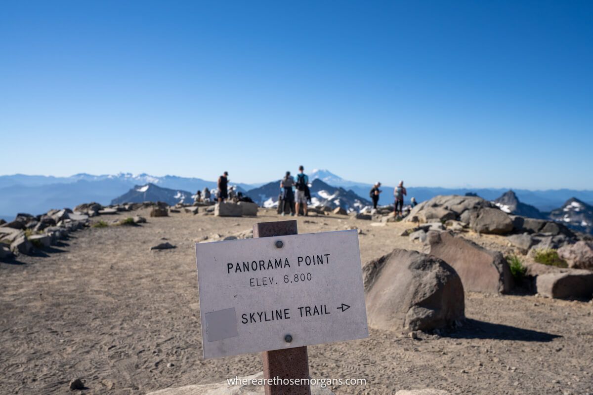
We noticed two spur trails leading up even higher but they were covered in snow and ice, and we didn’t have our crampons. So after enjoying the views, taking a ton of photographs and eating a light lunch, it was time to begin our descent. After hiking for around 10 minutes on the rocky, dusty and arid trail, we arrived at Panorama Point which is a popular out and back turnaround point with awesome views.
8. Steep Descent Into Paradise
We avoided the small, smelly vault toilet and cracked on with the next 1.7 miles of descent into Paradise. This route was way less attractive than the other side and it was getting so busy with bus loads of people. There were lots of spur paths that all rejoined the main trail further down, but we just stayed on Skyline the whole time and eventually arrived back to the parking lot at 10:30am.
The Morgan Conclusion
What we like: We’ve done a lot of travel around Washington and this hike was one of the most picturesque in the state. The mixed terrain, trail and views keep things interesting throughout, and the summit vista is incredible. If you time it right, wildflowers along the hike can be stunning.
What we don’t like: It’s one of the most popular hikes in Mt Rainier so parking and the trail itself can become unbearably busy, especially on weekends and holidays. The trail is only clear of snow for a few months each year, plus it takes a long time to reach from the greater Seattle area.
Is Skyline Trail worth it? Yes! Mt Rainier’s popular Skyline Trail is a truly special hike with stunning meadows, wildflowers, waterfalls and horizon-reaching snow capped volcano views. At 5.5 miles roundtrip with 1,700 ft elevation gain, it’s a great workout for strong hikers and the rewards are more than worth the effort!
We hope our guide to hiking Skyline Trail helps with planning your visit to Mount Rainier!
Please let us know if you have any questions in the comments below.
Happy Travels,
Mark and Kristen
Enjoy this guide? Pin it for later!
All Rights Reserved © Where Are Those Morgans, LLC. Republishing this article and/or any of its contents (text, photography, maps, graphics, etc.) in whole or in part is strictly prohibited.

Mark and Kristen spent 6 years traveling the world, visiting over 40 countries across 4 continents and more than 30 US states. They created Where Are Those Morgans in 2018 to help others plan the best possible vacations by writing authentic travel and hiking guides based on their real experiences.
Since the arrival of baby Maya in late 2024, Mark and Kristen’s extensive travels have slowed down but they still take plenty of trips. Where Are Those Morgans now helps millions of travelers each year to visit new places and hike new trails through information-packed blog posts and expert travel guidebooks. Read more about Mark and Kristen.
this article is very useful, thank you for making a good article
Thanks, Zidane. Hope you enjoy the hike!