Bench and Snow Lakes Trail is one of those borderline hidden gem hiking trails in Mt Rainier because it’s got all the hallmarks of a great hike but without the crowds you’ll find in Paradise and Sunrise. We had no idea what to expect, but it turned out to be a fun and picturesque trail with great views and we had it all to ourselves.
In this guide we explain everything you need to know about hiking Bench and Snow Lakes Trail in Mount Rainier, based on our experiences. Read more about us.
We visited Mt Rainier 5 different times when we lived near Seattle for 6 months in the summer of 2021. It was one of our favorite places to visit in Washington State. The famous Skyline Loop Trail was naturally top of our wishlist, but we also wanted to find some lesser known trails. And the Bench and Snow Lakes hike certainly scratched our lesser known trails itch.
We’d already been to Tipsoo Lake on the Naches Peak Loop Trail for sunrise and hiked a few other trails in the morning, before driving up Stevens Canyon Road and parking at the small trailhead. Our hike was peaceful, easy and didn’t take long to reach both lakes before heading back in late afternoon. The major downside? Bugs. They were so bad on this trail at the end of July. Okay, let’s begin!
Note: Our content is reader supported and contains affiliate links. If you make a purchase through one of these links, we may earn a small commission at no extra cost to you and it helps us keep this site running.
What You Need To Know
Okay, let’s dive right in. Here are the most important things you need to know about hiking Bench and Snow Lakes Trail:
- It’s on the easier end of moderately difficult.
- The trail is snow free mid-July through mid-October.
- Wildflowers are best here mid-July through mid-August.
- Parking is a roadside lot on Stevens Canyon Road.
- You don’t need specialist hiking gear.
- But wearing robust trail shoes is a good idea.
- The trail is equal parts covered and exposed.
- There are no restrooms in the parking lot.
- But there’s a vault toilet near Snow Lake.
- Don’t forget a swimsuit for the lakes on a hot day.
- Steven Canyon Road closes in winter.
- Check live road conditions before setting off.
- The trail is horrendously buggy at the end of July.
- Bench and Snow Lakes Trail is not dog friendly.
Trail Statistics
- Distance: 2.5 miles roundtrip
- Type: Out and back
- Elevation Gain: 700 ft
- Difficulty: Easy/moderate
- Time: 2 hours
- Trailhead: Stevens Canyon Road
Trailhead Parking
Bench and Snow Lakes Trailhead is located on Stevens Canyon Road just 3 miles east of Paradise Loop Road on the south side of Mt Rainier. The parking area is a small half-moon shape with space for a maximum of 20 cars. Now, although this is a lesser known hike, it doesn’t take much to fill the parking lot and there’s no backup parking area at all.
It costs $30/vehicle for 7 consecutive days entrance to Mt Rainier, and you’ll pay at either Nisqually entrance (southwest) or Stevens Canyon entrance (southeast). Alternatively, you can use an America the Beautiful Pass to enter for free.
Distances and average driving times from nearby cities:
- Seattle – 111 miles (2 hours 25 minutes)
- Bellevue – 103 miles (2 hours 25 minutes)
- Renton – 95 miles (2 hours 15 minutes)
- Everett – 130 miles (2 hours 50 minutes)
- Tacoma – 78 miles (1 hour 55 minutes)
- Portland – 156 miles (2 hours 55 minutes)
Trail Map
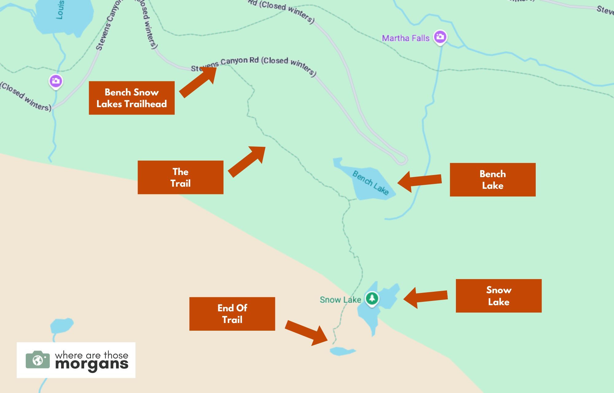
As you can see in the map we created above, after parking on Stevens Canyon Road you’ll hike to Bench Lake and then Snow Lake before reaching the end of the trail. It’s not a typical gain elevation then lose elevation type of hike, it’s more of an undulating up-down-up-down trail.
Trail Walkthrough
Next, let’s walk through the trail exactly as we hiked it so you know what to expect.
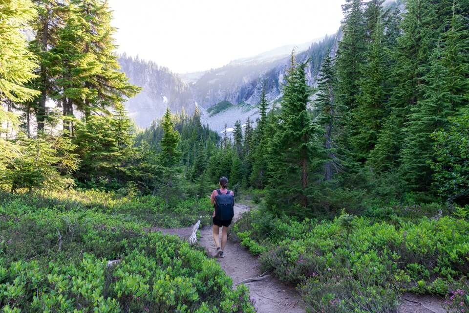
1. Begin The Hike
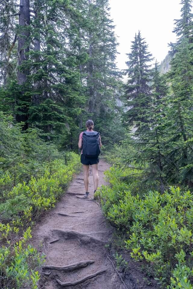
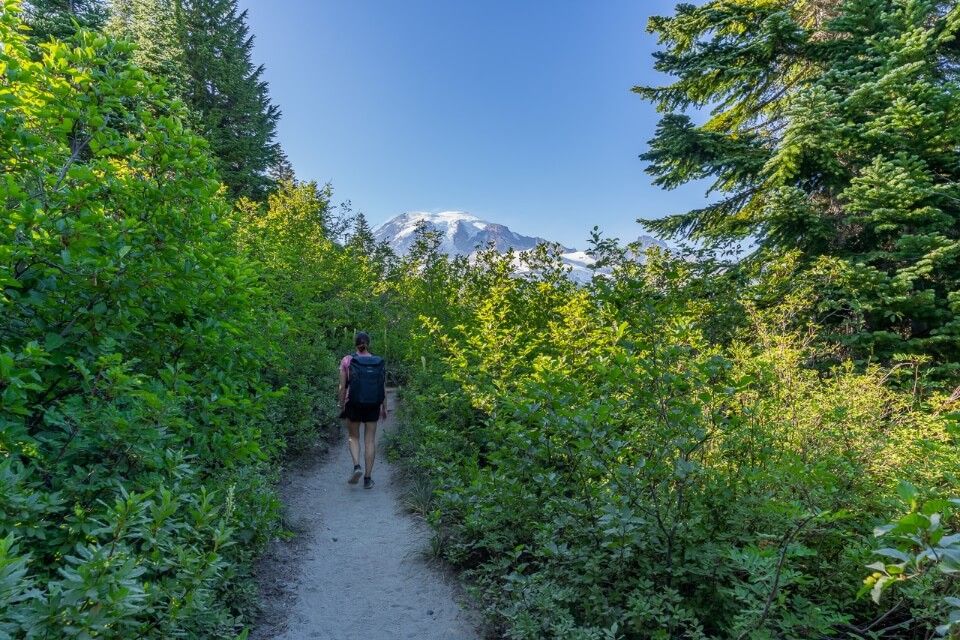
After parking in the small lot at around 5:00pm on a hot day near the end of July, we grabbed our gear and walked to the east side of the parking area to begin our hike. We immediately started climbing on a gradual slope before leveling out and cutting through a sea of gorgeous green meadows, shrubs and trees.
2. Bench Lake Overlook
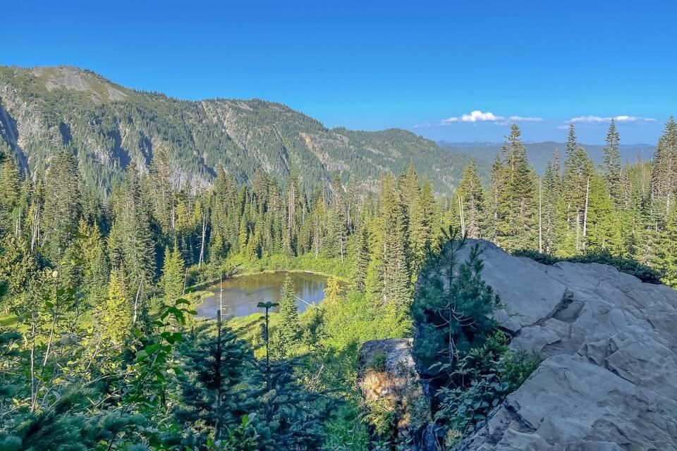
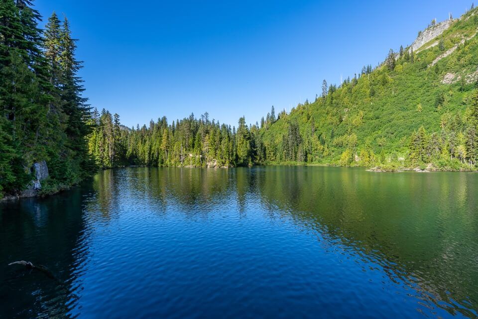
After just 0.5 miles walking on soft and bouncy packed dirt, we reached a small rocky ledge which opened up elevated views over the smaller northwest part of Bench Lake. It didn’t look like much from the overlook, but it was larger than it appeared and it had an incredibly photogenic secret up its sleeve.
3. Steep Trail To Bench Lake
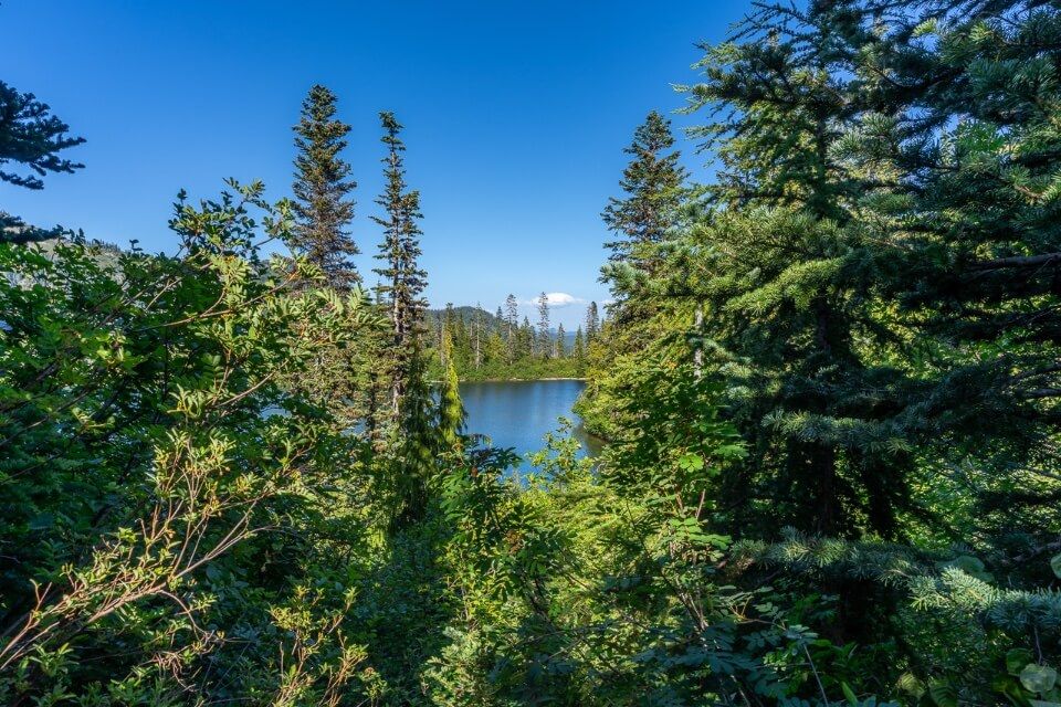
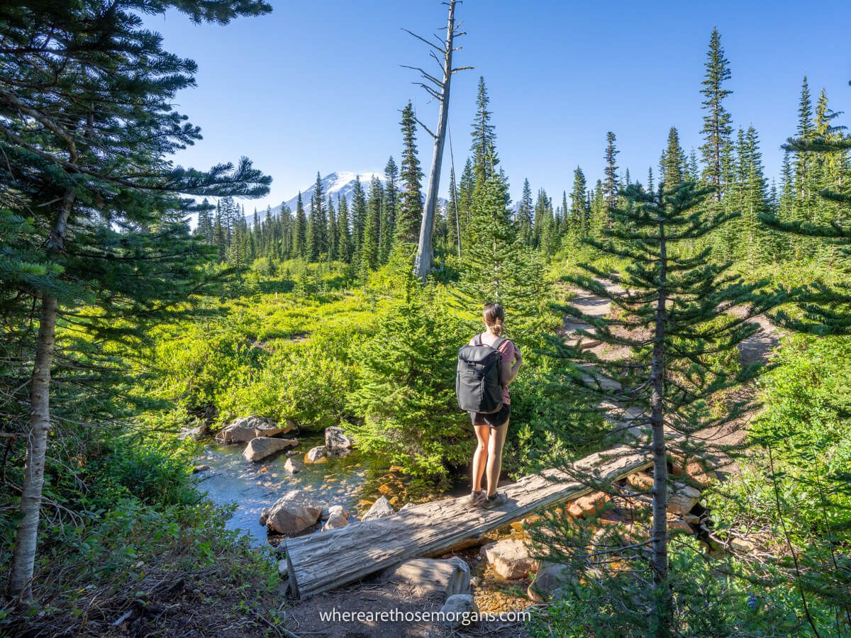
A further 0.25 miles along we reached a fork in the path and took the left turn for Bench Lake. The path was actually pretty steep and sketchy with shrubs and bushes protruding out into the trail, so we had to protect our eyes. There was a small beach-like area, but we walked beyond it to a clear viewpoint looking directly at Mt Rainier. But the bugs were terrible so we didn’t stay long at all!
4. Back On The Trail
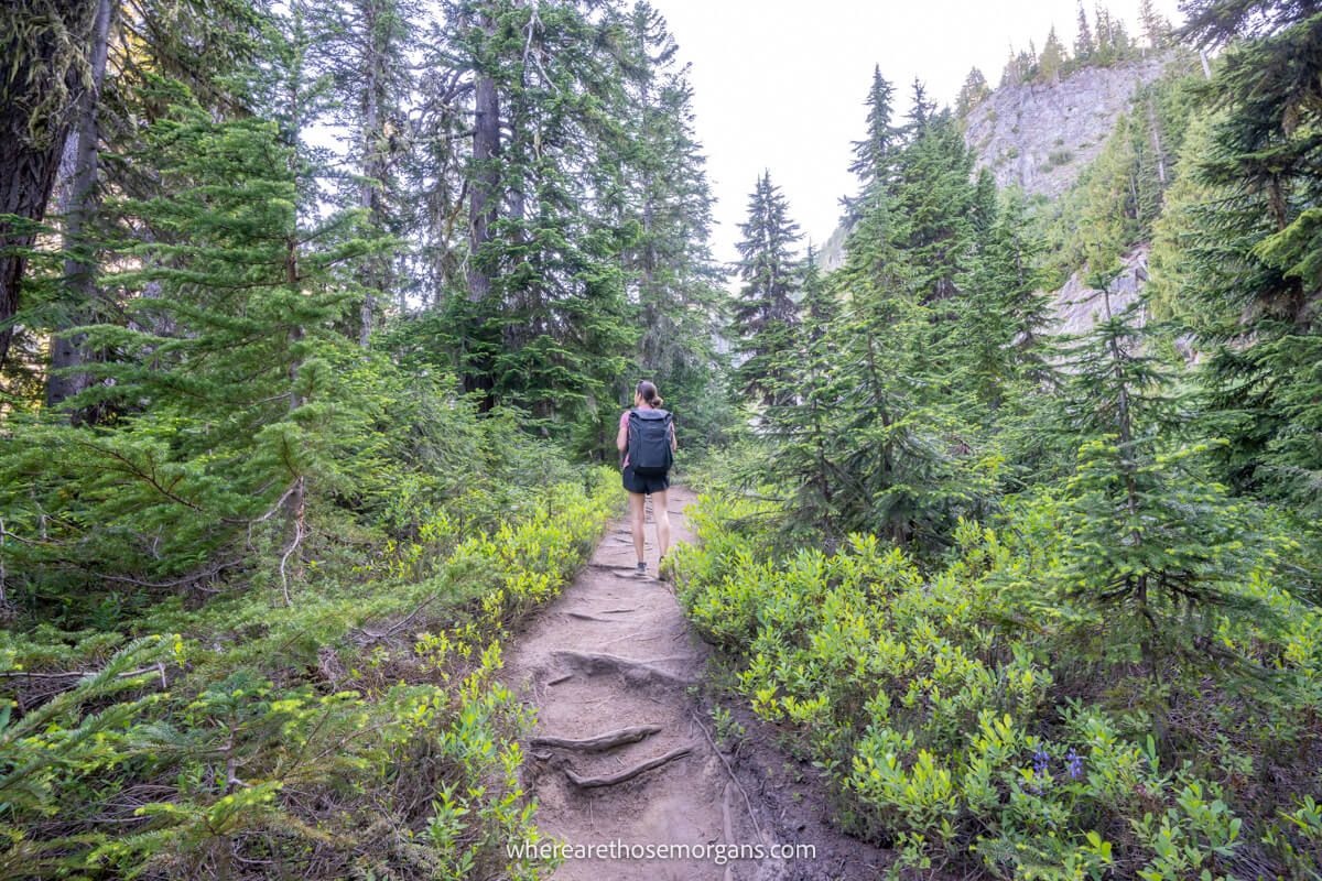
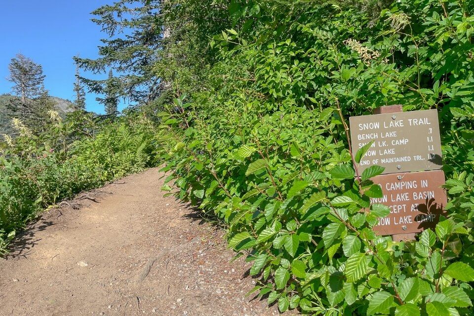
We climbed back up the steep and sketchy bank because there was no other route to the main trail. Then we took a left turn heading for Snow Lake. After 0.25 miles hiking through more meadows and climbing more thigh-burning steep and dusty banks we arrived at yet another fork. Left was to a vault toilet and two tent camping spots, but we took the right leading to Snow Lake.
5. Snow Lake
The path to Snow Lake overlook was flat and easy, and we saw two or three people swimming in the lake when we arrived. We keep mentioning bugs and we hope you don’t suffer the same as we did, but we had to move away from the water as soon as possible so we didn’t stay here long either. Seriously, no amount of bug spray was stopping the relentless swarm.
6. Unicorn Peak
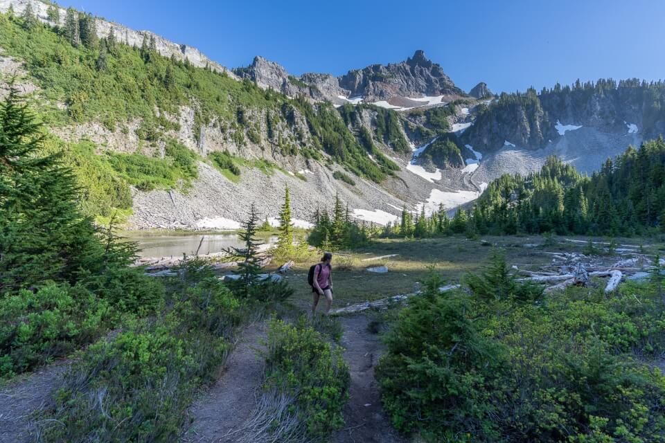
We continued walking a further 0.25 miles southwest from Snow Lake until we reached one final small body of shallow water at the base of a towering cliff. A sign read “end of maintained trail” but we didn’t really need to sign to figure that one out for ourselves! Looking up at the cliffs we tracked across until seeing what looked like a horn, and that was Unicorn Peak standing at 6,972 ft elevation.
7. The Return Journey
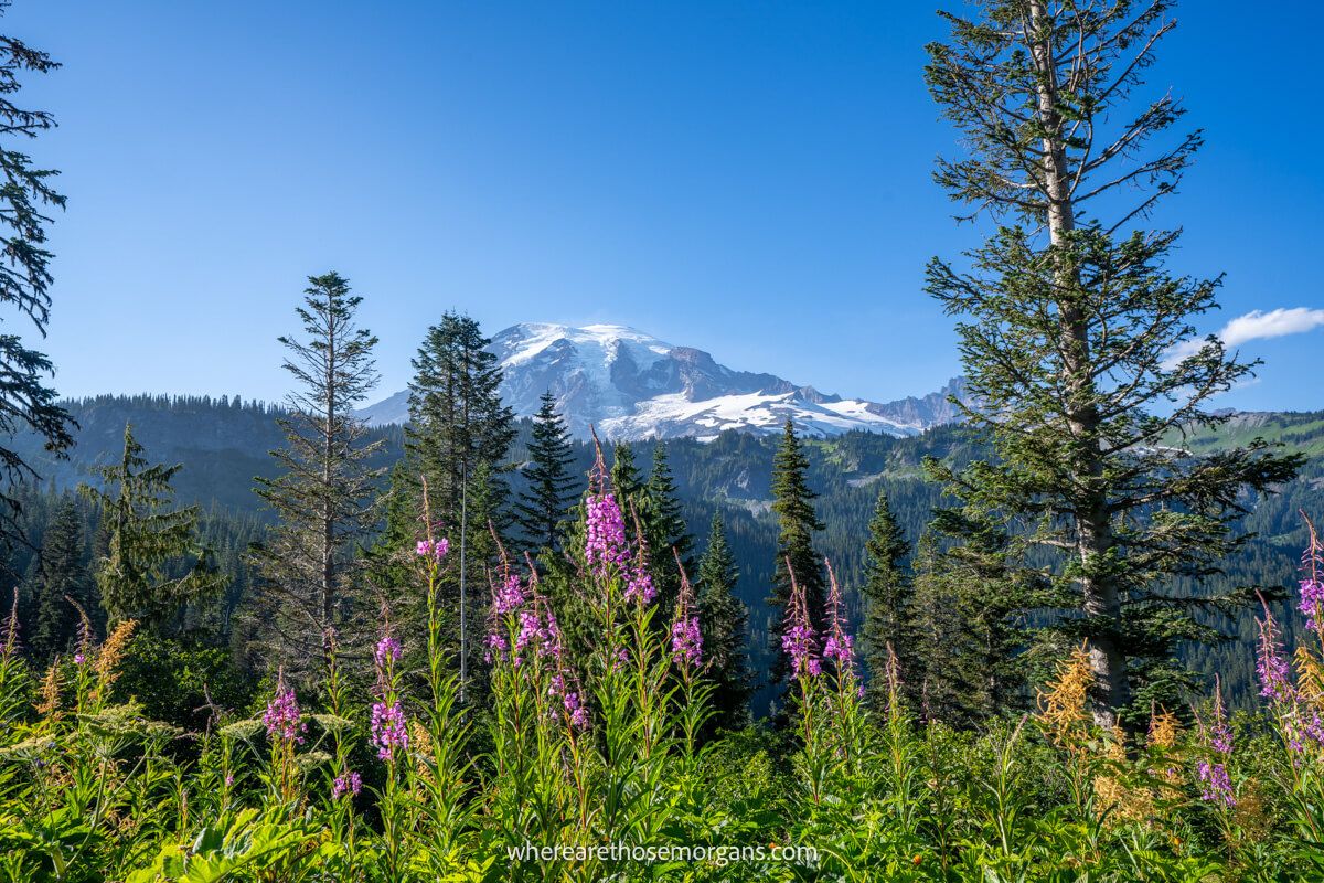
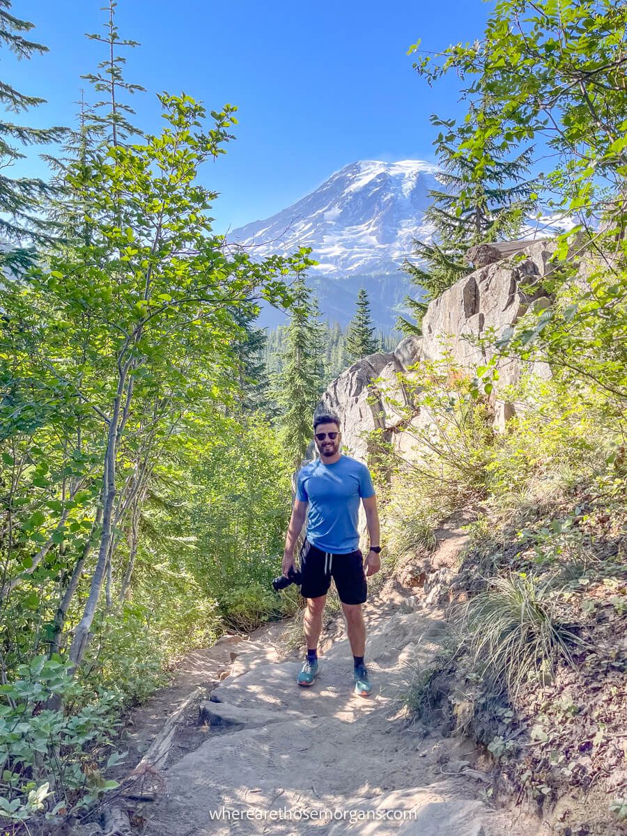
The return journey was quick and easy, but the best part was having non-stop Mt Rainier views the entire way back to the parking lot. Short but steep rocky steps with exposed tree roots were the only thing that slowed us down, but we barely noticed it because the views ahead were awesome. We barely saw anyone else the whole hike, which was a stark contrast to most other trails in the park.
The Morgan Conclusion
What we like: It’s a nice, easy and family friendly hike with meadows and lakes. Plus, it would have been even better a few weeks later with peak wildflowers. The trailhead is close to Paradise, so it’s easy to access from the most popular region. But the best part was how quiet the trail was compared to others in the park.
What we don’t like: Our major downside with this hike was bugs. We’d have liked to swim in the lakes and enjoy the view over Mt Rainier from Bench Lake but we were being eaten alive. The spur trail leading to Bench Lake was also surprisingly tricky and parking was limited.
Is Bench and Snow Lakes Trail worth it? Yes! Bench and Snow Lakes Trail is a fantastic lesser known hike in Mt Rainier. It’s short, easy, scenic and isn’t overcrowded. You can swim in two lakes, see wildflowers and enjoy north facing views over the snow capped volcano so it’s well worth adding to your itinerary.
We hope our guide to hiking Bench and Snow Lakes Trail helps with planning your visit to Mount Rainier!
Please let us know if you have any questions in the comments below.
Happy Travels,
Mark and Kristen
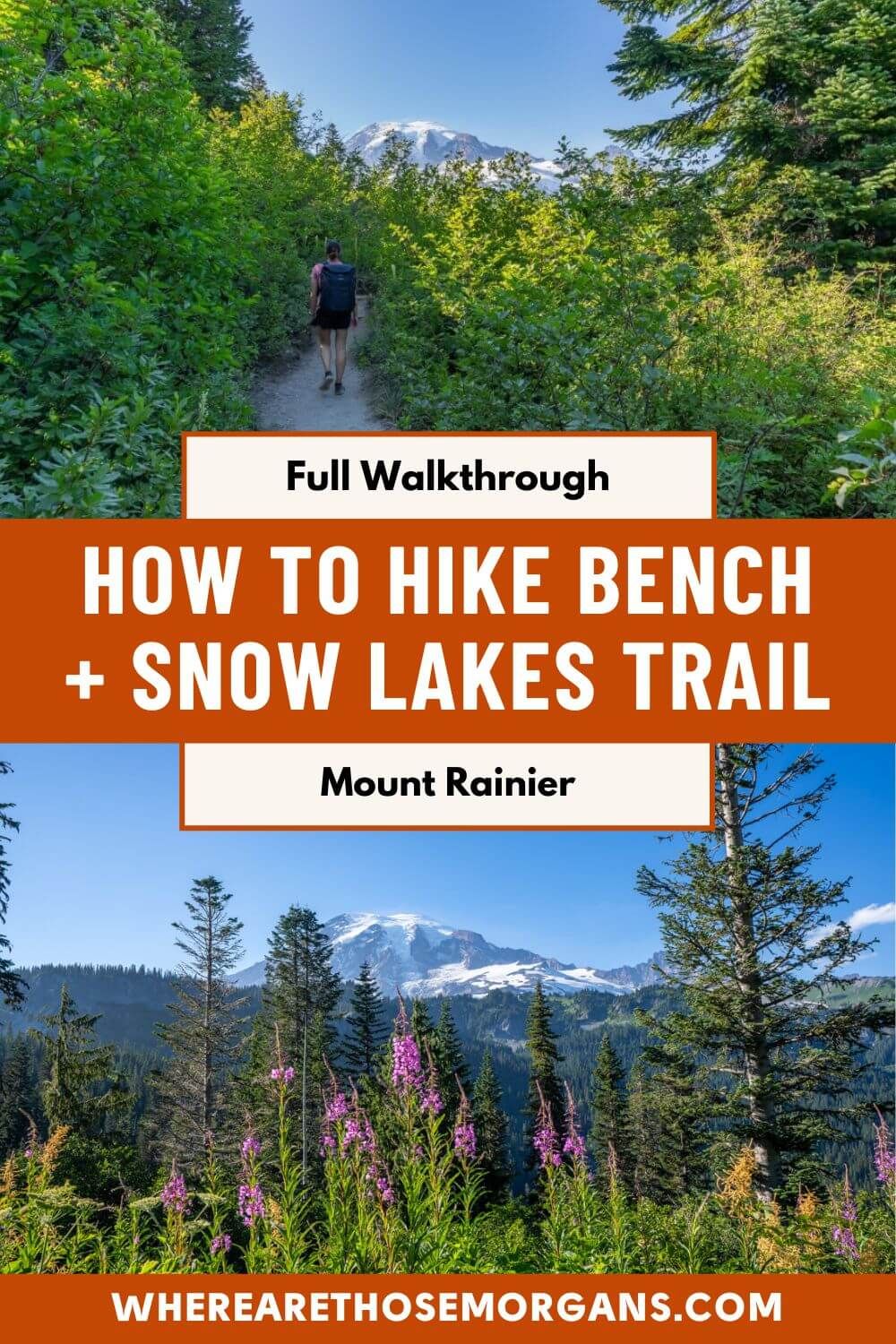
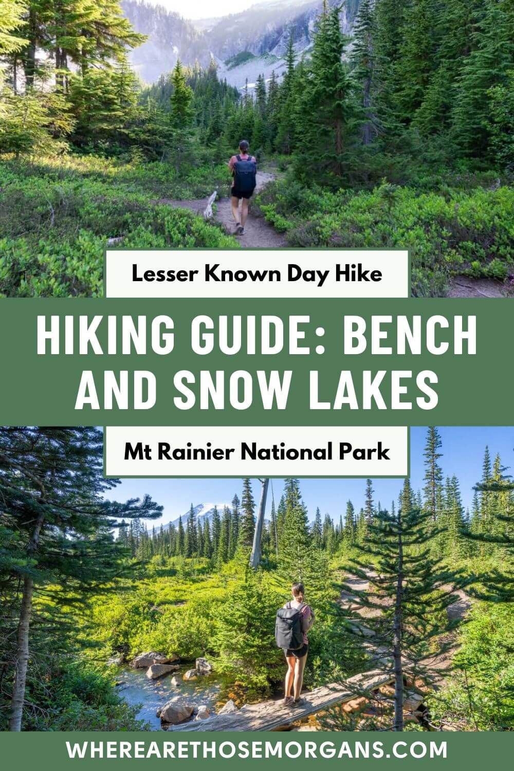
Enjoy this guide? Pin it for later!
All Rights Reserved © Where Are Those Morgans, LLC. Republishing this article and/or any of its contents (text, photography, maps, graphics, etc.) in whole or in part is strictly prohibited.

Mark and Kristen spent 6 years traveling the world, visiting over 40 countries across 4 continents and more than 30 US states. They created Where Are Those Morgans in 2018 to help others plan the best possible vacations by writing authentic travel and hiking guides based on their real experiences.
Since the arrival of baby Maya in late 2024, Mark and Kristen’s extensive travels have slowed down but they still take plenty of trips. Where Are Those Morgans now helps millions of travelers each year to visit new places and hike new trails through information-packed blog posts and expert travel guidebooks. Read more about Mark and Kristen.