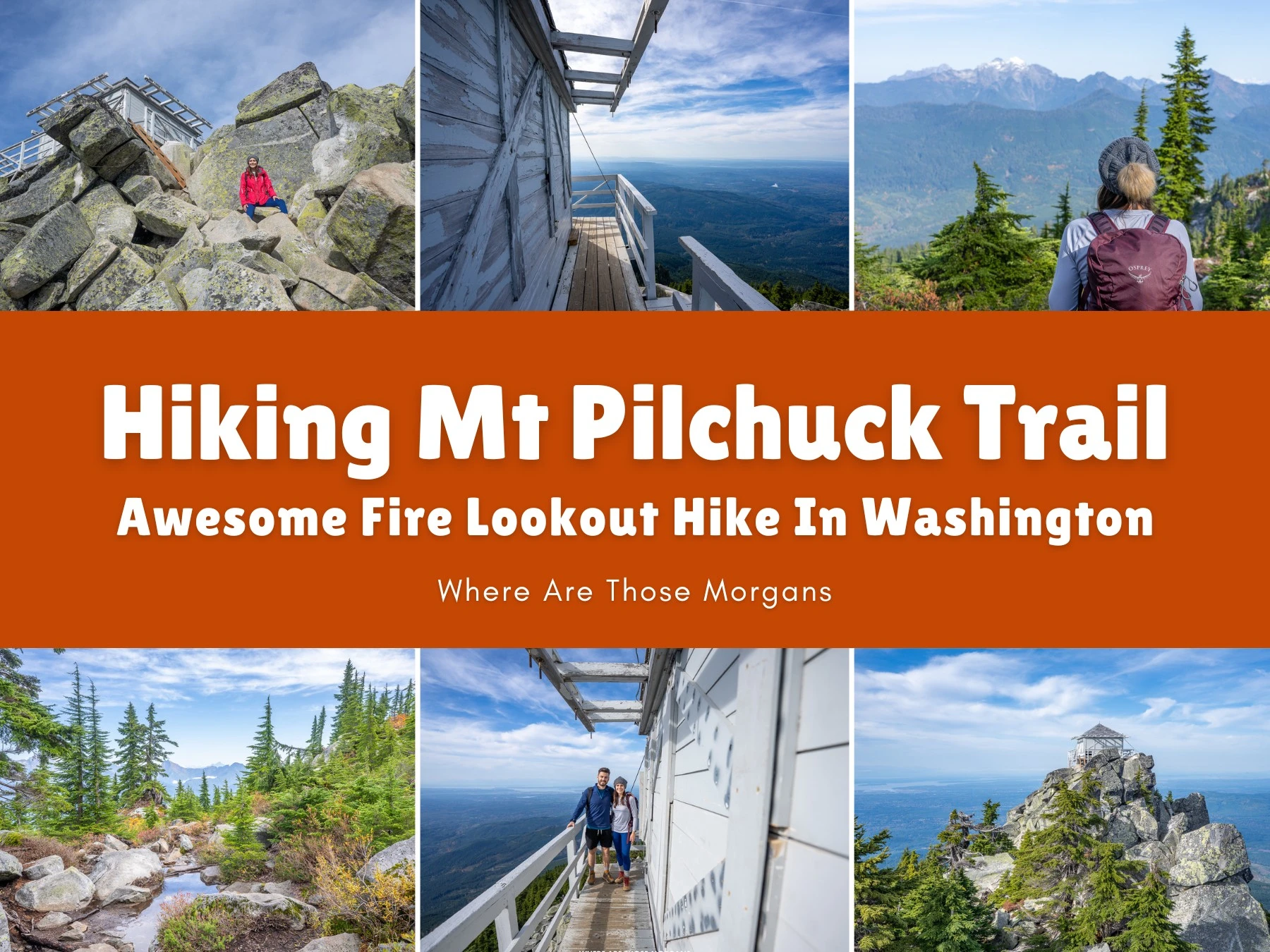
Outside of Washington’s three national parks, we’d say Mt Pilchuck was one of the trails we were most looking forward to hiking during the 6 months we lived near Seattle in 2021. After spending the late spring and summer ticking off countless amazing hikes in the Cascade Mountains, including the nearby Lake 22 Trail, we finally got around to hiking Mount Pilchuck on October 19th. We left it until later in the season to avoid the summer crowds, and it was the right call, we saw very few other hikers and had the fire lookout entirely to ourselves.
Our alarm went off super early, we threw a bunch of coffee down, ate massive bowls of oatmeal, drove to Granite Falls in the dark, and arrived at the beginning of a truly dreadful pot-hole filled 7-mile road leading up to Mt Pilchuck Trailhead as daylight broke. Honestly, the road looked like Swiss cheese, but it has since been graveled and is perfectly accessible for all cars. The slow rocking and rolling was annoying, but once we finally got out the hike was fantastic. Steep and rocky, but super scenic and a great workout.

Hi, we’re Mark and Kristen Morgan. We left our scientific careers in 2018 to become travel writers and photographers, and since then our expert guides have helped millions of travel planners take better trips. Read more about us.
Why trust us with your Mt Pilchuck hike? We spent 6 months hiking countless trails in Washington and Mount Pilchuck was one of our favorites. As always, every photo in this guide is ours.
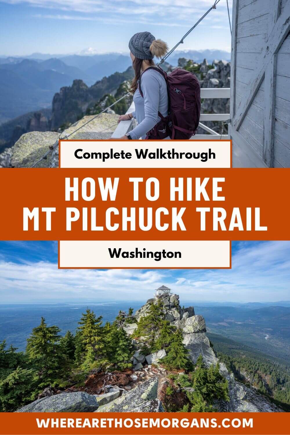
We took the gentle forest and steep boulder sections slowly so we could appreciate the whole hike and not just the summit, which we knew would be awesome. Then we eventually arrived at Mt Pilchuck fire lookout tower around 10:00 AM, and we had the summit to ourselves. Not just the fire tower with 360-degree views, but also the rocky ridge nearby which Mark climbed up and captured some of our favorite hiking photos from Washington. Our Gaia GPS app clocked us in close to 5.5 miles with around 2,250 feet elevation gain in total.
In this guide we explain everything you need to know about hiking Mt Pilchuck Fire Lookout Trail in Washington’s Cascade Mountains, based on our own experience. Let’s dive in!
Note: Our content is reader supported and contains affiliate links. If you make a purchase through one of these links, we may earn a small commission at no extra cost to you and it helps us keep this site running.
Need a hand planning your trip to Washington? We help independent travelers plan better, stress-free trips. Join a video call with Mark and we’ll build the perfect itinerary for your style, budget and priorities. See our travel planning help.
Trail Map & Hiking Stats

Map Key
- Red line: Hiking trail
- Purple line: Road to trailhead
Hiking Statistics
- Distance: 5.5 miles round trip
- Elevation gain: 2,250 feet
- Time: 4-5 hours
- Difficulty: Hard
At the time of our most recent update to this guide, Mt Pilchuck scores 4.8 / 5 on AllTrails and 4.6 / 5 on WTA. We hiked a lot of trails across Washington’s national parks and everywhere in-between, and relatively speaking for the area we’d personally lean closer to AllTrails score of 4.8. It was challenging but not too long, it had varied terrain to keep us interested, and the summit views were a magnificent payoff.
AllTrails also has the difficulty listed as hard, which we can’t argue with. At 5.5 miles round trip, it really wasn’t a long hike. But the gradient was steep for most of the trail and there were some boulder sections to navigate. Plus, at the very top, the climb up to the fire lookout tower was pretty vertigo-inducing. It took us 2 hours to get up, we spent 45 minutes at the top, and it took us 1 hour 45 minutes to get back down. So our total time car to car was around 4 hours 30 minutes.
Our Trail Walkthrough
Here’s a step-by-step walkthrough of our hike with photos we took along the route:
Driving To Mt Pilchuck Trailhead

When we hiked Mt Pilchuck in 2021, the trail itself wasn’t the hardest part of the day, navigating the awful 7-mile road from the highway to the trailhead was. We drove pot-hole roads all the time to reach trailheads around Washington, but this easily was one of the worst. The good news is that Mount Pilchuck was closed in 2023 so the roads could be repaired, which means since 2024, there’s been no more driving 5 mph up and down the road or the car suspension taking a beating.
By the time we arrived at the trailhead at 8:00 AM, there was only one other car parked. It was a Tuesday morning in October, but we were still surprised at how quiet it was. We got back down at around 12:30 PM and even then there were only 4 cars other than ours. The parking area was massive and had tons of room, but we’ve read a lot about how it fills quickly in peak hiking season and especially on weekends, so we’d arrive no later than 8:00 AM next time. Here’s the trailhead location we used for our GPS.
Displaying Our Interagency Pass

Mt Pilchuck Trailhead is located within Mt Baker-Snoqualmie National Forest, so we had to display either a Northwest Forest Pass or America the Beautiful Pass (also known as Interagency Pass). Back then, before having kids, we were cracking out visits to national parks like nobodies business so we’d renew our Interagency Pass every year. It always amazed us how many more places we could use our pass than just in the national parks.
So we displayed our pass on the mirror, grabbed our day packs, filled them with water and snacks from the trunk, and quickly used the vault toilets right next to where the trail began. There was no toilet paper so we had to run back to our car to grab some, but at least it didn’t smell like thousand-year old garbage.
Kristen’s top planning tip: The Discover Pass cannot be used for Mt Pilchuck because it’s not valid at USDA forest service trailheads. Even though the summit is located within Mount Pilchuck State Park, the trailhead is within the National Forest, so it’s subject to federal fees rather than state fees.
Gaining Gentle Elevation In Old Growth Forest

We began the hike by walking on a fairly narrow gravel and dirt path through old growth forest, before reaching a fork, taking a right turn and crossing a stream. A sign stating “entering Pilchuck State Park” told us we were on the right path.
Before long we were gaining gentle elevation on dirt trail and several sections of cribbed steps (dirt packed into wooden frames). It was very typical of hikes in this part of Washington, so nothing new or especially exciting just yet, but looking back we really miss hiking in those beautiful old growth forests.
Climbing Through A Talus Field

Around 1 mile into the hike we reached our first major directional change as the trail suddenly left the trees and entered a steep talus field filled with massive boulders. The important thing here was to follow an orange pole with an arrow pointing to the left in a sharp turn like a switchback.
We’d read this was a part of the hike that could be confusing, but we found the trail marker to be perfectly easy to follow without issue. And we didn’t have to climb any boulders, the beaten path only had small stones – but it was super uneven so we took a bit more care to avoid any twisted ankles.
Leaving The Forest

The trail narrowed, became steeper and arced gently around to the right as it re-entered the trees. Underfoot, the stones became small and medium sized, so we did a lot of stone hopping and paid attention to each foot placement. Some of the boggier sections had puncheon bridges and more steps made of wooden cribbing, and they actually made for cool photo subjects.
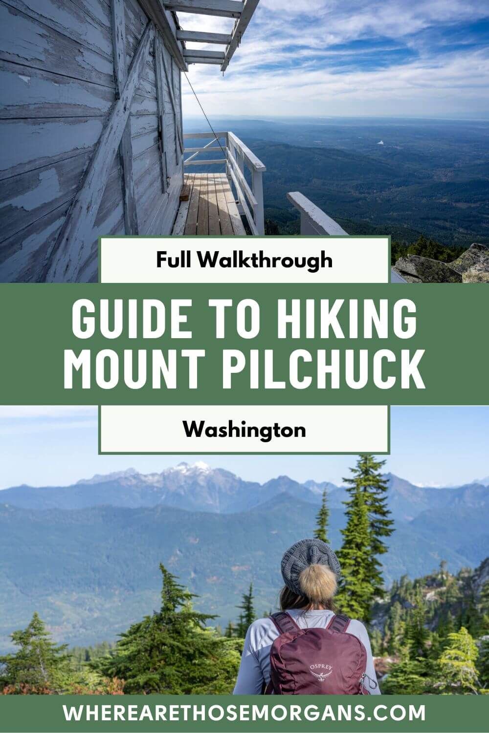
About half a mile later we left the forest entirely and our first views over the valleys and distant mountains began to open up. We could also see Mt Pilchuck fire lookout tower perched on the edge of a cliff way above us. It didn’t look too far away – but looks can be deceiving!
Grueling Climb To The Top

We have to admit the final third of the climb was tough going. We twisted and turned, followed more orange poles, navigated our way through a small boulder field via a series of short switchbacks and passed a handful of false summits. The trail was incredibly photogenic by now, both looking out at the views and up at the jagged summit peaks.
Eventually we passed over “the saddle” from the north side to the south side of the mountain, and then we began a long and gradual ascent to reach the lookout tower. This section was steep, slow going, very rocky, and felt like it was never going to end. We were definitely getting the end of our patience with how rocky it had become when we finished another series of small switchbacks, and then we saw the tower.
Summiting At Mt Pilchuck Fire Lookout

Relieved that the rocky climbing was over, we hiked up the final steep section of trail and reached a ladder set within a cluster of very large boulders which led us up to the white wooden fire lookout tower. Looking down from the ladder climb gave us butterflies and knee-wobbles, but once we were up it was awesome and we had the lookout to ourselves the whole 45 minutes we were up there.
We walked around all four sides admiring spectacular views over Washington State’s snow-capped volcano peaks, took tons of photos, and then crawled inside the lookout to take a look around. The shutters were on when we summited, with just a small crawl space for access so we had to take our day packs off and shuffle inside. After eating snacks and refueling, Mark quickly climbed onto a steep boulder ridge nearby for the Mt Pilchuck fire lookout money shot.
Descending Back To The Trailhead

After we’d had enough of the views and filled our SD cards with photos, we took the exact same route back down to the trailhead, always on the lookout for those orange trail marker poles. The going was mostly quicker, but we definitely found ourselves taking extra care in those steep and rocky sections.
In truth, we enjoyed the views more on the descent because we were able to look out at the horizon rather than inward towards the mountain peaks. By the end we were ready to be done, but we both commented that we thought it was an awesome hike overall.
Pros And Cons
Pros ✅
- Mixed terrain and scenery
- Easy to follow trail markers
- Sensational summit views
- Unique fire lookout tower
- Short trail (didn’t take all day)
- Resurfaced trailhead road
- Lake 22 nearby
Cons ❌
- Trail can be busy on weekends
- It’s not suitable for beginners
- Very rocky and uneven throughout
- Pretty steep in sections
- False summits can be confusing
- The bugs can be brutal

Important Things To Know
Sunrise and sunset: We would love to watch a sunrise or sunset at the summit of Mt Pilchuck. The 360-degree views were awesome, so either would be great, but we’d prioritize sunset because we could climb up to the boulder ridge and look directly west at the fire lookout as the sun set on the distant horizon behind the wooden structure. We’re experienced hikers, so going up to watch sunset and then going back down with headlamps would be doable. We’d check sunset times for Granite Falls and start hiking 3 hours before sunset to make sure we had enough time.
Sleeping in the lookout: Instead of hiking up in the dark before sunrise, we’d go up the evening before, watch the sunset, then sleep in Mt Pilchuck fire lookout. But because it’s first-come, first-served, and reservations can’t be made, we’d get up there well before sunset for a better chance of getting a space inside the lookout. The lookout’s winter shutters were already in place when we arrive in mid-October, and we’re not sure there would have been many people sleeping up there that night. That said, there’s every chance it would be full on weekends in warmer months, so in addition to a sleeping bag we’d also carry a tent and plenty of warm gear in case we had to sleep somewhere else near the summit.
Short hiking season: Like most trails in Washington, Mt Pilchuck’s hiking window is very small – it’s typically snow-free from mid-June through early November. We wouldn’t bother trying to hike it any than mid-June because there’d be a risk of snow on the ground which would make the hike harder and potentially more dangerous. We hiked in mid-October and the conditions were perfect, but we were lucky with clear weather.
When to hike: If we hiked Mt Pilchuck again, we’d begin very early or much later in the afternoon to get a parking space and avoid crowds on the trail. June, September or October would be quieter than July or August, but those two peak summer months are also when vibrant wildflowers are in bloom. One thing we know for sure is that we’d avoid weekends and especially holiday weekends.
Shoes: It should go without saying, but Mt Pilchuck was one hike in Washington we were glad to be wearing proper robust hiking shoes. The trail was very rocky and uneven for large parts, so we wouldn’t do it in regular running shoes or sandals. In good conditions, we don’t think any other specialist equipment is necessary. We don’t use poles but if we did, we’d take them on this hike.
Bugs: As always for Washington hikes, the bugs can be brutal in summer months so repellant would be the first thing we packed if we hiked it from June through September. There weren’t any bugs at all when we did it in mid-October, which was a welcome relief.
Dogs: Mt Pilchuck is a dog friendly trail, but we actually commented during the hike to say we didn’t think it would be suitable for every dog. We didn’t see any, but we know a lot of hikers take dogs up on leashes. The rocky sections would be tough going for small or massive dogs, and they’d have to be carried up the ladder into the lookout at the top.
Water: We’d read there was no water at the trailhead and very few places along the trail to fill water bottles (with filtration), so we drank loads before setting off and packed plenty for the hike. If we hiked it in summer, we’d carry even more water along with a few electrolyte drinks each.
Toilet: The vault toilet at the trailhead didn’t have any toilet paper so we had to grab a “just in case” roll from our car before after after our hike. There were no other toilets anywhere on the trail or at the summit.
Car break-ins: Pretty much every trail we hiked in Washington in the summer of 2021, the recent comments on AllTrails had a few unfortunate people saying they had their cars broken into when on the trail. Mt Pilchuck is one of those trails that has had break-ins. It’s such a shame, but it happens.
Amenities: The closest place to Mt Pilchuck for food was Granite Falls. We didn’t eat there, but Eat Thai, Omega Pizza & Pasta, and Playa Bonita all look like solid options. For accommodation, Mansion Inn in Lake Stevens is closest, but Holiday Inn or La Quinta in Marysville might be a better fit.

Was Mount Pilchuck Worth It?
Honestly, we absolutely loved hiking Mt Pilchuck, and there’s no doubt in our minds it lived up to expectations. But we must caveat that by saying we had no issues with parking, we barely saw anyone else on the trail, we had the fire lookout to ourselves the whole time we were at the summit, and the conditions were near-perfect. We know it would feel different if we struggled to park on a weekend, it was blazing hot, or the fire tower was swarming with other hikers.
All Trails has it rated at 4.8 / 5 with 6k+ ratings, and it’s hard for us to argue with those six thousand hikers. Now that the road leading to the trailhead has been resurfaced, we imagine that rating will rise to a 4.9 / 5 over time because it really is a fantastic hike and it leads to genuinely special views.
The only part we found ourselves beginning to get frustrated was the very rocky final half mile or so to the summit, it just got a bit tedious. Otherwise it was a great length, a decent workout, and a nice forest-to-rocks-to-views trail. We’d say it was up there with our favorite non-national park hikes in Washington.
Next Steps
We hope our Mt Pilchuck Trail guide helps with planning your trip to Washington’s Cascade Mountains.
Don’t forget you can book a travel planning video call with us if you’d like our expert help organizing your trip. We can answer any questions you have or walk through a personalized itinerary to make the most of your time.
Still researching for your trip?
- Here are the top hikes in Mt Rainier
- This is our Lake 22 hiking guide
- Here’s how to hike Wallace Falls
- Here’s our Lake Serene hiking guide
- This is how to visit Snoqualmie Falls
- Here’s how to day hike The Enchantments
Finally, if you’ll be visiting more places on the same trip, we recommend reading our Washington State travel guide for more helpful tips and advice.
Happy Travels,
Mark and Kristen
Enjoy this guide? Pin it for later!
All Rights Reserved © Where Are Those Morgans, LLC. Republishing this article and/or any of its contents (text, photography, maps, graphics, etc.) in whole or in part is strictly prohibited.

Mark and Kristen spent 6 years traveling the world, visiting over 40 countries across 4 continents and more than 30 US states. They created Where Are Those Morgans in 2018 to help others plan the best possible vacations by writing authentic travel and hiking guides based on their real experiences.
Since the arrival of baby Maya in late 2024, Mark and Kristen’s extensive travels have slowed down but they still take plenty of trips. Where Are Those Morgans now helps millions of travelers each year to visit new places and hike new trails through information-packed blog posts and expert travel guidebooks. Read more about Mark and Kristen.