We hiked the super scenic Black Elk Peak Trail on a beautifully sunny day when we road tripped through South Dakota in early October 2019. We’d already ticked off Badlands, Mount Rushmore, Custer Wildlife Loop, Iron Mountain Road and Needles Highway, and just when we thought the Black Hills couldn’t get any better, we climbed to Harney Peak Fire Lookout Tower at the summit of Black Elk Peak.
In this guide we show you exactly what you can expect when hiking the awesome Black Elk Peak Trail, based on our own experiences. We walk you through route options, parking and the trail itself with our photos.
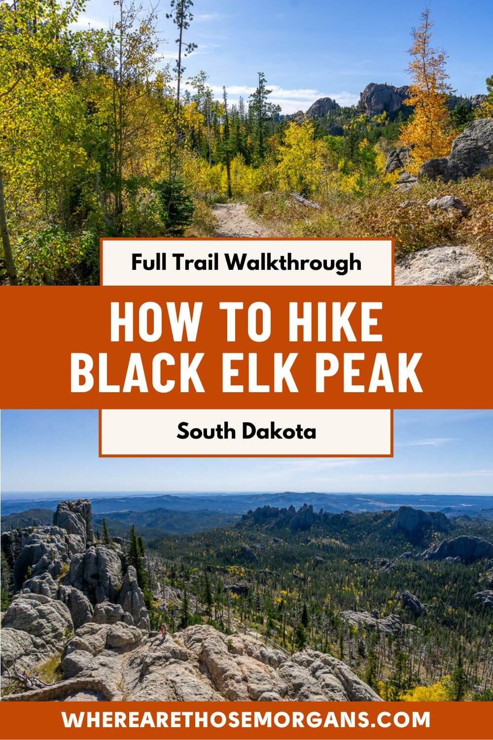
The trail is a moderately difficult 7-mile round trip hike in the classic mountain-style – all uphill and then all downhill. But don’t worry, the total elevation change is only 1,500 feet, which never felt too hard because it was spread across 3.5 miles each way. Now, the route options can seem confusing, but all you need to know is to take trail #9 up and trail #4 down for the best version.
We’ve hiked tons of amazing trails in the US and honestly Black Elk Peak is up there in our top 10. The trail is picturesque, varied and leads to seriously special 360-degree summit views overlooking 4 US states. We were genuinely blown away at the top, especially because an ocean of emerald green and golden yellow leaves covered the Black Hills when we hiked it. Read more about us.
Note: This article may contain affiliate links. If you make a purchase using one of these affiliate links, we may earn a small commission at no extra cost to you. Thank you!
Trail Information
- Distance: 7 miles round trip
- Elevation: 1,500 feet gain and loss
- Time: 3-5 hours
- Difficulty: Moderate
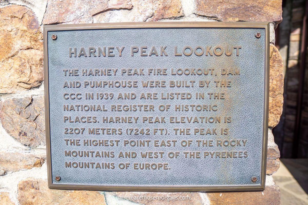
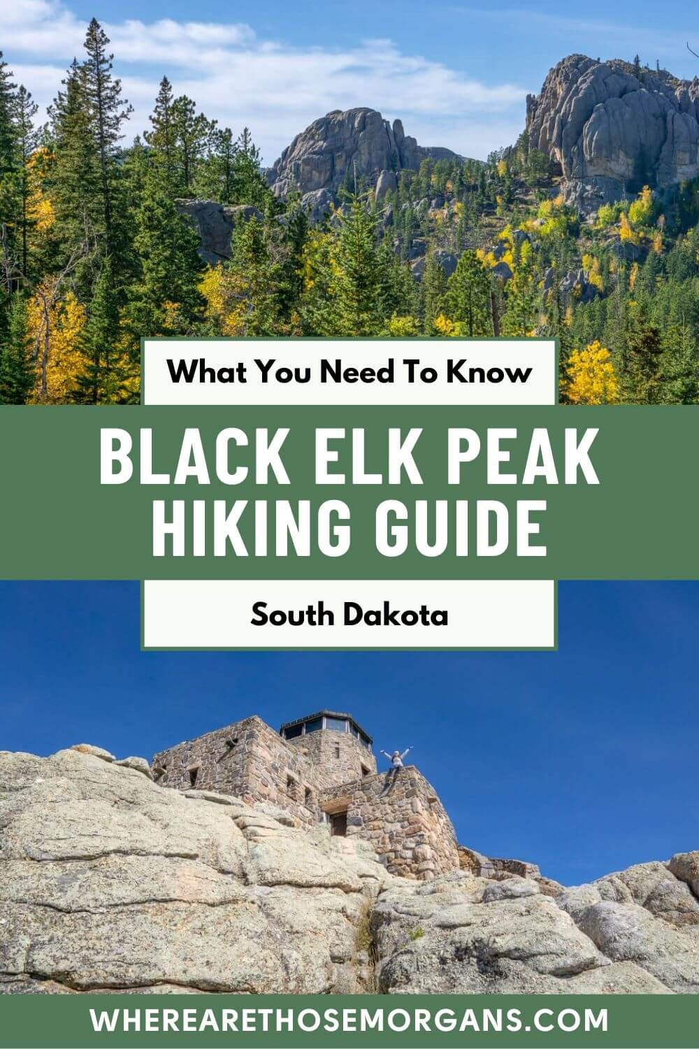
Black Elk Peak summit stands at 7,244 feet tall, which makes it the highest point in North America east of the Rocky Mountains. It used to be called Harney Peak, but it’s name was changed to Black Elk Peak in 2016 by the US Board on Geographic Names to honor an old Lakota Sioux shaman.
The trail is generally considered moderately difficult because the elevation gain and loss is gradual. But it’s still a 7-mile round trip trail that’ll take you between 3-5 hours to complete, and that’s not including any optional spur trails. If you’re a regular hiker and in reasonable shape, this hike is definitely achievable. Here are our hiking tips for beginners.
At the summit is Harney Peak Lookout Tower, which was one used as a fire detection viewpoint. The tower is no longer in use but we still explored its three levels and viewing balcony. Back in 2019 we were just starting out with making videos on hikes and we got this old-looking GoPro footage, but it shows you a bit of the trail.
Route Options
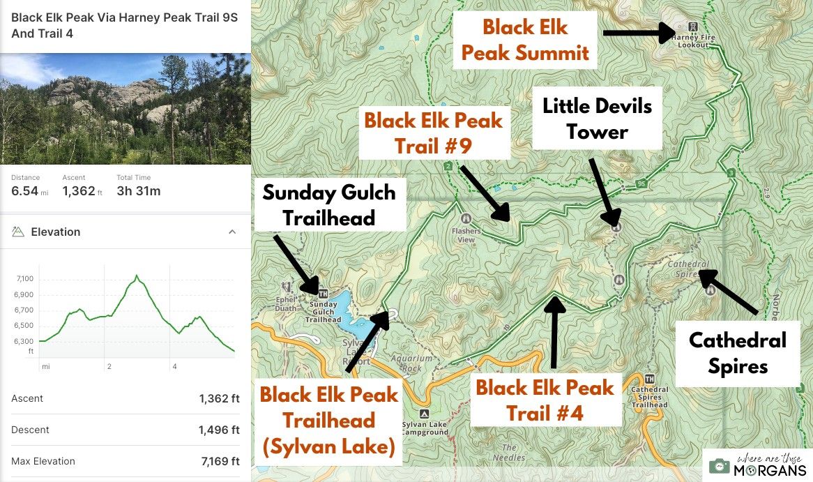
More than 10 different trails lead to Black Elk Peak summit, but the two most popular routes are trail 9 and trail 4, both of which begin and end at Sylvan Lake.
But remember, you could choose to hike trail 9 or 4 as an out-and-back instead of a loop. Or you could go up 4 and down 9 if you want to avoid the crowds because most others will do it in reverse. Note that if you want to do this hike in the easiest possible way, you should go up and down trail 9.
Here’s why we hiked up trail 9 and down trail 4:
Gradual – Trail 9 was the easier uphill hike because it was more gradual, whereas trail 4 was slightly steeper so we saved it for the way down. If you have bad ankles or knees you might want to consider going the opposite way.
Loop – We wanted to hike both trails to get more variation in our route, views and overall experience, so out and back wasn’t an option.
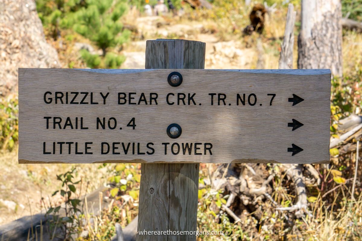
Spurs – There are optional spur trails leading to Little Devils Tower and Cathedral Spires from trail 4. After taking trail 9 to the summit, we were already half way down trail 4 before reaching the trail forks, so we could make a better decision about whether we had the time or energy to include them close the end of our hike.
Little Devils Tower would have added a further 0.6 miles and Cathedral Spires would have added a further 1 mile to our overall trail distance for the day.
Tip: We recommend adding Little Devils Tower to the end of your Black Elk Peak hike, but then do Cathedral Spires as a separate hike from Cathedral Spires trailhead on Needles Highway.
Trailhead Parking
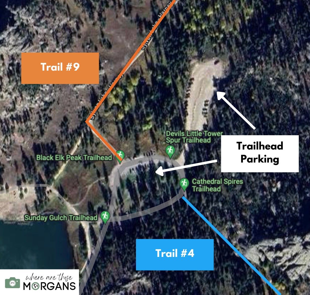
The trailhead for Black Elk Peak trails #4 and #9 was located on the eastern side of Sylvan Lake in Custer State Park. We paid an entrance fee of $20 per vehicle (which was good for 7 days) to enter Custer State Park at a small wooden kiosk moments after turning left to stay on SD-87 (Needles Highway).
We drove around a long right bend, passed by the parking lots and took a left turn when we saw a brown sign for Black Elk Peak Trailhead. Next, we followed the road all the way to the end and found a parking space as it looped in a circle.
Tip: If there’s no spaces in the loop parking area, you can drive into a long and narrow gravel overspill lot directly from the northwest side of the loop.
Sylvan Lake is easy to reach from the popular places to stay around South Dakota’s Black Hills. Here are driving distances and times:
- Custer: 7 miles (15 minutes)
- Keystone: 18.5 miles (35 minutes)
- Rapid City: 37 miles (55 minutes)
Trail Walkthrough
Okay, let’s get into our hiking walkthrough from start to finish so you know what to expect. You’ll see our own photos from the hike and we’ll describe the trail exactly as it was for us.
1. Trail 9
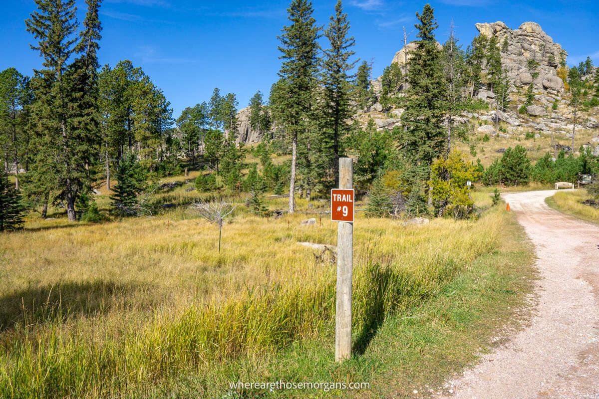
After watching sunrise at Mount Rushmore, we drove to Sylvan Lake and paid to enter Custer State Park. We arrived to the trailhead around mid-morning in October and there were plenty of parking spaces available. So we parked up, used the vault bathrooms and made sure we had plenty of water and food for the hike.
We used the compass app on our phone to make sure we were pointing northwest from the loop and easily located trail 9. At the start of the hike there was a group of information boards and maps of the various routes, so we took photos in case of emergency.
2. Slowly Gain Elevation
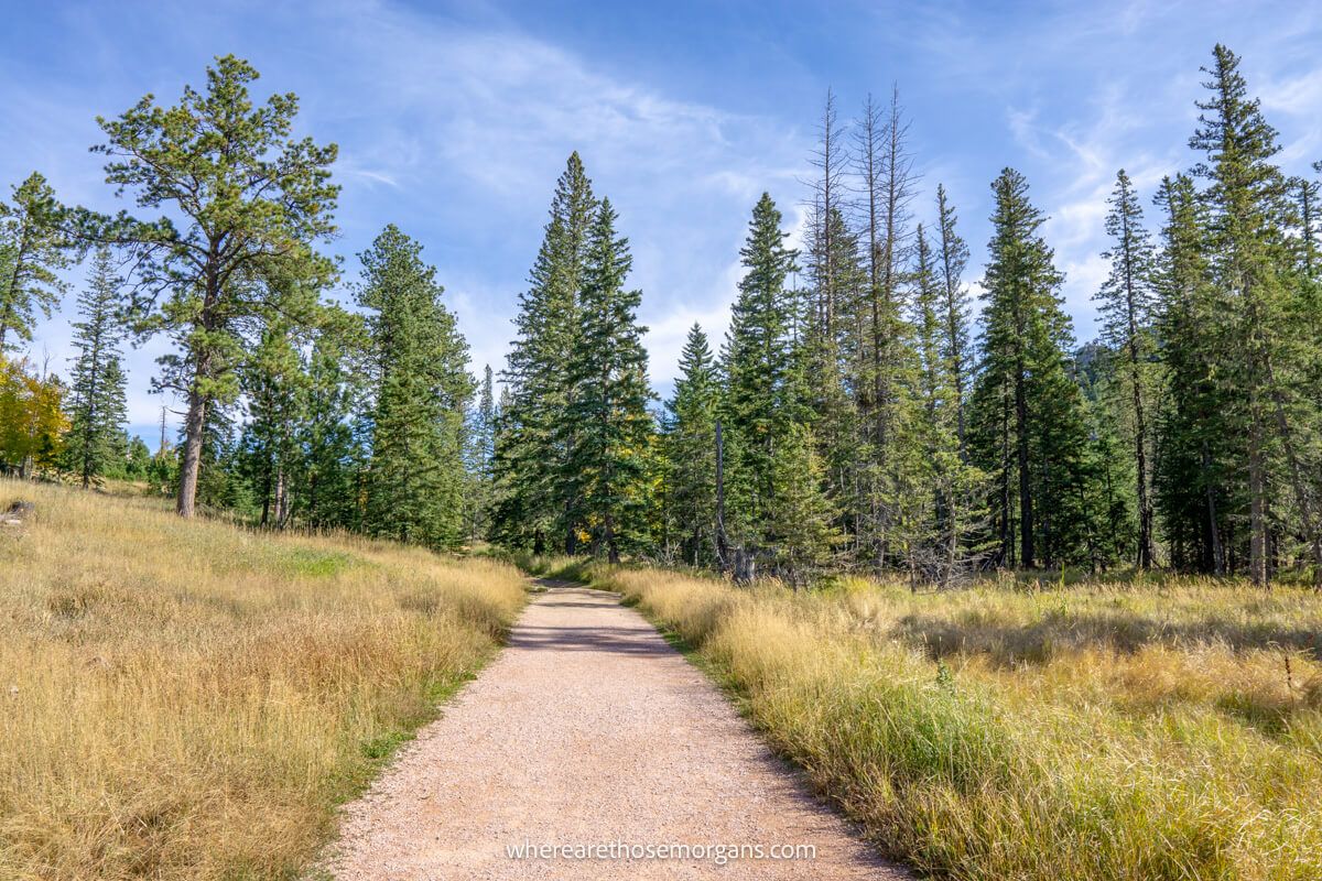
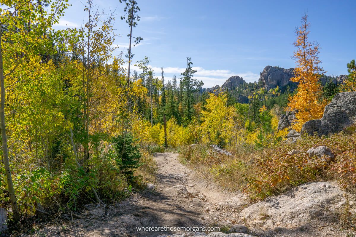
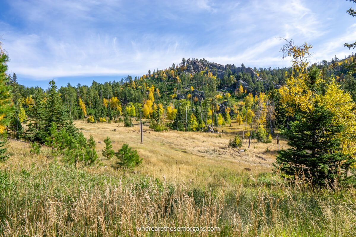
Almost immediately we were surrounded by beautiful meadows and forested areas. The trail was a narrow and soft dirt packed path, which was bouncy underfoot. Deep green and golden colored leaves were lighting up the granite hills all around us.
Slowly but surely the trail gained elevation so we were working up a sweat pretty early on in the hike. Before long the path lead into enclosed trees and it took some time before we emerged back out above the canopy.
3. Awesome Viewpoint
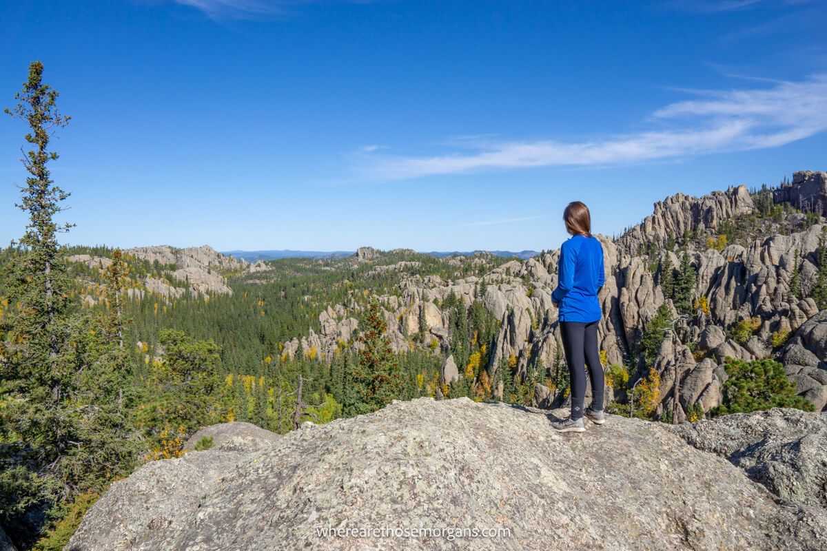
We reached a fork in the path, left was trail 2 (Lost Cabin Trail – wilderness permit required) and right continued on trail 9. Not long after taking the right turn, we spotted a rocky ledge leading out to the left and we took it.
Completely to our surprise, the rocky ledge opened up to a view over a dramatic valley filled with a sea of trees and piercing granite rocks bursting into the sky. At just 1 mile into the hike, we decided to stop at this amazing viewpoint and enjoy the scenery for a few minutes.
4. Metal Staircase
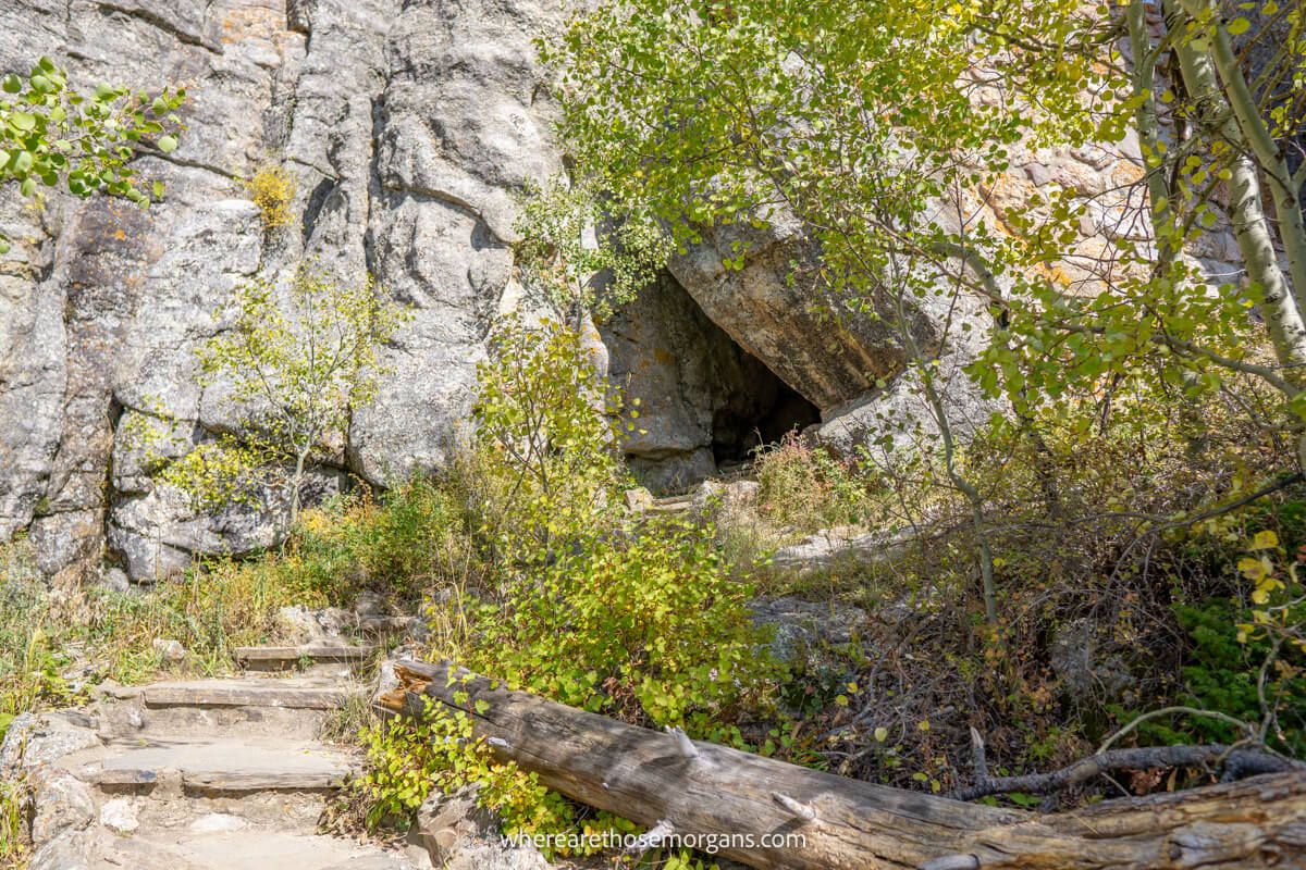
The trail turned steeper and climbed through more forested areas with fantastic views opening up time and time again. It came as a surprise when we passed through a cave-like gap in a granite wall and had to climb a metal staircase as we approached the latter parts of the ascent. But once we’d climbed it, we knew it wasn’t far to the summit.
The hike is signposted excellently throughout the trail and we knew exactly where we had to take the left turn from trail 9 to reach the top.
5. Black Elk Peak Summit
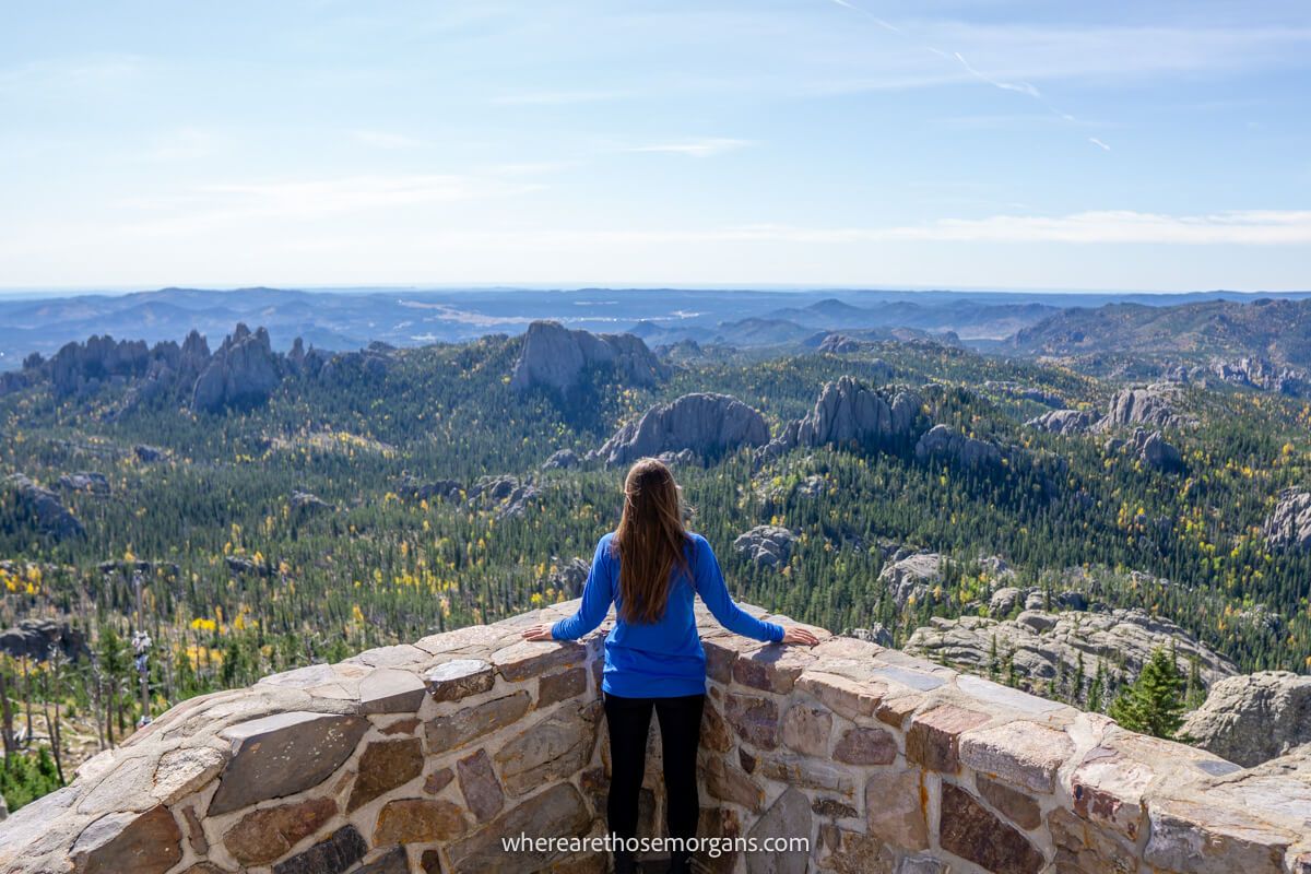
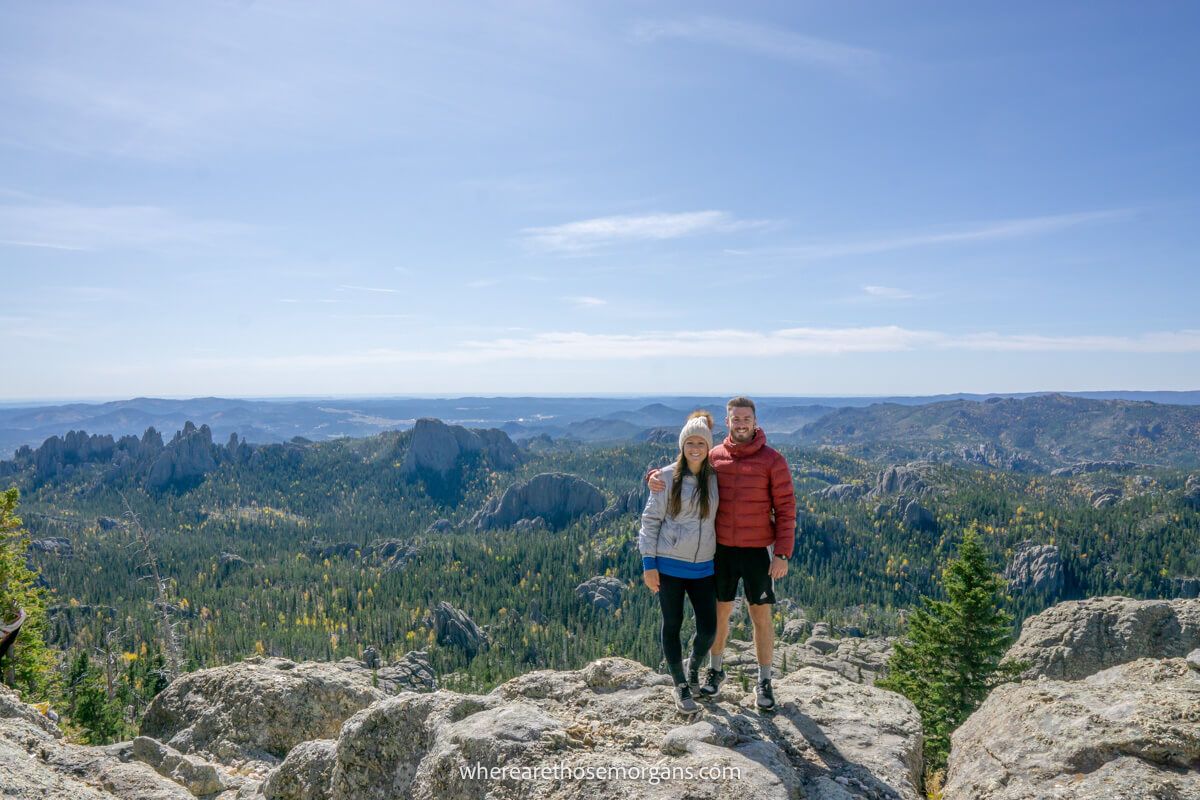
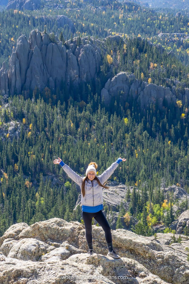
The final part of the ascent is on stone steps leading into Harney Peak Fire Tower. We could see the fire lookout tower from a bit further down the trail, but it was much bigger than we expected upon arrival. After exploring all three floors of the lookout tower, we went back outside to soak up its 360 degree horizon-reaching views over South Dakota, Montana, Wyoming and Nebraska.
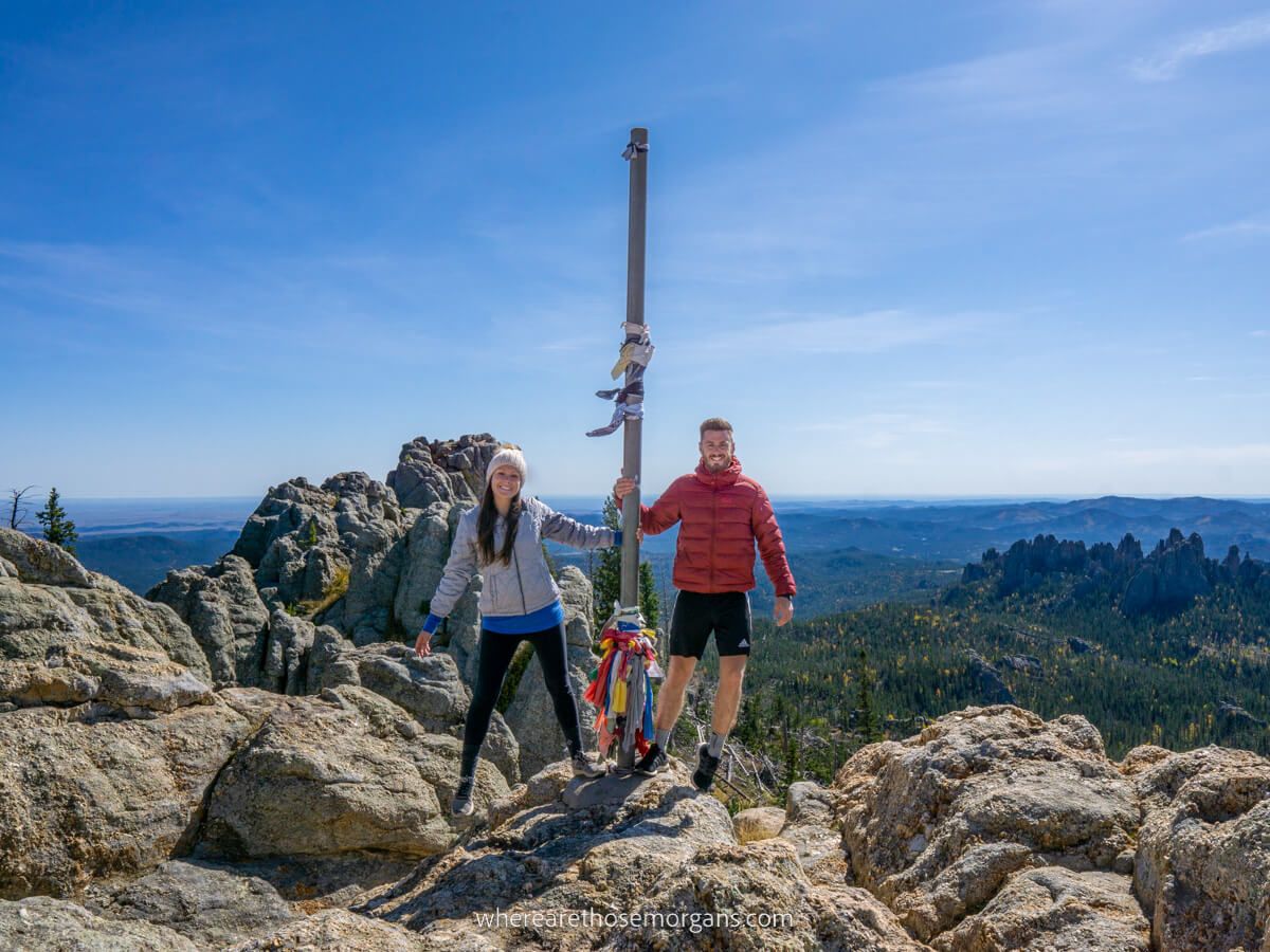
We took a photo with the summit flagpole, then sat on the boulders with our lunch, snacks and electrolyte drinks to refuel. The summit was relatively quiet, the weather was perfect and the views were incredible. So it was a pretty great lunch!
6. Trail 4
We stayed at the summit for a good half hour before beginning our descent on trail 3 (which transitions into trail 4). It was a slightly steeper elevation loss than it would have been on the other trail, but it curved around the side of a hill like a ledge and had stellar views throughout.
We ignored the left split when trail 3 (Norbeck) breaks off to the east and instead stayed on trail 4 (Little Devils Tower Trail) which eventually completes the loop back at Sylvan Lake.
7. Optional Spur Trails
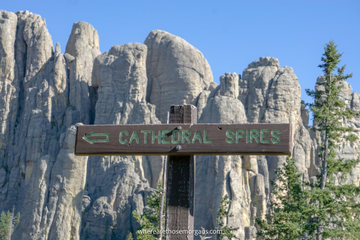
Next up were two important spur trails to consider. We’d just hiked Cathedral Spires from its proper trailhead on Needles Highway the day before, so we stayed on trail 4 at the first split. (Note, this is where you would turn off if you wanted to include Cathedral Spires to your hike).
But 0.2 miles later, we did take the spur to Little Devils Tower. It was gradual at first but it led to some light scrambling near the end and it was quite windy at the viewpoint. It added 0.8 miles to our hike but we had enough time and energy in the tank.
8. Ending The Hike
We have to admit the last 1.5 miles heading back to Sylvan Lake were pretty uneventful. It was a nice and easy walk through picturesque meadows, but it did feel like a bit of a slog and we were ready to be done by the end.
After passing over a small hill and seeing two restrooms blocks (the first ones since we set off), we thought we’d finished but that wasn’t quite the end. There was a final short walk through ponderosa pine forest and all of a sudden we were back at the parking loop.
Leave No Trace
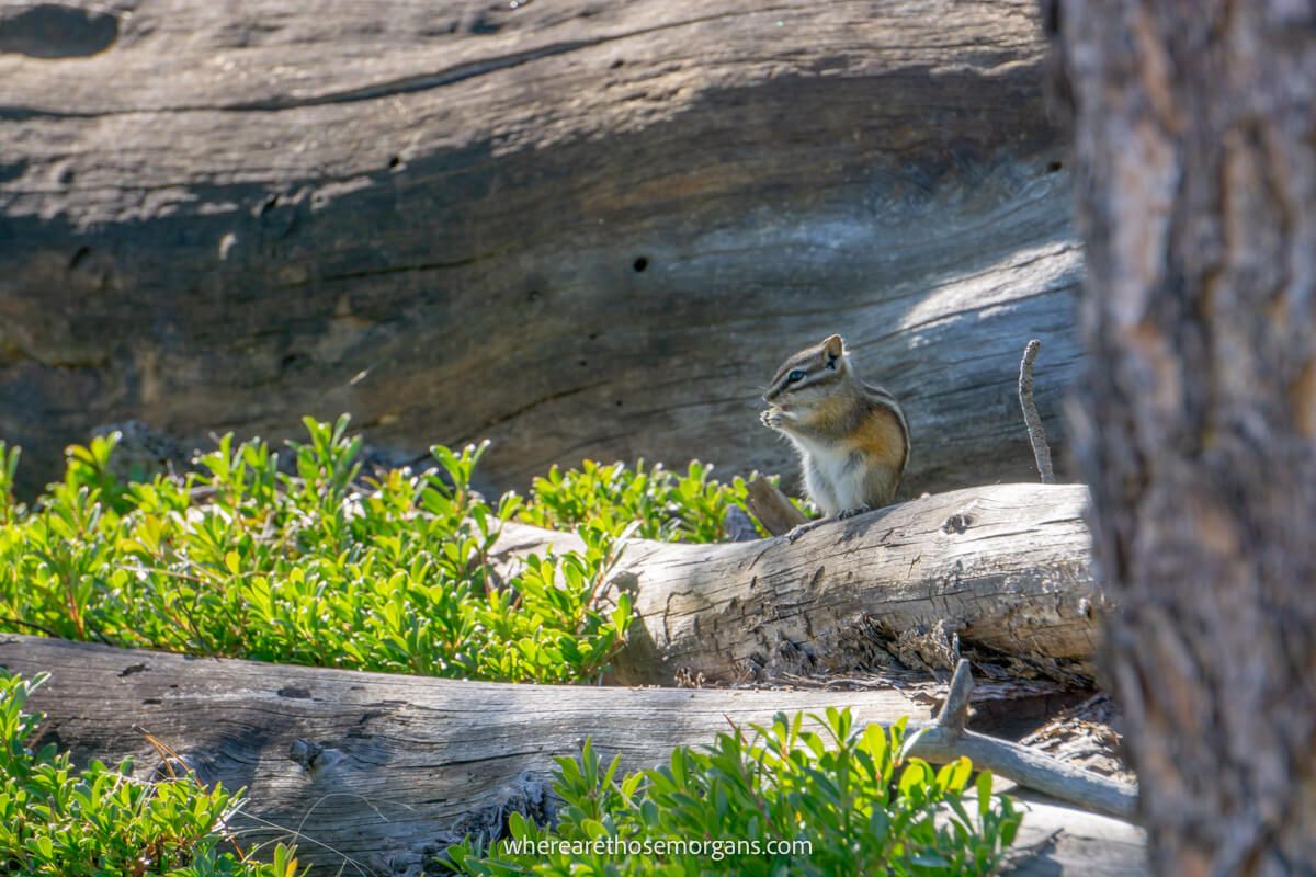
Please take great care not to disturb formations, vegetation or wildlife when you hike Black Elk Peak. It’s a beautiful place to visit and we all have to keep it that way for future generations to enjoy.
Remember and follow these 7 principles of leave no trace when hiking in the Black Hills:
- Plan ahead and prepare
- Travel and camp on durable surfaces
- Dispose of waste properly
- Leave what you find
- Minimize campfire impacts
- Respect wildlife
- Be considerate of others
When To Hike It
We think the very best time to hike Black Elk Peak is a weekday in early October when the crowds are at a minimum and fall foliage colors are most vibrant. We hiked the trail during peak foliage and it was truly stunning.
If you can’t make early October, we recommend hiking in late May, June or September to avoid the worst of the overcrowding in July and August. Weekends and especially holiday weekends will be busiest, so try to hike the trail on a weekday.
Sylvan Lake and both trails 4 and 9 were covered in snow the second time we visited the Black Hills in April 2021. We wanted to see more great places near Mt Rushmore but we couldn’t hike Black Elk Peak again which was a shame. Just something to bear in mind if you’re planning a trip in shoulder season.
Our Top Tips
- Check recent comments for trail conditions on All Trails
- Track your hike using an offline map with one of the best hiking apps
- Set off early to beat the crowds going up on trail #9
- Don’t set off too late in the day so you have enough daylight
- Take plenty of food, snacks, water and electrolyte drinks
- It can be very windy at the summit so take a wool hat
- Reverse the route (4 up and 9 down) if you prefer gradual descents
Where To Stay
Do you need a place to stay the night before or after hiking? Well, Custer is the closest and most convenient place to stay for the hike, and it’s also centrally located for reaching most other nearby attractions in the Black Hills. So it’s a great option.
Keystone is the obvious alternative and we think it works better if Mount Rushmore is your top priority. It’s also closer to Badlands National Park and Rapid City airport, so you could drive down to hike Black Elk Peak before returning to Keystone later in the day. Read our guide on the best places to stay near Mt Rushmore to learn more.
We hope our Black Elk Peak hiking guide helps with planning your trip to the Black Hills!
Please let us know if you have any questions in the comments box a little further below.
Happy hiking,
Mark and Kristen
Enjoy this guide? Pin it for later!
All Rights Reserved © Where Are Those Morgans, LLC. Republishing this article and/or any of its contents (text, photography, maps, graphics, etc.) in whole or in part is strictly prohibited.

Mark and Kristen spent 6 years traveling the world, visiting over 40 countries across 4 continents and more than 30 US states. They created Where Are Those Morgans in 2018 to help others plan the best possible vacations by writing authentic travel and hiking guides based on their real experiences.
Since the arrival of baby Maya in late 2024, Mark and Kristen’s extensive travels have slowed down but they still take plenty of trips. Where Are Those Morgans now helps millions of travelers each year to visit new places and hike new trails through information-packed blog posts and expert travel guidebooks. Read more about Mark and Kristen.