South Kaibab Trail is the most scenic and exciting hike leading down below Grand Canyon South Rim. It’s steeper, more challenging and harder to access than it’s main rival Bright Angel Trail, but we think South Kaibab is the better hike overall. The trail has several landmarks that can be used as turnaround points for easy, moderate and hard day hikes depending on how much you want to take on.
In this guide we show you how to day hike South Kaibab Trail at Grand Canyon South Rim, based on our experiences. Read more about us.
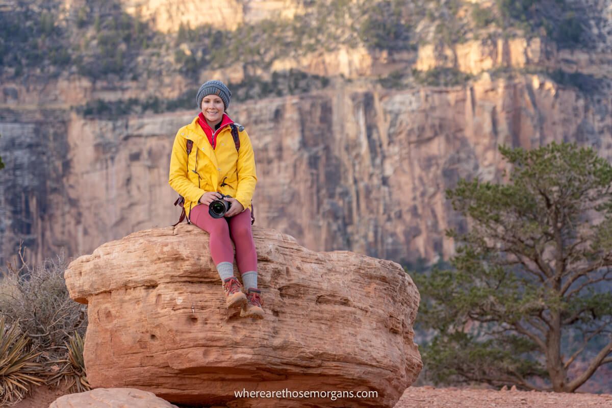
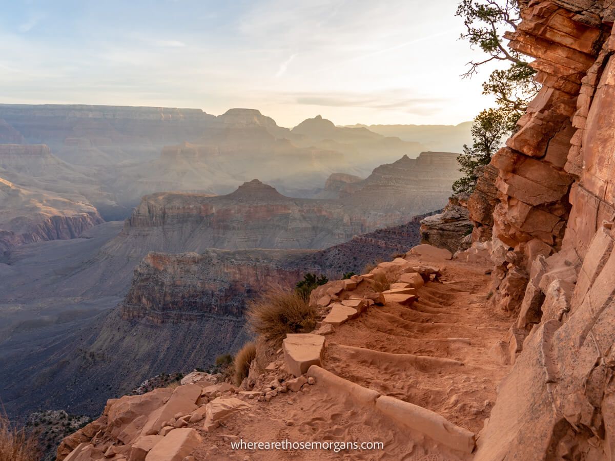
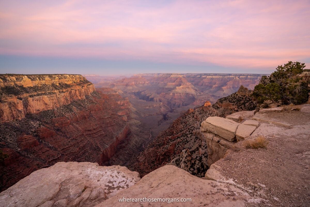
We spent 9 incredible hours hiking the amazing Rim to River Trail in December 2021, going down to the canyon floor on South Kaibab Trail and back up to the rim on Bright Angel Trail. It was cold and dark when we took the orange shuttle bus to the trailhead, but the morning soon warmed after we watched a stunning sunrise burst into the canyon at Ooh Aah Point. And the rest of the day was perfect.
The descent on South Kaibab Trail was steep and direct, whereas coming back up on Bright Angel Trail was more gradual and longer in distance. What we like the most about South Kaibab is how varied the trail and views are from top to bottom. But it is a steep path, so bear that in mind when planning how far down you go. Okay, let’s begin!
Note: This article may contain affiliate links. If you make a purchase using one of these affiliate links, we may earn a small commission at no extra cost to you. Thank you!
Grand canyon Planning
📖 Ultimate Guidebook: Get our complete 37-page Grand Canyon PDF with everything you need.
📞 Personalized Grand Canyon Planning: Book a call with Mark to have your questions answered and plan the perfect itinerary.
💡 Still Planning? Read our essential first-timer’s guide to visiting Grand Canyon.
What You Need To Know
Okay, let’s dive right in. Here are the key things you should know about hiking South Kaibab Trail:
- You do not need a permit for the hike
- The path is very clear and obvious throughout
- The temperature increases rapidly as you descend
- Storms are common July-September
- Check live trail conditions for updates
- You must carry plenty of water
- The full trail is a long and hard day hike
- Phantom Ranch is the full hike turnaround point
- Dogs are not allowed on the trail
- Popular thing to do on a Grand Canyon vacation
Important: It is not safe to hike down into the Grand Canyon on hot days with high temperatures. The NPS advises against hiking South Kaibab Trail from 10:00am-4:00pm in summer because it’s too dangerous. Multiple fatalities and rescues happen every year due to heat issues, so don’t take any unnecessary risks.
Trail Statistics
You should descend South Kaibab Trail as far as you feel comfortable before turning around. There are five major landmarks you can use to plan your hike:
- Ooh Ahh Point – 1.8 miles roundtrip (790 ft elevation change)
- Cedar Ridge – 3 miles roundtrip (1,120 ft elevation change)
- Skeleton Point – 6 miles roundtrip (2,040 ft elevation change)
- The Tipoff – 9 miles roundtrip (3,280 ft elevation change)
- Phantom Ranch – 14.6 miles roundtrip (4,700 ft elevation change)
Phantom Ranch is located on the canyon floor next to the Colorado River. If you decide to go all the way down and back up South Kaibab Trail, it’s a 14.6-mile hike with 4,700 ft elevation change. So you must be a strong and experienced hiker to take it on. Also, if you’re planning to day hike to Phantom Ranch and back, we strongly recommend going down South Kaibab and back up Bright Angel.
If you’re not a strong hiker or you just don’t want to spend an entire day hiking, only go down as far as Ooh Ahh Point or Cedar Ridge. Even going down to Skeleton Point and back is a hard day hike that should only be attempted by strong hikers in cooler temperatures.
Tip: Remember, every step you take down is a step you have to take back up. Carefully consider how much climbing you’re happy with, because trust us, that elevation is a killer!
Trail Map
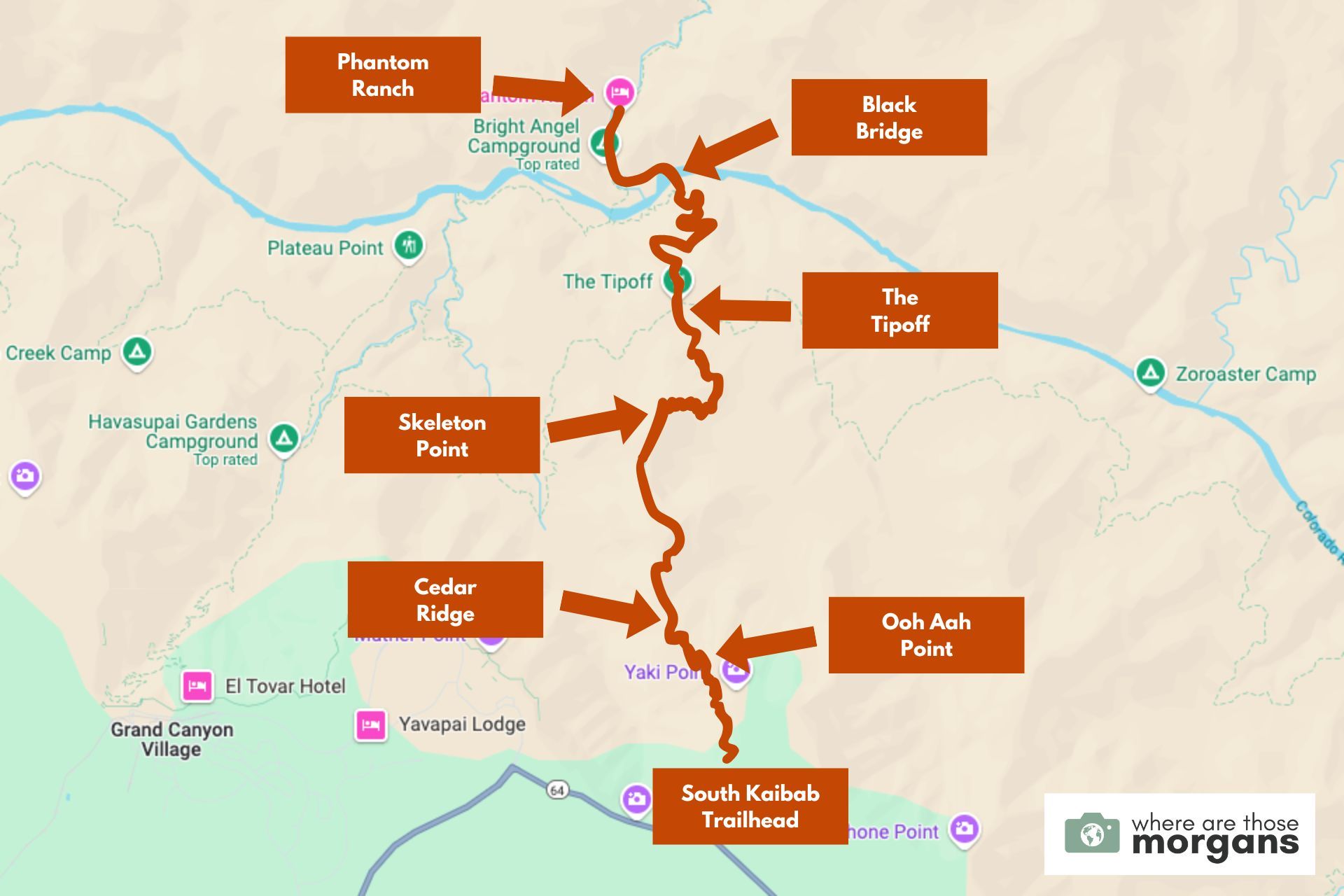
As you can see in the trail map we created above, there are lots of landmarks you can use to plan how far you go before turning around.
It’s a straightforward route beginning with lots of short switchbacks as far as Cedar Ridge, before flattening to Skeleton Point. A significant series of switchbacks drops down into lower sediment layers, before it flattens again to The Tipoff. Finally, another series of switchbacks leads down to the Colorado River at Black Bridge before flattening to Phantom Ranch.
Getting To South Kaibab Trailhead
South Kaibab Trailhead is inconvenient and hard to access from the main parking areas and visitor center in Grand Canyon Village. Unlike Bright Angel Trailhead which is right on the rim on the west side of the village near the park lodging, getting to South Kaibab Trailhead requires a bit more effort on your part.
Here are three ways you can access the trailhead:
- Take the orange Kaibab shuttle from the main visitor center near Mather Point.
- Park in this small lot 1 mile from the trailhead on Desert View Drive and walk up Yaki Point Road.
- Walk along South Rim Trail from the visitor center to the trailhead.
We took the first shuttle bus of the day (known as the “Hikers Express“) when we hiked down South Kaibab Trail. We’d be arriving back to the rim via Bright Angel, so we couldn’t park our car near Yaki Point Road and we didn’t want to add on another 2.5 miles of hiking before starting the mammoth day hike.
But you won’t need such an early start if you only hike a small portion down into the canyon, so you can take the orange Kaibab shuttle both ways. The easiest and most scenic way to do it is by hiking along the flat and easy South Rim Trail, but be aware it’s 5 miles roundtrip from the visitor center to South Kaibab Trailhead, before you hike down into the canyon.
Need help planning your trip to Grand Canyon?
Our popular Grand Canyon travel guidebook helps you with planning every aspect of your visit to South Rim, including the best viewpoints and hikes, where to eat and stay, itinerary ideas and map!
View Guidebook
Trail Walkthrough
Next, let’s walk through the hike exactly as we did it so you know what to expect.
Ooh Aah Point
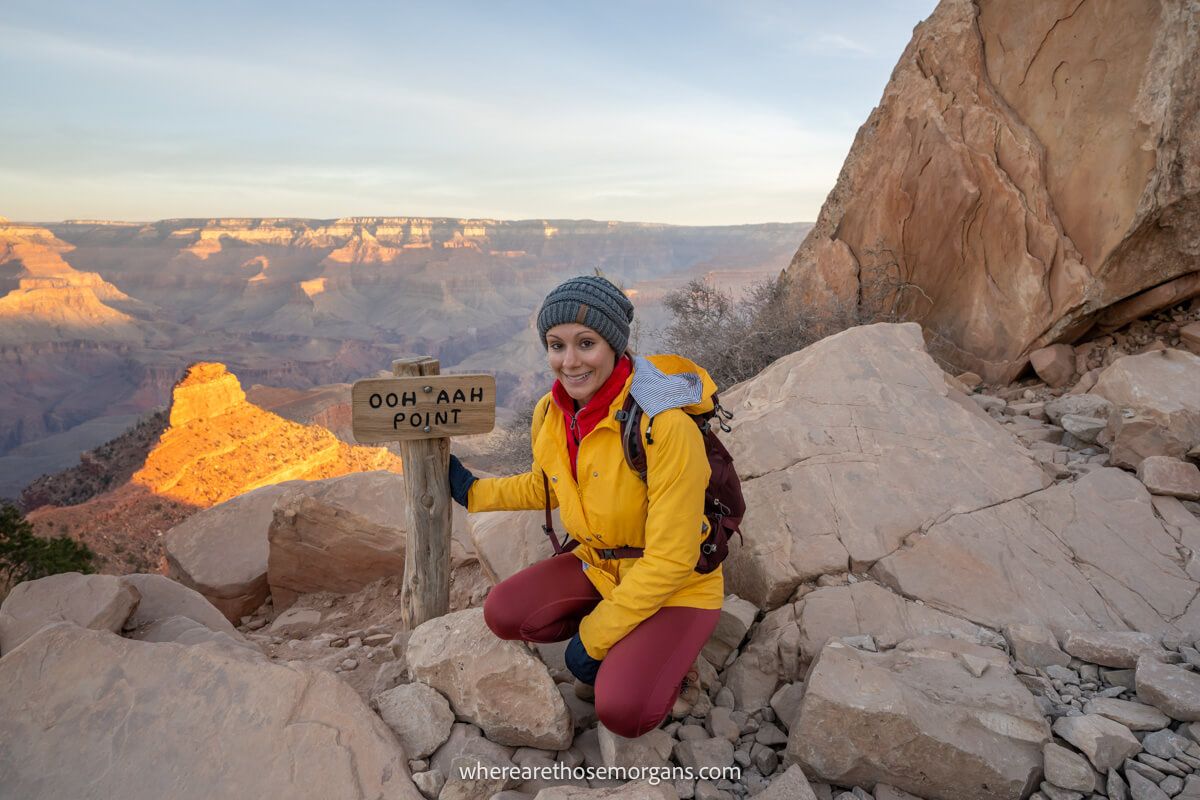
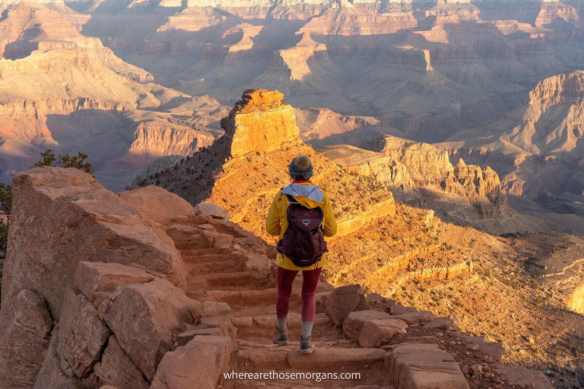
The very first part of the descent down to Ooh Aah Point is incredibly scenic. Not just views into the canyon, but the trail itself is like something out of a fantasy movie. We followed a series of short but steep switchbacks and hugged a wall tightly to the right side until it opened up to staggering views at Ooh Ahh Point. Oh, and brilliant beams of sunlight were crashing into the canyon at sunrise!
Tip: Turn around at Ooh Ahh point if you’re just getting into hiking, it’s too hot or you only want to get a quick taste of what it’s like inside the canyon. And as a secret insider tip, Ooh Ahh Point is one of our favorite hidden gem spots to watch sunrise.
Cedar Ridge
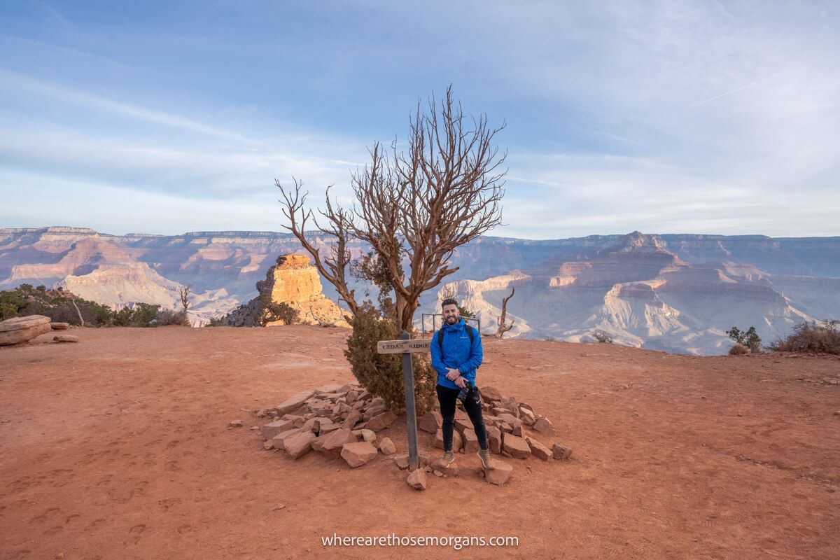
We could see the flat shelf at Cedar Ridge and its nearby submarine-shaped rock formation (called O’Neill Butte) from Ooh Aah Point. To reach it, we walked down an attractive cobblestone path surrounded by towering cliffs, buttes, spires and temples. We used the vault toilet at Cedar Ridge, looked back up at the rim and took a bunch of photos before cracking on with the descent.
Tip: Cedar Ridge is a great turnaround point if you’re short on time or you want to hike small portions of both South Kaibab and Bright Angel trails.
Skeleton Point
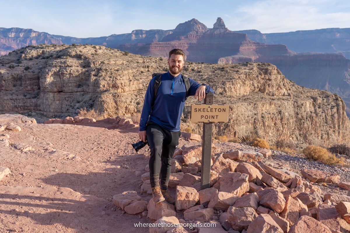
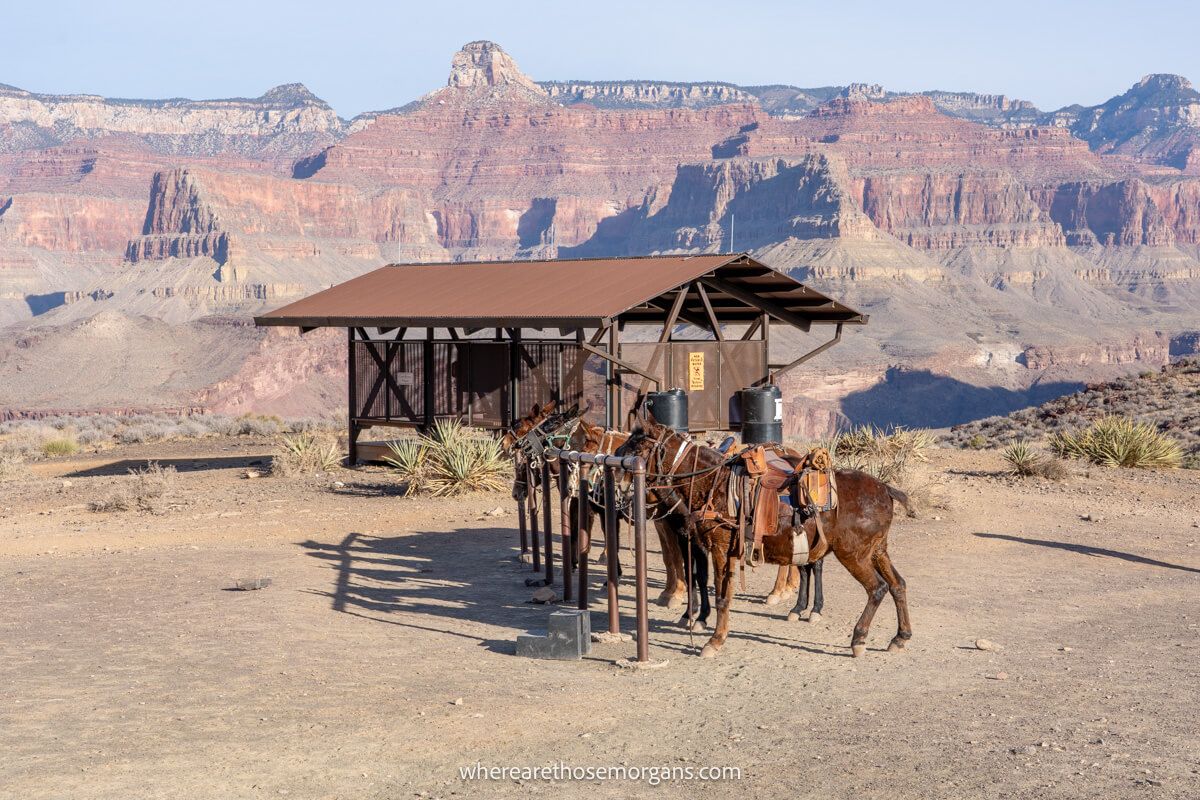
The next part of our descent was to drop down until we stood at the base of O’Neill Butte. From there we hugged a wall to the left until it opened up one of the most amazing views on the whole hike. We could see the trail curving ahead into the distance, so we followed the easy and gradual path until arriving to find two metal frames for mules at Skeleton Point.
Tip: Skeleton Point is as far as we recommend for a big day hike but without taking too much on, even if you’re a more experienced hiker. This would be a 4-6 hour hike and getting back up will be hard work on the steep trail.
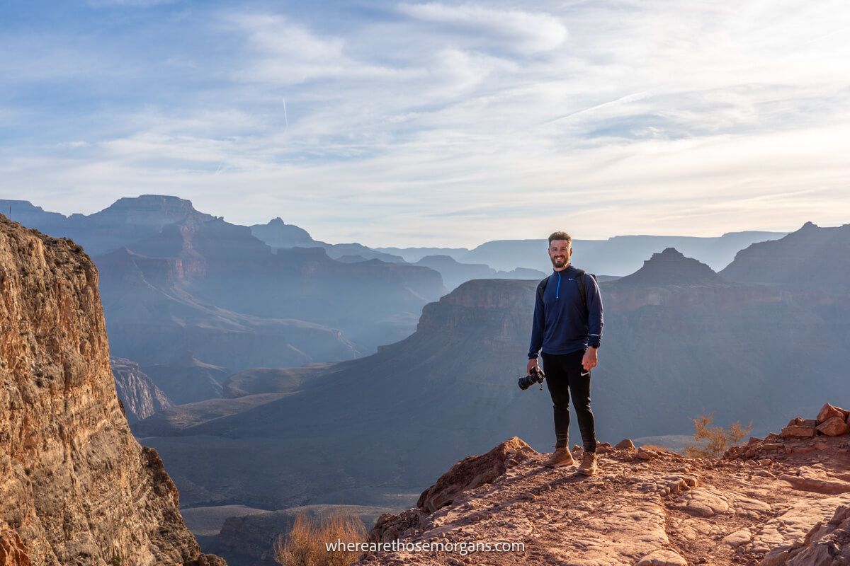
The Tipoff
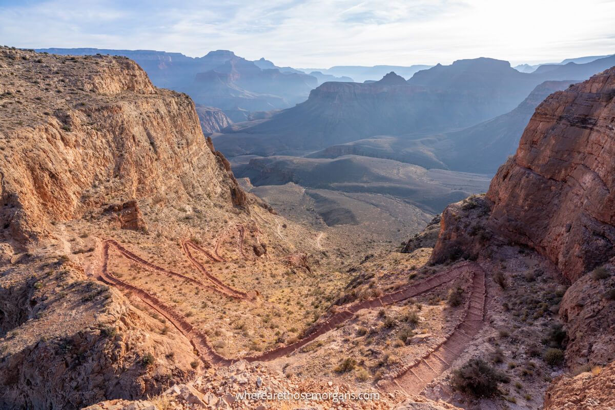
Immediately after Skeleton Point we dropped down a significant series of zig-zagging switchbacks into the sediment layer below. Going back up wouldn’t be fun, so make sure you’re up for it! At the bottom of the switchbacks, the trail turned easy and wide open until reaching The Tipoff, a flat plateau which we could see from afar. Here, we used the restroom and took a minute to rest in a shaded seating area.
Tip: This is the last place to turn around unless you’re serious about day hiking to Phantom Ranch and back. Consider that you still have to drop drop 1,400 ft over another 2.3 miles to reach the Colorado River.
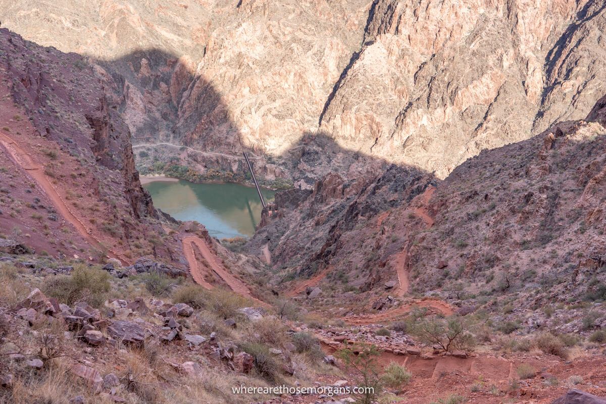
Phantom Ranch
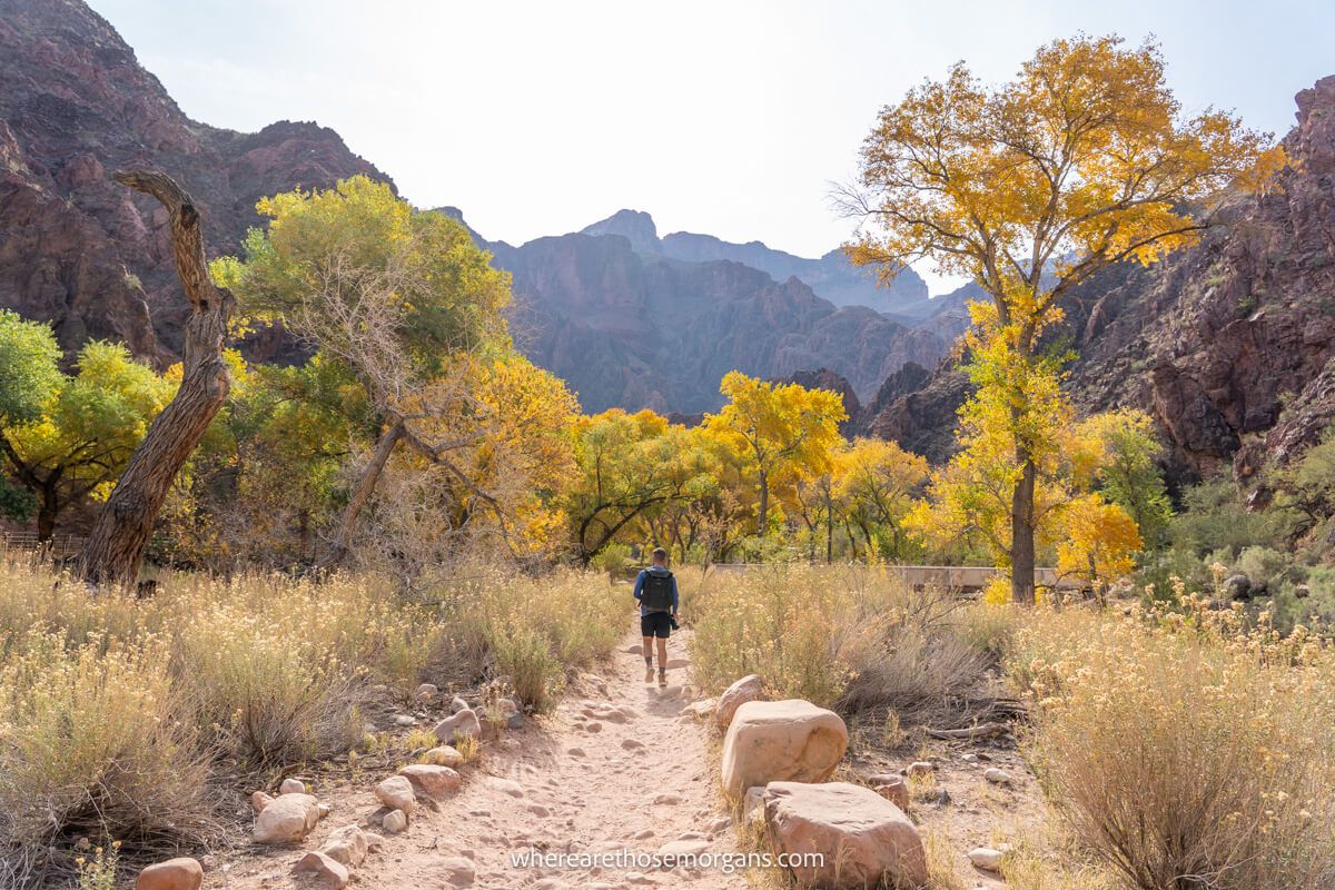
The final part of the descent was amazing! Up to The Tipoff it had been sandy and rocky underfoot, but now we were walking on maroon-colored dirt. Within a few minutes we got our first close-up view of the Colorado River, but it took another long series of switchbacks to finally reach Black Bridge. We crossed the river, walked to Phantom Ranch and grabbed a hot chocolate at the cafe.
The sense of satisfaction was enormous. Then we looked up at the 4,700 ft climb we had ahead of us on Bright Angel Trail to the rim. Oh boy! After refueling with a packed lunch and electrolyte drinks, we crossed the Colorado River on Silver Bridge and began our long ascent. You could go back up the shorter and steeper South Kaibab Trail, but you’ve already seen that trail, so why not see the other?!
Hiking Tips
- Set off early if you plan to hike the whole thing.
- Track your progress with a hiking app.
- Carry plenty of water, food and snacks.
- Wear comfortable but durable footwear.
- Always carry a means of treating water.
- Give yourself a cut off time for turning around.
- Keep on top of weather reports.
- Look for trail updates and warnings.
Best Time To Hike South Kaibab Trail
We’ve already mentioned this but it’s important so we’ll say it again: do not attempt hiking South Kaibab Trail during the day in summer. You’d be putting yourself at serious risk of heat related issues. If you must hike in the summer, set off at first light and make sure you’re back at the rim by 9:00am-10:00am latest.
Hiking between late fall and early spring is much safer. We day hiked Rim to River in early December and conditions were perfect. Even during our visit in November 2019, we remember the weather being hot and feeling glad we weren’t hiking inside the canyon. You have to remember the temperature on South Rim is much lower than inside the canyon, which traps heat like an oven.
If you only plan to hike down to Ooh Ahh Point or Cedar Ridge, you can hike any time of day (late fall-early spring). But if you want to go further, we strongly recommend setting off early so you have plenty of daylight hours. Remember, the days are shorter when the temperatures are cooler. We set off on our Rim to River day hike as daylight broke and it took us 9 hours.
The Morgan Conclusion
What we like: The trail and views are amazing throughout. It’s more varied and exciting than Bright Angel Trail, and we also like that it’s quieter because it’s harder to access. This is one of the most iconic day hikes at the Grand Canyon and it happens to be our personal favorite.
What we don’t like: Getting to the trailhead isn’t easy. It’s also a less inclusive hike because it’s harder and steeper, which means beginners or less able hikers might be better suited to Bright Angel instead.
Is South Kaibab Trail worth it? Yes! We think South Kaibab Trail is the most picturesque and exciting hike leading from Grand Canyon South Rim to the Colorado River. Accessing the trailhead requires a bit of effort, but that keeps it quieter. The trail is steep but it has diverse views all the way to Phantom Ranch. Intermediate hikers can turn around at Cedar Ridge or Skeleton Point, but very strong hikers can quickly get down to the canyon floor before climbing back up the more gradual Bright Angel Trail in the afternoon.

We hope our guide to hiking South Kaibab Trail helps with planning your visit to the Grand Canyon!
Please let us know if you have any questions in the comments below.
Happy Travels,
Mark and Kristen
Find our guide helpful? Pin it for your visit!


All Rights Reserved © Where Are Those Morgans, LLC. Republishing this article and/or any of its contents (text, photography, maps, graphics, etc.) in whole or in part is strictly prohibited.

Mark and Kristen spent 6 years traveling the world, visiting over 40 countries across 4 continents and more than 30 US states. They created Where Are Those Morgans in 2018 to help others plan the best possible vacations by writing authentic travel and hiking guides based on their real experiences.
Since the arrival of baby Maya in late 2024, Mark and Kristen’s extensive travels have slowed down but they still take plenty of trips. Where Are Those Morgans now helps millions of travelers each year to visit new places and hike new trails through information-packed blog posts and expert travel guidebooks. Read more about Mark and Kristen.
A wonderful adventure. Started before sunrise and as we descended, the canyon lit up with the sunrise. Once you have conquered this round trip experience of a lifetime, train for a rim to rim hike. North rim beautiful as well. Fewer tourists and traffic. Spend the night on the North rim and then, rim to rim back to South rim the following day. Then you deserve a T-shirt from gift shop saying Rim to Rim Grand Canyon. Incredible. Wish I was young enough to do it again.
Thank you, Jeri. Rim to Rim and back again is exactly what we plan to do next time we are at the Grand Canyon. South Rim is amazing but it is so busy and we know North Rim has very few visitors. Watching a sunset and then a sunrise from North Rim is very high on our wishlist!