The Fire Wave Trail is an easy 1.5-mile roundtrip hike with 175 feet elevation gain in Valley of Fire State Park, Nevada. We hiked the sandy and rocky trail to Fire Wave for sunrise and we were completely blown away by its otherworldly topography. As far as we’re concerned, it’s one of the most picturesque hiking trails in the American southwest, and you shouldn’t miss it if you’ll be visiting the Las Vegas area.
In this guide we explain everything you need to know about hiking the Fire Wave Trail, based on our own experiences. Read more about us.
We visited Valley of Fire for 2 days in November 2021 as part of our road trip from Seattle to Sedona. After 5 fun days in Las Vegas, we spent a full day in the park, watched sunset, stayed at a hotel in nearby Overton and then drove back into the park in the dark to hike Fire Wave for sunrise.
It turned out to be a super easy trail (even with just headlamps to light the way) and we were the only two people at the incredibly beautiful Fire Wave landscape waiting for sunrise with our cameras at the ready. Honestly, we’d put this up there with our favorite hikes in the US, so let’s get right into it!
Note: Our content is reader supported and contains affiliate links. If you make a purchase through one of these links, we may earn a small commission at no extra cost to you and it helps us keep this site running.
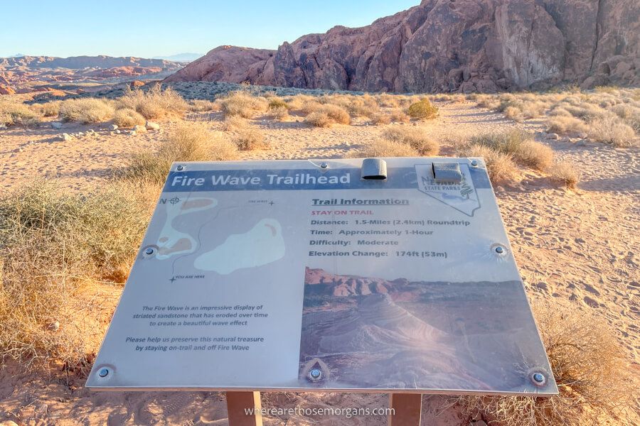
Trail Information
- Distance: 1.5 miles roundtrip
- Elevation gain: 175 feet
- Time: 1-2 hours
- Difficulty: Easy
The trail is short and has very little elevation gain, but it is sandy and rocky throughout so we recommend wearing robust shoes with good tread. At the trailhead you’ll see an information sign that says the hike is moderately difficult, but we think it should be rated as easy. With that said, the trail is completely exposed, so you must take precautions if you hike it in hot weather conditions.
You could easily hike to the Fire Wave and back in less than 1 hour if you’re short on time, but you’ll definitely want to spend some time enjoying the unique terrain at the end. Overall, we think it’s a hike the whole family can do, just note that it’s not accessible for wheelchairs or strollers.
Fire Wave Trailhead Parking
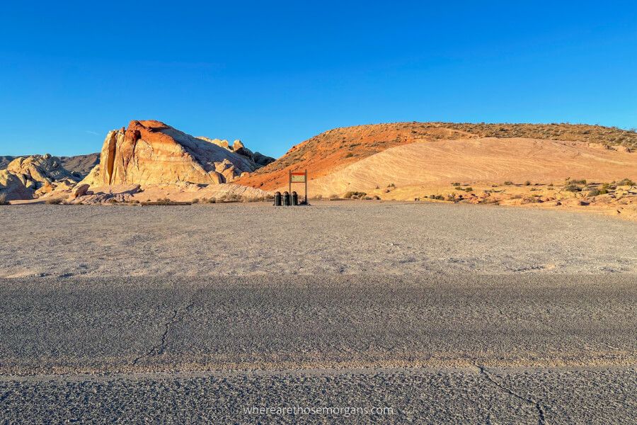
The trailhead parking area for hiking Fire Wave is located near the end of Mouse’s Tank Road in Valley of Fire State Park. It’s 61 miles from the center of the Las Vegas Strip and 19 miles from Overton, which is the closest place to the park with hotels.
- Here’s the exact Google Maps location for the trailhead parking area.
You can park on both sides of Mouse’s Tank Road at the trailhead. As you approach, you’ll find lots of spaces in the left side lot and maybe 10-15 spaces in the right side lot, which is where the trail begins.
Note: There are no restrooms at the trailhead, and the nearest vault toilets are located 1 mile away at the very end of Mouse’s Tank Road at The White Domes Trail.
Fire Wave Trail Map
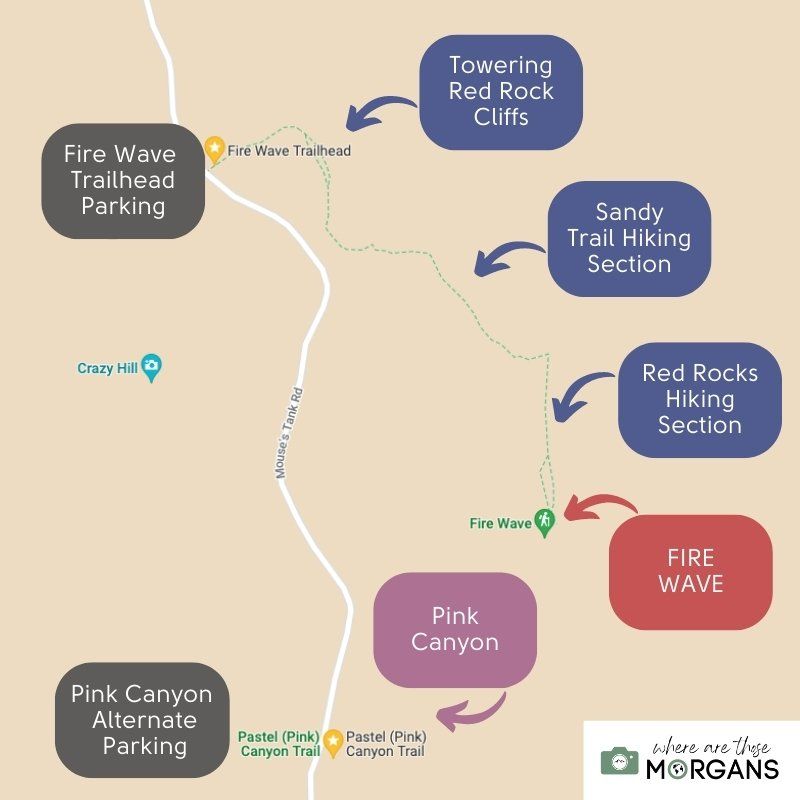
We created the map above to help you visualize the hike. Our walkthrough below covers each section in detail, so you’ll know exactly what to expect when you arrive. And we’ll cover Pink Canyon later in the guide.
Trail Walkthrough
We’re going to walk you through the hike exactly as it was for us and with our photos, so you know what to expect. We took most of the photo’s you’ll see below on the way back to the trailhead, otherwise they’d all be in the dark because we arrived at Fire Wave for sunrise!
Note: It doesn’t matter that we hiked at sunrise, you can still follow the walkthrough if you’ll be hiking it any other time of day.
1. Trailhead Parking
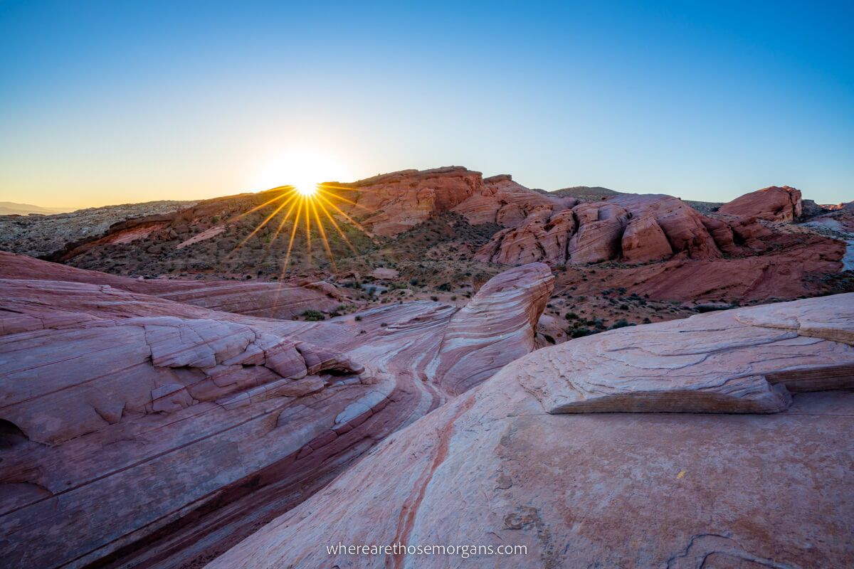
We left our hotel in Overton at 5:00am so we’d make it to Fire Wave in time for sunrise, which was around 6:30am near the end of November. Nobody else was in sight, and we arrived at the trailhead parking lot as the only vehicle.
We put our headlamps on, grabbed our photography gear and daypacks, and started walking on the sandy trail towards tall red rock cliffs.
2. Red Rock Cliffs
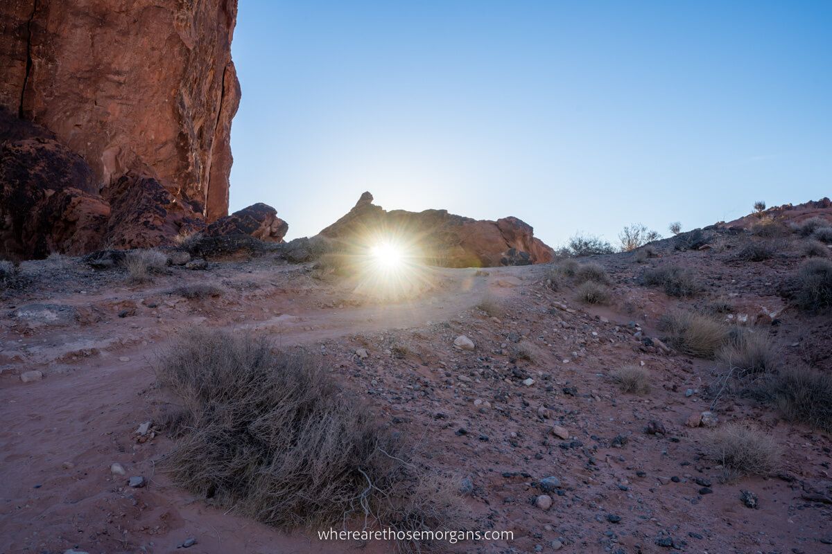
Once we reached the base of the towering cliffs, we turned right and followed wooden poles with reflective yellow strips heading southeast.
Not long after, we reached a cluster of huge boulders and small stones in a large pile. The trail circled around the boulders with a very slight elevation gain until it crested and transitioned into a gradual descent.
3. Sandy Path
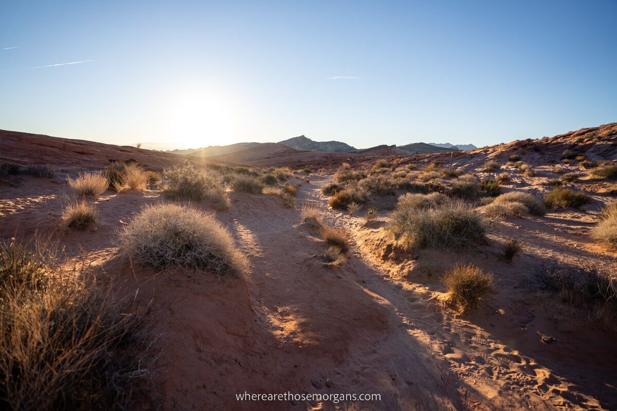
Next, we followed a narrow sandy trail as it cut through a shallow valley. It was here that we began to see the contrasts in colors between grays and reds ahead of us, even with headlamps on in the dark. So we knew we were getting close.
We continued along the path, following the poles with yellow stripes. In the dark it looked like there were several sandy trails leading in different directions, but we were using our hiking app to track our movement so we didn’t stray from the correct path.
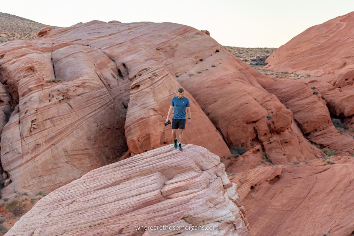
4. Red Rocks
Eventually the sandy trail transitioned into hard red rock, which made things easier underfoot. But the rocky area was wide open and it all looked the same, so we kept scanning with our headlamps to find the next trail marker pole and followed our offline map app.
By this point if you’re hiking in daylight you’ll already be able to tell how picturesque the rock formations are here. Our advice is to slow down and really look around so you don’t miss anything.
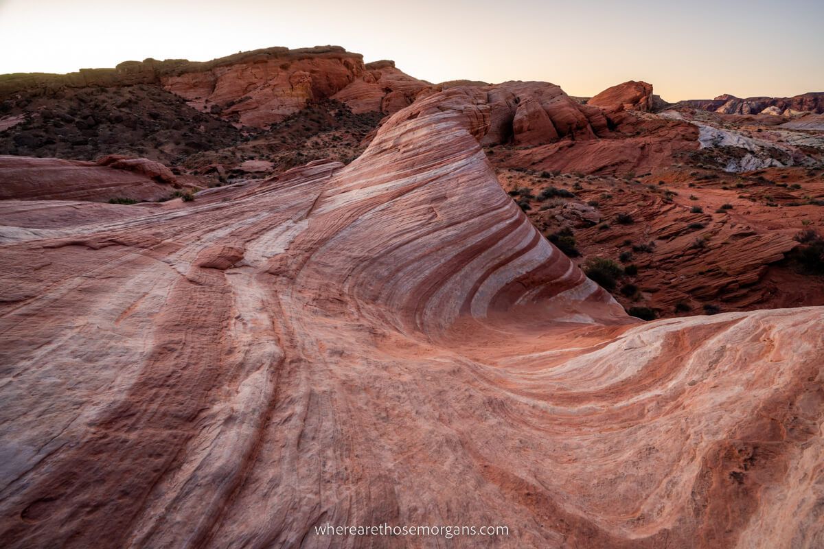
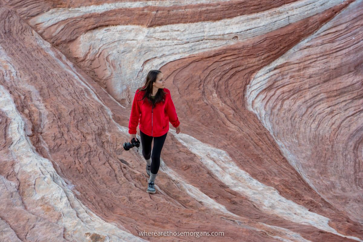
5. The Hump
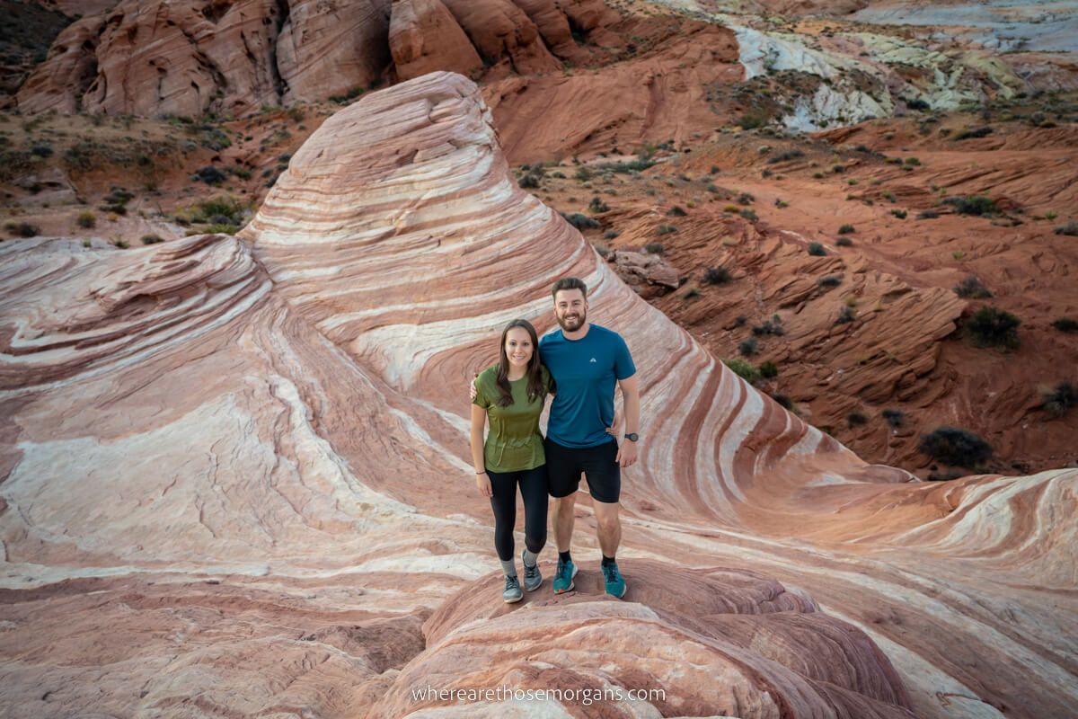
It was very obvious once we’d arrived to the final stretch because the formations began to look like candy with swirling patterns. So we followed the smoothly sloping red rock face south and gained elevation one final time.
As we were climbing it felt like we were walking into the sky, but as soon as we passed over the hump it instantly felt like we’d been teleported to another planet.
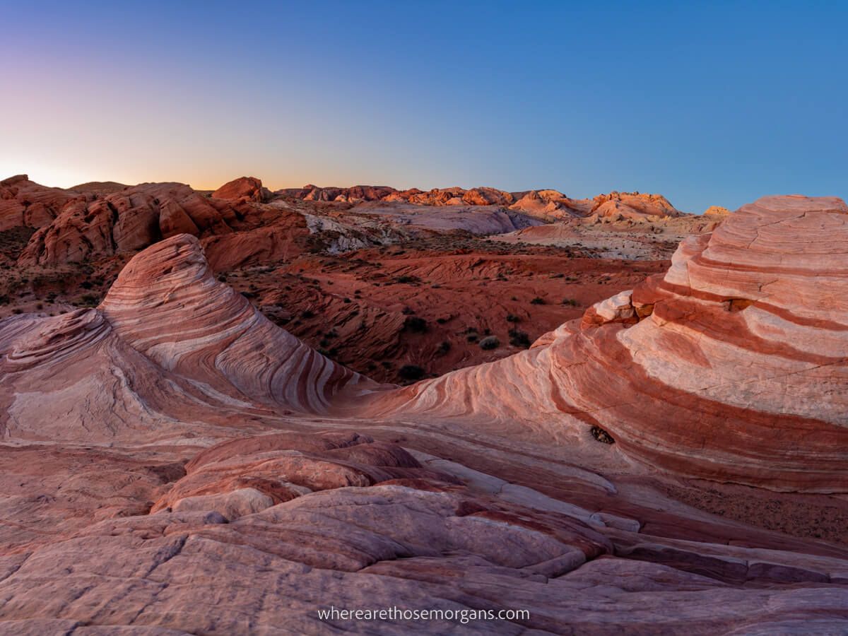
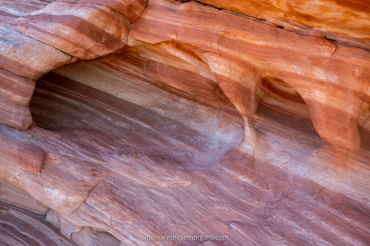
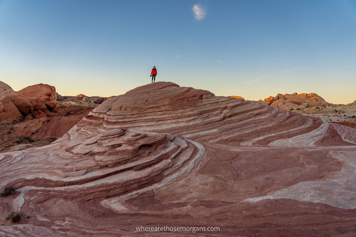
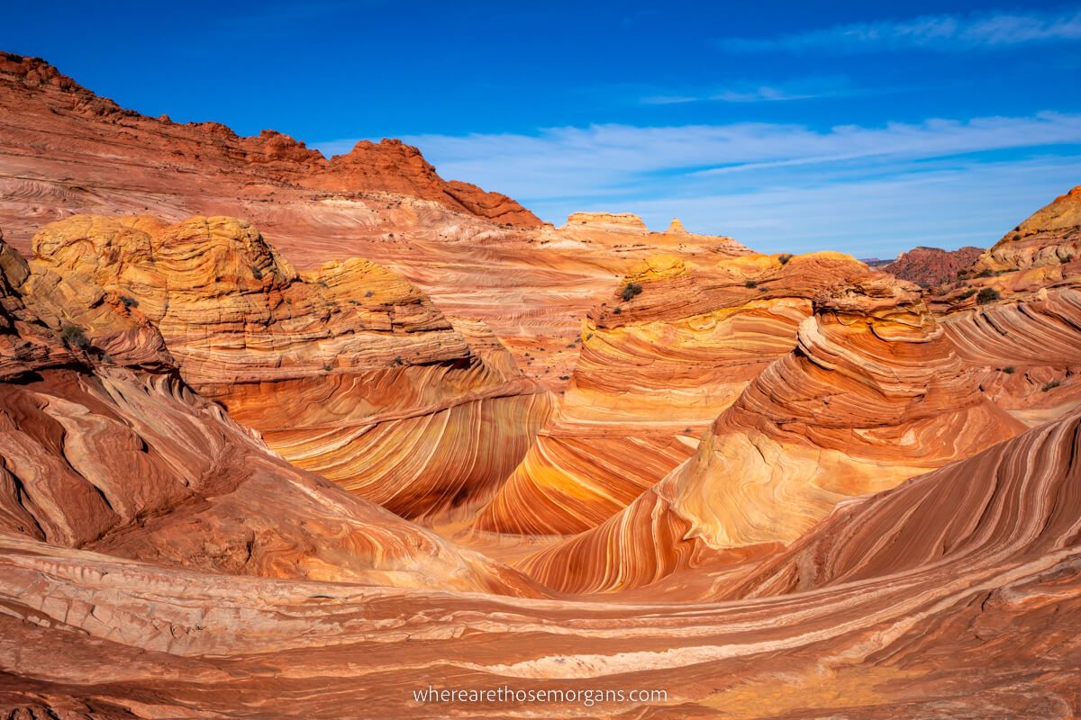
6. The Fire Wave
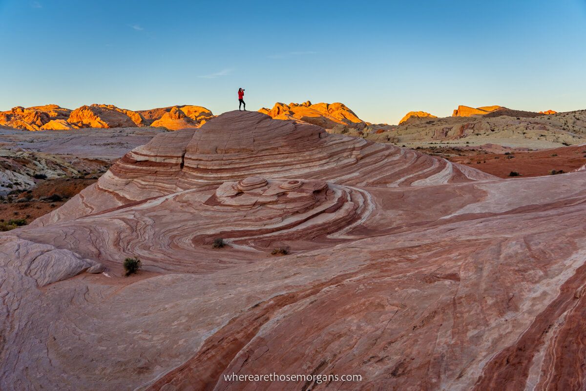
We were blown away by the flaming red landscape appearing as though it belonged on Mars. Red and white sandstone layers like waves curved around dome-shaped formations, creating a mind bending whirling effect like a lollipop.
We had the whole place to ourselves for the hour we spent walking around and photographing the sunrise. And it remains one of our favorite experiences in the US southwest to date.
7. Pink Canyon (Optional)
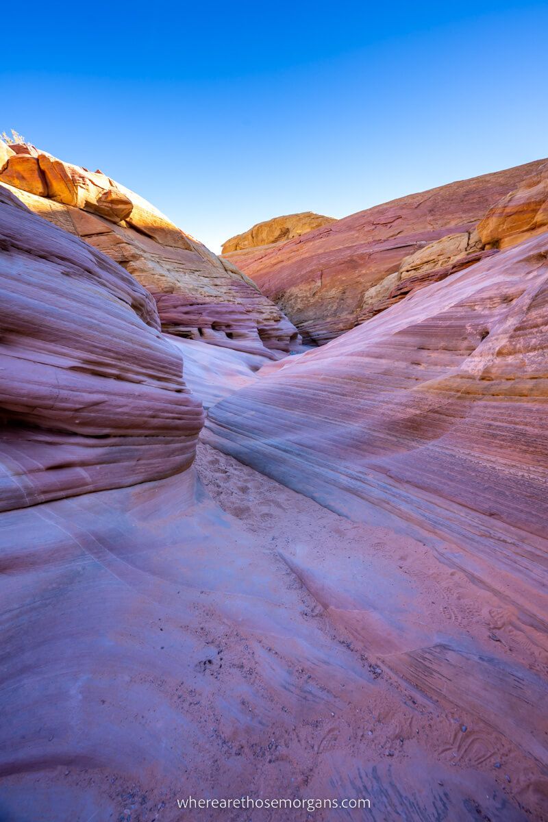
If you want to see Pink Canyon (you should, it’s beautiful!), then you have 2 options once you’re finished at Fire Wave:
- Turn around, go back to your car and drive to Pink Canyon
- Continue from Fire Wave to Pink Canyon on foot
At the time, we didn’t realize the two connected so easily, so we returned to our car, drove to White Domes and then drove to Pink Canyon. But it’s actually really easy to walk from Fire Wave to Pink Canyon, so it might be easier for you to do it while you’re there.
And if you’re looking for a really fun experience, you should hike Seven Wonders Trail, which consists of Fire Wave, Pink Canyon and then 5 more natural attractions in a larger loop which begins and ends at Fire Wave Trailhead.
Pros And Cons
Here are our pros and cons to hiking the Fire Wave Trail in Valley of Fire:
Pros
✅ Easy, flat and fun hike suitable for all abilities
✅ Spectacularly photogenic ending
✅ Perfect for solo visitors, couples, families and groups
✅ So much bang for your buck
✅ Lots of parking available
Cons
❌ Can be overcrowded at peak times
❌ Photos don’t look as good during the day
❌ Trail can be dangerous in hotter weather
Best Time To Hike Fire Wave Trail
We think a weekday morning for sunrise in November, December, January or February is the best time to hike Fire Wave Trail in Valley of Fire. You’d benefit from comfortable temperatures, fewer crowds and soft low angled sunlight.
Weekends and especially holiday weekends are naturally going to be busier, so we advise avoiding them if possible. March, April, September and October tend to be busier months because they’re warmer.
IMPORTANT: Valley of Fire is open year round, but it’s major trails including the Fire Wave are closed May-September because extreme heat causes too many emergency calls. If you visit the park in summer, you will not be able to hike this trail.
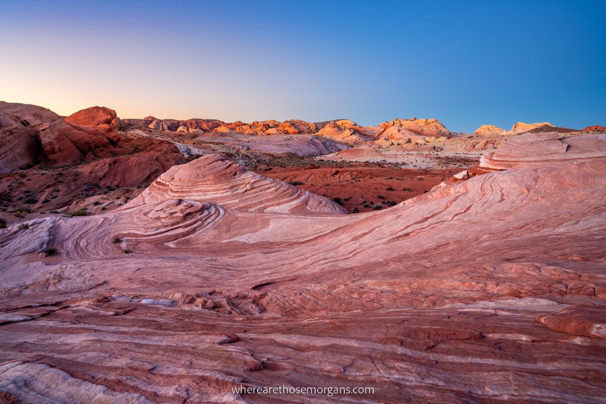
Our Fire Wave Sunrise Photos
We took so many photos during our hike! And instead of letting them go to waste, we thought we’d share some more with you in the hope that we inspire you to hike for sunrise when you visit.
Similarities With The Wave In Arizona
The last thing we’ll cover in this guide is comparisons being drawn between Fire Wave and The Wave in Arizona. We’ve hiked both and they’re both are amazing, but they’re also very different.
For us, The Wave is one of the most extraordinary landscapes in the US, but it has a lottery permit system that’s notorious for being the most difficult hiking permit to win in the country.
And that’s where the Fire Wave in Valley of Fire has a huge advantage. Anyone can turn up and hike Fire Wave between October-April without a permit. Sure, the topography isn’t quite as remarkable, but it’s not a million miles away either!
The Morgan Conclusion
The Fire Wave Trail in Valley of Fire is one of our favorite hikes in the American southwest. It’s easy to access from Las Vegas, it’s an easy hike suitable for the whole family and it leads to a magical terrain that you won’t see in many other places across the US.
Overall, we think it’s an unmissable stop between Vegas and Zion. And the next time we’re in the area with friends or family, we’ll definitely be taking them to see the Fire Wave at sunrise.
More From Las Vegas
- Free and cheap things to do in Vegas
- Fun things to do in Valley of Fire
- How to visit Seven Magic Mountains
- Las Vegas day trip ideas
- Las Vegas shows you can’t miss
- Our Las Vegas secret food tour
- Top hikes in Red Rock Canyon
- Top Las Vegas Strip hotels
- Visit the Hoover Dam from Las Vegas
Want more Nevada content? Head over to our Nevada Travel Guides to explore State Parks, beautiful landscapes and the best things to do in Las Vegas.
We hope our guide to hiking Fire Wave Trail helps with planning your visit to Valley of Fire State Park!
Please let us know if you have any questions in the comments below.
Happy Travels,
Mark and Kristen
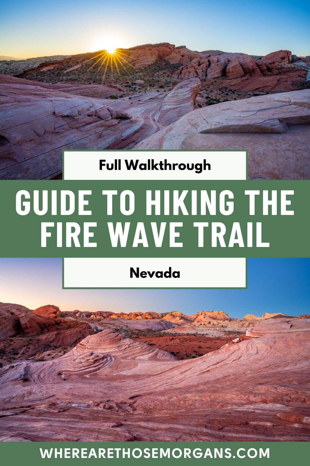
Enjoy this guide? Pin it for later!

All Rights Reserved © Where Are Those Morgans, LLC. Republishing this article and/or any of its contents (text, photography, maps, graphics, etc.) in whole or in part is strictly prohibited.

Mark and Kristen spent 6 years traveling the world, visiting over 40 countries across 4 continents and more than 30 US states. They created Where Are Those Morgans in 2018 to help others plan the best possible vacations by writing authentic travel and hiking guides based on their real experiences.
Since the arrival of baby Maya in late 2024, Mark and Kristen’s extensive travels have slowed down but they still take plenty of trips. Where Are Those Morgans now helps millions of travelers each year to visit new places and hike new trails through information-packed blog posts and expert travel guidebooks. Read more about Mark and Kristen.