Day hiking the iconic South Kaibab to Bright Angel Trail (also known as Rim to River) at Grand Canyon South Rim is one of our favorite travel memories to date. We had so much fun descending to the Colorado River on the steep South Kaibab Trail and climbing back up to the rim on the more gradual Bright Angel Trail. It’s easily among the best hikes we’ve done in the US, but trust us when we say it wasn’t easy!
In this guide we show you how to day hike the unique South Kaibab to Bright Angel Trail at Grand Canyon South Rim, based on our experiences. Read more about us.
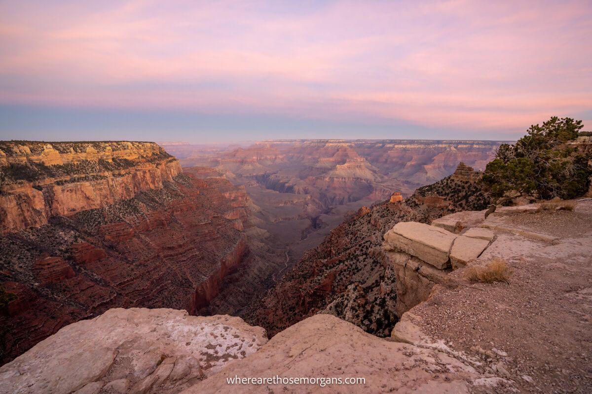
We hiked the Grand Canyon’s legendary Rim to River Trail on a beautiful day in December 2021. After taking the Hikers Express bus in the cold and dark from the visitor center to South Kaibab Trailhead, we watched a stunning sunrise burst into the canyon and the morning warmed up to give us perfect hiking conditions. And after almost 9 hours, we arrived back at Bright Angel Trailhead on South Rim.
The hike was endlessly picturesque, challenging and varied. We barely saw any other hikers, we took hundreds of photos and we even stopped for a hot chocolate at Phantom Ranch cafe on the canyon floor. It was a long day and by the end we were definitely getting tired, but it was a truly incredible experience that we’ll never forget. Okay, let’s begin!
Note: This article may contain affiliate links. If you make a purchase using one of these affiliate links, we may earn a small commission at no extra cost to you. Thank you!
Grand canyon Planning
📖 Ultimate Guidebook: Get our complete 37-page Grand Canyon PDF with everything you need.
📞 Personalized Grand Canyon Planning: Book a call with Mark to have your questions answered and plan the perfect itinerary.
💡 Still Planning? Read our essential first-timer’s guide to visiting Grand Canyon.
What You Need To Know
Okay, let’s dive right in. Here are the key things you should know about day hiking the Grand Canyon’s Rim to River Trail:
- It’s a long and hard hike that will challenge you physically and mentally.
- The second half of the trail climbs thousands of feet.
- It should only be attempted by strong and experienced hikers.
- Do not attempt this hike on hot days or anytime in summer.
- It’s much hotter inside the canyon compared to the rim.
- Getting an early morning start is essential.
- You must carry plenty of fluids, food and snacks.
- The hike is completely exposed to the elements.
- There is no potable water on South Kaibab Trail.
- Bright Angel Trail has water filling stations.
- Dogs are not allowed on the trail.
You can hike down and back up either trail but it’s important to know that South Kaibab Trail is shorter and steeper, whereas Bright Angel Trail is longer and more gradual. Technically, there are 4 ways you can hike Rim to River:
- Down and up Bright Angel Trail
- Down and up South Kaibab Trail
- Down Bright Angel and up South Kaibab
- Down South Kaibab and up Bright Angel
With that said, going down South Kaibab and up Bright Angel is the most commonly used route. It’s 17.1 miles in total with 4,740 ft elevation loss followed by 4,380 ft elevation gain.
Going down South Kaibab is more popular because the descent is on the steeper and shorter path, before a more gradual and longer ascent. Trust us, going up South Kaibab would not be fun! Also, there’s no water on the way down but there is water when you need it on the way back up Bright Angel Trail in the afternoon.
Overview Of Our Hike
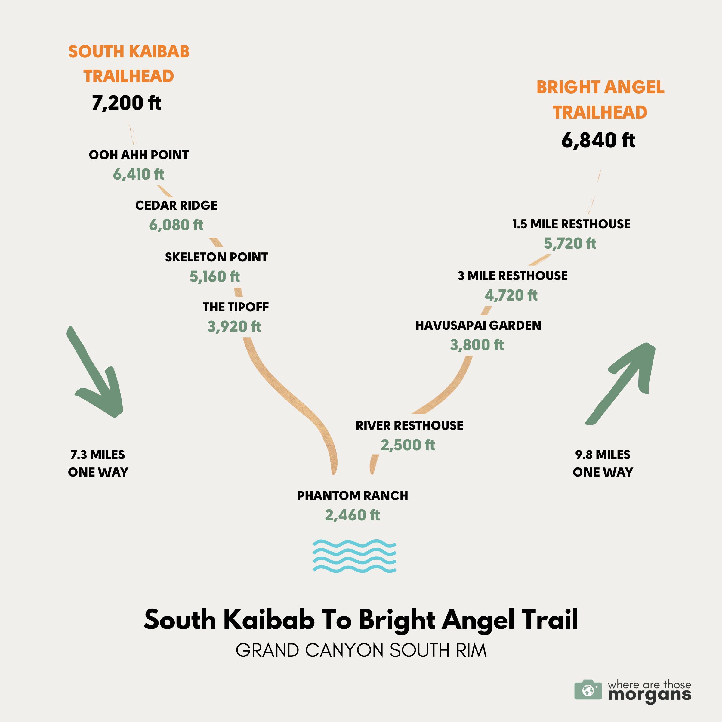
Hiking South Kaibab to Bright Angel Trail can take anywhere from 6-12 hours depending on your ability and conditions on the day. It took us 8 hours and 50 minutes to complete, and here are the interval times from our hike to use as a reference:
- 7:00am – Arrived at the visitor center to get the Hikers Express Shuttle
- 7:15am – Began hiking down South Kaibab Trail
- 7:35am – Reached Ooh Ahh Point as the sun was rising
- 8:00am – Arrived at Cedar Ridge
- 8:45am – Reached Skeleton Point
- 9:30am – Made it to The Tipoff
- 10:30am – Crossed Black Bridge over the Colorado River
- 10:50am – Walked into Phantom Ranch
- 11:35am – Crossed Bright Angel Bridge after lunch
- 12:05pm – Passed by River Resthouse and began the ascent
- 1:35pm – Long and slow climb to Havasupai Garden
- 2:35pm – Reached 3-Mile Resthouse
- 3:25pm – Arrived at 1.5-Mile Resthouse
- 4:05pm – Summited back at Bright Angel Trailhead
We got the very first shuttle of the day, took things nice and easy, stopped for lots of photos and had a 30 minute lunch break at Phantom Ranch. Overall, we think we paced ourselves well because any quicker we’d have sacrificed enjoying the trail, and any slower we’d have been pushing it for daylight hours.
Need help planning your trip to Grand Canyon?
Our popular Grand Canyon travel guidebook helps you with planning every aspect of your visit to South Rim, including the best viewpoints and hikes, where to eat and stay, itinerary ideas and map!
View Guidebook
Trail Walkthrough
Next, let’s walk through the hike exactly as we did it so you know what to expect.
South Kaibab Trailhead
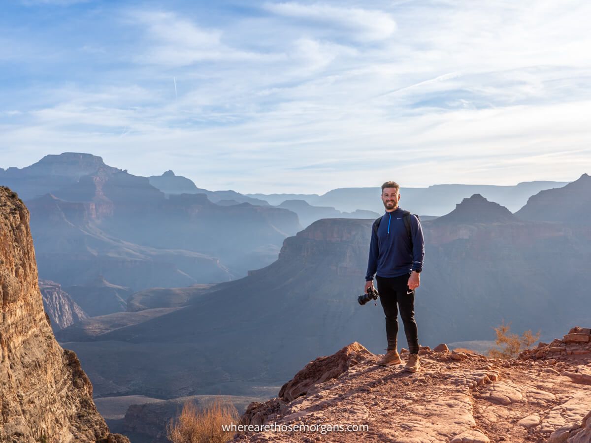
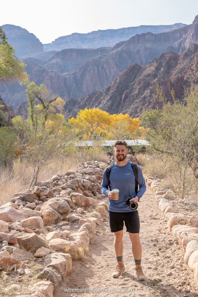
We got a super early start at our hotel in Tusayan, grabbed our hiking gear, ate a hearty breakfast and filled an extra hot coffee to combat the cold December morning. Next, we drove a few miles to the main visitor center parking lot and hopped on the Hikers Express shuttle at 7:00am. Before we knew it we were back out in the cold at South Kaibab Trailhead, ready for our adventure.
Ooh Aah Point (0.9 miles)
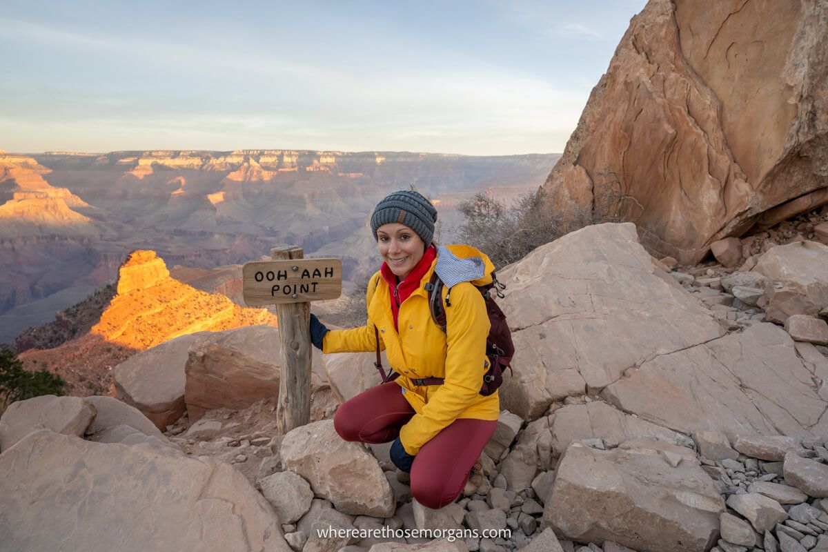
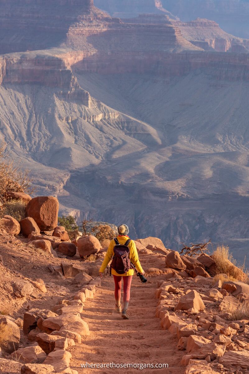
The first part of the descent to Ooh Aah Point was awesome. The views were amazing, the trail was photogenic and the switchbacks were gradual. But the best was yet to come because right as we arrived at Ooh Ahh Point, intense beams of sunlight burst into the canyon all around us. It was one of the highlights of our hike, so try timing your hike to arrive at this first landmark in time for sunrise.
Cedar Ridge (1.5 miles)
We didn’t hang around for long, quickly dropping down more short dirt-path switchbacks until reaching a flat table-top plateau called Cedar Ridge. This part of the hike was fairly easy going and the only other people on our morning shuttle turned around at Ooh Ahh Point. After stopping for a few photos, we each used the vault toilets at Cedar Right and then cracked on with the descent.
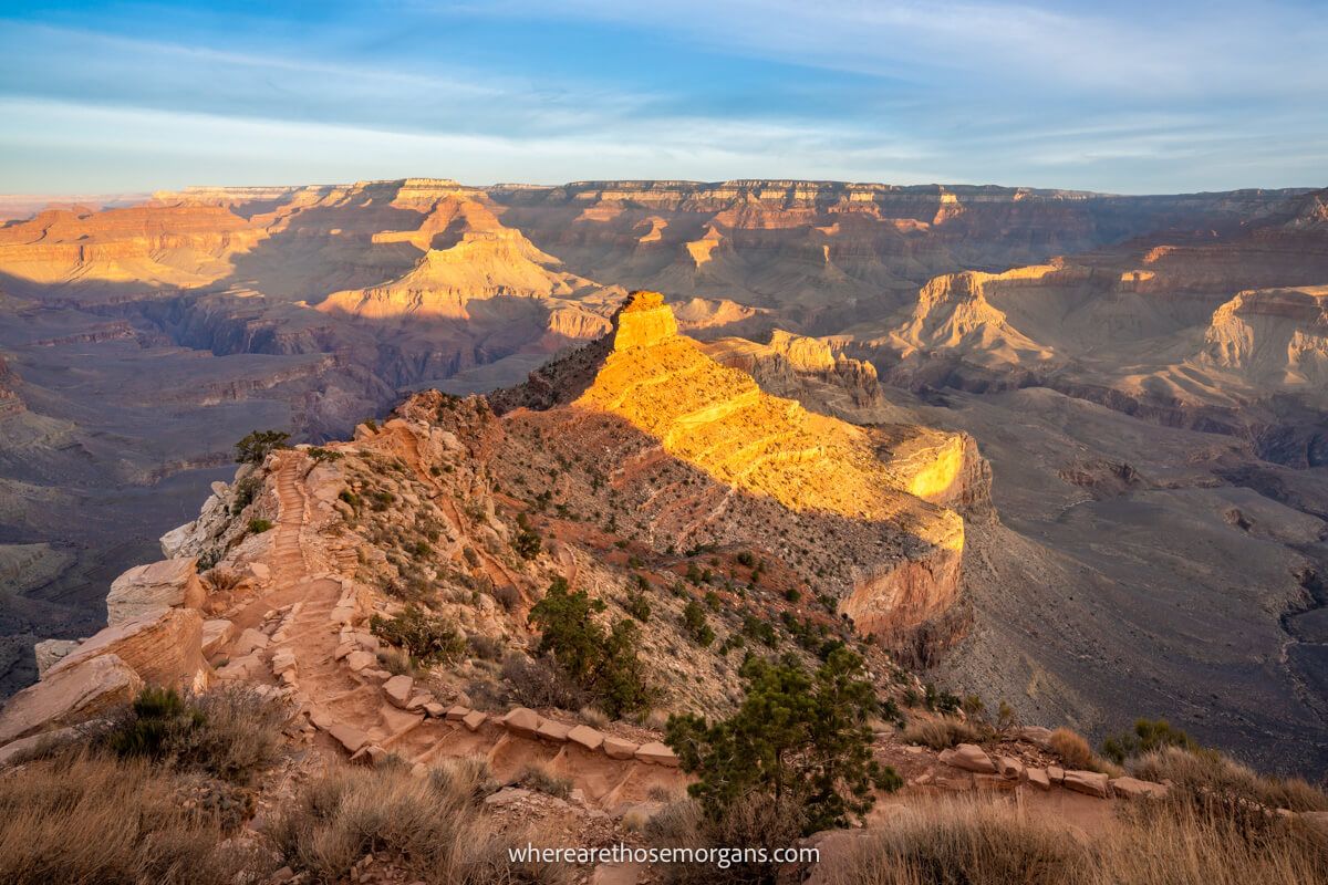
Skeleton Point (3 miles)
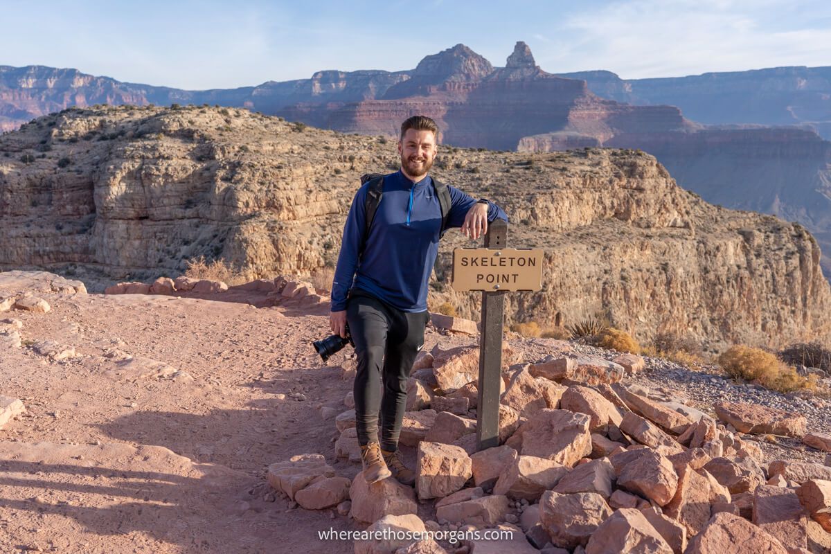
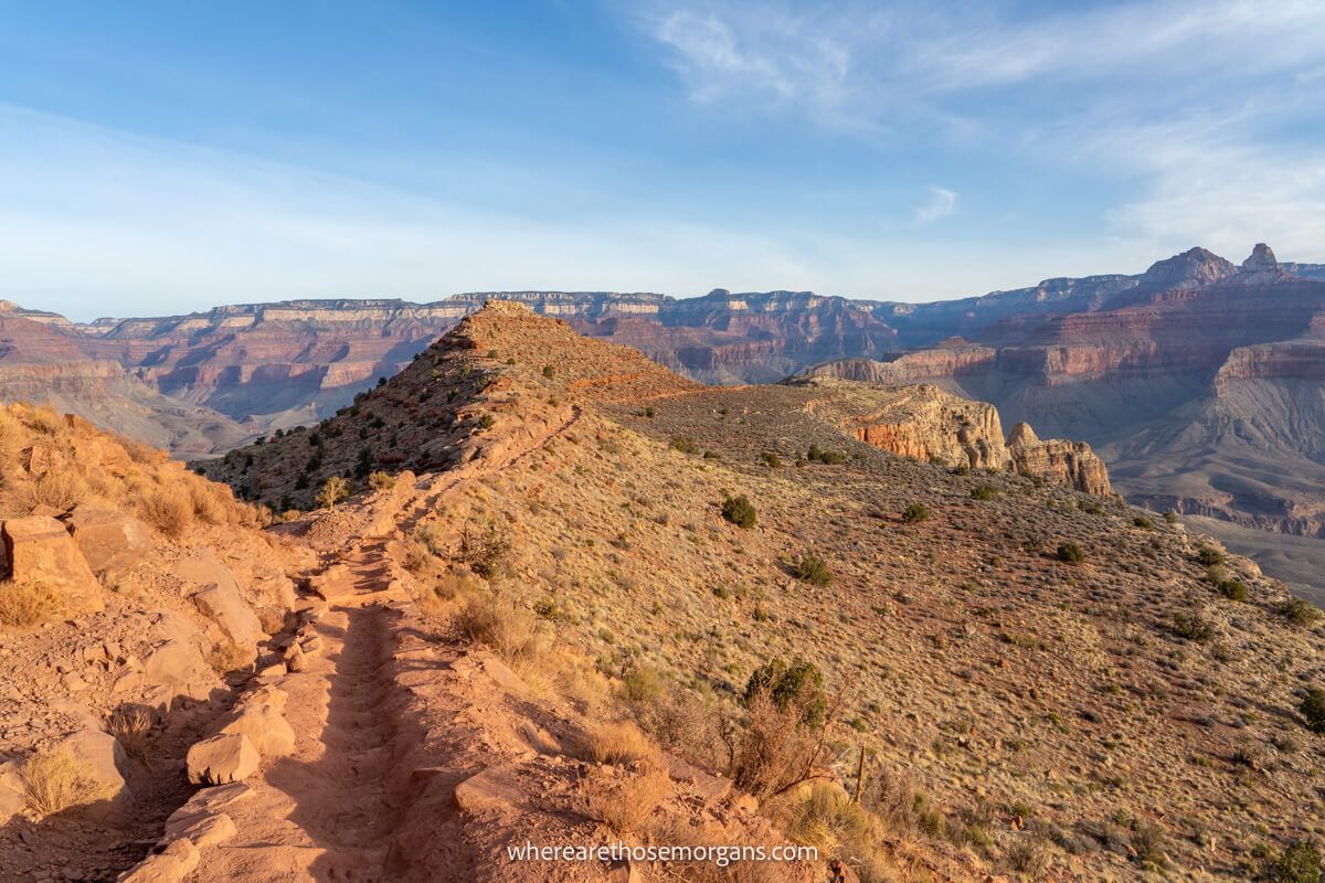
After leaving Cedar Ridge we dropped down to the base of O’Neill Butte, a massive submarine-shaped rock formation. After passing by its right hand side, we began hiking out further into the canyon and away from South Rim. Then all of a sudden a wide open view of the trail curving and leading to the flat Skeleton Point opened up. To the right side of Skeleton Point we could see huge and steep switchbacks.
The Tipoff (4.5 miles)
Immediately after leaving Skeleton Point we zig-zagged down into deeper sediment layers on those steep switchbacks. Then the trail flattened and was easy going for a nice long period. Eventually we reached a point where the trail curved left and a straight ahead view opened up to reveal a flat plateau with an enormous gaping crack right behind. The very edge of the flat plateau was The Tipoff.
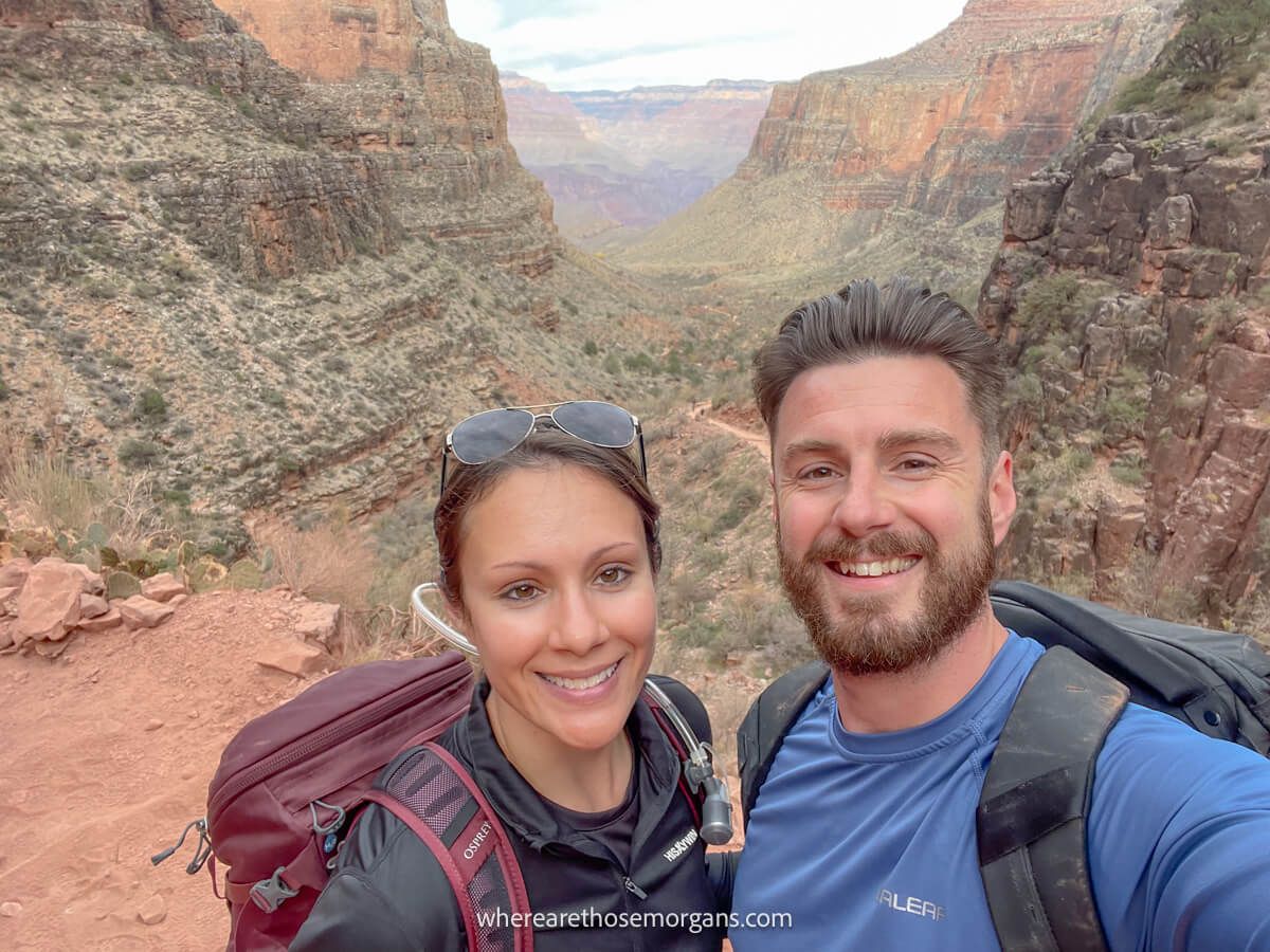
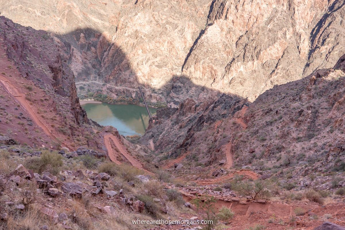
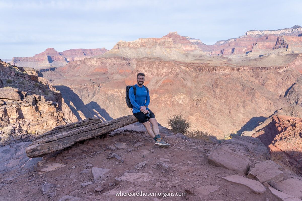
Phantom Ranch (7.3 miles)
The final part of the descent to the Colorado River was unforgettable. An amazing view of switchbacks cutting down to the river and Black Bridge opens up immediately after leaving The Tipoff. It didn’t take long for us to reach the bridge, cross over and walk alongside the river until entering Phantom Ranch. We grabbed a hot chocolate from the cafe and ate our packed lunch.
River Resthouse (9.3 miles)
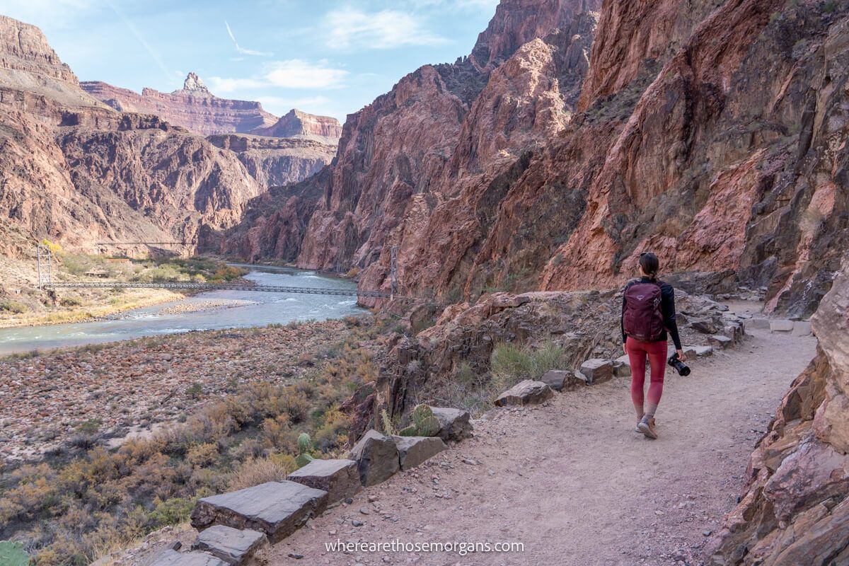
Radiant leaves illuminated the lower canyon at Phantom Ranch, which was totally unexpected. But we couldn’t bask in our achievement and enjoy the autumnal colors for long. We had 9.8 miles and 4,380 ft to go! Looking up at the rim was intimidating but brought on a wave of excitement. So we crossed Bright Angel Bridge, followed the river on a sandy path and arrived at River Resthouse.
Havasupai Garden (12.6 miles)
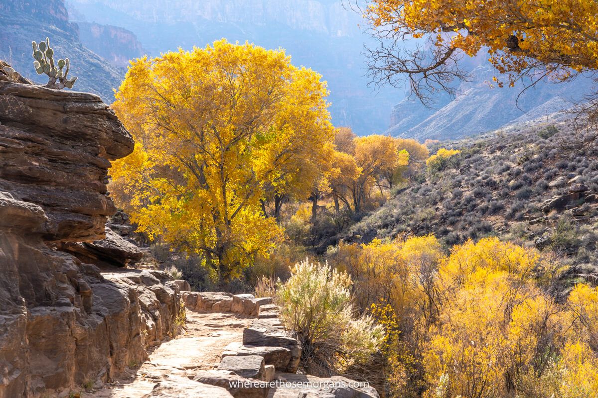
We didn’t bother with the toilet or spur trail leading down to a small beach at the resthouse. It was time to head away from the river and climb back to the rim. We began walking through a narrow gorge filled with plants and long grass, before reaching an immense series of switchbacks. At the top, we entered Garden Creek which was filled with vegetation and vibrant leaves all the way to Havasupai Garden.
3-Mile Resthouse (14.1 miles)
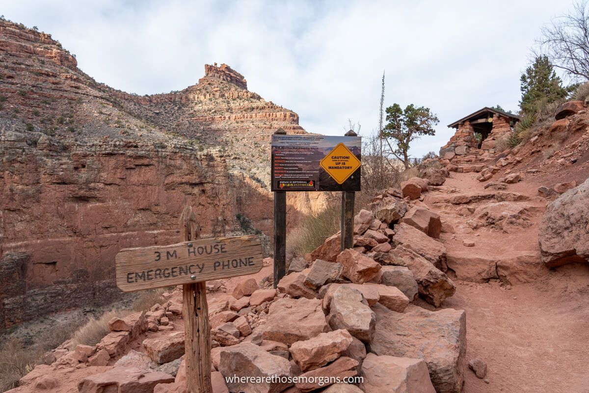
The first section between Havasupai Garden and 3-Mile Resthouse was easy going and gradual. But we were starting to fatigue and we remember this part feeling like it lasted forever. Then we hit the first of many switchbacks which would take us all the way up to the rim. Not long after starting the switchbacks we arrived at 3-mile resthouse, which was little more than a stone shelter.
1.5-Mile Resthouse (15.6 miles)
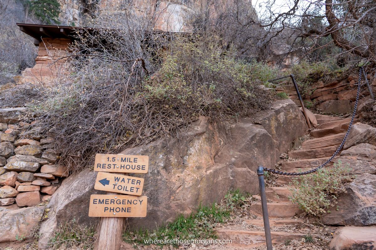
The next mile and a half were probably the toughest on the whole hike for us. It was a slog, switchback after switchback, and it felt like we were walking through syrup. The views behind were the same as they had been for ages, so we just got our heads down and put one foot in front of the other until we finally reached 1.5-mile resthouse, another small stone shelter.
Bright Angel Trailhead (17.1 miles)
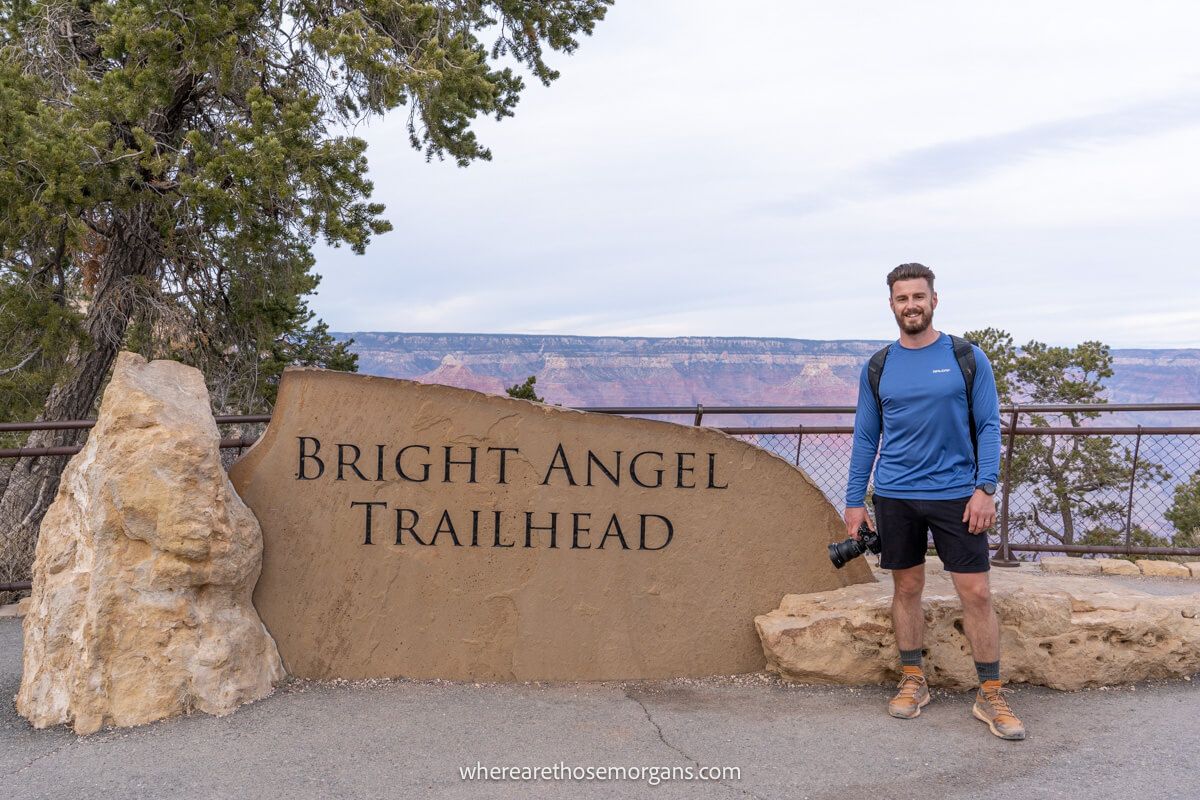
The last mile and a half to the rim was punishing but we had a renewed energy because we knew it was the final stretch. Passing through two tunnels helped to break up the monotony, but the switchbacks kept coming and coming. After a few choice words and lots of heavy breathing, we finally arrived back at the rim, more than ready for a celebratory beer!
Safety And Hiking Tips
Day hiking South Kaibab to Bright Angel Trail is not easy. Please ensure you’re prepared and confident in your ability to complete this hike without any issues.
Important safety resources:
- Drinking water – Important backcountry hiking updates including drinking water.
- Live weather – National Park live weather and road updates for Grand Canyon.
- Live webcams – See the park from various webcams for live conditions.
Our top tips:
- Late fall, winter and early spring are safer times to hike.
- Remember that daylight hours are shorter in winter.
- Eat well and hydrate in the days leading up to the hike.
- Get a good night’s sleep and wake up early to start at first light.
- You need a lot of water, electrolyte drinks, food and snacks.
- Don’t underestimate how much food you’ll need.
- Take a headlamp for the dark morning and evening.
- Wear robust, well worn and comfortable shoes.
- Carry a LifeStraw or other means of treating water.
- Give yourself a turnaround cutoff and stick to it.
- Use one of the popular hiking apps to track your hike.
Top tip: Remember, it takes longer to hike up than down. It might seem like you’re making good time but it can take up to twice as long on the way out. Always be aware of your time and consider shortening the route on connecting trails if you’re concerned it’s taking too long.
Best Time To Hike Rim To River Trail
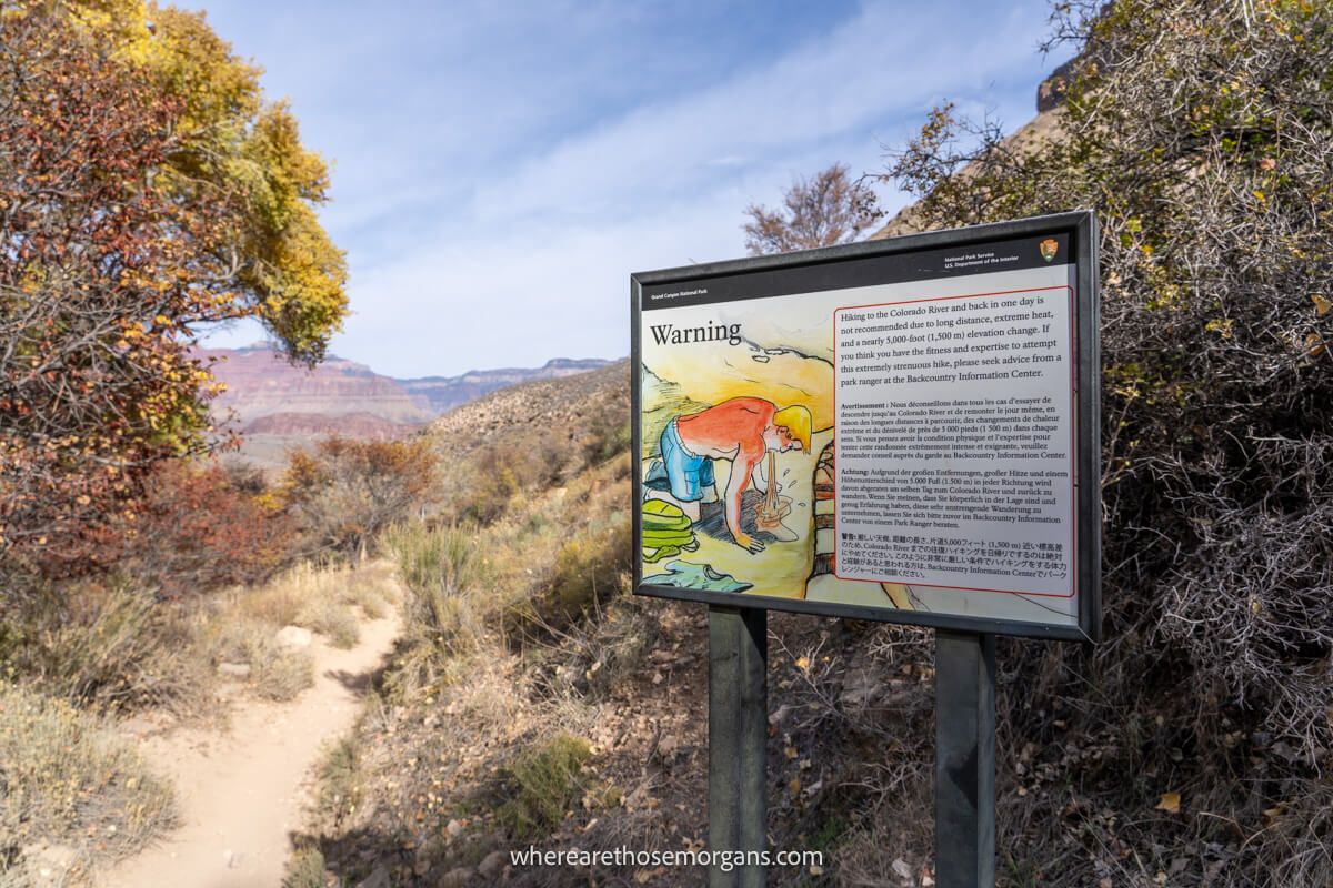
We’ve already mentioned this but it’s important so we’ll say it again: do not attempt hiking Rim to River Trail during the day in summer. You’d be putting yourself at serious risk of heat related issues. Hiking between late fall and early spring is much safer, think along the lines of late November through early March just to be on the safe side.
We day hiked South Kaibab to Bright Angel Trail in early December and conditions were perfect. But it’s important to know that the weather is extremely changeable in winter. The day after our hike, we had a full whiteout snow day and couldn’t see 10 feet into the canyon all day. And remember, this hike will eat up a full day of your Grand Canyon itinerary.
In terms of time of day, it’s imperative you set off as early as possible if you plan to complete the full Rim to River hike. Set an early alarm, head out in the dark, get the Hikers Express shuttle and begin hiking at first light. That way you have more daylight hours to play with, so you can have more breaks and enjoy the hike more.
The Morgan Conclusion
What we like: It’s one of the iconic Grand Canyon trails and it was a truly unique experience. Hiking down from to the Colorado River was always on our bucket list and we’re so glad we had the chance to do it. We love South Kaibab Trail, we think it’s more varied and has better views. The shuttles are great both in the morning and afternoon once back at the rim. Oh, and the colorful desert vegetation was a nice surprise.
What we don’t like: It’s definitely not the safest hike we’ve ever done. There’s a lot that can go wrong with heat and lack of water sources. The second half of the hike was pure elevation gain which was tough when we started to get tired near the end.
Is Rim to River Trail worth it? Yes, the Grand Canyon’s Rim to River Trail is one of the most memorable and unique hikes in the US. It’s very hard and should only be attempted by strong hikers in cooler temperatures, but the trail is incredibly picturesque and the sense of achievement is enormous. In our opinion, it’s one of America’s most epic day hikes.

We hope our Rim to River hiking guide from South Kaibab to Bright Angel helps with planning your visit to the Grand Canyon!
Please let us know if you have any questions in the comments below.
Happy Travels,
Mark and Kristen
Find this guide helpful? Pin it for your visit!
All Rights Reserved © Where Are Those Morgans, LLC. Republishing this article and/or any of its contents (text, photography, maps, graphics, etc.) in whole or in part is strictly prohibited.

Mark and Kristen spent 6 years traveling the world, visiting over 40 countries across 4 continents and more than 30 US states. They created Where Are Those Morgans in 2018 to help others plan the best possible vacations by writing authentic travel and hiking guides based on their real experiences.
Since the arrival of baby Maya in late 2024, Mark and Kristen’s extensive travels have slowed down but they still take plenty of trips. Where Are Those Morgans now helps millions of travelers each year to visit new places and hike new trails through information-packed blog posts and expert travel guidebooks. Read more about Mark and Kristen.
I read your blog post this past week to prep for solo hiking this same route yesterday. I was so nervous because I had never hiked anything this long or with this much elevation before, but it’s been bucket list for me to go down to the Colorado and cross a suspension bridge while experiencing the majestic canyon! I used your timeline and it was a HUGE help to make sure I was on track, mentally break up the hike into sections, and ease my nerves. Thank you for posting this! It was amazing!
Hi Sarah, Congratulations on completing this solo hike, what an accomplishment! This is one of the best hikes we have ever done and so happy we could help you experience it too. Your comment has made our day 🙂
I’m just finished this hike and it was amazing! I prepped by studying your guide religiously. Thanks for all your tips.
Happy to hear you enjoyed the hike, Brad! Thank you for letting us know. South Rim to North Rim hike next time you are in Grand Canyon?!