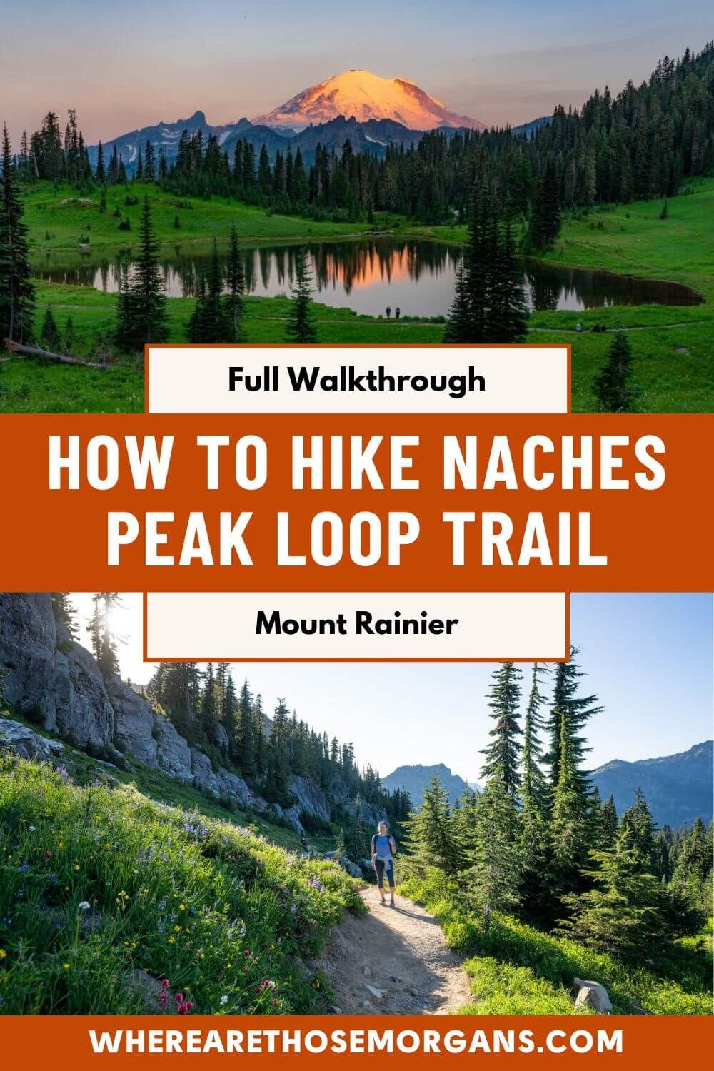
Naches Peak Loop Trail is one of our favorite Mt Rainier hiking trails because it’s quiet, easy, incredibly picturesque and half the hike is on the famous Pacific Crest Trail. We hiked the loop close to sunset, then returned at sunrise to photograph Mt Rainier reflecting in the mirror-like Tipsoo Lake which is the star attraction on the trail.
In this guide we explain everything you need to know about hiking Naches Peak Loop Trail in Mount Rainier, based on our experiences. Read more about us.
We hiked more trails than we could count when we lived near Seattle for 6 months in 2021. And Mt Rainier was the one place we couldn’t stop going back to because the trails ticked so many boxes. Admittedly, we only really knew about Skyline Trail before we researched hikes in the park to include on our wishlist. But we slowly formulated a shortlist of trails and Naches Peak Loop was near the top.
We’d already hiked Mt Fremont Trail in the nearby Sunrise region earlier in the morning before heading up Chinook Pass to hike Naches Peak Loop later in the afternoon. We only saw one other person on the entire loop (a weathered shirtless guy hiking the full PCT!) and the scene at Tipsoo Lake genuinely stopped us in our tracks. We knew we had to go back at sunrise! Okay, let’s begin!
Note: Our content is reader supported and contains affiliate links. If you make a purchase through one of these links, we may earn a small commission at no extra cost to you and it helps us keep this site running.
What You Need To Know
Okay, let’s dive right in. Here are the most important things you need to know about hiking Naches Peak Loop Trail:
- The hike is on the easier end of moderately difficult.
- Half of the hike is on the famous Pacific Crest Trail.
- The trail is snow free mid-July through mid-October.
- Wildflowers are best here around early-mid August.
- You don’t need specialist hiking gear.
- It’s a short hike so you can pack light.
- The trail is mostly open and totally exposed.
- Sunrise or early morning is the best time to hike.
- Hike clockwise for the best views.
- There’s a very smelly toilet at Tipsoo Lake.
- The road to Chinook Pass and Tipsoo Lake closes in winter.
- Check Mt Rainier’s live road conditions before arriving.
- Dogs are allowed on the PCT but not on Naches Peak Trail.
Trail Statistics
- Distance: 3.3 miles roundtrip
- Type: Loop
- Elevation Gain: 600 ft
- Difficulty: Easy/moderate
- Time: 2 hours
- Trailhead: Tipsoo Lake or Naches Peak
We hiked Naches Peak Loop Trail two hours before sunset on July 23rd in a clockwise direction. Clockwise is best because it means you get direct Mt Rainier views as you walk downhill to the west. Our goal was to time it for peak wildflowers season but we were maybe one or two weeks early.
Sunset was a wonderful time of day to hike because it had cooled after a long hot day and it was less busy than it would have been at midday. But it did mean a lot of the trail was blanketed in deep shadows, and worse still we were looking directly at the sun next to Mt Rainier so taking photos was near impossible. If we hiked Naches Peak Loop Trail again we’d do it at sunrise.
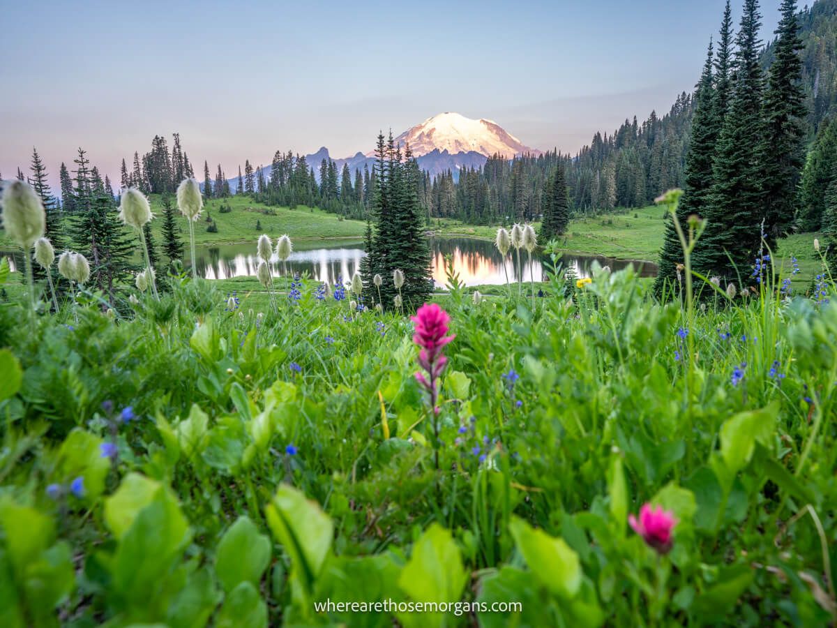
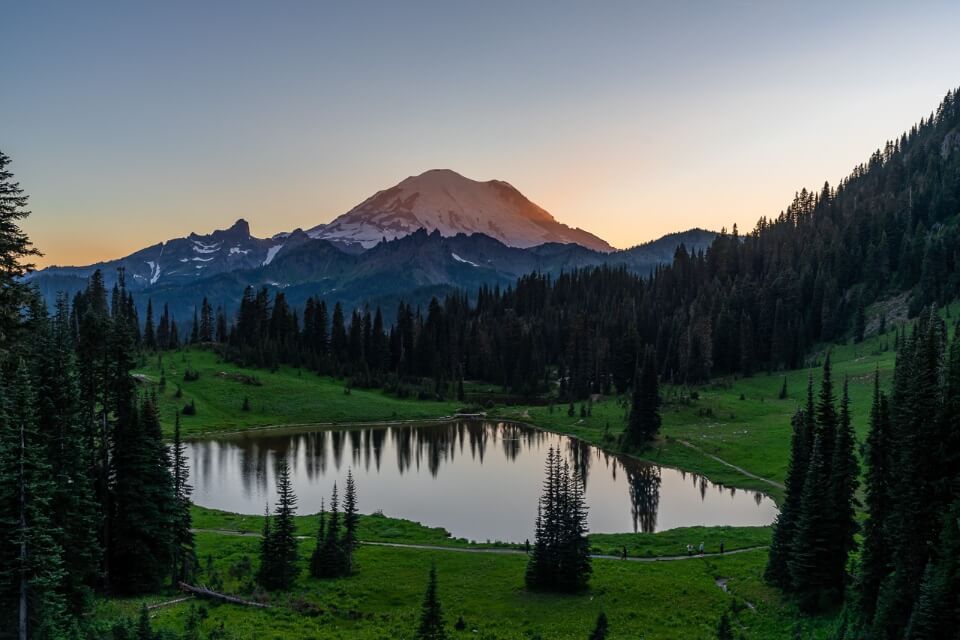
Tipsoo Lake
Tipsoo Lake is one of our favorite photo spots in Mt Rainier. It’s a small lake surrounded by lush green meadows with wildflowers and pristine reflections of the snow capped volcano off to the west.
We took the photo above at 5:15am, not long before sunrise in July and there were at least 10 other photographers out with us at dawn. By the time sunlight began to glow on Mt Rainier’s eastern face, there were maybe 30 of us out on the lakeside slope.
You’ll pass by the lake when you hike Naches Peak Loop Trail, but if you don’t want to hike you can still easily see the lake by parking in a lot nearby. The major downside to visiting Tipsoo Lake is bugs. We got swarmed and dive-bombed the entire time we were taking photos!
Naches Peak Loop Trailhead Parking
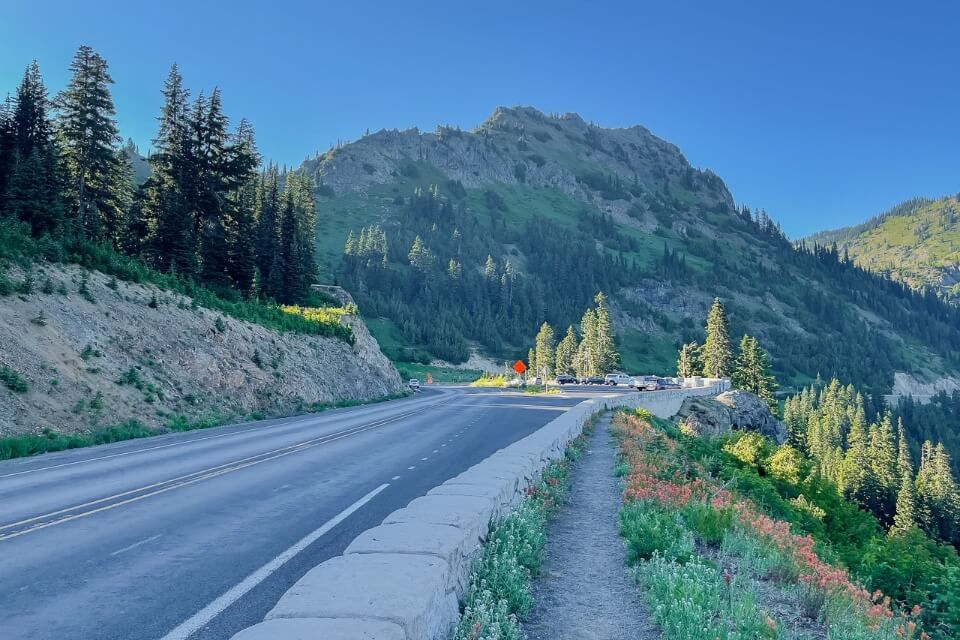
Naches Peak Loop Trailhead is located in Wenatchee National Forest on WA-410, just outside Mt Rainier National Park boundaries. Parking for the trailhead is a little further up WA-410 in pullovers on both sides of the road at Chinook Pass Overlook Trailhead. You can then walk alongside the main road to access the trailhead.
But remember this is a loop hike, and there are more places you can park within Mt Rainier boundaries on the other side of the loop. The easiest place to park is Tipsoo Lake Comfort Station which has a large off-road lot, but if it’s full you can also park on the roadside around the lake.
Distances and average driving times from nearby cities:
- Seattle – 88 miles (1 hour 50 minutes)
- Bellevue – 80 miles (1 hour 50 minutes)
- Renton – 70 miles (1 hour 40 minutes)
- Everett – 108 miles (2 hours 15 minutes)
- Tacoma – 73 miles (1 hour 40 minutes)
- Portland – 168 miles (3 hours 05 minutes)
The key thing to know is if you park at Chinook Pass you must display a $5 National Forest day pass or America the Beautiful Pass. Whereas if you park at Tipsoo Lake you must display a $30 Mt Rainier pass or America the Beautiful Pass.
Trail Map
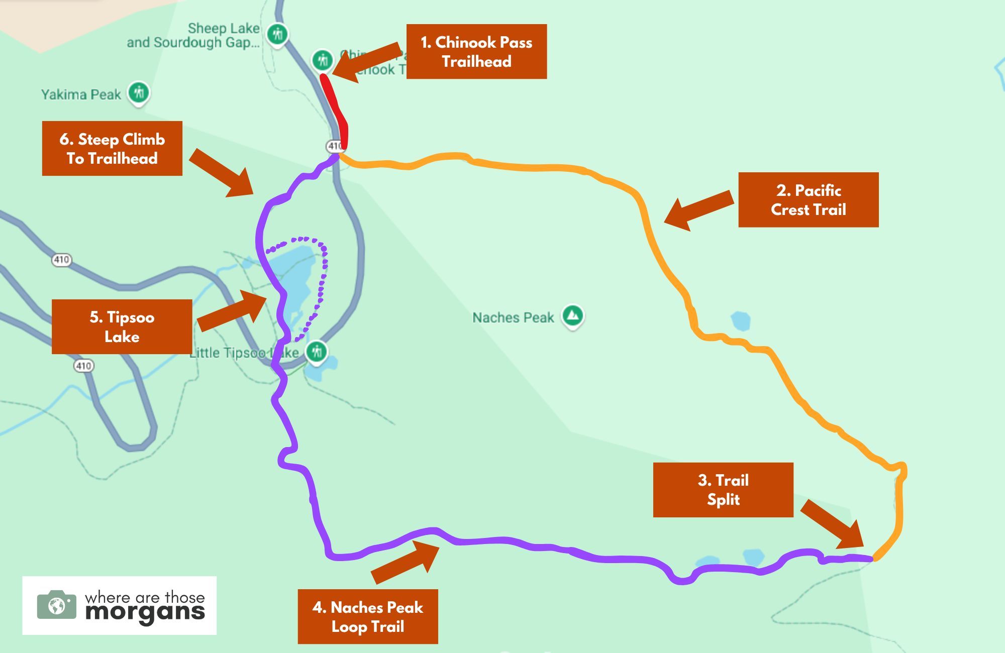
As you can see in the map we created above, after parking at Chinook Pass Trailhead you’ll walk on a short roadside path (red) to join the Pacific Crest Trail (orange) heading southeast.
Half way around the hike you’ll split onto Naches Peak Loop Trail (purple) and follow it down to Tipsoo Lake, where you can go either way around the lake (dotted purple line). And finally it’s a short but steep climb back to the trailhead.
Trail Walkthrough
Next, let’s walk through the trail exactly as we hiked it so you know what to expect.
1. Begin The Hike
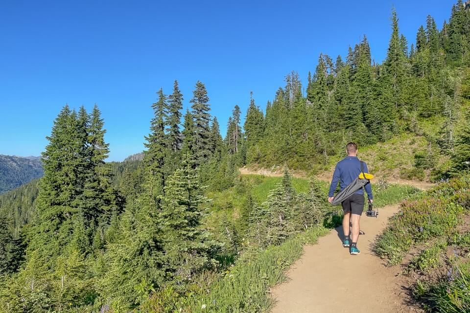
After parking in the Chinook Pass Overlook Trailhead roadside parking lot, we grabbed our gear, hopped over a low stone wall and walked along a narrow dirt path next to the road in order to reach the trailhead proper. The path sloped up to a bridge crossing the road and we took a left turn to begin officially walking on the Pacific Crest Trail and the first half of Naches Peak Loop.
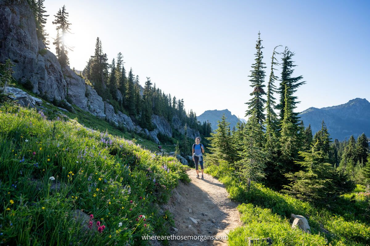
2. Vibrant Wildflowers
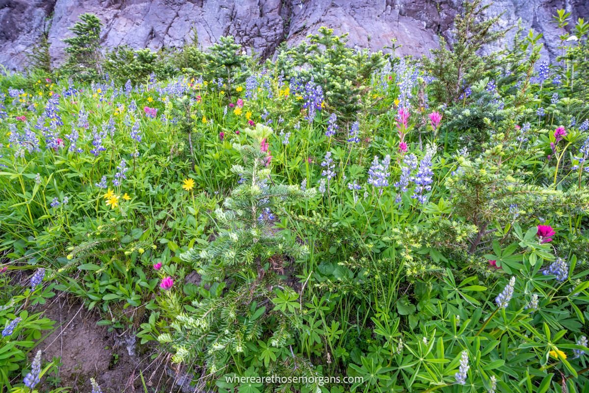
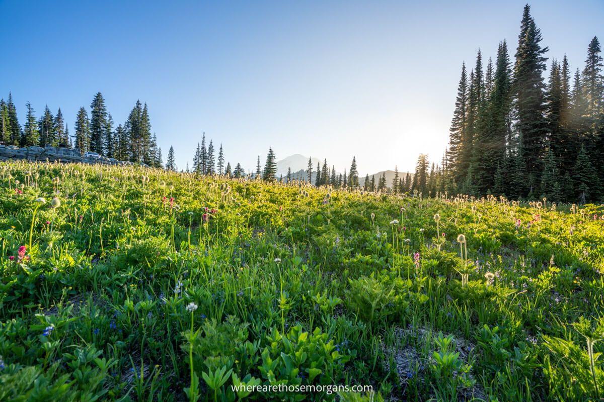
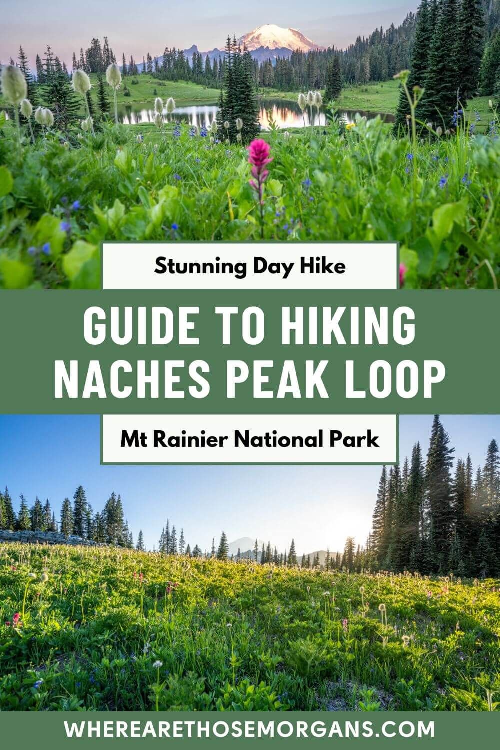
The trail began with a very gradual ascent on a dusty dirt path. As we slowly but surely gained elevation, our view over to the left was an immense valley depression around which WA-410 curved. We hiked near the end of July and although it wasn’t quite peak season, vibrant wildflowers were still blooming in patches alongside the trail.
3. Unnamed Lake
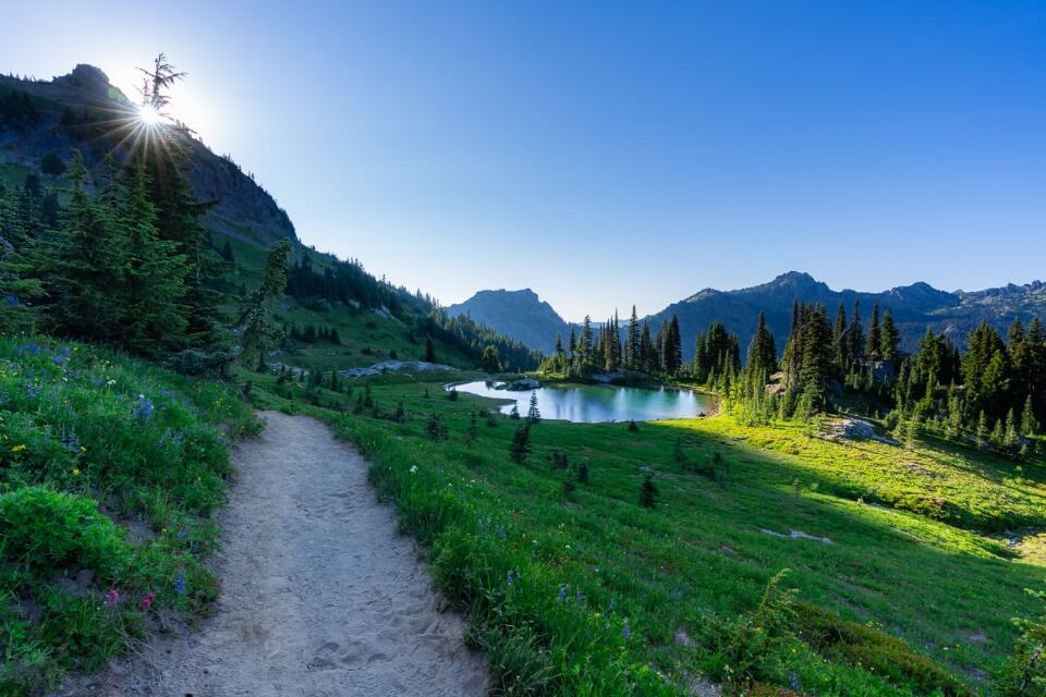
After 1 mile of easy but very dusty hiking, we reached a picturesque lake sitting in a shallow bowl among the meadows and trees. The lake doesn’t have a name but we saw a half dozen hikers wading through the water and relaxing on a collection of rocks nearby. The bugs here were pretty awful, so we didn’t stick around too long.
4. Short Climb On Pacific Crest Trail
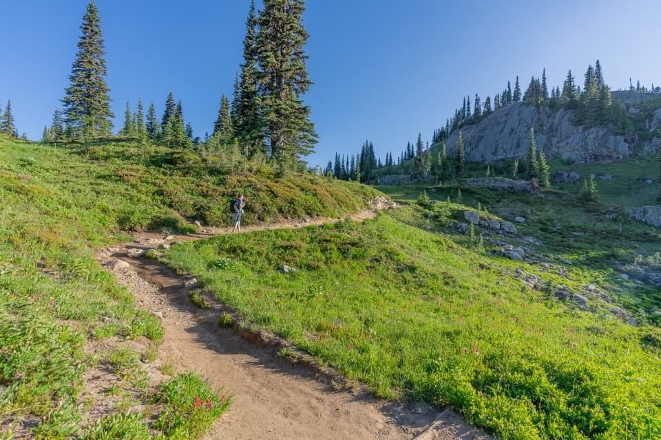
After the unnamed lake it was a very gradual and winding route as we kept heading southeast on the PCT. The elevation gain was gentle and we kept walking past small patches of gorgeous wildflowers, so make sure you keep an eye out for the different colors.
5. Views Over Dewey Lake
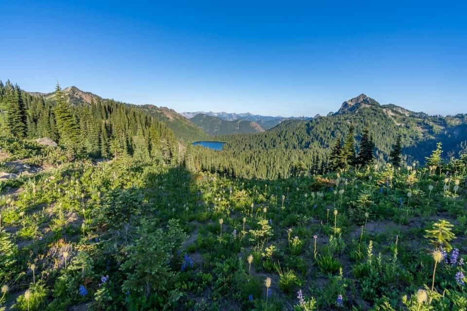
After another 0.5 miles (for a total of 1.5 miles at this point) we reached the highest point of the hike, which had stunning views over Dewey lake and mountain peaks stretching to the horizon. The Pacific Crest Trail continued straight ahead along the ridge but we took a right turn instead, heading directly away from Dewey Lake and onto Naches Peak Loop Trail.
6. Lush Meadows
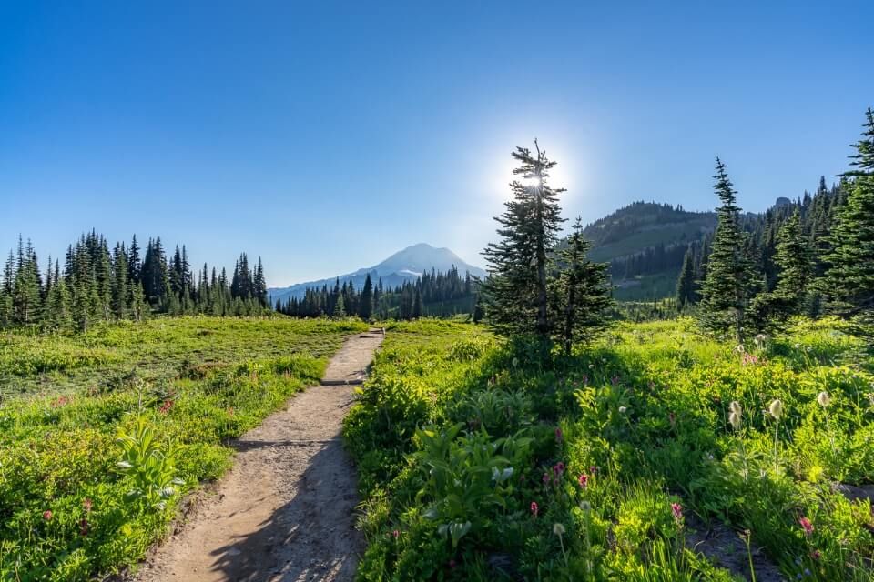
The right turn immediately opened up to the most beautiful section of the trail outside of Tipsoo Lake. It doesn’t get much better than wide open lush green meadows with Mt Rainier dominating the distant skyline. But this was also when we realized sunset wasn’t a good time to hike for our photos, and we ended up trying to use trees to block the sun.
7. Descend To Little Tipsoo Lake
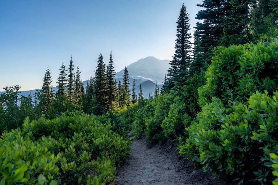
It was gradual downhill for the next 1.5 miles after taking the right turn onto Naches Peak Loop Trail. And on that downhill we had direct views of Mount Rainier the whole time, which is why hiking clockwise is better. We passed by two small ponds that were covered in swarms of bugs, then continued descending on the easy-going dirt packed path until reaching Little Tipsoo Lake.
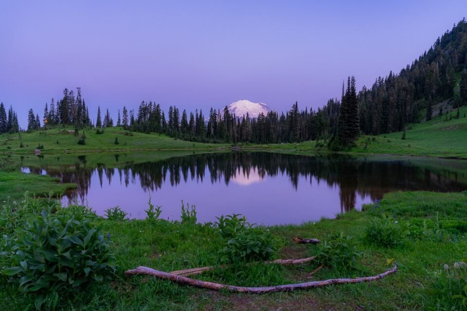
8. Tipsoo Lake
We actually had to bypass Little Tipsoo Lake quickly so we could make it to the larger and far more attractive Tipsoo Lake in time for sunset. After quickly walking up the lake’s steep eastern slope, we had direct views of Mt Rainier towering out from behind meadow, lake and forest which really was a sight to behold. In fact, it was so amazing that we barely noticed we were being eaten alive by bugs!
9. Steep Climb To The Stone Bridge
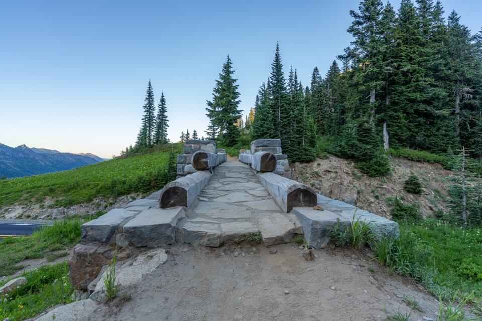
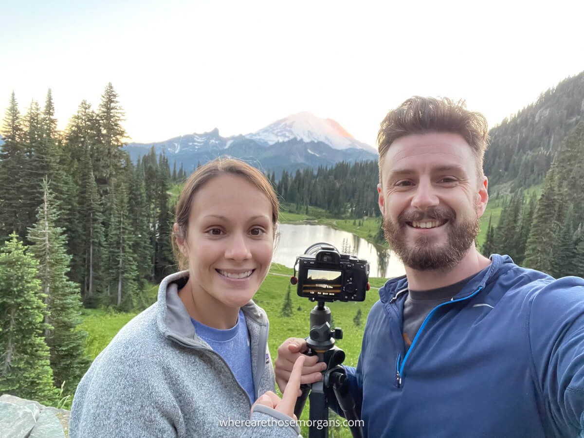
After taking dozens of sunset photos, we left Tipsoo Lake and climbed what turned out to be the steepest part of the trail a few hundred feet to rejoin the bridge, trailhead and parking area at Chinook Pass. It was a bit of a thigh burner but nothing too serious, and that was the loop complete. We went back to Tipsoo Lake the next morning for sunrise photos and they were even better than the sunset!
The Morgan Conclusion
What we like: It’s cool to say you’ve hiked a part of the Pacific Crest Trail, but the national park half of the trail is much prettier. We like that there’s no long lines to enter through a pay station and that you can park in the national forest if you don’t want to pay for the national park entrance. It’s also great at different times of day, but especially at sunrise.
What we don’t like: Like all other hikes in Mt Rainier, the window is very small between mid-July to mid-October. There’s also nothing else to do in this area on the border between the national park and national forest, plus the closest amenities are a long drive away.
Is Naches Peak Loop Trail worth it? Yes! Naches Peak Loop is a fantastic family friendly hike with a short distance and small amount of elevation gain that passes by wildflowers, meadows and stunning lakes with Mt Rainier views. It’s one of our favorite lesser known hikes in the park, and it’s also one of the most photogenic so we highly recommend including it on your itinerary.
We hope our guide to hiking Naches Peak Loop Trail helps with planning your visit to Mount Rainier!
Please let us know if you have any questions in the comments below.
Happy Travels,
Mark and Kristen
Enjoy this guide? Pin it for later!
All Rights Reserved © Where Are Those Morgans, LLC. Republishing this article and/or any of its contents (text, photography, maps, graphics, etc.) in whole or in part is strictly prohibited.

Mark and Kristen spent 6 years traveling the world, visiting over 40 countries across 4 continents and more than 30 US states. They created Where Are Those Morgans in 2018 to help others plan the best possible vacations by writing authentic travel and hiking guides based on their real experiences.
Since the arrival of baby Maya in late 2024, Mark and Kristen’s extensive travels have slowed down but they still take plenty of trips. Where Are Those Morgans now helps millions of travelers each year to visit new places and hike new trails through information-packed blog posts and expert travel guidebooks. Read more about Mark and Kristen.