Spray Park Trail was one of our favorite hidden gem hikes in Mount Rainier. Like most people, the main reason we drove the awful 15-mile road to Mowich Lake was to hike to Tolmie Peak fire lookout. Spray Park was just the “other” hike we planned to do in the afternoon, but it turned out to be a fantastic trail with a huge waterfall, amazing views and stunning meadows. And we even saw a bear eating berries!
In this guide we explain everything you need to know about hiking Spray Park Trail in Mt Rainier National Park, based on our experiences. Read more about us.
When we lived near Seattle for 6 months in the summer of 2021, we hiked non-stop in Washington’s national parks and Cascade Mountains. Mt Rainier was among our favorite spots in the state, so we made sure to explore each region properly before leaving. The road up to Mowich Lake really was as terrible as we’d read about, but it was worth it for a Tolmie Peak Trail and Spray Park Trail double bubble.
The early part of the hike was easy going on soft and undulating dirt packed forest trails. But after the waterfall, a series of steep switchbacks sure did a number on our lungs and thighs! Our reward? A flat walk through truly beautiful meadows filled with wildflowers and non-stop views. It was one of the most photogenic places we saw in the whole park. Okay, let’s begin!
Note: Our content is reader supported and contains affiliate links. If you make a purchase through one of these links, we may earn a small commission at no extra cost to you and it helps us keep this site running.
What You Need To Know
Okay, let’s dive right in. Here are the most important things you need to know about hiking Spray Park Trail:
- It’s a moderately difficult hike with a steep climb to the meadows.
- The trail is snow free mid-July through mid-October.
- Wildflowers are best here late-July through mid-August.
- Parking is at the end of the road near the campground.
- Use restrooms at the campground before starting.
- It’s a much quieter trail than others in the park.
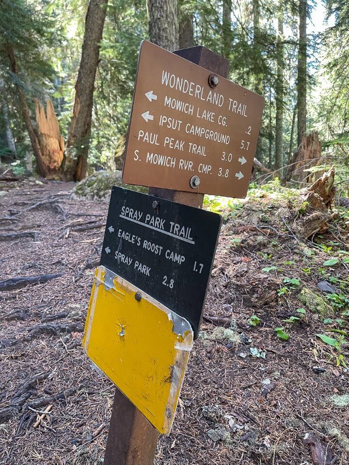
- The very first part is on the famous Wonderland Trail.
- You don’t need specialist hiking gear.
- But wearing robust trail shoes is a good idea.
- Large parts of the trail are under cover of trees.
- Don’t forget a swimsuit for Mowich Lake on a hot day.
- Spray Park Trail is not dog friendly.
Trail Statistics
- Distance: 6-8 miles roundtrip
- Type: Out and back
- Elevation Gain: 1,700 ft
- Difficulty: Moderate
- Time: 3-5 hours
- Trailhead: Mowich Lake
The beauty of hiking Spray Park is that you can go as far as you want before turning around once you reach the meadows after climbing the steep switchbacks. We think 6-8 miles is good target to aim for on a day hike, especially if you’re combining it with Tolmie Peak. But you can go further, even as far as rejoining Wonderland Trail at Carbon River Suspension Bridge.
Spray Park Trailhead Parking
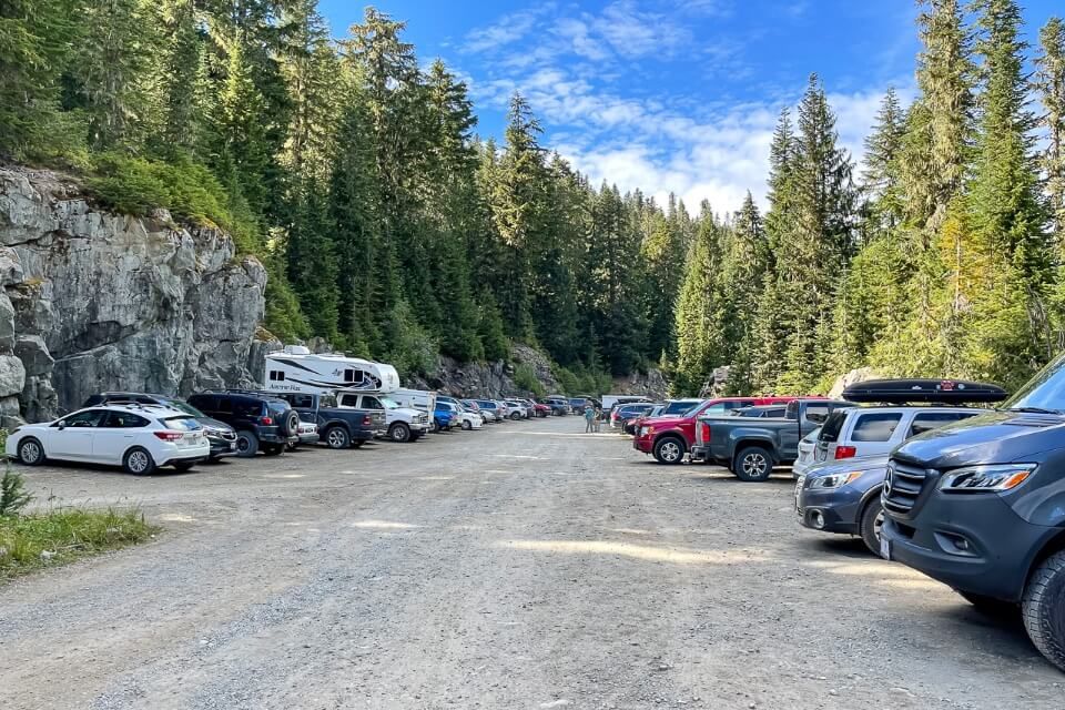
Spray Park Trailhead is located at the very end of Mowich Lake Road in the Carbon River region of Mount Rainier National Park. The parking area is small, rough and on both sides of the road as it dead-ends near the campground. You’ll then walk through the campground to begin the hike.
Carbon River is a much quieter area of the park and it doesn’t have a drive-through entrance kiosk, but you must still pay entrance fees of $30/vehicle for 7 days and display the ticket on your car dashboard. You can buy a pass online in advance or in person at Paul Peak Trailhead. Alternatively, you can display an America the Beautiful Pass if you have one instead.
Distances and average driving times from nearby cities:
- Seattle – 70 miles (2 hours 5 minutes)
- Bellevue – 69 miles (2 hours 5 minutes)
- Renton – 58 miles (1 hour 50 minutes)
- Everett – 96 miles (2 hours 35 minutes)
- Tacoma – 48 miles (1 hour 45 minutes)
- Portland – 186 miles (3 hours 45 minutes)
Three miles after leaving Carbonado, you’ll reach a fork in the road. Left is for Carbon River Road but you want the right to continue on Mowich Lake Road. After a minute or so, tarmac ends and the road turns to gravel, stones, dust and potholes. The rough surface lasts for around 15 miles and it’s all uphill with sharp bends, drop offs and teeth clenching moments every time you hit a pothole.
It took us around 55 minutes to drive up in darkness and around 45 minutes on the way down. We took it nice and easy, moving over for anyone who felt like blowing past, probably in a hire car! It’s important to know that the road closes in winter, so check live road conditions before you set off to make sure it’s open.
Trail Map
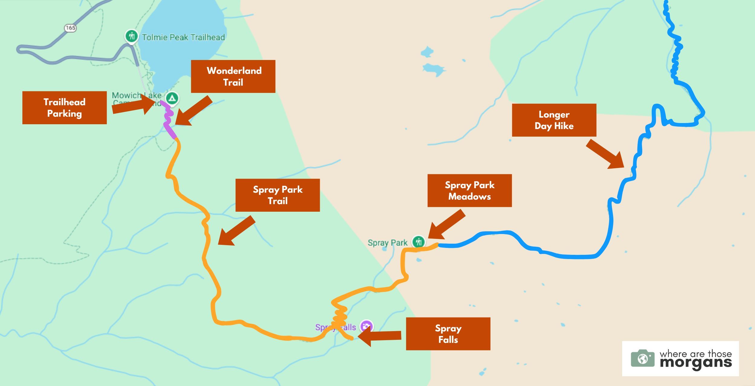
As you can see in the map we created above, after parking near the campground you’ll walk on a small portion of the Wonderland Trail (pink) before turning onto Spray Park Trail (orange).
After seeing Spray Falls, a series of steep switchbacks will lead you directly to the meadows. You can turn around at any point, but we stopped around the point our orange line turns into blue. The blue line represents a much longer day hike into the Spray Park meadows.
Trail Walkthrough
Next, let’s walk through the trail exactly as we hiked it so you know what to expect.
1. Begin The Hike
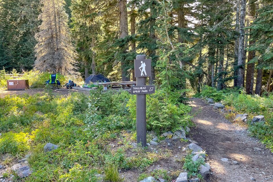
Earlier in the morning we hiked up to Tolmie Peak fire lookout, before refueling with food and drinks once we got back to our car. But we weren’t hanging around, so we grabbed our gear, walked through the campground, used the restrooms and got onto Spray Park Trail at around 11:00am.
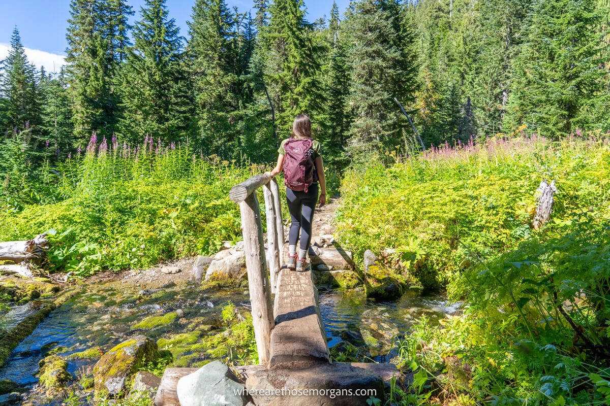
2. Wonderland Trail
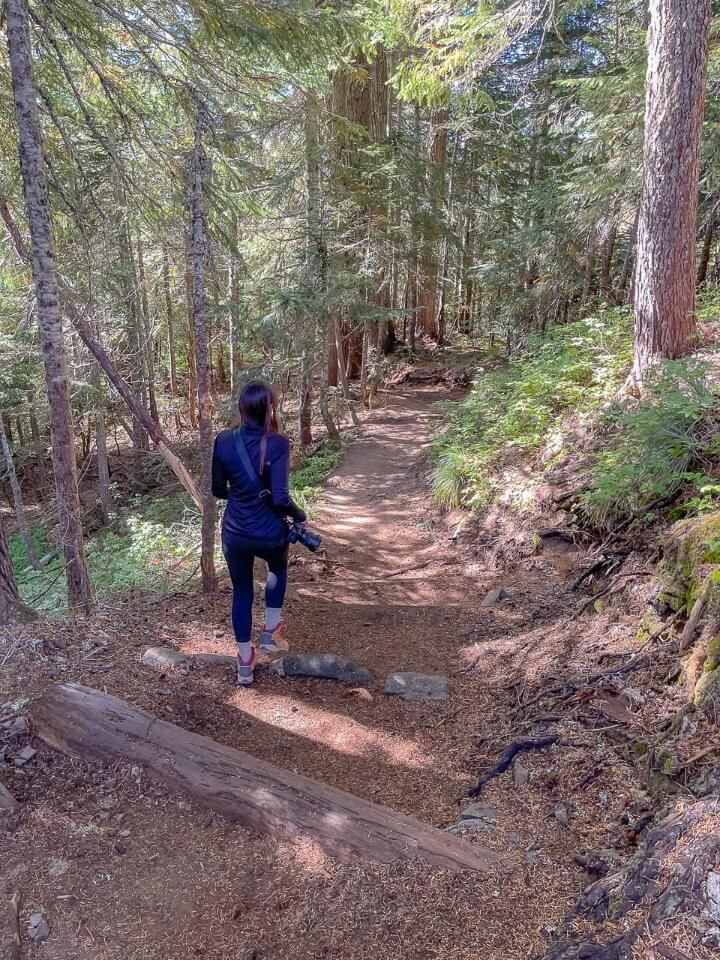
There’s nothing better on the ankles and knees than a soft and bouncy forest dirt trail. And that’s exactly what we got in the early parts of this trail. It felt like we were walking on clouds as we made quick progress on the 0.3-mile stretch on Mt Rainier’s famous Wonderland Trail.
3. Eagle Cliff
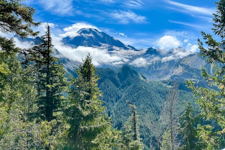
Next, we took a left at the fork aiming for Eagles Roost Camp and Spray Park. The forest trail was so peaceful, easy going and soft underfoot, and eventually we reached a short spur leading off to the right. The spur led down to an incredible overlook called Eagle Cliff which had direct views over Mt Rainier dominating the skyline ahead, so don’t miss it when you’re on the hike!
4. Picturesque Forest
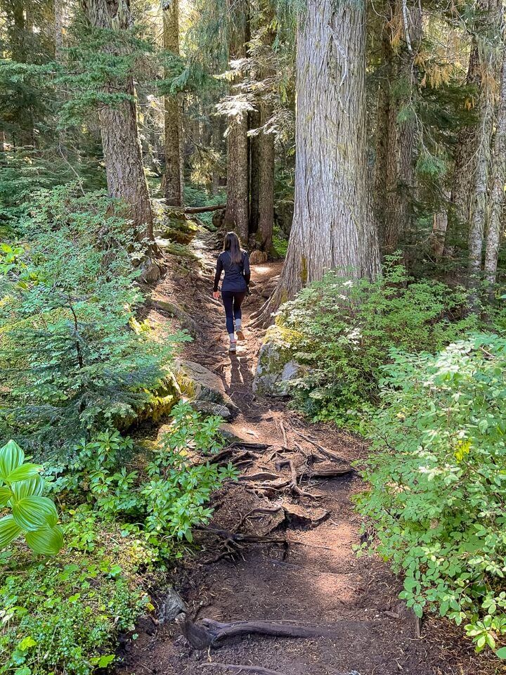
Back into the forest we followed dirt packed paths with tree roots swirling out of the ground and sunlight occasionally breaking through the canopy. Before long the trail opened up into a large boulder field for maybe a minute or so before quickly ending and heading back inside covered forest. Then after another mile of gentle and undulating hiking, we reached another fork in the path.
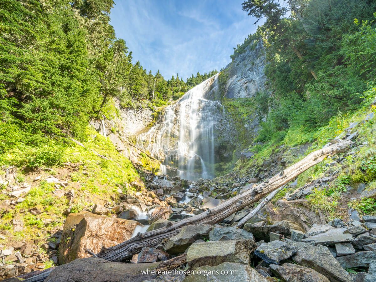
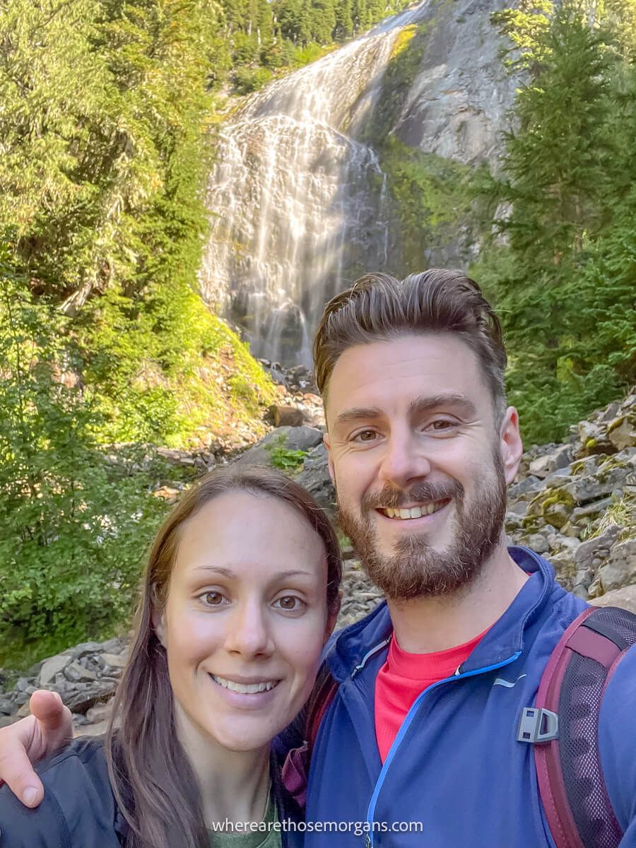
5. Spray Falls
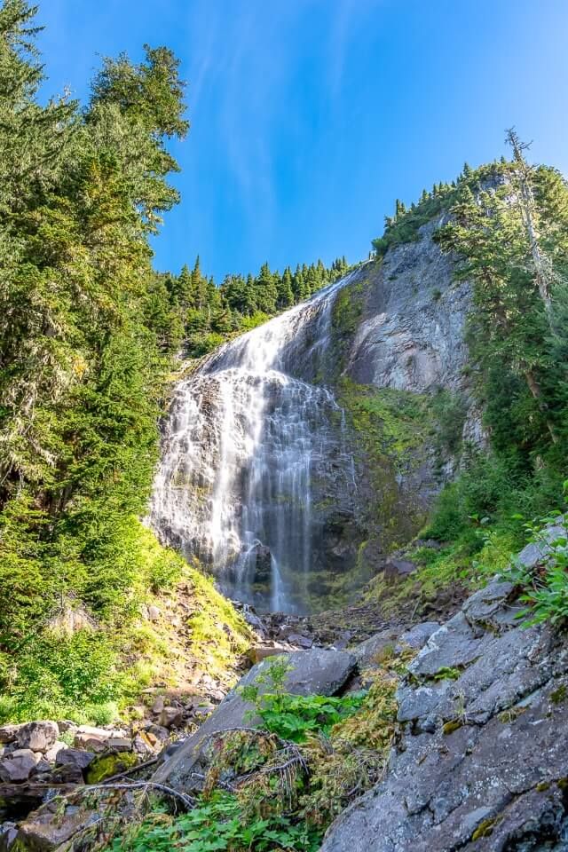
Left and upward was directly for Spray Park meadows, but we had to see the impressive see Spray Falls first so we took the right spur. It was just 0.1 miles to the waterfall, but that included crossing a narrow wooden bridge and descending a steep rocky area. Within a few minutes we could see Spray Falls and it genuinely surprised us. We didn’t expect it to be as massive or photogenic, so that was a bonus!
6. Steep Switchbacks
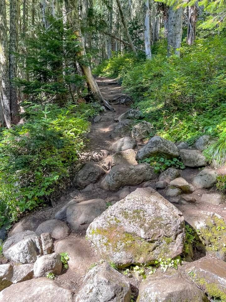
We didn’t try getting close to the waterfall because it was steep and slippery on the boulders, plus we’d already been hiking all morning and we wanted to get to the meadows as quickly as possible. Immediately after rejoining the main trail, we got straight onto a series of 8 slow, steep and punishing switchbacks. After the eighth turn, the trail straightened and crossed Spray Creek on a small wooden bridge.
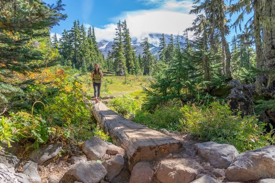
7. Spray Park Meadows
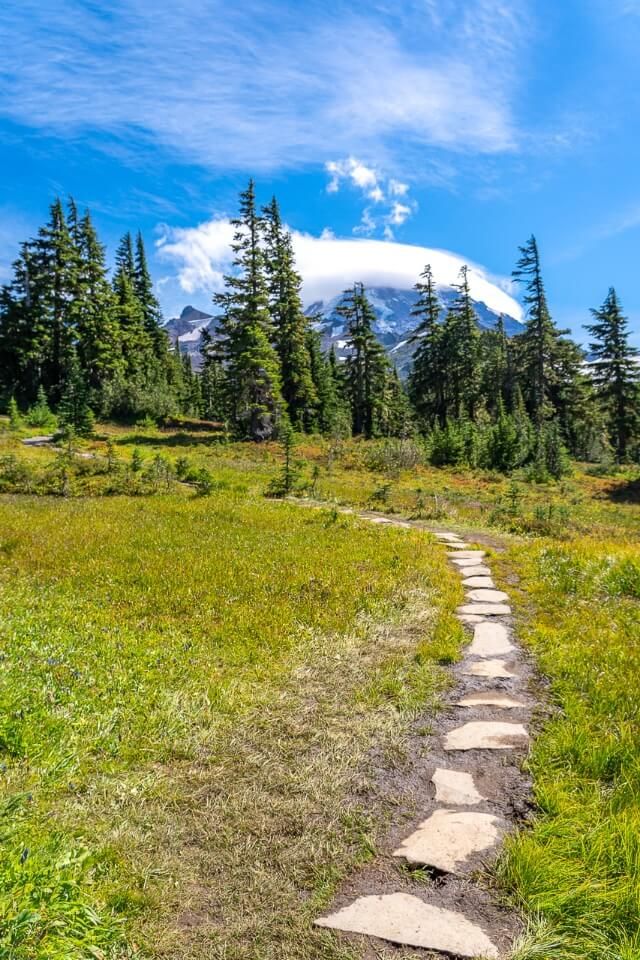
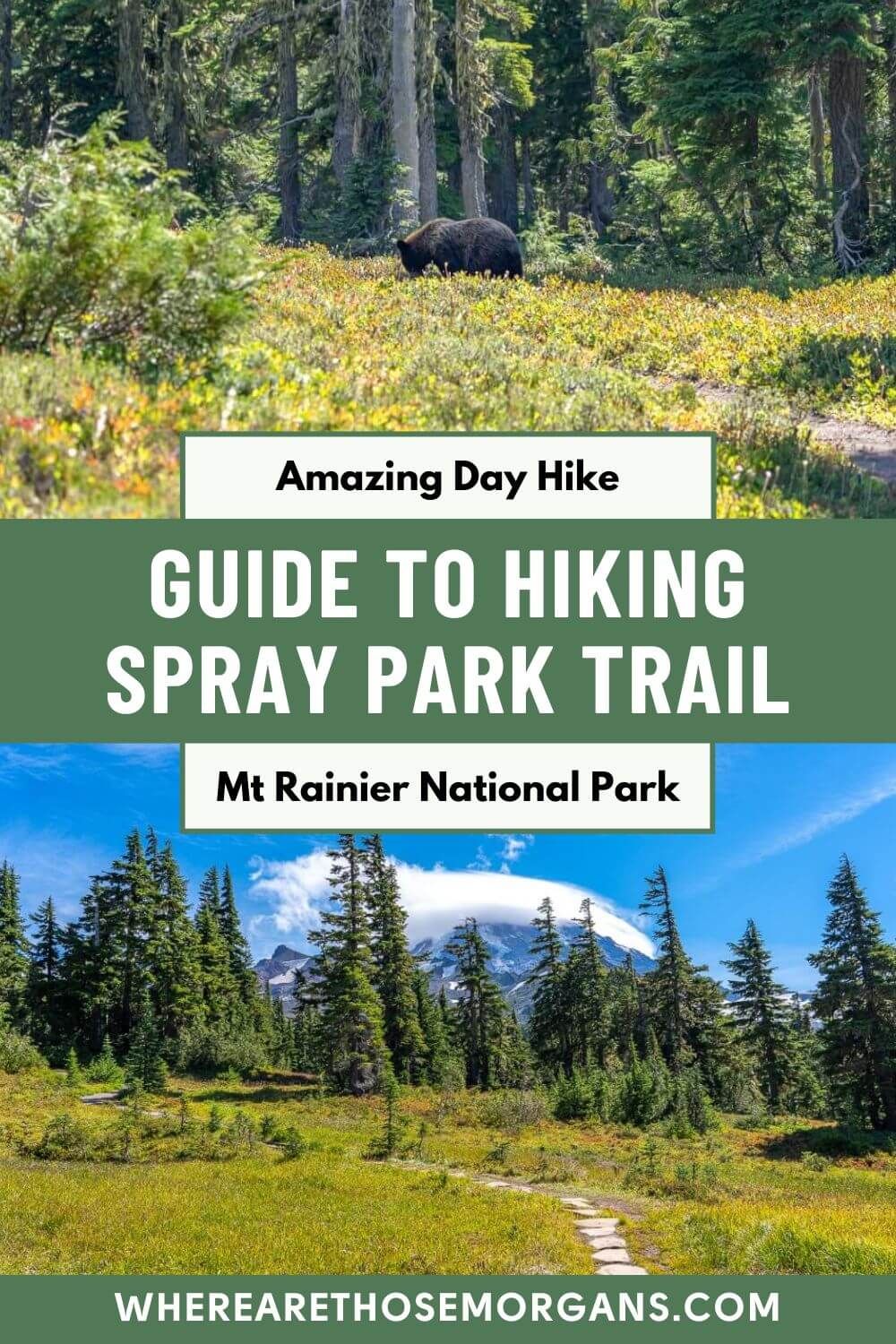
After the bridge we saw our first wide open and lush green meadow, and to the southeast we had majestic views over Mt Rainier. It was already worth conquering those sucky switchbacks. As we walked, mesmerized by the scenery, we met another couple who told us that they’d seen a bear near some trees around 20 feet from the trail a few minutes ahead of us.
8. Watch For Bears
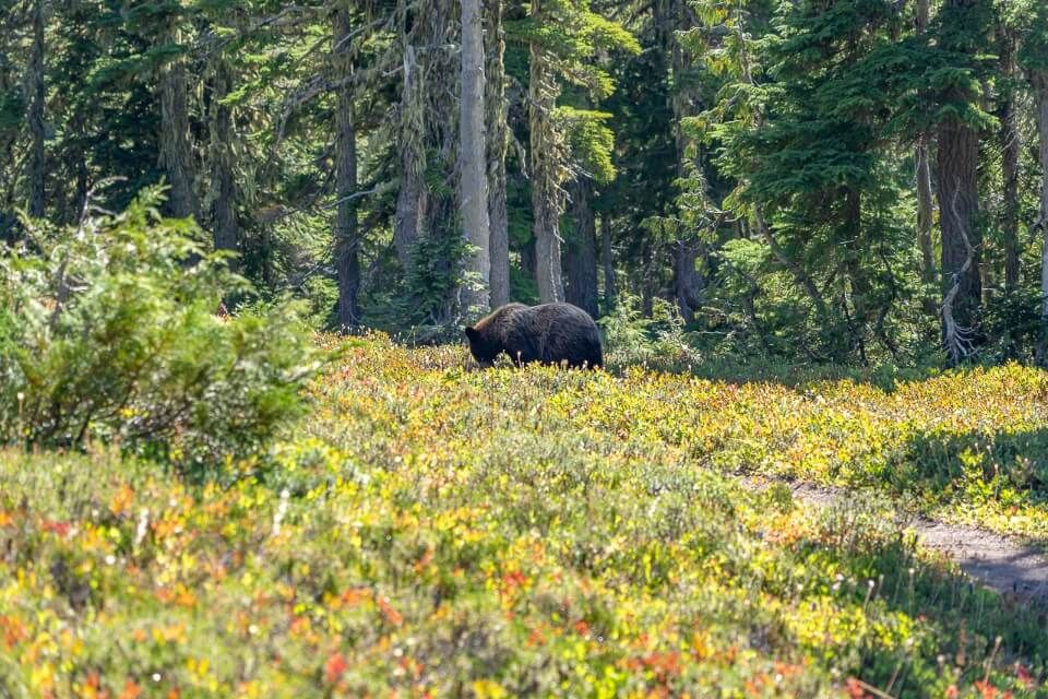
We were a bit hesitant about the bear so we didn’t rush to see it. By the time we arrived, the black bear was around 100 ft from the path and we were more than happy to observe from a distance. After a quick switch to our 105mm lens, we managed to capture the bear that you can see in our photo above. Then we went merrily on our way to the next vibrant meadow in Spray Park.
9. Head Back Down
It really is staggeringly picturesque in the meadows here and we wished we had more time to keep going. But we were hungry, tired and still had to drive a few hours to get home, so we decided to turn around and head back. The return journey was easy, down the switchbacks and along the undulating forest path. All we had to do now was drive back down the pothole-heavy Mowich Lake Road!
The Morgan Conclusion
What we like: It’s up there with the most underrated hidden gem trails at Mt Rainier in our opinion. The meadows are genuinely gorgeous and there’s barely anyone up there. Also, Spray Falls was unexpectedly awesome, so it delivers on more than one front.
What we don’t like: Our major issue is the terrible road quality leading to the trailhead. Parking could be better, as could the amenities at Mowich Lake. Also, the switchbacks leading up the the meadows are pretty brutal after already hiking to Tolmie Peak!
Is Spray Park Trail worth it? Yes! Spray Park is a fantastic lesser known hike in Mt Rainier featuring a massive waterfall, stunning meadows and a great chance to see wildlife because it’s so quiet. Plus, the trail is incredibly picturesque and it only has one steep series of switchbacks. If you don’t mind putting up with a poor quality 15-mile road to access the trailhead, you should add this hike to your itinerary.
We hope our guide to hiking Spray Park Trail helps with planning your visit to Mount Rainier!
Please let us know if you have any questions in the comments below.
Happy Travels,
Mark and Kristen
Enjoy this guide? Pin it for later!
All Rights Reserved © Where Are Those Morgans, LLC. Republishing this article and/or any of its contents (text, photography, maps, graphics, etc.) in whole or in part is strictly prohibited.

Mark and Kristen spent 6 years traveling the world, visiting over 40 countries across 4 continents and more than 30 US states. They created Where Are Those Morgans in 2018 to help others plan the best possible vacations by writing authentic travel and hiking guides based on their real experiences.
Since the arrival of baby Maya in late 2024, Mark and Kristen’s extensive travels have slowed down but they still take plenty of trips. Where Are Those Morgans now helps millions of travelers each year to visit new places and hike new trails through information-packed blog posts and expert travel guidebooks. Read more about Mark and Kristen.